Public Tags
Tag: Road·(Old·Alignment)
Showing latest 50 of 88 images tagged with Road (Old Alignment) tag.
|
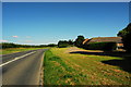
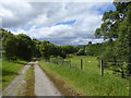
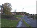
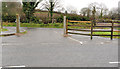
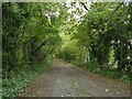
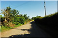
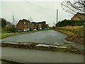
Old road and new road
by John Winder geograph for square SO7524 The road to the left is the modern alignment of the B4215 between Gloucester and... (more)
|
|
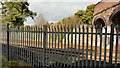
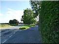
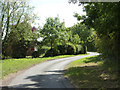
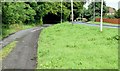
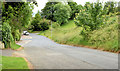
The Ballinderry Road, Lisburn (old alignment)
by Albert Bridge geograph for square J2564 One of the side effects of the building of the Belfast Dublin railway was the... (more)
|
|
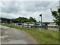
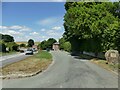
Old Middlewich Road meets the M6
by Stephen Craven geograph for square SJ7371 The original alignment of Middlewich Road was cut off by the motorway,... (more)
|
|
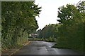
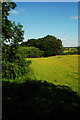
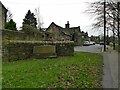
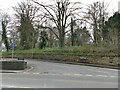
Old Epsom Road
by Hugh Craddock geograph for square TQ0752 This is a remnant of the old Epsom Road, the former Leatherhead to Guildford... (more)
Tags:
Road (Old Alignment)
top:Roads, Road TransportX
|
|
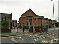
Old Glenlivet road
by Alan O'Dowd geograph for square NJ2126 The old alignment of the road has been turned into a lay-by and picnic site... (more)
|
|
Course of old railway at Rymes Place Farm
by John Winder geograph for square SO7424 Taken from the bridge which carried the old alignment of the Newent road over... (more)
|
|
The old road at Boulder Clough
by Stephen Craven geograph for square SE0323 This old road descending into the clough has been replaced by the present... (more)
|
|
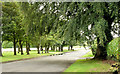
The old alignment of Ilkley Road in Otley
by Stephen Craven geograph for square SE1945 The road is now reduced to a single lane width just serving a scrapyard, but the... (more)
|
|
The west end of Calverley Lane
by Stephen Craven geograph for square SE2235 The lane was straightened at some time in the 20th century, presumably when the... (more)
|
|
End of the old road in front of Bolton Abbey station
by Stephen Craven geograph for square SE0653 This is the old alignment of the Skipton to Bolton Abbey road, before it was... (more)
|
|
Old road in front of Bolton Abbey station
by Stephen Craven geograph for square SE0653 This is the old alignment of the Skipton to Bolton Abbey road, before it was... (more)
|
|
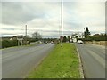
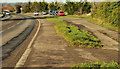
New and old roads, Ballybracken, Ballynure/Larne (July 2017)
by Albert Bridge geograph for square J3396 The main road has been rebuilt twice in the last 50 (or so) years. My 1965 map... (more)
Tags:
place:BallynureX
Dual CarriagewayX
type:GeographX
place:LarneX
RoadX
Road (Old Alignment)
subject:Road JunctionX
Road JunctionX
top:Roads, Road TransportX
|
|
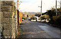
The old Comber Road, Hillsborough (2)
by Albert Bridge geograph for square J2558 See J2558 : The old Comber Road, Hillsborough (1). The other end of the old road. The present alignment is in... (more)
|
|
Selby Road, West Garforth
by Stephen Craven geograph for square SE3932 This view shows the old and new road alignments; the old route now provides... (more)
|
|
The old road at Balvattie
by Stephen Craven geograph for square NH5449 What is now the A832 has been straightened out, leaving this old alignment as a layby.
|
|
Service road parallel to Armley Ridge Road
by Stephen Craven geograph for square SE2535 A short service road with parking area. Comparing old maps, this appears to be... (more)
|
|
The old alignment of Colton Lane
by Stephen Craven geograph for square SE3633 This is now just a footpath. The present line of Colton Lane leads towards the... (more)
|
|
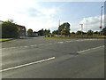
Swindon Road, Winterbourne Monkton
by Stephen Craven geograph for square SU1071 To the right is the old road alignment; it has now been straightened.
|
|
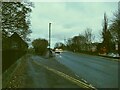
Old alignment of Bath Road, West Kennet
by Stephen Craven geograph for square SU1168 The A4 has been realigned to straighten out a tight bend.
|
|
Sign for Calverley Gate
by Stephen Craven geograph for square SE2037 This is the old alignment of Carr Road, which used to have a sharp right angle... (more)
|
|
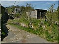
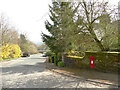
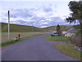
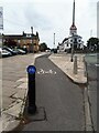
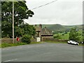
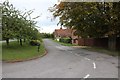
Old alignment of the A70 at Inches, Monksfoot
by Alan O'Dowd geograph for square NS7828 Possibly not the busiest postbox in the country!
Tags:
A70X
type:GeographX
top:Housing, DwellingsX
Post BoxX
subject:RoadX
Road (Old Alignment)
top:Roads, Road TransportX
top:UplandsX
|
|
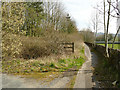
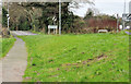
Footpath, Comber
by Albert Bridge geograph for square J4568 The present Ballygowan Road J4568 : The Ballygowan Road, Comber heads off south west (top right) but the... (more)
Tags:
ComberX
FootpathX
top:PathsX
RoadX
Road (Old Alignment)
top:Roads, Road TransportX
top:Suburb, Urban FringeX
|
|
The old Ballynahinch Road, Lisburn
by Albert Bridge geograph for square J2763 A section of the Ballynahinch Road J2762 : The Ballynahinch Road, Lisburn abandoned following the building... (more)
|
|
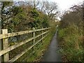
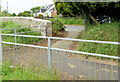
Path alongside the Wharfe of the edge of Otley
by Stephen Craven geograph for square SE1845 This is what remains of the old alignment of Ilkley Road, now reduced to a... (more)
|
|
Old course of Field Head Lane
by Stephen Craven geograph for square SE2227 The lane used to pass under the Wakefield to Bradford railway line, that closed... (more)
|
|
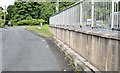
Station Road bridge, South Gosforth
by Stephen Craven geograph for square NZ2568 The railway through Gosforth opened in 1864 and the OS map of that year already... (more)
|
|
Cycle link to Leeds and Bradford Road
by Stephen Craven geograph for square SE2234 This cycle lane on the pavement where the main Stanningley Road bends towards... (more)
|
|
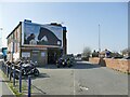
Leeds Motorcycle MOT Centre, York Road
by Stephen Craven geograph for square SE3233 The now car-free road to the right is the original alignment of Torre Road... (more)
Tags:
type:GeographX
MoT Test CentreX
Road (Old Alignment)
top:Roads, Road TransportX
top:Suburb, Urban FringeX
|
|
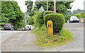
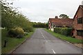
Postbox on Stansfield Brow
by Stephen Craven geograph for square SD9645 The layby shown here is the original road alignment; what must have been a very... (more)
|
|
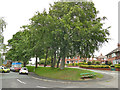
Green space between Heaton Avenue and Dixon Lane
by Stephen Craven geograph for square SE2732 The presence of this wide verge is explained by the fact that Heaton Avenue... (more)
|
|
Two road alignments, Lambeg
by Albert Bridge geograph for square J2766 The Belfast end of the present and previous lines of Queensway (at Derryvolgie... (more)
|
|
Wash Lane Farm (1)
by Stephen Craven geograph for square SJ7371 The farm is alongside the original alignment of Middlewich Road before the M6 cut it off.
|
|
The old road at Barbers Bridge
by John Winder geograph for square SO7721 This is the old course of the Newent road at Barbers Bridge, rerouted and... (more)
|
|
Old Sturton Road
by Richard Croft geograph for square SK7886 The old road near Mill House Farm
|
|
Start of Burton Old Road West
by Stephen Craven geograph for square SK1209 This has been the 'old' road for over 100 years.
|
|
Junction of Middlewich Road and Old Middlewich Road
by Stephen Craven geograph for square SJ7560 Old Middlewich Road is in the foreground, now cut off (other than for cycles)... (more)
Tags:
top:City, Town CentreX
type:GeographX
Puffin CrossingX
Road (Old Alignment)
top:Roads, Road TransportX
|
|
The old course of Wood Lane
by Stephen Craven geograph for square SE2631 The start of Wood Lane has been bypassed by the more recent Dunlop Avenue to the... (more)
|
|
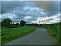
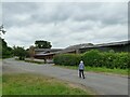
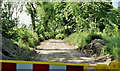
Old road line, Ballysallagh, Craigantlet (June 2018)
by Albert Bridge geograph for square J4477 The old course of the Craigantlet Road, from the Bangor side, looking towards... (more)
Tags:
BallysallaghX
place:CraigantletX
top:Derelict, DisusedX
type:GeographX
subject:RoadX
Road (Old Alignment)
top:Roads, Road TransportX
|
|
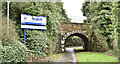
Railway bridge, Seahill, Bangor (December 2017)
by Albert Bridge geograph for square J4481 An overbridge at the entrance to Seahill station (left). It carries the railway... (more)
Tags:
subject:BridgeX
type:GeographX
railway:Northern Ireland RailwaysX
PathX
top:PathsX
Railway BridgeX
Railway StationX
top:RailwaysX
Road (Old Alignment)
Seahill (Co Down)X
TranslinkX
|
|
The Rathgael Road (old line), Bangor - July 2015 (2)
by Albert Bridge geograph for square J4879 See J4879 : The Rathgael Road (old line), Bangor - July 2015 (1). The old line, on the south eastern of the Clandeboye Road, now... (more)
|
|
The Rathgael Road (old line), Bangor - July 2015 (1)
by Albert Bridge geograph for square J4879 A section of the old line of the Rathgael Road J4879 : The Rathgael Road, Bangor (July 2015), on the north western... (more)
|
|
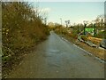
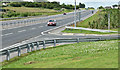
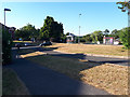
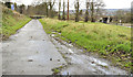
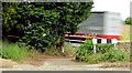
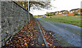
The Belfast road (old line), Templepatrick (August 2014)
by Albert Bridge geograph for square J2385 The building of the M2 J2486 : M2 (outward) at Templepatrick and J2486 : M2 (inward), Templepatrick (more than 40 years ago) and... (more)
Tags:
Lay-byX
LaybyX
subject:RoadX
RoadX
Road (Old Alignment)
top:Roads, Road TransportX
TemplepatrickX
|
|
The Old Belfast Road, Newtownards - June 2014(3)
by Albert Bridge geograph for square J4773 See J4773 : The Old Belfast Road, Newtownards - June 2014(2). The stopped-up end of the Old Belfast Road seen from the verge... (more)
|
|
The Old Belfast Road, Newtownards - June 2014(2)
by Albert Bridge geograph for square J4773 The stopped-up end of the Old Belfast Road J4773 : The Old Belfast Road, Newtownards - June 2014(1) at the Kempe Stones Road... (more)
|
|
The Old Belfast Road, Newtownards - June 2014(1)
by Albert Bridge geograph for square J4773 The Old Belfast Road, now a cul-de-sac, looking down towards the Scrabo Road.... (more)
|
|
The old Belfast Road, Dundonald/Comber
by Albert Bridge geograph for square J4471 The old line of the Belfast Road, now replaced by the present road (left), close... (more)
|
|
The Old Milltown Road, Belfast (2)
by Albert Bridge geograph for square J3368 The western part of the Old Milltown Road J3368 : The Old Milltown Road, Belfast is a cul-de-sac ending... (more)
|
|
The old Movilla Road, Newtownards
by Albert Bridge geograph for square J5074 The old line of the Movilla Road (to Millisle) long-since replaced by the... (more)
|
|
Road to the Kingswell
by Bill Nicholls geograph for square SU4988 View down the old Reading road which past the Kingswell Hotel now its entrance road.
|
|
The old road
by Bill Nicholls geograph for square SU4988 This section to the bend would have been the old Reading road from Wantage, when... (more)
|