|
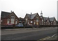
Tendring Adult Education College, St Osyth Road, Clacton-on-Sea
by Duncan Graham
geograph for square TM1715
Built in 1893, this building was St Osyth Road School from 1894 to 1997 and... (more)
|
|
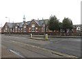
Tendring Adult Education College, St Osyth Road, Clacton-on-Sea
by Duncan Graham
geograph for square TM1715
Built in 1893, this building was St Osyth Road School from 1894 to 1997 and... (more)
|
|
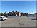
Tendring Adult Education College, St Osyth Road, Clacton-on-Sea
by Duncan Graham
geograph for square TM1715
Photograph taken from the Alton Park Road car park looking east. The side and... (more)
|
|
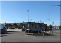
Tendring Adult Education College, St Osyth Road, Clacton-on-Sea
by Duncan Graham
geograph for square TM1715
Photograph taken from the Lidl car park looking west; the edge of the Lidl... (more)
|
|
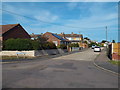
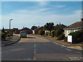
St. Clair's Drive, St. Osyth
by Malc McDonald
geograph for square TM1216
St. Clair's Drive is a residential road in the village of St. Osyth, near Clacton.
|
|
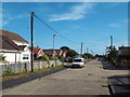
St. Clair's Road, St. Osyth
by Malc McDonald
geograph for square TM1216
St. Clair's Road is a residential road in the village of St. Osyth, near Clacton.
|
|
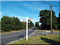
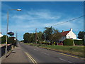
Frowick Lane, near St. Osyth
by Malc McDonald
geograph for square TM1117
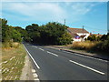
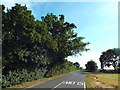
Frowick Lane at its junction with the B1027 road near St. Osyth, in north Essex.
|
|
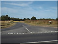
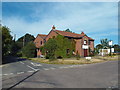
Road junction at St. Osyth
by Malc McDonald
geograph for square TM1216
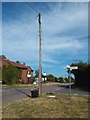
The road straight ahead is a by-pass which avoids the village of St. Osyth. The... (more)
|
|
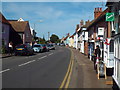
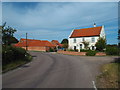
The Red Lion, St. Osyth
by Malc McDonald
geograph for square TM1215
The Red Lion pub in the centre of St. Osyth, a village in north Essex.
|
|
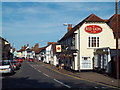
Clacton Road, St. Osyth
by Malc McDonald
geograph for square TM1215
Clacton Road in the centre of St. Osyth, a village in north Essex.
|
|
Longfields, St. Osyth
by Malc McDonald
geograph for square TM1215
Longfields is a residential road in the village of St. Osyth, near Clacton.
|
|
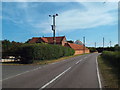
Clacton Road, St. Osyth
by Malc McDonald
geograph for square TM1215
Clacton Road leads out of the village of St. Osyth, heading towards Clacton.
|
|
St. Osyth by pass
by Malc McDonald
geograph for square TM1216
This road by-passes the village of St. Osyth.
|
|
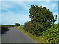
Track near St. Osyth
by Malc McDonald
geograph for square TM1317
This track leads to an isolated house near St. Osyth, in north Essex.
|
|
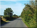
Clay Lane, near St. Osyth
by Malc McDonald
geograph for square TM1317
Clay Lane passing through north Essex countryside, near St. Osyth.
|
|
Crossroads at St. Osyth Heath
by Malc McDonald
geograph for square TM1318
The crossroads in the small hamlet of St. Osyth Heath, in north Essex.
|
|
The Blue Sari, St. Osyth Heath
by Malc McDonald
geograph for square TM1318
The Blue Sari is a former pub, now a restaurant and bar, in the hamlet of St.... (more)
|
|
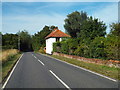
Hartleywood Farm, St. Osyth Heath
by Malc McDonald
geograph for square TM1418
Heath Road, in the small hamlet of St. Osyth Heath in north Essex. At the bend... (more)
|
|
Rectory Road, St. Osyth Heath
by Malc McDonald
geograph for square TM1418
Rectory Road passing a farm in the small hamlet of St. Osyth Heath, in north Essex.
|
|
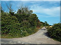
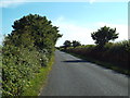
Farm track near St. Osyth
by Malc McDonald
geograph for square TM1216
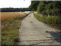
This track leads to a farm in countryside near Clacton, in north Essex.
|
|
Clay Lane, near St. Osyth
by Malc McDonald
geograph for square TM1316
Clay Lane passing through north Essex countryside, near Clacton.
|
|
Clay Lane, near St. Osyth
by Malc McDonald
geograph for square TM1316
Clay Lane passing through north Essex countryside, near Clacton.
|
|
Clay Lane, near St. Osyth
by Malc McDonald
geograph for square TM1316
Clay Lane passing through north Essex countryside.
|
|
Clay Lane, near St. Osyth
by Malc McDonald
geograph for square TM1317
|
|
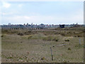
Colne Point Nature Reserve
by terry joyce
geograph for square TM0912
This is part of Colne Point Nature Reserve. The Jetty (disused) on Ray Creek and... (more)
|
|
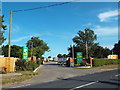
Caravan park near Clacton
by Malc McDonald
geograph for square TM1217
The entrance to a caravan park near Clacton, in north Essex.
|