Public Tags
Tag: Staithes
Showing latest 50 of 141 images tagged with Staithes tag.

|
Dunston Coal Staithes (panorama)
by Andrew Curtis for square NZ2362 Panorama stitched from 7 photos taken from a location on the Dunston bank of the... (more)
Tags:
top:Estuary, Marine
top:Historic Sites and Artefacts
Panorama
top:Railways
top:Rivers, Streams, Drainage
Staithes
river:Tyne
panorama:Wideangle
|

|
Dunston Coal Staithes
by Andrew Curtis geograph for square NZ2362 Tags:
top:Historic Sites and Artefacts
top:Industry
top:Lowlands
Staithes
top:Suburb, Urban Fringe
river:Tyne
|
|
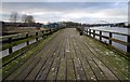
Derwenthaugh Staithes
by Andrew Curtis geograph for square NZ2063 Derwenthaugh Staithes (a Geordie dialect word, pronounced 'steeths')... (more)
Tags:
top:Historic Sites and Artefacts
top:Industry
top:Lowlands
top:Railways
top:Rivers, Streams, Drainage
Staithes
river:Tyne
|
|
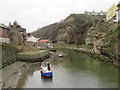
Staithes Beck, Staithes
by Malc McDonald geograph for square NZ7818 Staithes Beck, looking upstream.
Tags:
type:Geograph
county:North Yorkshire
River
subject:River
top:Rivers, Streams, Drainage
place:Staithes
Staithes Beck
near:Whitby
|
|
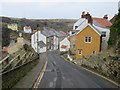
Staithes Lane, Staithes
by Malc McDonald geograph for square NZ7818 Staithes Lane descending into the centre of Staithes, a village on the Yorkshire coast.
Tags:
Coastal Village
type:Geograph
county:North Yorkshire
place:Staithes
Steep Descent
Steep Gradient
Steep Hill
Steep Road
subject:Village
top:Village, Rural Settlement
near:Whitby
|
|
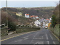
Staithes Lane, Staithes
by Malc McDonald geograph for square NZ7818 Staithes Lane descends a steep gradient to the village of Staithes on the Yorkshire coast.
Tags:
Coastal Village
type:Geograph
county:North Yorkshire
subject:Slope
place:Staithes
Steep Descent
Steep Gradient
Steep Hill
Steep Road
top:Village, Rural Settlement
near:Whitby
|
|
Norton Staithe
by Roger Jones geograph for square TG4001 This is a roadside view of the site of the staithe opposite the former... (more)
|
|
Coal staithes
by Stephen Craven geograph for square NZ8005 Category: Coal staithes Coal staithes in the station yard at Egton Bridge. Long disused but the track... (more)
|
|
Rockland Staithe
by Roger Jones geograph for square TG3204 Rockland Staithe leads to Rockland Broad, and then via dikes to the River Yare.
Tags:
Boats
top:Docks, Harbours
near:River Yare
top:Rivers, Streams, Drainage
place:Rockland St. Mary
place:Rockland Staithe
Staithe
|
|
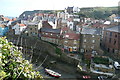
Cowbar and the Lifeboat Station, Staithes
by Paul Buckingham geograph for square NZ7818 The lifeboat station is located in the hamlet of Cowbar just across the Staithes... (more)
|
|
Staithes from Cowbar Bank
by Graham Horn geograph for square NZ7818 Approaching from the west this is the first proper view of the old village that... (more)
|

|
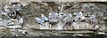
Boats on Staithes Beck
by Rob Farrow geograph for square NZ7818 Looking upstream on Staithes Beck in Staithes with small boats tethered in place... (more)
Tags:
Cliff Face
top:Coastal
Cowbar
top:Docks, Harbours
top:Estuary, Marine
Small Boats
Staithes
top:Village, Rural Settlement
|
|
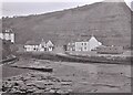
Gulls nesting at Staithes
by Dave Pickersgill for square NZ7818 Tags:
subject:Bird
top:City, Town Centre
type:Close Look
top:Estuary, Marine
bird:Gull
top:Lowlands
Staithes
place:Staithes
village:Staithes
|
|
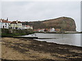
Staithes Harbour and Cowbar Nab
by Richard Sutcliffe geograph for square NZ7818 The Staithes Sandstone is very well exposed in the cliff of Cowbar Nab.
The... (more)
Tags:
top:Coastal
top:Estuary, Marine
type:Geograph
top:Geological Interest
subject:Harbour
top:Rocks, Scree, Cliffs
Sandstone
Scanned Negative
Staithes
|
|
Staithes harbourside
by Malc McDonald geograph for square NZ7818 The beach and harbourside at Staithes, on the Yorkshire coast.
Tags:
top:Coastal
Coastal Village
top:Docks, Harbours
type:Geograph
subject:Harbour
Harbour
Harbourside
county:North Yorkshire
place:Staithes
Staithes Beck
top:Village, Rural Settlement
near:Whitby
|
|
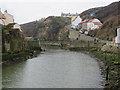
Staithes Beck, Staithes
by Malc McDonald geograph for square NZ7818 Staithes Beck, looking upstream.
Tags:
type:Geograph
county:North Yorkshire
subject:River
River
top:Rivers, Streams, Drainage
place:Staithes
near:Whitby
|
|
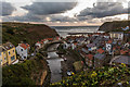
Sunrise at Staithes
by Oliver Mills geograph for square NZ7818 A somewhat underwhelming sunrise, taken from the viewpoint on the east side of... (more)
Tags:
top:Coastal
type:Geograph
top:Rivers, Streams, Drainage
top:Rocks, Scree, Cliffs
place:Staithes
Staithes Beck
Sunrise
Viewpoint
subject:Village
top:Village, Rural Settlement
|
|
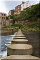
Stepping stones at Staithes
by Oliver Mills geograph for square NZ7818 A more exciting way to cross Staithes Beck than to cross the bridge further downstream.
Tags:
top:Canals
top:Coastal
type:Geograph
top:Paths
top:Rivers, Streams, Drainage
place:Staithes
Staithes Beck
subject:Stepping Stones
top:Village, Rural Settlement
|

|
Coal Staithes
by Mick Garratt geograph for square SE7097 The end of the line of the Rosedale branch railway. The railway was built by the... (more)
|
|
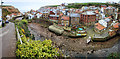
Staithes on a grey day
by Andy Stephenson geograph for square NZ7818 A panoramic view across Staithes Beck from the Cowbar side, with sleet just... (more)
Tags:
top:Coastal
top:Docks, Harbours
top:Estuary, Marine
place:Staithes
Staithes Beck
subject:Village
top:Village, Rural Settlement
|
|
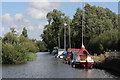
Rockland Staithe
by Richard Croft geograph for square TG3204 Rockland Staithe and the dike to Rockland Broad
|
|
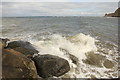
Staithes Harbour
by Richard Croft for square NZ7819 Waves breaking on the end of the north breakwater in Staithes Harbour
|

|
Staithes
by Richard Croft geograph for square NZ7818 View across Staithes harbour from the mooring pontoon
|
|
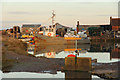
Brancaster Staithe
by Richard Croft geograph for square TF7944 Fishing boat moored at Brancaster Staithe
|

|
Sunset at Brancaster Staithe
by Richard Croft for square TF7944 Sunset over the reeds at Brancaster Staithe
|

|
Brancaster Staithe
by Richard Croft geograph for square TF7944 Dusk view at Brancaster Staithe
|

|
Hickling Staithe
by Roger Jones geograph for square TG4022 Hickling Staithe leading to Hickling Broad.
|
|
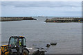
Staithes harbour
by Pauline E geograph for square NZ7818 Ebb tide at Staithes. The ship is probably heading to Teeside.
|
|
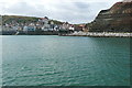
Staithes Harbour
by Graham Horn for square NZ7818 From the northern breakwater we can see how it, together with Cowbar Nab to the... (more)
|
|
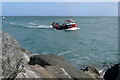
Entering Staithes harbour
by Graham Horn geograph for square NZ7819 I watched this small fishing boat struggling to get into the harbour against a... (more)
|
|
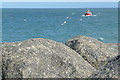
Coming in to harbour
by Graham Horn geograph for square NZ7819 A fishing boat is battling to get in to Staithes Harbour. It is a falling tide... (more)
|
|
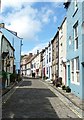
High Street, Staithes
by Rob Farrow geograph for square NZ7818 The village of Staithes is full of attractive buildings such as the ones seen... (more)
|

|
Staithes harbour
by Dave Pickersgill geograph for square NZ7818 Tags:
top:Docks, Harbours
top:Estuary, Marine
type:Geograph
subject:Harbour
top:Lowlands
village:Staithes
Staithes
subject:Village
top:Village, Rural Settlement
|
|
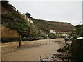
Staithes Beck in spate after heavy rain
by Martin Dawes geograph for square NZ7818 Tags:
top:Coastal
Footbridge Over Beck
type:Geograph
top:Rivers, Streams, Drainage
top:Rocks, Scree, Cliffs
place:Staithes
Staithes Beck
top:Village, Rural Settlement
|

|
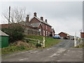
Road junction at Staithes
by Malc McDonald geograph for square NZ7718 A junction on the A174 road at Staithes, on the Yorkshire coast. In the... (more)
Tags:
road:A174
type:Geograph
Junction of A-Road and Minor Road
county:North Yorkshire
subject:Road Junction
Road Junction
top:Roads, Road Transport
place:Staithes
near:Whitby
|
|
Former railway station, Staithes
by Malc McDonald geograph for square NZ7818 A former railway station at Staithes, on the Yorkshire coast. The station closed in 1958.
Tags:
Converted Former Railway Station
Former Railway Station Buildings
type:Geograph
county:North Yorkshire
subject:Railway Station
former:Railway Station Building
Railway Station Building (Converted)
top:Railways
Site of Former Railway Station
place:Staithes
near:Whitby
|

|
Church Street, Staithes
by Malc McDonald geograph for square NZ7818 Church Street is a narrow lane in the village of Staithes, on the Yorkshire coast.
Tags:
Coastal Village
type:Geograph
Narrow Road
Narrow Street
county:North Yorkshire
place:Staithes
subject:Village
top:Village, Rural Settlement
near:Whitby
|

|
Breakwater at Staithes
by Malc McDonald geograph for square NZ7819 A view to sea along the northern breakwater at Staithes, on the Yorkshire coast.
Tags:
subject:Breakwater
Breakwater
top:Estuary, Marine
type:Geograph
county:North Yorkshire
place:Staithes
near:Whitby
|

|
Breakwater at Staithes Harbour
by Malc McDonald geograph for square NZ7819 A view along the northern breakwater at Staithes, on the Yorkshire coast.
Tags:
subject:Breakwater
Breakwater
top:Coastal
type:Geograph
county:North Yorkshire
place:Staithes
near:Whitby
|

|
Breakwater at Staithes Harbour
by Malc McDonald geograph for square NZ7819 A view to the end of the northern breakwater at Staithes Harbour, on the Yorkshire coast.
Tags:
Breakwater
subject:Breakwater
top:Coastal
type:Geograph
county:North Yorkshire
place:Staithes
near:Whitby
|
|
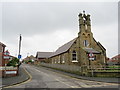
Our Lady Star of the Sea church, Staithes
by Malc McDonald geograph for square NZ7818 The church of Our Lady Star of the Sea in the village of Staithes, on the Yorkshire coast.
Tags:
subject:Church
Church
type:Geograph
county:North Yorkshire
top:Religious Sites
place:Staithes
Village Church
top:Village, Rural Settlement
near:Whitby
|
|
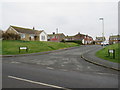
Captain Cook's Close, Staithes
by Malc McDonald geograph for square NZ7818 Captain Cook's Close in the village of Staithes, on the Yorkshire coast.
Tags:
type:Geograph
county:North Yorkshire
Residential
Residential Area
Residential Cul-De-Sac
Residential Road
Residential Street
place:Staithes
subject:Village
top:Village, Rural Settlement
near:Whitby
|
|
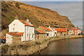
North Side
by Richard Croft geograph for square NZ7818 Staithes Beck and North Side from the footbridge
|
|
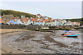
Staithes (2)
by Chris Heaton geograph for square NZ7818 Lovely Yorkshire coastal town tumbling down to the coast, with its striking... (more)
|
|
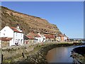
Red roofed cottages below Cowbar Nab
by Graham Hogg geograph for square NZ7818 On North Side beside Staithes Beck
Tags:
top:Coastal
subject:Cottage
top:Estuary, Marine
type:Geograph
top:Housing, Dwellings
top:Rivers, Streams, Drainage
top:Roads, Road Transport
place:Staithes
Staithes Beck
|
|
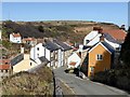
Staithes Lane, Staithes
by Graham Hogg geograph for square NZ7818 The steep hill leading to the harbour NZ7818 : Lobster pots at Staithes Harbour
Tags:
top:Coastal
type:Geograph
top:Housing, Dwellings
subject:Lane
top:Roads, Road Transport
place:Staithes
top:Village, Rural Settlement
|
|
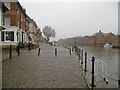
York, King's Staith
by Mike Faherty geograph for square SE6051 Once the heart of York's port on the Ouse; now occupied by bars and public... (more)
Tags:
top:City, Town Centre
top:Docks, Harbours
type:Geograph
top:Historic Sites and Artefacts
top:Lowlands
subject:Quay
river:River Ouse
Staithe
|
|
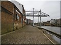
York, Queen's Staith
by Mike Faherty geograph for square SE6051 Once the heart of York's port on the Ouse; now occupied by converted... (more)
Tags:
top:City, Town Centre
top:Derelict, Disused
top:Docks, Harbours
type:Geograph
top:Historic Sites and Artefacts
top:Lowlands
subject:Quay
Staithe
|
|
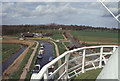
Horsey Staithe
by Stephen McKay geograph for square TG4522 Looking down at the staithe from the deck of Horsey Windpump.
Tags:
Boats
subject:Channel
top:Flat Landscapes
type:Geograph
top:Historic Sites and Artefacts
top:Rivers, Streams, Drainage
Staithe
Windpump
|
|
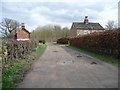
Parlington Lane between the Staith Cottages
by Christine Johnstone geograph for square SE4135 There were coal staithes just east of here, on the Aberford Railway.
|
