Public Tags
Tag: Storm·Ciara
Showing latest 50 of 52 images tagged with Storm Ciara tag.
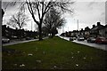
|
After Storm Ciara - Kingstanding, North Birmingham
by Martin Richard Phelan geograph for square SP0795 A view northwards on the B4138 Kingstanding Road after the passing of Storm... (more)
Tags:
place:B4138 Kingstanding Road
type:Geograph
area:Kingstanding
top:Lowlands
area:North Birmingham
top:Paths
subject:Road
top:Roads, Road Transport
Storm Ciara
top:Suburb, Urban Fringe
area:West Midlands
|

|
Lichfield Road: Storm Ciara bending birches
by John Sutton geograph for square TL4756 The blowy early afternoon of Storm Ciara was nothing like as devastating in... (more)
Tags:
top:Air, Sky, Weather
place:Cambridge
type:Geograph
top:Housing, Dwellings
Storm Ciara
top:Suburb, Urban Fringe
Trees
season:Winter
|

|
Failed roots
by Bob Harvey for square TF0820 The tree seen in TF0820 : A fossilised wind, its root structure ripped from what had been wet... (more)
Tags:
place:Bourne Woods
type:Close Look
Fallen Tree
Forestry Commission
Gale Damage
tree:Larch
woodland:Larch Plantation
top:Lowlands
Storm Ciara
Storm Damaged Tree
storm:Storm Dennis
subject:Tree
top:Woodland, Forest
|

|
Two more fallen trees
by Bob Harvey for square TF0820 These two fell during the same period (Storms Ciara or Dennis, I think Dennis... (more)
Tags:
place:Bourne Woods
type:Cross Grid
Fallen Tree
Forestry Commission
top:Lowlands
Storm Ciara
Storm Damage
Storm Damaged Tree
Storm Dennis
subject:Tree
top:Woodland, Forest
|

|
A fossilised wind
by Bob Harvey geograph for square TF0820 A memory of Storm Dennis, on the 16th and 16th of February 2020. The ground... (more)
Tags:
place:Bourne Woods
Fallen Tree
Gale Damage
type:Geograph
tree:Larch
woodland:Larch Plantation
top:Lowlands
Storm Ciara
storm:Storm Dennis
subject:Tree
top:Woodland, Forest
|

|
Fallen Scots Pine
by Bob Harvey geograph for square TF0821 This is the remains of the Scots Pine that fell across the forest track during... (more)
Tags:
Fallen Tree
Forestry Commission
Forestry Track
type:Geograph
top:Lowlands
tree:Scots Pine
Storm Ciara
Storm Damage
Storm Damaged Tree
subject:Tree
top:Woodland, Forest
|

|
In Ciara’s wake 6, Teignmouth
by Robin Stott geograph for square SX9372 On the fourth day following Storm Ciara the weather continues windy and showery.... (more)
Tags:
top:Air, Sky, Weather
top:City, Town Centre
top:Coastal
top:Docks, Harbours
Ebb Tide
top:Estuary, Marine
Gale Force Winds
type:Geograph
river:River Teign
top:Rivers, Streams, Drainage
Storm Ciara
place:Teignmouth
postcode district:TQ14
|

|
In Ciara’s wake 4, Teignmouth
by Robin Stott geograph for square SX9372 The weather on the third day following Storm Ciara is as forecast: somewhat... (more)
Tags:
top:Air, Sky, Weather
top:Coastal
top:Docks, Harbours
top:Estuary, Marine
Gale Force Winds
type:Geograph
top:Lowlands
Storm Ciara
place:Teignmouth
postcode district:TQ14
top:Village, Rural Settlement
|

|
In Ciara’s wake 3, Teignmouth
by Robin Stott geograph for square SX9372 The weather on the second day following Storm Ciara is as forecast: sunshine,... (more)
Tags:
top:Air, Sky, Weather
top:Coastal
top:Docks, Harbours
top:Estuary, Marine
Gale Force Winds
type:Geograph
top:Lowlands
Storm Ciara
top:Suburb, Urban Fringe
place:Teignmouth
postcode district:TQ14
|

|
In Ciara’s wake 2, Teignmouth
by Robin Stott geograph for square SX9372 The weather on the second day following Storm Ciara is as forecast: sunshine,... (more)
Tags:
top:Coastal
top:Docks, Harbours
top:Estuary, Marine
Gale Force Winds
type:Geograph
top:Lowlands
top:Rivers, Streams, Drainage
Storm Ciara
top:Suburb, Urban Fringe
place:Teignmouth
postcode district:TQ14
|

|
Porthcawl: a huge wave comes in
by Chris Downer geograph for square SS8176 Storm Ciara was forecast to bring strong winds over most of England and Wales... (more)
Tags:
top:Air, Sky, Weather
Breakwater
top:City, Town Centre
top:Coastal
top:Docks, Harbours
type:Geograph
Harbour
subject:Sea
Storm
Storm Ciara
Waves
|

|
Porthcawl: a big wave obscures the lighthouse
by Chris Downer geograph for square SS8176 Storm Ciara was forecast to bring strong winds over most of England and Wales... (more)
Tags:
top:Air, Sky, Weather
Breakwater
subject:Breakwater
top:City, Town Centre
top:Coastal
top:Docks, Harbours
type:Geograph
Harbour
Storm
Storm Ciara
Waves
|

|
Porthcawl: another wave hits the harbour wall
by Chris Downer geograph for square SS8176 Storm Ciara was forecast to bring strong winds over most of England and Wales... (more)
Tags:
top:Air, Sky, Weather
Breakwater
subject:Breakwater
top:City, Town Centre
top:Coastal
top:Docks, Harbours
type:Geograph
Harbour
Storm
Storm Ciara
Waves
|

|
Porthcawl: waves crash over the breakwater
by Chris Downer geograph for square SS8176 Storm Ciara was forecast to bring strong winds over most of England and Wales... (more)
Tags:
top:Air, Sky, Weather
Breakwater
subject:Breakwater
top:City, Town Centre
top:Coastal
top:Docks, Harbours
type:Geograph
Harbour
Storm
Storm Ciara
Waves
|

|
Porthcawl: big waves by the harbour breakwater
by Chris Downer geograph for square SS8176 Storm Ciara was forecast to bring strong winds over most of England and Wales... (more)
Tags:
top:Air, Sky, Weather
Breakwater
top:City, Town Centre
top:Coastal
top:Docks, Harbours
type:Geograph
Harbour
subject:Sea
Storm
Storm Ciara
Waves
|

|
Flood plain of the Trent
by Bob Harvey geograph for square SK7855 The civil war landscape near South Muskham, hidden by the waters of the Trent,... (more)
Tags:
top:Farm, Fishery, Market Gardening
subject:Flood
Flood Plain
Flooding
type:Geograph
top:Historic Sites and Artefacts
top:Lowlands
near:River Trent
River Trent
top:Rivers, Streams, Drainage
Storm Ciara
Storm Dennis
|

|
Storm Ciara: Tree damage
by Bob Harvey for square TF0621 One of the two Cedars of Lebanon at St Michael's church has shed a branch... (more)
Tags:
near:A151
top:Air, Sky, Weather
tree:Cedar of Lebanon
type:Close Look
place:Edenham
top:Lowlands
Storm Ciara
Storm Damage
subject:Tree
top:Village, Rural Settlement
|

|
Storm Ciara: Rain front
by Bob Harvey geograph for square TF0820 A front of very heavy rain came through this afternoon during the storm.
Tags:
top:Air, Sky, Weather
place:Bourne
type:Geograph
top:Housing, Dwellings
top:Lowlands
Rain
weather:Rain
Storm Ciara
top:Suburb, Urban Fringe
subject:Weather
|

|
Jesus Green: a gap in the avenue
by John Sutton geograph for square TL4559 The cones surround the remains of a tree felled a week before by Storm Ciara.... (more)
Tags:
place:Cambridge
top:City, Town Centre
type:Geograph
top:Park and Public Gardens
Storm Ciara
Trees
season:Winter
|

|
Aftermath of Storm Ciara
by Richard Hoare geograph for square SH7961 This is beside the Tannery. Water poured through this area on 9 February to a... (more)
|

|
EU flag still flying
by Stephen Craven geograph for square SP2662 This photo was taken during a dry but windy spell in 'Storm Ciara'... (more)
|

|
Henfield, Sussex - Cat and Canary sign in 35 m/s winds
by Ian Hawfinch for square TQ2016 The sign was hanging at 30-40 degrees to the vertical on account of Storm Ciara.
Tags:
top:Business, Retail, Services
Cat and Canary
type:Close Look
place:Henfield
Pub
subject:Sign
top:Sport, Leisure
Storm Ciara
place:Sussex
|

|
Pumping water from Crevenagh Park & Ride, Omagh
by Kenneth Allen for square H4572 Some drivers were caught out by Storm Ciara H4572 : Flooding at Crevenagh Park & Ride car park, Omagh
|

|
Flooding at Crevenagh Park & Ride car park, Omagh
by Kenneth Allen geograph for square H4572 They were caught out by the heavy overnight rain caused by Storm Ciara
|

|
Flooding at Irishtown Road, Omagh
by Kenneth Allen geograph for square H4572 Caused by Storm Ciara - most wise motorists decided to turn back
|

|
Flooding along Ballinamullan Burn
by Kenneth Allen geograph for square H4772 Pictured at Mullaghmore / Cranny caused by Storm Ciara
|

|
Camowen River overflowing at the Lovers Retreat
by Kenneth Allen geograph for square H4672 Caused by Storm Ciara - the highest that I've ever seen here
|

|
Flooding at Cranny Playing Fields, Mullaghmore
by Kenneth Allen geograph for square H4772 Heavy rain last night caused by Storm Ciara
|

|
Flooding caused by Storm Ciara
by Kenneth Allen geograph for square H4772 The way forward is blocked at the footbridge over Ballinamillan Burn between... (more)
|

|
Flooded path, Cranny
by Kenneth Allen geograph for square H4772 A product of Storm Ciara - these joggers couldn't go any further
|

|
A sudden fall of snow
by Bob Harvey geograph for square TF0820 In what was around 6 degrees of air temperature we had a sudden fall of snow the... (more)
Tags:
top:Air, Sky, Weather
place:Bourne
type:Geograph
top:Housing, Dwellings
top:Lowlands
weather:Snow
Storm Ciara
Stormlight
top:Suburb, Urban Fringe
subject:Weather
|

|
Wind and rain from Storm Ciara at the Point, Teignmouth
by Robin Stott geograph for square SX9372 Some of the night and all morning, Sunday 9 February 2020, curtains of fine rain... (more)
Tags:
top:Air, Sky, Weather
Beach
top:City, Town Centre
top:Coastal
Gale Force Winds
type:Geograph
Low Tide
Raining
Seafront
Storm Ciara
place:Teignmouth
postcode district:TQ14
|

|
Storm Ciara: Squally rain
by Bob Harvey geograph for square TF0820 View from my office window during a period of intense rainfall
Tags:
top:Air, Sky, Weather
place:Bourne
type:Geograph
top:Housing, Dwellings
top:Lowlands
weather:Rain
Rain
Storm Ciara
top:Suburb, Urban Fringe
subject:Weather
|

|
In Ciara’s wake 5, Teignmouth
by Robin Stott geograph for square SX9372 In continuing strong westerly winds and a spring tide (ie high), the swollen... (more)
Tags:
top:Air, Sky, Weather
top:City, Town Centre
top:Coastal
top:Docks, Harbours
top:Estuary, Marine
Gale Force Winds
type:Geograph
Storm Ciara
place:Teignmouth
postcode district:TQ14
|

|
Fallen Scots Pine
by Bob Harvey geograph for square TF0821 This is the Erstwhile crown of the tree seen in TF0821 : Fallen Scots Pine.
This bit, and... (more)
Tags:
Fallen Tree
Forestry Commission
type:Geograph
top:Lowlands
tree:Scots Pine
Storm Ciara
Storm Damage
Storm Damaged Tree
subject:Tree
top:Woodland, Forest
|

|
Structural failings
by Bob Harvey geograph for square TF0820 The roots of the tree in TF0820 : A fossilised wind and TF0820 : Failed roots, showing how shallow and... (more)
Tags:
place:Bourne Woods
Fallen Tree
Forestry Commission
Gale Damage
type:Geograph
tree:Larch
woodland:Larch Plantation
top:Lowlands
Storm Ciara
storm:Storm Dennis
subject:Tree
top:Woodland, Forest
|

|
A bit of Brash
by Bob Harvey for square TF0821 Some scraps removed from the path when clearing up after the incident seen in... (more)
Tags:
place:Bourne Woods
type:Close Look
Forestry Commission
top:Lowlands
Storm Ciara
Storm Damage
subject:Woodland
top:Woodland, Forest
|

|
Flooding in Kelham Parish
by Bob Harvey geograph for square SK7855 The Trent flood plain doing what it is supposed to do
Tags:
Flood Plain
subject:Flood Plain
Flooding
type:Geograph
top:Lowlands
near:Newark
near:River Trent
River Trent
top:Rivers, Streams, Drainage
Storm Ciara
Storm Dennis
|

|
High water level at Bells Bridge, Omagh
by Kenneth Allen geograph for square H4572 The arches are nearly covered
|

|
Water bursting through a manhole cover, Omagh
by Kenneth Allen for square H4572 Pictured along Dublin Road but at least the road wasn't flooded like in... (more)
|

|
Flooded banks along the three rivers at Campsie, Omagh
by Kenneth Allen geograph for square H4572 The junction of the Drumragh and Camowen Rivers form the Strule here
It was... (more)
|

|
Flooded banks along the Drumragh River, Omagh
by Kenneth Allen geograph for square H4572 Pictured at Campsie before it joins the River Camowen to form the Strule
|

|
Risking it through the flooded road, Campsie
by Kenneth Allen geograph for square H4572 A young driver got away with driving fast through the water lying across Irishtown Road
|

|
Making it through the flood on Irishtown Road, Omagh
by Kenneth Allen geograph for square H4572 This SUV was better equipped to drive along the raised footpath at a slow pace
|

|
Trees immersed in the flooded river, Mullaghmore
by Kenneth Allen geograph for square H4772 Pictured along the Highway to Health path
The view is normally like this H4772 : "The Six Men" along the Camowen River
|

|
Rivers Agency van, Lovers Retreat
by Kenneth Allen geograph for square H4672 An official has come to inspect the flooding along the river
|

|
Overflowing river, Lovers Retreat
by Kenneth Allen geograph for square H4672 Pictured from here H4672 : Picturing the overflowing river, Lovers Retreat
|

|
Looking at the flood, Lovers Retreat
by Kenneth Allen geograph for square H4672 Pictured along the Camowen River
The water is above the level of the ground... (more)
|

|
Watching the flood at the Lovers Retreat
by Kenneth Allen geograph for square H4672 Locals have come out to look at the exceptionally high surge of water coming over the weir
|

|
High water level at Cranny footbridge
by Kenneth Allen for square H4772 Pictured here H4772 : Flooding caused by Storm Ciara - this is as high as I've ever seen it
|
