Public Tags
Tag: Sustainable·Urban·Drainage·System·(SUDS)
Showing latest 50 of 64 images tagged with Sustainable Urban Drainage System (SUDS) tag.

|
SUDS pond, Kilmardinny Gait
by Richard Sutcliffe geograph for square NS5573 A Sustainable Urban Drainage System (SUDS) pond at Kilmardinny Gait (a new... (more)
Tags:
subject:Drainage
type:Geograph
top:Housing, Dwellings
top:Lakes, Wetland, Bog
Sustainable Urban Drainage System (SUDS)
|
|
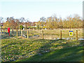
SUDS pond at The Ridings
by Rose and Trev Clough geograph for square NY4053 SUDS stands for sustainable urban drainage system - for information see... (more)
|
|
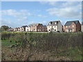
New estate - SUDS
by Chris Allen geograph for square SO8753 The hollow in the foreground has been excavated as part of the new estate and is... (more)
Tags:
type:Geograph
top:Housing, Dwellings
New Housing Estate
top:Rivers, Streams, Drainage
Sustainable Urban Drainage System (SUDS)
place:Worcester
|

|
SuDS ponds
by Richard Sutcliffe geograph for square NS4963 Balancing ponds beside Bankhead Avenue, built during the construction of the new... (more)
Tags:
Balancing Pond
top:Boundary, Barrier
Fence
type:Geograph
top:Housing, Dwellings
top:Lakes, Wetland, Bog
Lifebelt
New Houses
subject:Pond
Sustainable Urban Drainage System (SUDS)
|

|
SUDS information panel
by Richard Sutcliffe for square NS5365 An information panel, explaining that the area behind the fence NS5365 : Queen Elizabeth University Hospital is a... (more)
|

|
SUDS pond
by Richard Sutcliffe geograph for square NS5365 A Sustainable Urban Drainage System (SUDS) pond beside the Queen Elizabeth... (more)
|
|
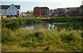
SUDS pond
by Richard Sutcliffe geograph for square NS6773 A Sustainable Urban Drainage System (SUDS) pond beside new houses. As well as... (more)
Tags:
type:Geograph
top:Housing, Dwellings
top:Lakes, Wetland, Bog
subject:Pond
Sustainable Urban Drainage System (SUDS)
|

|
SUDS drainage at Doonfoot
by Mary and Angus Hogg geograph for square NS3118 This enhancement of a natural feature is being used for a Sustainable Urban... (more)
Tags:
type:Geograph
top:Lowlands
top:Rivers, Streams, Drainage
Sustainable Urban Drainage System (SUDS)
|
|
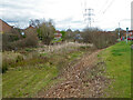
SUDS in St Peter The Great
by Chris Allen geograph for square SO8652 Although described as wetlands by a fellow contributor, I believe this and at... (more)
Tags:
subject:Drainage
type:Geograph
top:Rivers, Streams, Drainage
Sustainable Urban Drainage System (SUDS)
place:Worcester
|

|
Attenuation basin at Frobisher Meadows
by Stephen Craven geograph for square SE3823 Part of a Taylor Wimpey development of 408 homes on the site of the former... (more)
|

|
Whittington Walk housing development, Worcester - SUDS
by Chris Allen geograph for square SO8853 The pond is part of a Sustainable Urban Drainage System. The brick building is... (more)
Tags:
Electricity Substation
top:Energy Infrastructure
type:Geograph
New Housing Development
subject:Pond
top:Rivers, Streams, Drainage
Sustainable Urban Drainage System (SUDS)
place:Worcester
|
|
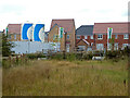
Whittington Walk housing development, Worcester
by Chris Allen geograph for square SO8853 The houses in the background are finished and occupied but the complex is still... (more)
Tags:
Building Site
subject:Construction
top:Construction, Development
type:Geograph
top:Housing, Dwellings
New Housing Development
top:Rivers, Streams, Drainage
Sustainable Urban Drainage System (SUDS)
place:Worcester
|
|
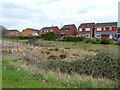
Houses on Heath Drive, St Peter The Great
by Chris Allen geograph for square SO8652 Seen across a damp patch that is marked as a drain on the map and is almost... (more)
Tags:
type:Geograph
subject:Houses
top:Housing, Dwellings
Modern Housing Development
top:Rivers, Streams, Drainage
Sustainable Urban Drainage System (SUDS)
place:Worcester
|

|
The SUDS pond at Doonfoot
by Mary and Angus Hogg geograph for square NS3118 The new housing development was required to include a Sustainable Urban Drainage... (more)
Tags:
type:Geograph
top:Lakes, Wetland, Bog
top:Lowlands
top:Park and Public Gardens
Sustainable Urban Drainage System (SUDS)
top:Water Resources
|

|
Doing what it's meant to do
by Richard Sutcliffe geograph for square NS5573 The Sustainable Urban Drainage System (SUDS) pond at Kilmardinny Gait has filled... (more)
Tags:
type:Geograph
top:Housing, Dwellings
top:Lakes, Wetland, Bog
subject:Pond
top:Roads, Road Transport
Sustainable Urban Drainage System (SUDS)
|

|
SuDS pond
by Richard Sutcliffe for square NO5101 Sustainable drainage system beside new housing on the edge of St Monans. It is... (more)
Tags:
type:Cross Grid
subject:Drainage
top:Housing, Dwellings
New Housing
top:Rivers, Streams, Drainage
Sustainable Urban Drainage System (SUDS)
|

|
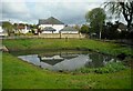
SuDS pond
by Richard Sutcliffe geograph for square NS5472 Sustainable urban Drainage System pond beside Norman MacLeod Crescent. There is... (more)
Tags:
type:Geograph
top:Housing, Dwellings
top:Lakes, Wetland, Bog
subject:Pond
Sustainable Urban Drainage System (SUDS)
|
|
SuDS pond
by Richard Sutcliffe geograph for square NS5472 Sustainable urban Drainage System pond beside Norman MacLeod Crescent. There is... (more)
Tags:
type:Geograph
top:Housing, Dwellings
top:Lakes, Wetland, Bog
subject:Pond
Sustainable Urban Drainage System (SUDS)
|

|
SuDS pond
by Richard Sutcliffe geograph for square NS4245 Sustainable urban Drainage System pond at the new Draffen Park housing... (more)
Tags:
type:Geograph
top:Housing, Dwellings
top:Lakes, Wetland, Bog
subject:Pond
Sustainable Urban Drainage System (SUDS)
|

|
Kessington Gate Wetland
by Richard Sutcliffe geograph for square NS5671 Sustainable Urban Drainage System (SUDS) pond constructed as part of the... (more)
Tags:
top:Educational Sites
type:Geograph
top:Grassland
top:Lakes, Wetland, Bog
subject:Pond
Sustainable Urban Drainage System (SUDS)
Wetland
|

|
Queen Elizabeth University Hospital
by Richard Sutcliffe geograph for square NS5365 A Sustainable Urban Drainage System (SUDS) pond is located beside the Queen... (more)
|

|
Queen Elizabeth University Hospital
by Richard Sutcliffe geograph for square NS5365 A Sustainable Urban Drainage System (SUDS) pond is on the right of the fence.... (more)
|

|
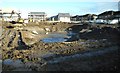
New units Nunnery Park, Worcester
by Chris Allen geograph for square SO8854 The two smaller of the three units being built on Nunnery Park between the A4440... (more)
Tags:
Building Site
Business Park
top:Business, Retail, Services
subject:Construction
top:Construction, Development
type:Geograph
Sustainable Urban Drainage System (SUDS)
place:Worcester
|
|
Big muddy hole
by Richard Sutcliffe geograph for square NS5260 This is in fact a SuDS (Sustainable Drainage System) pond under construction.... (more)
Tags:
top:Construction, Development
type:Geograph
subject:Pond
Sustainable Urban Drainage System (SUDS)
top:Water Resources
|

|
SUDS facility on Mill Way
by Stephen Craven geograph for square SE2045 A 'sustainable urban drainage scheme' for this large modern housing... (more)
|

|
Thorpe Park utilities: bottom pond
by Stephen Craven geograph for square SE3734 A chain of four ponds provides a SUDS (sustainable urban drainage scheme) for... (more)
|

|
Thorpe Park utilities: top pond
by Stephen Craven geograph for square SE3834 A chain of four ponds provides a SUDS (sustainable urban drainage scheme) for... (more)
|

|
SuDS pond
by Richard Sutcliffe geograph for square NS5868 The Sustainable drainage systems pond is related to the new housing development... (more)
Tags:
type:Geograph
top:Grassland
top:Housing, Dwellings
top:Lakes, Wetland, Bog
subject:Pond
top:Roads, Road Transport
Sustainable Urban Drainage System (SUDS)
|

|
SuDS pond
by Richard Sutcliffe geograph for square NS5868 The Sustainable drainage systems pond is related to the new housing development... (more)
Tags:
type:Geograph
top:Housing, Dwellings
top:Lakes, Wetland, Bog
subject:Pond
top:Roads, Road Transport
Steps
Sustainable Urban Drainage System (SUDS)
|

|
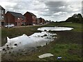
Neighbourhood sustainable drainage storage pond
by David Lally geograph for square SK3885 Slowly becoming naturalised i.e. looking nicer than two years ago: SK3885 : Neighbourhood sustainable drainage storage pond.
Tags:
type:Geograph
top:Park and Public Gardens
subject:Pond
top:Suburb, Urban Fringe
Sustainable Drainage System
Sustainable Urban Drainage System (SUDS)
|
|
Neighbourhood sustainable drainage storage pond
by David Lally geograph for square SK3885 Tags:
type:Geograph
top:Park and Public Gardens
subject:Pond
top:Suburb, Urban Fringe
Sustainable Drainage System
Sustainable Urban Drainage System (SUDS)
|

|
SuDS Drainage Pond
by valenta geograph for square NH6543 SuDs drainage pond by the new West Link Road and Holm Mills Bridge over the River Ness
Tags:
subject:Drainage
type:Geograph
top:Heath, Scrub
bridge:Holm Mills
place:Inverness
top:Lowlands
river:River Ness
top:Rivers, Streams, Drainage
top:Suburb, Urban Fringe
Sustainable Urban Drainage System (SUDS)
|

|
Regency Gate sustainable urban drainage system, Worcester
by Chris Allen geograph for square SO8254 New housing development off the A44 near the edge of Worcester. The houses on... (more)
Tags:
subject:Drainage
type:Geograph
New Housing Development
top:Rivers, Streams, Drainage
top:Suburb, Urban Fringe
Sustainable Urban Drainage System (SUDS)
place:Worcester
|

|
Whittington Walk housing development, Worcester - drainage scheme
by Chris Allen geograph for square SO8853 This is one of two newly created ponds that I believe are part of a sustainable... (more)
Tags:
subject:Drainage
type:Geograph
New Housing Development
top:Rivers, Streams, Drainage
Sustainable Urban Drainage System (SUDS)
place:Worcester
|

|
Sustainable urban drainage system and new houses, worcester
by Chris Allen geograph for square SO8654 Seen from Williamson Road on the site of the former 'Metal Box'... (more)
Tags:
type:Geograph
subject:Houses
top:Housing, Dwellings
New Housing Development
top:Rivers, Streams, Drainage
Sustainable Urban Drainage System (SUDS)
|

|
Balancing pond
by David Lally geograph for square SK4933 On the Circuit Drive estate
Tags:
type:Geograph
subject:Pond
top:Rivers, Streams, Drainage
top:Suburb, Urban Fringe
Sustainable Drainage System
Sustainable Urban Drainage System (SUDS)
|

|
Cowcroft Drive, Worcester
by Chris Allen geograph for square SO8254 Part of a large new housing development by multiple companies. The open land to... (more)
Tags:
type:Geograph
subject:Houses
top:Housing, Dwellings
New Housing Development
top:Suburb, Urban Fringe
Sustainable Urban Drainage System (SUDS)
place:Worcester
|

|
Ashford Road, Worcester
by Chris Allen geograph for square SO8254 Some open space in the Grove Farm development. On the right is a play area and... (more)
Tags:
type:Geograph
Housing Development
subject:Open Area
Play Area
top:Suburb, Urban Fringe
Sustainable Urban Drainage System (SUDS)
place:Worcester
|

|
Urban drainage pond off Bruce Smeaton Way (2)
by Stephen Craven geograph for square SE4223 This appears to be a constructed urban drainage facility (SUDS) to store water... (more)
|

|
Urban drainage pond off Bruce Smeaton Way (1)
by Stephen Craven geograph for square SE4223 This appears to be a constructed urban drainage facility (SUDS) to store water... (more)
|
|
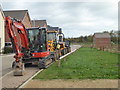
Construction equipment - new estate
by Chris Allen geograph for square SO8753 Uffnells Farm Substation and a sustainable urban drainage system are in the... (more)
|

|
Whittington Walk - drainage scheme
by Chris Allen geograph for square SO8853 The nearest structure is marked on the map as a balancing pond and is presumably... (more)
Tags:
subject:Drainage
type:Geograph
New Housing Development
top:Rivers, Streams, Drainage
top:Suburb, Urban Fringe
Sustainable Urban Drainage System (SUDS)
place:Worcester
|
|
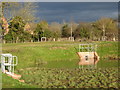
Sustainable Urban Drainage System, new estate, Worcester
by Chris Allen geograph for square SO8753 This is a pond that appears to have been excavated as part of a new development.
Tags:
top:Construction, Development
type:Geograph
New Housing Estate
Sustainable Urban Drainage System (SUDS)
place:Worcester
|

|
Sustainable urban drainage scheme
by Chris Allen geograph for square SO8853 Part of the Whittington walk housing development. The brick building is an... (more)
Tags:
subject:Drainage
Electricity Substation
type:Geograph
New Housing Development
top:Rivers, Streams, Drainage
top:Suburb, Urban Fringe
Sustainable Urban Drainage System (SUDS)
place:Worcester
|
|
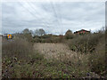
Sustainable urban drainage scheme from Grasshopper Avenue
by Chris Allen geograph for square SO8652 One of three ponds in close proximity at this end of the St Peter The Great... (more)
Tags:
subject:Drainage
type:Geograph
Modern Housing Development
top:Rivers, Streams, Drainage
top:Suburb, Urban Fringe
Sustainable Urban Drainage System (SUDS)
place:Worcester
|

|
Maryhill Lochgilp St SUD
by Richard Sutcliffe geograph for square NS5669 A SUDs pond close to the Lochgilp Street housing development (completed in... (more)
Tags:
top:Boundary, Barrier
type:Geograph
top:Lakes, Wetland, Bog
subject:Pond
Railings
Scottish Water Infrastructure
Sustainable Urban Drainage System (SUDS)
top:Water Resources
|

|
Small pond off Whistler Drive
by Stephen Craven geograph for square SE4223 One of several ponds constructed as part of the Micklefields development, and... (more)
|

|
SUDS at Newton Hill
by Stephen Craven geograph for square SE3322 This recently created pond is presumably intended as a runoff retention facility... (more)
|

|
SUDS development off Entwisle Way
by Stephen Craven geograph for square SJ7157 Intended to retain excess rainwater runoff from the Acorn Meadows housing development.
|

|
SUDS development off Thorneycroft Way
by Stephen Craven geograph for square SJ7157 Intended to retain excess rainwater runoff from the Meadow View housing development.
|
