Geograph - photograph every grid square
About tags on Geograph
Tags
Geographical Context
Subjects
Types
Other Prefixes
Public Tags
Related Tags
|
Coverage Map
Tag:
TPT
Showing latest 50 of 82 images tagged with
TPT
tag.
View all tagged images
-
In Browser
Search within these images
:
Temporary bridge on the TPT diversion at Dunford Bridge
by
Dave Pickersgill
geograph for square
SE1602
This is a temporary bridge on the Trans Pennine Trail diversion at Dunford... (
more
)
Tags:
subject:
Bridge
top:
Construction, Development
place:
Dunford Bridge
type:
Geograph
top:
Paths
TPT
long distance path:
Trans Pennine Trail
top:
Uplands
TPT sign at Kendal Green
by
Dave Pickersgill
for square
SE3403
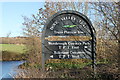
A Trans Pennine Trail (TPT) sign on the Dove Valley Trail at Kendal Green, Barnsley.
Tags:
place:
Barnsley
place:
Kendal Green
top:
Paths
top:
Sport, Leisure
top:
Suburb, Urban Fringe
TPT
Trans Pennine Trail
long distance path:
Trans Pennine Trail
TPT sign
by
Dave Pickersgill
for square
SE2602
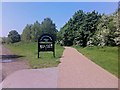
A sign just off the Trans Pennine Trail (TPT) at Oxspring.
Tags:
top:
Lowlands
place:
Oxspring
top:
Paths
Sign
top:
Sport, Leisure
TPT
long distance path:
Trans Pennine Trail
top:
Village, Rural Settlement
TPT sign
by
Dave Pickersgill
for square
SK2999
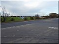
TPT (Trans Pennine Trail) sign at Cote Green Car park near Wortley.
Tags:
top:
Lowlands
top:
Paths
TPT
Trans Pennine Trail
long distance path:
Trans Pennine Trail
place:
Wortley
TPT sign footpath straight on is called Maggot Lane
by
Steve Fareham
geograph for square
SE2702
Tags:
place:
Oxspring
top:
Paths
county:
South Yorkshire
top:
Sport, Leisure
TPT
long distance path:
Trans Pennine Trail
The ice is beginning to melt on the TPT Oxspring
by
Steve Fareham
geograph for square
SE2703
Tags:
top:
Paths
county:
South Yorkshire
top:
Sport, Leisure
TPT
long distance path:
Trans Pennine Trail
Trans Pennine Trail (TPT) passes through Far Coates farmyard
by
Steve Fareham
geograph for square
SE2703
Tags:
top:
Farm, Fishery, Market Gardening
top:
Paths
county:
South Yorkshire
top:
Sport, Leisure
TPT
long distance path:
Trans Pennine Trail
The TPT track emerges from Burn airfield onto Common Lane
by
Steve Fareham
geograph for square
SE6029
Tags:
Burn Airfield
NCN62
county:
North Yorkshire
top:
Paths
top:
Sport, Leisure
TPT
long distance path:
Trans Pennine Trail
TPT junction signs off Burn Lane
by
Steve Fareham
geograph for square
SE6027
Not forgetting the zero tolerance to poachers.
Tags:
NCN62
county:
North Yorkshire
top:
Paths
top:
Sport, Leisure
TPT
long distance path:
Trans Pennine Trail
Junction for walkers on TPT NCN62 near Carlton N Yorks
by
Steve Fareham
geograph for square
SE6323
Tags:
NCN62
top:
Roads, Road Transport
top:
Sport, Leisure
TPT
long distance path:
Trans Pennine Trail
Powerlines cross Gowdall Lane part of the TPT
by
Steve Fareham
geograph for square
SE6322
Tags:
top:
Energy Infrastructure
Gowdall
NCN 62
Pylon
top:
Roads, Road Transport
TPT
long distance path:
Trans Pennine Trail
TPT follows Field Lane towards Gowdall
by
Steve Fareham
geograph for square
SE6121
Tags:
NCN 62
top:
Roads, Road Transport
top:
Sport, Leisure
TPT
long distance path:
Trans Pennine Trail
TPT junction with A645
by
Steve Fareham
geograph for square
SE6221
A short stretch of the trail now follows the busy A645 west for half a mile or so.
Tags:
road:
A645
NCN 62
Pollington
top:
Roads, Road Transport
TPT
long distance path:
Trans Pennine Trail
TPT barrier near Balne Lodge
by
Steve Fareham
geograph for square
SE6218
Tags:
NCN 62
top:
Paths
top:
Sport, Leisure
TPT
long distance path:
Trans Pennine Trail
TPT sign
by
Steve Fareham
geograph for square
SE6117
Tags:
top:
Flat Landscapes
NCN 62
top:
Paths
top:
Sport, Leisure
TPT
long distance path:
Trans Pennine Trail
Trans Pennine Trail (TPT) Topham Ferry
by
Steve Fareham
geograph for square
SE6117
Tags:
NCN 62
top:
Paths
top:
Sport, Leisure
Sykehouse
TPT
long distance path:
Trans Pennine Trail
Topham Ferry Lane and TPT sign
by
Steve Fareham
geograph for square
SE6217
Tags:
NCN 62
top:
Paths
top:
Roads, Road Transport
Sykehouse
TPT
long distance path:
Trans Pennine Trail
top:
Village, Rural Settlement
Small weir on the River Dove near Barnsley
by
Steve Fareham
geograph for square
SE3804
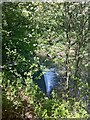
Almost hidden by the trees the weir is just visible from the Trans Pennine Trail (TPT).
Tags:
near:
Barnsley
river:
Dove
River Dove
top:
Rivers, Streams, Drainage
TPT
long distance path:
Trans Pennine Trail
Wombwell
TPT (Trans Pennine Trail) junction
by
Steve Fareham
geograph for square
SE3904
Left Worsbrough, right to Barnsley and Leeds.
Tags:
near:
Barnsley
top:
Paths
top:
Sport, Leisure
TPT
long distance path:
Trans Pennine Trail
Trans Pennine Trail
Wombwell
The SE end of the Huthwaite Tunnel
by
Dave Pickersgill
for square
SE2800
This line was part of the original Manchester/Sheffield line, built by the... (
more
)
Tags:
type:
Close Look
place:
Huthwaite
top:
Paths
top:
Railways
place:
Thurgoland
TPT
long distance path:
Trans Pennine Trail
subject:
Tunnel
top:
Uplands
top:
Village, Rural Settlement
TPT sign at Cote Green
by
Dave Pickersgill
for square
SK2999
Tags:
type:
Close Look
place:
Cote Green
top:
Paths
subject:
Sign
Sign
TPT
long distance path:
Trans Pennine Trail
top:
Uplands
top:
Village, Rural Settlement
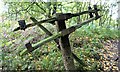
Railway infrastructure remnants
by
Dave Pickersgill
for square
SE2502
Railway infrastructure remnants close to the Trans Pennine Trail (TPT) at Oxspring.
Tags:
type:
Close Look
top:
Historic Sites and Artefacts
place:
Oxspring
top:
Paths
subject:
Railway Infrastructure
top:
Railways
top:
Suburb, Urban Fringe
TPT
long distance path:
Trans Pennine Trail
top:
Uplands
Bridge on the Trans Pennine Trail diversion
by
Dave Pickersgill
for square
SE1702
This is a new (permanent) bridge on the Trans Pennine Trail diversion at Dunford... (
more
)
Tags:
subject:
Bridge
top:
Construction, Development
type:
Cross Grid
place:
Dunford Bridge
top:
Paths
TPT
long distance path:
Trans Pennine Trail
top:
Uplands
TPT signs in Hirst Courtney village
by
Steve Fareham
geograph for square
SE6124
Tags:
Hirst Courtney
NCN62
county:
North Yorkshire
top:
Roads, Road Transport
top:
Sport, Leisure
TPT
long distance path:
Trans Pennine Trail
top:
Village, Rural Settlement
The former railway viaduct across the River Dearne
by
Steve Fareham
geograph for square
SE3806
Now carrying a section of the TPT.
Tags:
near:
Barnsley
Former Railway Viaduct
top:
Paths
top:
Railways
top:
Rivers, Streams, Drainage
TPT
long distance path:
Trans Pennine Trail
Power lines march across the farmland crossing the TPT
by
Steve Fareham
geograph for square
SE6218
Tags:
top:
Energy Infrastructure
top:
Flat Landscapes
NCN 62
top:
Paths
top:
Sport, Leisure
TPT
long distance path:
Trans Pennine Trail
The navigable River Don
by
Steve Fareham
geograph for square
SK5299
In the foreground is the shadow of the girder span of Conisbrough viaduct now... (
more
)
Tags:
Canal Boat
near:
Doncaster
former:
Railway Viaduct
River Don
top:
Rivers, Streams, Drainage
county:
South Yorkshire
top:
Sport, Leisure
TPT
long distance path:
Trans Pennine Trail
Tomorrow (13/09/14) is Penistone show day and also the adjacent TPT's 25th anniversary
by
Steve Fareham
geograph for square
SE2403
Tags:
near:
Barnsley
top:
Paths
place:
Penistone
top:
People, Events
county:
South Yorkshire
top:
Sport, Leisure
TPT
long distance path:
Trans Pennine Trail
top:
Village, Rural Settlement
The TPT Dunford Bridge artwork
by
Steve Fareham
geograph for square
SE1502
Tomorrow the 13th September is the trail's 25th anniversary. The section... (
more
)
Tags:
Artwork
near:
Barnsley
place:
Dunford Bridge
top:
Paths
near:
Penistone
top:
Roads, Road Transport
county:
South Yorkshire
TPT
long distance path:
Trans Pennine Trail
top:
Village, Rural Settlement
The TPT passes under Ecklands Bridge and its willow artwork
by
Steve Fareham
geograph for square
SE2102
Tomorrow the 13th September is the trail's 25th anniversary.
Tags:
Artwork
near:
Barnsley
top:
Paths
near:
Penistone
county:
South Yorkshire
TPT
long distance path:
Trans Pennine Trail
TPT art on Ecklands Bridge
by
Steve Fareham
for square
SE2102
Tags:
Artwork
top:
Paths
near:
Penistone
county:
South Yorkshire
top:
Sport, Leisure
TPT
long distance path:
Trans Pennine Trail
TPT direction post Millhouse Green
by
Steve Fareham
geograph for square
SE2202
Tags:
near:
Barnsley
top:
Paths
near:
Penistone
county:
South Yorkshire
top:
Sport, Leisure
TPT
long distance path:
Trans Pennine Trail
top:
Village, Rural Settlement
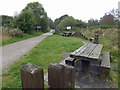
TPT picnic site near Thurgoland
by
Steve Fareham
geograph for square
SE2900
Tags:
near:
Barnsley
top:
Paths
Picnic Table
county:
South Yorkshire
top:
Sport, Leisure
TPT
long distance path:
Trans Pennine Trail
Trans Pennine Trail (TPT) Cote Green car park
by
Steve Fareham
geograph for square
SK2999
Tags:
near:
Barnsley
subject:
Car Park
top:
Paths
county:
South Yorkshire
top:
Sport, Leisure
TPT
TPT67
long distance path:
Trans Pennine Trail
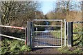
Gate on the Trail
by
Dave Pickersgill
geograph for square
SE3403
A gate on the Trans Pennine Trail (TPT) (Dove Valley Trail) at Kendal Green, Barnsley.
Tags:
place:
Barnsley
Gate
place:
Kendal Green
top:
Paths
TPT
Trans Pennine Trail
long distance path:
Trans Pennine Trail
top:
Village, Rural Settlement
Trans Pennine Trail signs Owston Grange
by
Steve Fareham
geograph for square
SE5710
NCN 62.
Tags:
NCN62
top:
Paths
top:
Sport, Leisure
TPT
A tree blocking entrance to the farmland off the Selby to York cycle route
by
Steve Fareham
geograph for square
SE6139
Tags:
Cyclepath
top:
Farm, Fishery, Market Gardening
top:
Lowlands
NCN65
TPT
Trans Pennine Trail sign
by
Dave Pickersgill
geograph for square
SE2403
Tags:
place:
Barnsley
top:
City, Town Centre
type:
Geograph
top:
Paths
place:
Penistone
subject:
Sign
TPT
long distance path:
Trans Pennine Trail
Trans Pennine Trail Sign
top:
Uplands
Trans Pennine Trail, Penistone
by
Dave Pickersgill
for square
SE2403
Tags:
place:
Barnsley
top:
City, Town Centre
type:
Close Look
top:
Paths
place:
Penistone
subject:
Sign
TPT
long distance path:
Trans Pennine Trail
Trans Pennine Trail Sign
top:
Uplands
Huthwaite Tunnel warning sign
by
Dave Pickersgill
for square
SE2900
Tags:
type:
Close Look
place:
Hunthwaite
place:
Hunthwaite Tunnel
top:
Paths
top:
Railways
subject:
Sign
TPT
top:
Uplands
Walkers enter the Hunthwaite Tunnel
by
Dave Pickersgill
for square
SE2800
Tags:
place:
Barnsley
top:
Historic Sites and Artefacts
type:
Inside
top:
Paths
top:
Railways
top:
Sport, Leisure
TPT
long distance path:
Trans Pennine Trail
subject:
Tunnel
top:
Uplands
Penistone Station
by
Dave Pickersgill
geograph for square
SE2503
This disused platform at Penistone railway station was originally the main line... (
more
)
Tags:
top:
City, Town Centre
top:
Derelict, Disused
type:
Geograph
place:
Penistone
Penistone Line Trail
top:
Railways
Station
Station Building
Station Platform
TPT
long distance path:
Trans Pennine Trail
Trans Pennine Trail
top:
Uplands
Trans Pennine Trail Toll Bar
by
Steve Fareham
geograph for square
SE5607
Tags:
near:
Doncaster
NCN 62
top:
Paths
top:
Sport, Leisure
TPT
Bridge over railway carrying a spur for horse riding of the Trans Pennine Trail
by
Steve Fareham
geograph for square
SE3721
Tags:
top:
Paths
top:
Railways
top:
Sport, Leisure
TPT
near:
Wakefield
county:
West Yorkshire
Entrance to Heath Hall
by
Steve Fareham
geograph for square
SE3520
Tags:
Ncn67
top:
Roads, Road Transport
TPT
TPT67
top:
Village, Rural Settlement
near:
Wakefield
Trans Pennine Trail to Heath
by
Steve Fareham
geograph for square
SE3519
Tags:
Ncn67
top:
Paths
top:
Sport, Leisure
TPT
TPT67
near:
Wakefield
Longdendale Trail
by
Steve Fareham
geograph for square
SK0396
Tags:
Former Railway Track
long distance path:
Longdendale Trail
NCN 62
top:
Paths
top:
Sport, Leisure
TPT
long distance path:
Trans Pennine Trail
top:
Uplands
Longdendale Trail
by
Steve Fareham
geograph for square
SK0397
Tags:
Former Railway Track
long distance path:
Longdendale Trail
NCN 62
top:
Paths
top:
Sport, Leisure
Sustrans
TPT
long distance path:
Trans Pennine Trail
top:
Uplands
Bridleway sign to Rhodeswood Dam from the Longdendale Trail
by
Steve Fareham
geograph for square
SK0497
Tags:
Former Railway Track
NCN 62
top:
Paths
top:
Sport, Leisure
Sustrans
TPT
long distance path:
Trans Pennine Trail
Longdendale Trail
by
Steve Fareham
geograph for square
SK0498
Tags:
Former Railway Track
long distance path:
Longdendale Trail
NCN 62
top:
Paths
top:
Sport, Leisure
TPT
long distance path:
Trans Pennine Trail
top:
Uplands
View more in the Image Search
or
in Browser
View images matching 'TPT' anywhere
in
the tags
Don't click these:
PotMel 1
PotMel 2
☰
Home
View
Search
Marked Images
Maps
Browser
Explore
Showcase
New Images
Collections
Interact
Games
Discussions
Blog
Contributors
Submit
Statistics
Leaderboards
General
FAQ
Help Pages
Sitemap
Contact Us
Support Us
sponsored by
🔍︎
What to search:
Photos
Enter keywords or a location/postcode to search nearby images
Enter a Grid Reference
Placenames
Collections
Website Pages
Everything
Others:
Advanced Search
|
Image Browser
Or:
Coverage Map
|
Searchable Map
You are not logged in
|
login
|
register