Public Tags
Tag: Taff·Trail
Other tags: long distance path:Taff Trail
Showing latest 50 of 355 images tagged with Taff Trail tag.
|
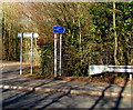
Taff Trail direction sign in Abercanaid Industrial Estate
by Jaggery geograph for square SO0504 The blue sign on the far right here Link... (more)
Tags:
type:Geograph
top:Paths
Taff Trail
long distance path:Taff Trail
top:Village, Rural Settlement
|
|
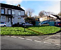
Taff Trail signpost, Quakers Yard
by Jaggery geograph for square ST0996 Following the course of the River Taff, the Taff Trail is a walking and cycling... (more)
|

|
Taff Trail direction sign, Taffs Mead Embankment, Cardiff
by Jaggery geograph for square ST1775 At the southern end of Taffs Mead Embankment at the Penarth Road junction.... (more)
|

|
Junction of path and track on the Taff Trail, Pontypridd
by Jaggery geograph for square ST0789 Diverging from the Taff Trail path, the track on the right descends towards a... (more)
|
|
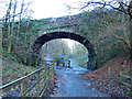
Taff Trail/Celtic Trail junction
by John Light geograph for square ST1285 The left hand fork ahead leads north along the Taff Trail/Celtic Trail towards... (more)
Tags:
national cycle route:4
national cycle route:8
Bridge
national cycle route:Celtic Trail
national cycle route:Lon Las Cymru
top:Paths
long distance path:Taff Trail
|

|
Taff Embankment
by Karl LP geograph for square ST1875 In Grangetown, looking south down the Taff embankment, following the path of the... (more)
Tags:
top:City, Town Centre
type:Geograph
Grangetown
top:Park and Public Gardens
subject:Path
top:Paths
Taff Trail
long distance path:Taff Trail
|

|
Taff Trail signposts near Iron Bridge, Tongwynlais
by Jaggery geograph for square ST1381 Brown signs pointing left and right show the route of the Taff Trail and... (more)
Tags:
national cycle route:8
National Cycle Network Route 8
path:National Cycle Route 8
NCN Route 8
top:Paths
Sustrans Route 8
long distance path:Taff Trail
Taff Trail
|
|
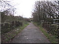
Taff Trail near Pontypridd
by John Light geograph for square ST0891 An old railway bridge which used to carry the Pont Shon Norton Branch of the... (more)
Tags:
national cycle route:47
national cycle route:8
Bridge
national cycle route:Lon Las Cymru
top:Paths
long distance path:Taff Trail
|
|
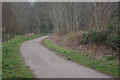
Taff Trail, Aberfan
by Stephen McKay geograph for square SO0700 The Taff Trail is a cycle and walking route that broadly follows the River Taff... (more)
Tags:
top:Paths
Taff Trail
|

|
The Taff Snail
by Robin Drayton geograph for square ST1380 Graffiti beside the Taff Trail.
The Taff Trail is a long distance recreational... (more)
Tags:
place:Cardiff
type:Geograph
subject:Graffiti
National Cycle Network Route 8
top:Paths
place:Radyr
top:Suburb, Urban Fringe
long distance path:Taff Trail
|

|
Under the A4058, Pontypridd
by Jaggery geograph for square ST0789 From the edge of Ynysangharad Park, the Taff Trail, on the north bank of the... (more)
|

|
Taff Trail footbridge over the A470, Pontypridd
by Jaggery geograph for square ST0889 From the River Taff side looking towards Pentrebach Road.
Tags:
Footbridge Over Road
top:Paths
top:Suburb, Urban Fringe
long distance path:Taff Trail
Taff Trail
|

|
Taff Trail north of Abercynon
by John Light geograph for square ST0995 The Taff Trail continues to follow the minor road at this point. An Andrew Rowe... (more)
Tags:
national cycle route:47
national cycle route:8
national cycle route:Lon Las Cymru
Millennium Milepost
top:Roads, Road Transport
Signpost
long distance path:Taff Trail
|

|
The Taff Trail near Radyr
by Robin Drayton geograph for square ST1380 Taken from near to a footbridge over the River Taff.
The Taff Trail is a long... (more)
|
|
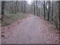
Taff Trail north of Castell Coch
by John Light geograph for square ST1283 Category: National Cycle Network route Looking south up the hill towards Castell Coch. This part of the trail is not as... (more)
|

|
Bridge over temporary section of Taff Trail
by David Smith geograph for square ST1283 At the time of the picture, the Taff Trail had been diverted for construction of... (more)
|

|
Honey garlic, Taff Trail
by Derek Harper for square SO1122 Nectaroscordum siculum growing beside Talybont-on-Usk bridleway 28/1. Most of... (more)
Tags:
national park:Brecon Beacons
trail:Brinore Tramroad
type:Close Look
plant:Honey Garlic
Nectaroscordum Siculum
top:Paths
long distance path:Taff Trail
top:Wild Animals, Plants and Mushrooms
|
|
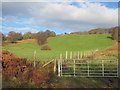
Fields seen from the Taff Trail/Celtic Trail
by John Light geograph for square ST1088 Surprisingly rural scene above the Taff Vale/Cwm Taf.
Tags:
national cycle route:4
national cycle route:8
top:Boundary, Barrier
national cycle route:Celtic Trail
top:Grassland
national cycle route:Lon Las Cymru
top:Lowlands
long distance path:Taff Trail
|

|
Taff Trail, Troedyrhiw
by Stephen McKay geograph for square SO0601 The Taff Trail runs from Cardiff to Brecon and, on this stretch, follows the... (more)
Tags:
top:Paths
Taff Trail
|
|
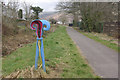
Taff Trail, Troedyrhiw
by Stephen McKay geograph for square SO0602 The Taff Trail passes through the outskirts of Troedyrhiw, following the course... (more)
Tags:
top:Paths
Taff Trail
|

|
Taff Trail near Aberfan
by Stephen McKay geograph for square SO0701 The Taff trail runs from Cardiff to Brecon and on this stretch between Aberfan... (more)
Tags:
top:Paths
Taff Trail
|

|
A468 at Nantgarw; the crossing for the Taff Trail
by David Smith geograph for square ST1285 The Taff Trail crosses this dual carriageway where the dismantled railway was... (more)
|

|
Sustrans milepost beside River Taff and Taff Trail
by David Smith geograph for square ST1578 Tags:
type:Geograph
subject:Milepost or Milestone
top:Paths
top:Rivers, Streams, Drainage
Sustrans Milepost
river:Taff
long distance path:Taff Trail
|

|
Pont y Gwaith, a bridge over River Taff
by David Smith for square ST0897 A steep climb up to the apex of the bridge, part of the Taff Trail
Tags:
subject:Bridge
type:Close Look
type:Cross Grid
Historic Stone Bridge
top:Paths
River Taff
top:Rivers, Streams, Drainage
long distance path:Taff Trail
|

|
Left ahead to stay on the Taff Trail, Pontypridd
by Jaggery geograph for square ST0889 The white arrow on the sign points towards this... (more)
|

|
Red Spice, Merthyr Tydfil
by Jaggery geograph for square SO0406 Bangladeshi and Indian cuisine restaurant at 1 Bethesda Street in the Georgetown... (more)
Tags:
Bangladeshi & Indian Restaurant
top:Business, Retail, Services
Restaurant
Taff Trail
long distance path:Taff Trail
|

|
Taff Trail and the road to Talybont-on-Usk
by Jaggery geograph for square SO1022 Viewed from a junction on the road from Talybont-on-Usk to Aber Village.
Turn... (more)
|

|
Taff Trail and the road to Llanfrynach
by Jaggery geograph for square SO1022 Viewed from a junction on the road from Talybont-on-Usk to Aber Village.
Ahead... (more)
|
|
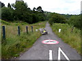
No motorbikes allowed on the Taff Trail, Aberfan
by Jaggery geograph for square SO0700 A boulder reinforces the message in the sign on the path surface.
Tags:
Cycle and Footpath
Cycleway and Footpath
Footpath Cycleway
top:Paths
long distance path:Taff Trail
Taff Trail
|

|
Taff Trail above Castell Coch
by John Light geograph for square ST1382 Category: National Cycle Network route Coming from the south, this junction is not waymarked at present. To keep on the... (more)
|

|
Taff Trail north of Castell Coch
by John Light geograph for square ST1282 Category: National Cycle Network route The trail is shown heading downhill towards Taff's Well.
|

|
River Taff by Taff Trail
by John Light geograph for square ST1478 Category: River Taken from where the old bridge crossed the Taff.
Tags:
national cycle route:8
national cycle route:Lon Las Cymru
top:Rivers, Streams, Drainage
top:Suburb, Urban Fringe
long distance path:Taff Trail
|

|
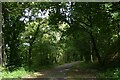
Signboard for Taff Trail at Nantgarw
by David Smith geograph for square ST1285 The Taff Trail drops through the woodlands to rejoin the former railway track.... (more)
|
|
Taff Trail west of Craig yr Allt
by David Smith for square ST1284 The ridge of Craig yr Allt means that the Taff Trail and two roads are squeezed... (more)
Tags:
type:Cross Grid
subject:Cycle Route
top:Paths
long distance path:Taff Trail
top:Woodland, Forest
|

|
Taff Trail in Tal Fechan Forest
by David Smith geograph for square SO0415 A quiet country road, part of the Taff Trail cycle route
Tags:
subject:Cycle Route
type:Geograph
top:Paths
top:Roads, Road Transport
long distance path:Taff Trail
top:Woodland, Forest
|

|
On the left, part of the Taff Trail, by Pontsticill Reservoir
by David Smith geograph for square SO0514 The Taff Trail cycle and foot path has an off-road stretch through forest tracks... (more)
Tags:
subject:Cycle Route
type:Geograph
top:Paths
top:Roads, Road Transport
long distance path:Taff Trail
top:Woodland, Forest
|

|
If you want to go on, turn back! A sign on NCN8, Taff Trail
by David Smith geograph for square ST0797 The Taff Trail for walkers and cyclists heading north has climbed steeply from... (more)
|

|
Taff Trail by flood plain of River Taff
by David Smith geograph for square ST0891 Tags:
national cycle route:8
subject:Cycle Route
type:Geograph
top:Grassland
NCN8
top:Paths
top:Rivers, Streams, Drainage
river:Taff
long distance path:Taff Trail
|

|
Path junction
by Derek Harper geograph for square SO1021 The Taff Trail & Usk Valley Walk diverge here, the latter following... (more)
Tags:
national park:Brecon Beacons
Bridleway
Footpath Signposts
type:Geograph
top:Lowlands
top:Moorland
Path Junction
top:Paths
long distance path:Taff Trail
Track
long distance path:Usk Valley Walk
Woods
|

|
Junction on Taff Trail
by Derek Harper geograph for square SO1021 The Taff Trail meets the Usk Valley Walk which heads right down Talybont-on-Usk... (more)
Tags:
national park:Brecon Beacons
Bridleway
type:Geograph
top:Lowlands
top:Paths
Public Footpath
top:Sport, Leisure
gate:Steel
long distance path:Taff Trail
fence:Timber
Trees
long distance path:Usk Valley Walk
Walkers
Waymark
|

|
Sheep pasture by Taff Trail
by Derek Harper geograph for square SO1122 In a field next to SO1122 : Henry Vaughan Garden, and likewise sandwiched between the Taff Trail... (more)
Tags:
national park:Brecon Beacons
top:Farm, Fishery, Market Gardening
type:Geograph
top:Lowlands
Sheep Pasture
long distance path:Taff Trail
Trees
|

|
Taff Trail crossing Brinore Tramroad
by Derek Harper geograph for square SO1122 Talybont-on-Usk bridleway 28/1 carries the Taff Trail alongside the dismantled... (more)
Tags:
national park:Brecon Beacons
Bridleway
Bridleway Bridge Over Tramroad
type:Geograph
top:Historic Sites and Artefacts
top:Lowlands
top:Paths
long distance path:Taff Trail
Trees
Walls
Weight Limit Warning Sign
top:Woodland, Forest
|

|
Taff Trail past the edge of a disused canal, Abercanaid
by Jaggery geograph for square SO0503 The information board records that the Glamorganshire Canal which transported... (more)
Tags:
disused:Canal
type:Geograph
top:Paths
long distance path:Taff Trail
Taff Trail
top:Village, Rural Settlement
|

|
Old railway bridge on the Taff Trail
by John Winder geograph for square SO0716 The bridge once carried the line from Brecon to Merthyr Tydfil, opened in the... (more)
Tags:
Bicycles
subject:Bridge
top:Derelict, Disused
type:Geograph
Old Railway
Old Railway Bridge
top:Paths
top:Railways
top:Sport, Leisure
Taff Trail
long distance path:Taff Trail
near:Talybont
place:Torpantau Summit
|
|
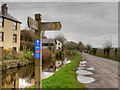
Monmouthshire and Brecon Canal Towpath, Taff Trail (NCN 8)
by David Dixon geograph for square SO0527 The Taff Trail (Taith Taf) is a popular walking and cycle path that runs for 55... (more)
|
|
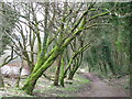
Trees flanking Taff Trail path
by John Light geograph for square ST0891 A pleasant tree lined section of the Taff Trail between Pontypridd and... (more)
Tags:
national cycle route:47
national cycle route:8
national cycle route:Lon Las Cymru
top:Lowlands
top:Paths
long distance path:Taff Trail
|

|
Taff Trail looking south
by John Light geograph for square SN9721 The track climbs gently from Blaenglyn towards Storey Arms. Fan Fawr is in the distance.
|

|
White Hart Bridge, Monmouthshire and Brecon Canal
by Derek Harper geograph for square SO1122 Canal Bridge No.143 is listed and described at... (more)
Tags:
national park:Brecon Beacons
Canal Bridge
top:Canals
Canalside Trees
type:Geograph
top:Historic Sites and Artefacts
Hut
Listed Structure
top:Lowlands
canal:Monmouthshire and Brecon
top:Paths
Public Footpath
long distance path:Taff Trail
trail:Talybont Orchard Trail
Towpath
|

|
Pub garden from the aqueduct, Talybont-on-Usk
by Derek Harper geograph for square SO1122 From the aqueduct... (more)
Tags:
Aqueduct
national park:Brecon Beacons
top:Business, Retail, Services
top:Canals
type:Geograph
top:Historic Sites and Artefacts
Houses
top:Housing, Dwellings
Listed Structure
top:Lowlands
canal:Monmouthshire and Brecon
Outdoor Tables and Chairs
Parapet
top:Paths
Pub Garden
Public Footpath
long distance path:Taff Trail
trail:Talybont Orchard Trail
Towpath
top:Village, Rural Settlement
|

|
Narrowboats, Monmouthshire and Brecon Canal
by Derek Harper geograph for square SO1122 The towpath here at Talybont carries the Talybont Orchard Trail, the Taff Trail,... (more)
Tags:
national park:Brecon Beacons
Canal Embankment
top:Canals
Canalside Trees
type:Geograph
top:Lowlands
canal:Monmouthshire and Brecon
Narrowboats
top:Paths
Public Footpath
top:Sport, Leisure
long distance path:Taff Trail
trail:Talybont Orchard Trail
Telegraph Poles
Towpath
|
