Public Tags
Tag: The·Shropshire·Way
Other tags: footpath:The Shropshire Way
Showing images tagged with The Shropshire Way tag.
|
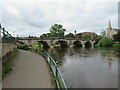
River Severn at Shrewsbury
by Malc McDonald geograph for square SJ4912 A view of the River Severn flowing through the town of Shrewsbury, looking... (more)
Tags:
Bridge
Bridge Over River
type:Geograph
subject:Path
top:Paths
river:River Severn
top:Rivers, Streams, Drainage
Riverside Path
long distance footpath:Severn Way
ldp:Severn Way
long distance path:Severn Way
Severn Way
Severn Way Long Distance Footpath
Severn Way Path
place:Shrewsbury
county:Shropshire
ldp:Shropshire Way
long distance path:Shropshire Way
Shropshire Way
The Severn Way
footpath:The Shropshire Way
|

|
River Severn at Shrewsbury
by Malc McDonald geograph for square SJ4912 A view of the River Severn flowing through the town of Shrewsbury, looking... (more)
Tags:
Bridge
Bridge Over River
type:Geograph
top:Paths
subject:River
river:River Severn
top:Rivers, Streams, Drainage
Riverside Path
long distance footpath:Severn Way
ldp:Severn Way
long distance path:Severn Way
Severn Way
Severn Way Long Distance Footpath
Severn Way Path
place:Shrewsbury
county:Shropshire
ldp:Shropshire Way
long distance path:Shropshire Way
Shropshire Way
The Severn Way
footpath:The Shropshire Way
|

|
Kingsland Bridge toll house, Shrewsbury
by Malc McDonald geograph for square SJ4812 There is a toll for vehicles to cross the Kingsland Bridge in Shrewsbury. The... (more)
Tags:
subject:Cottage
Former Tollhouse
type:Geograph
Old Toll Cottage
top:Roads, Road Transport
place:Shrewsbury
county:Shropshire
ldp:Shropshire Way
long distance path:Shropshire Way
Shropshire Way
The Shropshire Way
footpath:The Shropshire Way
Toll
bridge:Toll
Toll Bridge
Toll Cottage
Tollhouse
|

|
Kingsland Bridge, Shrewsbury
by Malc McDonald geograph for square SJ4812 Kingsland Bridge spans the River Severn in the town of Shrewsbury. It is on the... (more)
Tags:
subject:Bridge
Bridge Over a River
Bridge Over River
type:Geograph
top:Roads, Road Transport
place:Shrewsbury
county:Shropshire
Shropshire Way
ldp:Shropshire Way
long distance path:Shropshire Way
The Shropshire Way
footpath:The Shropshire Way
|

|
Kingsland Bridge, Shrewsbury
by Malc McDonald geograph for square SJ4811 Kingsland Bridge is a bridge across the River Severn in the town of Shrewsbury.... (more)
Tags:
subject:Bridge
Bridge Over Road
type:Geograph
road:Minor Road
Minor Road
Minor Road Bridge
Road Bridge Over Minor Road
Road Bridge Over Road
bridge:Road Over Road
place:Shrewsbury
county:Shropshire
ldp:Shropshire Way
Shropshire Way
long distance path:Shropshire Way
top:Suburb, Urban Fringe
footpath:The Shropshire Way
The Shropshire Way
|

|
Kingsland Bridge, Shrewsbury
by Malc McDonald geograph for square SJ4811 Kingsland Bridge is a bridge across the River Severn in the town of Shrewsbury.... (more)
Tags:
type:Geograph
Minor Road
road:Minor Road
subject:Road
place:Shrewsbury
county:Shropshire
ldp:Shropshire Way
long distance path:Shropshire Way
Shropshire Way
top:Suburb, Urban Fringe
footpath:The Shropshire Way
The Shropshire Way
|

|
On the Shropshire Way approaching Lower Stanway
by Jeff Buck geograph for square SO5491 Heading north along the Shropshire Way approaching Lower Stanway.
Shropshire... (more)
Tags:
country:England
Farm
type:Geograph
Long Distance Path
place:Lower Stanway
top:Paths
county:Shropshire
Shropshire Way
long distance path:Shropshire Way
footpath:The Shropshire Way
|

|
Kingsland Bridge, Shrewsbury
by Malc McDonald geograph for square SJ4812 Kingsland Bridge crosses the River Severn in Shrewsbury. The bridge is on the... (more)
Tags:
subject:Bridge
Bridge Over a River
Bridge Over River
type:Geograph
top:Roads, Road Transport
place:Shrewsbury
county:Shropshire
long distance path:Shropshire Way
Shropshire Way
footpath:The Shropshire Way
|

|
Towards Wilderhope Manor on the Shropshire Way
by Jeff Buck geograph for square SO5492 Heading north towards Wilderhope Manor on the Shropshire Way.
Shropshire Way... (more)
Tags:
country:England
type:Geograph
Long Distance Path
place:Longville in the Dale
top:Paths
county:Shropshire
long distance path:Shropshire Way
Shropshire Way
footpath:The Shropshire Way
|

|
The Shropshire Way at Lower Stanway
by Jeff Buck geograph for square SO5491 Heading north along the Shropshire Way at Lower Stanway.
Shropshire Way... (more)
Tags:
country:England
Farm
top:Farm, Fishery, Market Gardening
type:Geograph
Long Distance Path
place:Lower Stanway
top:Paths
county:Shropshire
long distance path:Shropshire Way
Shropshire Way
footpath:The Shropshire Way
|

|
The Shropshire Way at Hopescross
by Jeff Buck geograph for square SO5490 Looking southeast along the Shropshire Way at Hopescross.
Shropshire Way... (more)
Tags:
country:England
top:Farm, Fishery, Market Gardening
type:Geograph
place:Hopescross
Long Distance Path
top:Paths
county:Shropshire
long distance path:Shropshire Way
Shropshire Way
footpath:The Shropshire Way
|

|
The Shropshire Way near Holdgate
by Jeff Buck geograph for square SO5590 Heading north along the Shropshire Way northwest of Holdgate.
Shropshire Way... (more)
Tags:
country:England
Farm
top:Farm, Fishery, Market Gardening
type:Geograph
place:Holdgate
Long Distance Path
top:Paths
county:Shropshire
Shropshire Way
long distance path:Shropshire Way
footpath:The Shropshire Way
|

|
The Shropshire Way near Holdgate
by Jeff Buck geograph for square SO5589 Heading northwest along the Shropshire Way near the village of Holdgate.... (more)
Tags:
country:England
top:Farm, Fishery, Market Gardening
top:Flat Landscapes
type:Geograph
place:Holdgate
Long Distance Path
top:Paths
county:Shropshire
Shropshire Way
long distance path:Shropshire Way
footpath:The Shropshire Way
|

|
The Shropshire Way on Brown Clee Hill
by Jeff Buck geograph for square SO5985 Looking north along the Shropshire Way on Brown Clee Hill.
Tags:
place:Brown Clee
hill:Brown Clee
Brown Clee
Brown Clee Hill
country:England
type:Geograph
top:Heath, Scrub
top:Paths
county:Shropshire
Shropshire Way
The Shropshire Way
footpath:The Shropshire Way
top:Uplands
|

|
The Shropshire Way Approaching Abdon Burf
by Jeff Buck geograph for square SO5986 The Shropshire Way Approaching Abdon Burf on Brown Clee Hill.
Wikipedia Brown... (more)
Tags:
place:Abdon Burf
Abdon Burf
place:Brown Clee
country:England
type:Geograph
top:Heath, Scrub
top:Paths
Radio Mast
Radio Tower
county:Shropshire
Shropshire Way
footpath:The Shropshire Way
The Shropshire Way
top:Uplands
|

|
A brook on the Shropshire Way
by Jeff Buck geograph for square SO5490 Seen from a footbridge on the Shropshire Way.
Shropshire Way Wikipedia... (more)
Tags:
Brook
country:England
type:Geograph
place:Holdgate
top:Rivers, Streams, Drainage
county:Shropshire
long distance path:Shropshire Way
footpath:The Shropshire Way
|

|
The Shropshire Way near Hergan
by Jeff Buck geograph for square SO2685 Looking south along the Shropshire Way between Hergan hill and Three Gates.... (more)
Tags:
country:England
Farm
type:Geograph
Path
top:Paths
county:Shropshire
Shropshire Way
long distance path:Shropshire Way
The Shropshire Way
place:Three Gates
|

|
View west from the Shropshire Way
by Jeff Buck geograph for square SO2784 View west from the Shropshire Way near Mardu.
Tags:
country:England
Farm
top:Farm, Fishery, Market Gardening
type:Geograph
place:Mardu
Path
county:Shropshire
long distance path:Shropshire Way
Shropshire Way
The Shropshire Way
top:Uplands
|

|
View from the Shropshire Way
by Jeff Buck geograph for square SO2783 Looking south along the Shropshire Way on the Cefns near Mardu.
Wikipedia... (more)
Tags:
country:England
top:Farm, Fishery, Market Gardening
type:Geograph
place:Mardu
Path
top:Paths
county:Shropshire
Shropshire Way
long distance path:Shropshire Way
The Shropshire Way
|

|
The Shropshire Way on the Cefns
by Jeff Buck geograph for square SO2783 Heading north along the Shropshire Way on the Cefns near Mardu.
Wikipedia... (more)
Tags:
country:England
type:Geograph
place:Mardu
Path
top:Paths
county:Shropshire
Shropshire Way
long distance path:Shropshire Way
The Shropshire Way
|

|
The Shropshire Way near Whitcott Keysett
by Jeff Buck geograph for square SO2883 The Shropshire Way near Whitcott Keysett north of Clun.
Wikipedia... (more)
Tags:
country:England
Farm
type:Geograph
Path
top:Paths
county:Shropshire
Shropshire Way
long distance path:Shropshire Way
The Shropshire Way
place:Whitcott Keysett
|

|
On the Shropshire Way
by Jeff Buck geograph for square SO2882 A photo opportunity on the Shropshire Way northwest of Clun.
Wikipedia... (more)
Tags:
Barley
crop:Barley
place:Clun
Crops
country:England
Farm
top:Farm, Fishery, Market Gardening
type:Geograph
subject:Path
Path
top:Paths
county:Shropshire
long distance path:Shropshire Way
Shropshire Way
The Shropshire Way
|

|
The Shropshire Way
by Jeff Buck geograph for square SO2882 Heading north along the Shropshire Way northwest of Clun.
Wikipedia... (more)
Tags:
Barley
crop:Barley
place:Clun
Crops
country:England
Farm
top:Farm, Fishery, Market Gardening
type:Geograph
subject:Path
Path
top:Paths
county:Shropshire
long distance path:Shropshire Way
Shropshire Way
The Shropshire Way
|

|
The Shropshire Way north of Clun
by Jeff Buck geograph for square SO2881 Heading north along the Shropshire Way north of Clun.
Wikipedia... (more)
Tags:
place:Clun
country:England
type:Geograph
Path
top:Paths
county:Shropshire
Shropshire Way
long distance path:Shropshire Way
The Shropshire Way
|

|
The Shropshire Way north of Clun
by Jeff Buck geograph for square SO2981 Heading north on the Shropshire Way next to the River Unk.
Wikipedia... (more)
Tags:
place:Clun
country:England
type:Geograph
subject:Path
Path
top:Paths
river:River Unk
River Unk
county:Shropshire
long distance path:Shropshire Way
Shropshire Way
The Shropshire Way
|

|
The Shropshire Way leaving Clun
by Jeff Buck geograph for square SO2981 The Shropshire Way as it heads north out of the village of Clun.
Wikipedia... (more)
Tags:
place:Clun
country:England
type:Geograph
Path
subject:Path
top:Paths
county:Shropshire
Shropshire Way
long distance path:Shropshire Way
The Shropshire Way
top:Village, Rural Settlement
|

|
The Shropshire Way at Horrock
by Jeff Buck geograph for square SO3182 Looking north along the Shropshire Way at a place called Horrock just east of... (more)
Tags:
place:Clun
country:England
type:Geograph
Path
top:Paths
Public Footpath
Public Right of Way
county:Shropshire
footpath:The Shropshire Way
The Shropshire Way
|

|
On the Shropshire Way
by Jeff Buck geograph for square SO2685 Well as near as possible as the path veers across a field near Hergan hill.... (more)
Tags:
country:England
Farm
top:Farm, Fishery, Market Gardening
type:Geograph
Path
top:Paths
county:Shropshire
Shropshire Way
long distance path:Shropshire Way
The Shropshire Way
|

|
The Shropshire Way at Three Gates
by Jeff Buck geograph for square SO2785 There isn't much at Three Gates, just a farm and a few buildings.... (more)
Tags:
country:England
type:Geograph
place:Mardu
Path
top:Paths
Settlement
county:Shropshire
long distance path:Shropshire Way
Shropshire Way
The Shropshire Way
place:Three Gates
top:Village, Rural Settlement
|

|
Approaching Three Gates
by Jeff Buck geograph for square SO2785 Heading north along the Shropshire Way at the small settlement of Three Gates.... (more)
Tags:
country:England
type:Geograph
place:Mardu
Path
top:Paths
Settlement
county:Shropshire
long distance path:Shropshire Way
Shropshire Way
The Shropshire Way
top:Village, Rural Settlement
|

|
Near the Shropshire Way
by Jeff Buck geograph for square SO2784 Just a slight diversion to the east of the Shropshire Way near Mardu.
Tags:
country:England
Farm
top:Farm, Fishery, Market Gardening
type:Geograph
place:Mardu
county:Shropshire
long distance path:Shropshire Way
The Shropshire Way
top:Uplands
|

|
Barley next to the Shropshire Way
by Jeff Buck for square SO2882 A field of barley next to the Shropshire Way.
Wikipedia... (more)
Tags:
Barley
crop:Barley
type:Close Look
place:Clun
Crops
country:England
Farm
top:Farm, Fishery, Market Gardening
Path
county:Shropshire
long distance path:Shropshire Way
The Shropshire Way
|

|
The Shropshire Way north of Clun
by Jeff Buck geograph for square SO3182 Looking northeast along the Shropshire Way north of Clun. The path on the left... (more)
Tags:
place:Clun
country:England
type:Geograph
Path
top:Paths
Public Footpath
Public Right of Way
county:Shropshire
The Shropshire Way
footpath:The Shropshire Way
|

|
The Shropshire Way heading towards Clun
by Jeff Buck geograph for square SO3081 Heading south along the Shropshire Way towards Clun.
Tags:
place:Clun
country:England
top:Farm, Fishery, Market Gardening
type:Geograph
Long Distance Path
Path
top:Paths
county:Shropshire
The Shropshire Way
footpath:The Shropshire Way
|

|
Towards Clun on the Shropshire Way
by Jeff Buck geograph for square SO3081 Entering Clun from the north on the Shropshire Way.
Tags:
place:Clun
country:England
type:Geograph
Long Distance Path
Path
top:Paths
county:Shropshire
footpath:The Shropshire Way
The Shropshire Way
|

|
Trow Brook
by Jeff Buck geograph for square SO5589 Trow Brook seen from a footbridge on the Shropshire Way.
Shropshire Way... (more)
Tags:
Brook
country:England
type:Geograph
place:Holdgate
Long Distance Path
top:Rivers, Streams, Drainage
county:Shropshire
footpath:The Shropshire Way
|

|
Walker on The Shropshire Way
by Dave Croker geograph for square SO3594 |

|
Shropshire Way stile, Wilderhope Manor
by Christine Johnstone geograph for square SO5492 There are five footpaths radiating from this point, including the Shropshire Way.
|

|
Shropshire Way, Wenlock Edge
by David Dixon geograph for square SO6099 The Shropshire Way is a waymarked long distance footpath part of which traces... (more)
Tags:
Escarpment
Footpath
Limestone
Long Distance Walking Route
top:Paths
top:Sport, Leisure
footpath:The Shropshire Way
Wenlock Edge
|

|
The Shropshire Way, Wenlock Edge
by David Dixon geograph for square SO6199 The Shropshire Way is a waymarked long distance footpath part of which traces... (more)
Tags:
Escarpment
Footpath
top:Geological Interest
Limestone
Long Distance Walking Route
top:Sport, Leisure
footpath:The Shropshire Way
Wenlock Edge
|

|
Avenue of trees on Adstone Hill
by Dave Croker geograph for square SO3894 This is part of the Shropshire Way.
|

|
Farmland crossed by the Shropshire Way
by Christine Johnstone geograph for square SO4589 Looking towards Hatton Wood from Acton Scott historic working farm.
|

|
Shropshire Way stile
by Christine Johnstone geograph for square SO4589 On the eastern side of the car park at Acton Scott historic working farm.
|

|
Farm below Wenlock Edge
by David Dixon geograph for square SO6199 Looking down from the Shropshire Way.
|

|
Disused Quarry, Wenlock Edge
by David Dixon geograph for square SO6199 Wenlock Edge is a limestone escarpment running for 24 km (15 miles) between... (more)
|

|
Track up Lindley Hill
by Christine Johnstone geograph for square SO3593 Part of the Shropshire Way [the section between Bridges and Bishop's Castle].
Tags:
Footpath
top:Paths
top:Roads, Road Transport
footpath:The Shropshire Way
Track
Unmetalled Track
Woodland Track
|

|
View from Wenlock Edge
by David Dixon geograph for square SO6199 Looking across the farmland near Much Wenlock.
|
