
|
Portway Branch, Titford Canal
by Stephen McKay
geograph for square SO9887
The end of the Titford Canal divides into two channels: the Portway Branch (seen... (more)
|

|
Bottom Lock, Oldbury Locks (Approximately 60 Metres North of Tat Bank Road) Birmingham Canal Titford Branch, Oldbury
by Chris Allen
geograph for square SO9989
Lock No. 6 on the Titford Canal. Opened 1838 and now listed Grade II.
|
|
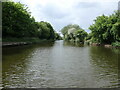
Causeway Green branch of the BCN's Titford canal
by Christine Johnstone
geograph for square SO9887
Providing access to the southern of the two Titford Pools. Now truncated by the... (more)
|

|
Oldbury Top Lock
by Stephen McKay
geograph for square SO9988
This flight of six locks on the Titford Canal raises boats up to the highest... (more)
|

|
Causeway Green branch of the Titford Canal
by Chris Allen
geograph for square SO9887
Seen from the end of the canal at Causeway Green End. This short stub is only... (more)
|

|
Titford engine houses
by Chris Allen
geograph for square SO9988
Two conjoined beam pumping engine houses. One was for a 1837 Boulton & Watt... (more)
|

|
The Tat Bank branch of the Titford Canal
by Chris Allen
geograph for square SO9988
Seen from Tat Bank Bridge. Looking back towards Titford Junction. Tat Bank... (more)
|
|
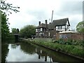
The New Navigation
by Christine Johnstone
geograph for square SO9887
Appropriately, alongside the BCN's Titford Canal, near Titford Pools.
|

|
Northern Titford Pool and the Portway Branch
by Christine Johnstone
geograph for square SO9888
The Portway Branch is now less than half its original length. The pools are... (more)
|
|
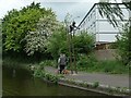
Two men chatting under The Rock Driller
by Christine Johnstone
geograph for square SO9887
At the junction of the Portway and Causeway Green branches of the Titford Canal.... (more)
|

|
Narrows on the Titford Canal
by Christine Johnstone
geograph for square SO9988
The site of the demolished Mill Bridge.
|

|
Gongoozlers on Tat Bank Road
by Christine Johnstone
geograph for square SO9988
Watching a hireboat work up lock 5 on the BCN's Titford Canal.... (more)
|

|
Titford Canal, between locks 5 and 4
by Christine Johnstone
geograph for square SO9988
The towpath is classed as a traffic-free cycle route.
|

|
Oldbury Locks, Titford Canal 1978
by Guy Butler-Madden
geograph for square SO9988
The narrow boat is in the top lock of the flight lifting it to 511 feet, the... (more)
|

|
Lock No. 2 of the Titford Canal (Main Line)
by Chris Allen
geograph for square SO9988
Flight of six locks on that branch of the Birmingham Canal Navigations. Listed Grade II.
|

|
Top lock (No. 1) of the Titford Canal (Main Line)
by Chris Allen
geograph for square SO9988
This is the highest level in the Birmingham Canal Navigations. The lock is... (more)
|

|
Overgrown side pond, lock 2, Titford canal
by Christine Johnstone
geograph for square SO9988
The six locks in this flight are quite close together and have sideponds to... (more)
|

|
Exit from southern Titford Pool to the Portway Branch
by Christine Johnstone
geograph for square SO9887
Not currently navigable for a narrowboat. The pools are navigable canal... (more)
|

|
The southern of the two Titford Pools
by Christine Johnstone
geograph for square SO9887
The pools are navigable canal reservoirs on the highest level of the BCN. Seen... (more)
|

|
Titford pumphouse alongside lock 1
by Christine Johnstone
geograph for square SO9988
The Birmingham Canal Navigations Society uses some of the building for meetings... (more)
|

|
BCN's Titford canal, between locks 2 and 3
by Christine Johnstone
geograph for square SO9988
The towpath rises up over a disused canal arm which once served a chemical works.
|

|
Low water in the pound between Locks 6 and 5
by Christine Johnstone
geograph for square SO9989
On the BCN's Titford Canal. Navigable with care if you stay in the middle.
|

|
Titford Canal - Tat Bank Bridge
by Chris Allen
geograph for square SO9988
Cuts the canal between the two bottom locks of the 6 lock flight.
|

|
Titford Canal - Jarvis Bridge
by Chris Allen
geograph for square SO9887
Carrying the A4123 over the canal.
|

|
Titford Canal - New Inns Road Bridge
by Chris Allen
geograph for square SO9988
|

|
Fourth Lock from Bottom, Oldbury Locks, (Approximately 90 Metres North of Engine Steel) Birmingham Canal Titford Branch
by Chris Allen
geograph for square SO9988
Lock No. 3 of (6). Listed Grade II.
|

|
Third Lock from Bottom, Oldbury Locks (Approximately 90 Metres South of Tat Bank Road) Birmingham Canal Titford Branch
by Chris Allen
geograph for square SO9988
Lock No. 4 (of 6). Listed Grade II. Seen from a bridge over a former arm.
|

|
Third Lock from Bottom, Oldbury Locks (Approximately 90 Metres South of Tat Bank Road) Birmingham Canal Titford Branch
by Chris Allen
geograph for square SO9988
Lock No. 4 of 6 and listed Grade II.
|

|
Second Lock from Bottom, Oldbury Locks, adjoining Stoney Lane Bridge, Tat Bank Road, Birmingham Canal Titford Branch
by Chris Allen
geograph for square SO9988
One of six locks opened in 1838 and now listed Grade II.
|
|
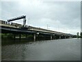
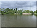
M5 viaduct and the southern Titford Pool
by Christine Johnstone
geograph for square SO9887
A contrast in vehicle speed and transport technology. The pools are navigable... (more)
|
|
The northern of the two Titford Pools
by Christine Johnstone
geograph for square SO9888
The pools are navigable canal reservoirs on the highest level of the BCN. Seen... (more)
|

|
The BCN's Titford Canal, Langley
by Christine Johnstone
geograph for square SO9987
A green route through the conurbation.
|
|
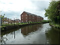
Canalside flats on Maltings Avenue
by Christine Johnstone
geograph for square SO9988
With a fine view across the Titford canal to Langley Park.
|

|
Titford Canal - Uncle Ben's Bridge
by Chris Allen
geograph for square SO9987
|

|
Disused railway bridge over the Titford Canal
by Chris Allen
geograph for square SO9988
This is near Langley Green Station.
|

|
Portway Branch of the Titford Canal
by Chris Allen
geograph for square SO9888
This is a dead end branch that is 4.75 furlongs long and ends at Birchfield... (more)
|

|
The Tat Bank branch of the Titford Canal
by Chris Allen
geograph for square SO9988
Seen from Tat Bank Bridge. Looking towards a covered bridge in the BIP works.... (more)
|
|
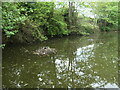
A nesting coot on the Titford Canal, Langley
by Christine Johnstone
geograph for square SO9987
Not particularly bothered by the photographer's passing narrowboat.
|
|
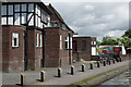
The New Navigation, Langley
by Stephen McKay
geograph for square SO9887
This establishment appeared to be non-operational at the time of passing but the... (more)
|

|
Langley Maltings from the Titford Canal
by Chris Allen
geograph for square SO9988
The maltings were built in the 1870-1890s for the nearby Showell's... (more)
|

|
Langley Maltings from the Titford Canal
by Chris Allen
geograph for square SO9988
The maltings were built in the 1870-1890s for the nearby Showell's... (more)
|
|
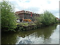
Building site alongside the Titford Canal
by Christine Johnstone
geograph for square SO9988
New housing on Waterside Crescent is replacing industrial buildings.
|

|
Oldbury Locks
by Stephen McKay
geograph for square SO9988
There are six locks here leading up from the BCN (Birmingham Canal Navigations)... (more)
|
|
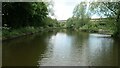
The current head of navigation, Causeway Green Branch
by Christine Johnstone
geograph for square SO9887
Cut off by the M5.
|
