Public Tags
Tag: Tourist·Roadsign
Showing images tagged with Tourist Roadsign tag.
|
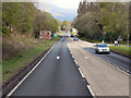
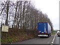
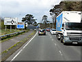
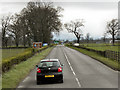
Tourist Roadsign on the A120 Coggeshall Road
by Geographer for square TL8523 Tags:
A Roads (Classified A)X
A120X
at:CoggeshallX
top:Roads, Road TransportX
RoadsignX
subject:SignX
on:The A120 Coggeshall RoadX
Tourist Roadsign
|
|
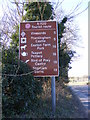
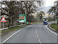
Tourist roadsign on the A1120 Yoxford Road
by Geographer for square TM3869 Category: Road sign Near Oak Tree Farm
Tags:
A Road (Classified A)X
A1120X
near:Oak Tree FarmX
top:Roads, Road TransportX
RoadsignX
subject:SignX
on:The A1120 Yoxford RoadX
Tourist Roadsign
at:YoxfordX
Yoxford RoadX
|
|
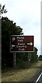
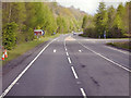
Tourist roadsign on A12 Martlesham bypass
by Geographer geograph for square TM2547 Category: Road sign Tags:
A Road (Classified A)X
A12X
on:A12 Martlesham BypassX
BypassX
near:MartleshamX
Martlesham BypassX
top:Roads, Road TransportX
RoadsignX
subject:SignX
Tourist Roadsign
|
|
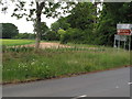
Side of B481 Red Lane and field beyond
by David Hawgood geograph for square SU6990 This is the northern end of B481 at a junction with B480. The sign shows... (more)
Tags:
FieldX
type:GeographX
top:Roads, Road TransportX
subject:RoadsideX
RoadsignX
Tourist Roadsign
top:Village, Rural SettlementX
crop:WheatX
|
|
Roadsign on the A120 Coggeshall Road
by Geographer for square TL8523 Approaching the junction with the B1024 Colne Road taken from the junction with Tey Road
|
|
Balloch, Stirling Road
by David Dixon geograph for square NS4082 Entering Balloch via the A811, Stirling Road.
|
|
A814 Garelochhead
by David Dixon geograph for square NS2490 |
|
Southbound A82
by David Dixon geograph for square NS3588 The southbound A82 at the dual carriageway near the turning for Garelochhead (A817).
|
|
Northbound A82
by David Dixon geograph for square NS3783 The Northbound A82, approaching the turning for the Cameron House and Duck Bay... (more)
|
|
A81, Dumgoyne
by David Dixon geograph for square NS5282 The southbound A81, near the turning for the Glengoyne Distillery.
|
|
Stoneymollan Roundabout
by David Dixon geograph for square NS3881 This large metal sculpture, which shows wildbirds in flight was installed in the... (more)
|
|
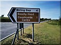
Road Sign, Warren Hill Eastbourne
by PAUL FARMER geograph for square TV5997 Tags:
type:GeographX
top:Roads, Road TransportX
RoadsignX
subject:SignX
Tourist Roadsign
Warren HillX
place:Warren HillX
|
|
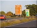
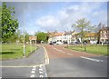
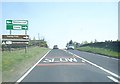
Lay-by on A354, Blandford Forum by-pass
by David Smith geograph for square ST8906 There is a tourist information sign on this small lay-by, advertising North Dorset
|
|
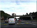
M271 Nursling Spur Motorway & footpath bridge
by Geographer geograph for square SU3714 |
|
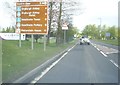
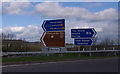
Tourist notice as approaching B6404 road junction
by Stanley Howe geograph for square NT5930 By A68, with St Boswells cricket ground off left.
Tags:
A68X
B6404X
top:Roads, Road TransportX
place:St BoswellsX
Tourist Roadsign
top:Village, Rural SettlementX
|
|
Tourist road sign in West Auckland
by Stanley Howe geograph for square NZ1826 Keep left for North Pennines and Weardale.
|
|
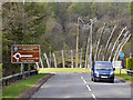
A818 Approaching Crosskeys
by David Dixon geograph for square NS3385 Approaching the Crosskeys Roundabout on the A818 towards Helensburgh.
|
|
Northbound A82, Arden
by David Dixon geograph for square NS3684 The northbound A82 approaching the junction with the A818 (for Helensburgh)
|
|
A82, Bandry
by David Dixon geograph for square NS3590 The northbound A82 passing the junction with the Old Military Road towards Luss.
|
|
A811, Kippen Station
by David Dixon geograph for square NS6695 Approaching the Kippen Station roundabout on the A811 from Stirling.
|
|
A811, Near Kippen
by David Dixon geograph for square NS6795 |
|
M6 Junction 35
by Ian Taylor geograph for square SD5170 Direction signs at the NW exit from the roundabout, for the A601(M).
The brown... (more)
|
|
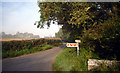
Road to Herston Halt
by Des Blenkinsopp geograph for square SZ0179 Still a bit of mist around at the start of a beautiful day. Herston Halt is a... (more)
Tags:
top:Roads, Road TransportX
Tourist Roadsign
|
|
A120 Coggeshall Road, Coggeshall
by Geographer geograph for square TL8523 Approaching the junction with the B1024 Colne Road
|
|
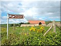
Sign and Barn, Oborne
by Des Blenkinsopp geograph for square ST6517 |
|
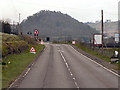
Ascending Kiln Pit Hill
by Stanley Howe geograph for square NZ0355 Towards the Whittonstall-Slaley crossroads, at its crest.
|
|
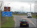
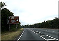
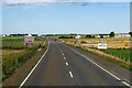
A99 approaching Wick
by David Dixon geograph for square ND3548 Tags:
road:A99X
Brown Road SignX
type:GeographX
NC500X
North Coast 500X
camera:Panasonic DMC-G7X
top:Roads, Road TransportX
Scottish HighlandsX
Tourist Roadsign
|
|
Beaufort Bridge over River Laune and picnic area
by Martin Dawes geograph for square V8892 The L3025 goes to Beaufort off the N72 Ring of Kerry
Tags:
Beaufort BridgeX
type:GeographX
river:LauneX
top:LowlandsX
Picnic AreaX
top:Rivers, Streams, DrainageX
Road Bridge Over RiverX
top:Roads, Road TransportX
top:Sport, LeisureX
Timber LorryX
Tourist Roadsign
top:Woodland, ForestX
|