
|
The U40 in Evening Mist
by Ian Dodds
geograph for square NT0361
U-roads are the lowliest of roads, and therefore quite good for walking along,... (more)
|

|
Abbey Lane, Leiston
by Geographer
geograph for square TM4363
At the junction with George Road
Road No.U2419
|

|
Moat Road, Theberton
by Geographer
geograph for square TM4365
At the junction with the B1122 Leiston Road
Road No.U2405
|

|
Clay Hill
by Geographer
geograph for square TM2866
Category: Lane
Looking towards the B1116 Dennington Road near Park Gate Farm and the footpath... (more)
|

|
New Road, Badingham
by Geographer
geograph for square TM3169
Category: Lane
Looking towards Redhouse Road near the footpath to Redhouse Road
Badingham... (more)
|

|
Old Rectory Road, Badingham
by Geographer
geograph for square TM3167
Category: Road
Looking towards the A1120 High Road near the footpath to Low Street
Road No.U2613
|

|
The end of Strickland Manor Hill
by Geographer
geograph for square TM3769
Category: Road
Near the footpath to the A1120 Yoxford Road & Poplartree Cottages
Yoxford... (more)
|

|
Mill Road, Halesworth
by Geographer
geograph for square TM3878
Category: Road
Road No.U1101
|

|
Hampton Avenue, Thurlton
by Geographer
geograph for square TM4198
At the junction with Beccles Road
Road No.U76543
|

|
College Road, Thurlton
by Geographer
geograph for square TM4197
At the junction with Beccles Road
Road No.U76482
|

|
Low Road, Kelsale
by Geographer
geograph for square TM3864
At the junction with Bridge Street(U2412) near Kelsale Village Hall
Road No.U2410
|

|
Hall Road, Lound
by Geographer
geograph for square TG5000
At the junction with Yarmouth Road
Road No.U61824
|

|
Cherry Lane, Browston
by Geographer
geograph for square TG4901
At the junction with Browston Lane
Road No.U61860
|

|
Low Road, Kelsale
by Geographer
geograph for square TM3864
Category: Village street
At the junction with Bridge Street
Road No.U2410
|

|
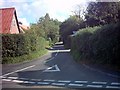
Owls Green near Brundish
by Geographer
geograph for square TM2869
Category: Lane
Road No.U2623
|
|
Mill Road, Badingham
by Geographer
geograph for square TM3068
Category: Road junction
At the junction with Low Street
Road No.U2611 at the junction with C215
|

|
Gravelpit Lane, Snetterton
by Geographer
geograph for square TL9991
At the junction with Ada Cole Avenue near All Saints Church & Anne Colvin... (more)
|

|
Gravelpit Lane, Snetterton
by Geographer
geograph for square TL9991
At the junction with Ada Cole Avenue near All Saints Church
Road No.U33045
|

|
Gravelpit Lane, Snetterton
by Geographer
geograph for square TL9991
At the junction with Ada Cole Avenue near Anne Colvin House
Road No.U33045
|

|
Cherry Lane sign
by Geographer
for square TG4901
On Cherry Lane at the junction with Browston Lane
Road No.U61860
|

|
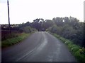
Shrublands Farm, Hollow Lane, Badingham
by Geographer
geograph for square TM3267
Category: Farm
Road No.U2535
|
|
The B1120 looking towards the junction with the U2516
by Geographer
geograph for square TM3067
Category: B road (Classified B)
|

|
The Street, Norton Subcourse
by Geographer
geograph for square TM4198
At the junction with Loddon Road
Road No.U76353
|

|
Bribery Lane, Walsham Le Willows
by Geographer
geograph for square TM0271
At the junction with the C555 Finningham Road
Road No.U5928
|

|
Bribery Lane, Walsham Le Willows
by Geographer
geograph for square TM0271
At the junction with the C555 Finningham Road
Road No.U5928
|

|
Chapel Hill, Denton
by Geographer
geograph for square TM2788
At the junction with Norwich Road
Road No.U76156
|

|
Chapel Hill sign
by Geographer
for square TM2788
On Chapel Hill at the junction with Norwich Road
Road No.U76156
|

|
Chapel Hill, Denton
by Geographer
geograph for square TM2788
At the junction with Norwich Road
Road No.U76156
|
|
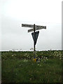
Roadsign on Church Lane
by Geographer
geograph for square TM4494
At the Junction with Burrows Green
Road No.U76289
|
|
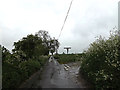
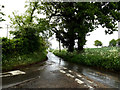
Church Lane, Aldeby
by Geographer
geograph for square TM4494
Looking towards Station Road at the junction with Burrows Green
Road No.U76289
|
|
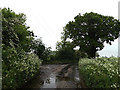
Church Lane, Aldeby
by Geographer
geograph for square TM4494
At the junction with Waterheath Road
Road No.U76289
|
|
Church Lane, Aldeby
by Geographer
geograph for square TM4494
At the junction with Waterheath Road
Road No.U76289
|

|
Looking towards High Street
by Geographer
geograph for square TM3483
Near the footpath & Hulver Cottages
Road No.U1205
|

|
Grove Road, Knodishall
by Geographer
geograph for square TM4162
Looking towards Friston near the footpath to Clouting's Farm
Road no.U2301
|

|
Lymball's Lane
by Geographer
geograph for square TM4270
At the junction with Bowman's Lane
Road no.U2807
|

|
Mill Road, Friston
by Geographer
geograph for square TM4059
At the junction with the A1094 Aldeburgh Road
Road No.U2306
|

|
Mill Road, Friston
by Geographer
geograph for square TM4059
Looking towards the A1094 Aldeburgh Road
Road No.U2306
|

|
Mill Road, Friston
by Geographer
geograph for square TM4059
Looking towards Friston near the footpaths
Road No.U2306
|

|
Mill Road, Friston
by Geographer
geograph for square TM4059
Looking towards the A1094 Aldeburgh Road near the footpaths
Road No.U2306
|

|
School Road sign
by Geographer
for square TM4161
On School Road at the junction with Grove Road
Road No.U2329
|

|
School Road
by Geographer
geograph for square TM4161
At the junction with Grove Road
Road No.U2329
|

|
Grove Road & Sandlings Walk Footpath sign
by Geographer
geograph for square TM4160
Knodishall footpath no.5 leading to Knodishall footpath no.4 & Knodishall... (more)
|

|
High Road looking towards Apsey Green
by Geographer
geograph for square TM2562
Near Linden Lea and the footpath to Saxtead Green
Road No.U2107
|

|
Chapel Road (U2123)
by Geographer
geograph for square TM2565
Looking towards Saxtead Little Green near the footpath to Worlds End Road
|

|
Chapel Road (U2123)
by Geographer
geograph for square TM2565
Looking towards Saxtead Little Green near the footpath to the A1120 Several Road
|

|
Chapel Road (U2123) and footpath to A1120 Several Road
by Geographer
geograph for square TM2565
Looking towards the A1120 Several Road
|

|
The U2226 looking towards Dodds Wood
by Geographer
geograph for square TM3662
Category: Road.
|

|
The U2226 looking towards Silverlace Green
by Geographer
geograph for square TM3662
Category: Road
Approaching the junction with the U2227
|

|
South Manor Lane, Bramfield
by Geographer
geograph for square TM4072
Category: Road
Looking towards Spindle Wood Game Farm at the junction with the A144 Bramfield... (more)
|

|
North Green
by Geographer
geograph for square TM3867
Category: Road
Looking towards the A12 Main Road near the footpaths to Tiggins Lane & A12... (more)
|
