
|
Ufford Bridge
by Geographer
geograph for square TM3051
Category: Bridge
Looking towards Ufford, Lower Street crosses the River Deben here.
|

|
Ufford village sign (detail)
by Adrian S Pye
for square TM2952
Ufford is famous for the Suffolk Punch and proudly displays one on the village... (more)
|

|
Lower Street, Ufford
by Geographer
geograph for square TM2952
Category: Lane
At the junction of Ufford Place & Church Lane
|

|
Ufford Village Sign
by Geographer
for square TM2952
Category: Village sign
On Barrack Lane at the junction with The Avenue
(Close up)
|

|
B1438 Yarmouth Road, Ufford
by Geographer
geograph for square TM2852
Category: Road
Looking towards Ufford
|

|
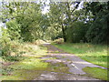
Footpath to the A12 Ufford Bypass & Spring Lane
by Geographer
geograph for square TM2953
Off the B1438 Yarmouth Road
|

|
Footpath to the A12 Ufford Bypass & Spring Lane
by Geographer
geograph for square TM2953
Off the B1438 Yarmouth Road
|

|
Footpath to the A12 Ufford Bypass & Spring Lane
by Geographer
geograph for square TM2953
Off the B1438 Yarmouth Road
|

|
Footpath to the A12 Ufford Bypass & Spring Lane
by Geographer
geograph for square TM2953
Off the B1438 Yarmouth Road
|
|
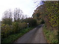
East Lane, Ufford
by Geographer
geograph for square TM3052
Category: Lane
|

|
Entering Ufford on the B1438 Yarmouth Road
by Geographer
geograph for square TM2951
|

|
A12 Wickham Market Bypass
by Geographer
geograph for square TM2852
Category: A road (Classified A)
Looking towards Ufford near the Restricted Byway to Byng Hall Road
|

|
Restricted Byway to Ufford
by Geographer
geograph for square TM2852
Category: Restricted Byway
Taken from the Northbound side of the A12 Wickham Market Bypass
|

|
Ufford Telephone Box
by Geographer
for square TM2952
Category: Telephone Box
On Loudham Lane
|

|
Ufford Village Notice Board
by Geographer
for square TM2952
Category: Notice board
On Barrack Lane
|

|
Barrack Lane & Barrack Lane Postbox
by Geographer
geograph for square TM2952
Category: Lane
At the junction of Ufford Place & Church Lane
Postbox No.IP13 8238
|

|
Loudham Lane
by Geographer
geograph for square TM2952
Category: Lane
Looking towards Ufford
|
|
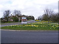
Floral Display on the B1438 High Street
by Geographer
geograph for square TM2952
Category: Road junction
Looking towards Ufford at the junction with the B1438 Yarmouth Road
|

|
Ufford Chapel (converted)
by Geographer
geograph for square TM2953
Category: Chapel (converted)
On the B1438 Yarmouth Road
|

|
Waterfall at Ufford Bridge
by Geographer
geograph for square TM3051
Category: Waterfalls
Off Lower Street near the footpath to Summer Lane
|

|
Footpath to Summer Lane
by Geographer
geograph for square TM3051
Category: Footpath
At Ufford Bridge off Lower Street
|

|
Side of Ufford Bridge
by Geographer
geograph for square TM3051
Category: Bridge
|

|
Ufford Bridge
by Geographer
geograph for square TM3051
Category: Bridge
Bridge over the River Deben on Lower Street looking towards Low Farm & Eyke.
|
|
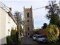
St Mary's Church, Ufford
by Geographer
geograph for square TM2952
Category: Church (Church of England)
Taken from Church Lane
Link |

|
Ufford Village Sign
by Geographer
geograph for square TM2952
Category: Village sign
On Barrack Lane at the junction of The Avenue
|
|
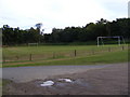
Ufford Recreation Ground
by Geographer
geograph for square TM2952
Category: Recreation ground
Off The Avenue
|
|
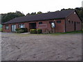
The Pavilion, Ufford Recreation Ground
by Geographer
geograph for square TM2952
Category: Village hall
Off The Avenue
|

|
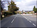
B1438 Yarmouth Road, Pettistree
by Geographer
geograph for square TM2953
Category: B road (Classified B)
Looking towards Ufford at the junction with Old Main Road
|
|
B1438 High Street & The Crown Public House
by Geographer
geograph for square TM2952
Category: B road (Classified B)
Looking towards Ufford near the Clappers Path footpath
|
|
The former A12 at Ufford
by Geographer
geograph for square TM2852
Category: Road (disused)
Taken from the current A12 end
Off the A12
|

|
Organ, St Andrew's church, Ufford
by J.Hannan-Briggs
for square TF0904
Single manual and pedals originally built in 1912 by Norman & Beard. Rebuilt... (more)
|

|
Memorial to James Manners, St Andrew's church, Ufford
by J.Hannan-Briggs
for square TF0904
Rt Hon. Lord James Manners was son of John, 2nd Duke of Rutland and Lucy née... (more)
|

|
Memorial to Richard Bourne, St Andrew's church, Ufford
by J.Hannan-Briggs
for square TF0904
Died in 1705, aged 85. Nice scrolls and weeping Putti.
|

|
Sedilia and Piscina, St Andrew's church, Ufford
by J.Hannan-Briggs
for square TF0904
|

|
Interior, St Andrew's church, Ufford
by J.Hannan-Briggs
for square TF0904
|

|
St Andrew's church, Ufford
by J.Hannan-Briggs
geograph for square TF0904
|

|
The White Lion Public House
by Geographer
geograph for square TM2952
Lower Street, Ufford
|
|
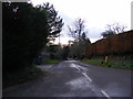
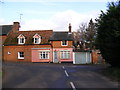
Lower Road, Ufford
by Geographer
geograph for square TM2952
At the junction with Lower Street
|
|
Lower Road, Ufford
by Geographer
geograph for square TM2952
At the junction with Lower Street
|

|
Hospital Grove
by Geographer
geograph for square TM2852
Category: Grove
Off the B1438 High Street,Ufford
|

|
Loudham Lane, Ufford
by Geographer
geograph for square TM3052
Category: Lane
Near the footpath to Loudham Hall, Loudham Hall Road & Mill Lane looking... (more)
|

|
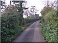
Loudham Lane, Ufford
by Geographer
geograph for square TM3052
Category: Lane
Looking towards Loudham Road
|
|
East Lane, Ufford
by Geographer
geograph for square TM3052
Category: Lane
|

|
Loudham Lane, Ufford
by Geographer
geograph for square TM3052
Category: Road junction
At the junction with East Lane
|

|
Loudham Lane, Ufford
by Geographer
geograph for square TM2952
Category: Road junction
At the junction with Spring Lane
|

|
Loudham Lane, Ufford
by Geographer
geograph for square TM2952
Category: Lane
Near Byng Brook
|

|
Church Lane, Ufford
by Geographer
geograph for square TM2952
Category: Road junction
At the junction with Barrack Lane
|

|
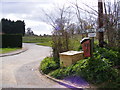
Spring Lane, Ufford
by Geographer
geograph for square TM2953
Category: Lane
Looking towards Loudham Lane
|
|
Lodge Road, Ufford
by Geographer
geograph for square TM2952
Category: Road
At the junction with Byng Hall Road
|

|
The Avenue, Ufford
by Geographer
geograph for square TM2952
Category: Lane
Near the junction with Barrack Lane
|
