
|
RAF Broadwell WW2 control tower
by Vieve Forward
geograph for square SP2506
The derelict remains of the control tower of RAF Broadwell, an airfield which... (more)
|

|
WW2 torpedo, Tory Island
by Rossographer
geograph for square B8646
This WW2 torpedo has been erected midway between An Baile Thiar and An Baile... (more)
|

|
Pillbox, Rathfriland
by Rossographer
geograph for square J2033
WW2 pillbox on Downpatrick Street, Rathfriland.
|

|
Graffiti inside double Norcon pillbox, SW site, former RAF Southrop
by Vieve Forward
for square SP1703
Written in pencil by a soldier of the rank of Gunner (Gnr) of the Heavy... (more)
|

|
Remains of WW2 blast shelters, former RAF Windrush
by Vieve Forward
geograph for square SP1812
The remains of two WW2 blast shelters can be seen to the right of the picture... (more)
|

|
Statue and pillbox in the grounds of Faringdon House
by Vieve Forward
geograph for square SU2895
The statue, with others, was brought to Faringdon House from the Great... (more)
|

|
RAF Broadwell WW2 ancillary buildings
by Vieve Forward
for square SP2507
These two WW2 buildings are situated inside Cotswold Natural Stone's... (more)
|

|
RAF Broadwell WW2 ancillary buildings
by Vieve Forward
for square SP2507
These three WW2 buildings are situated inside Cotswold Natural Stone's... (more)
|

|
Former electricity substation, RAF Broadwell
by Vieve Forward
geograph for square SP2508
This wall, once topped with barbed wire and sporting a 'Danger' sign,... (more)
|

|
Former WW2 hangar, Nebo Farm
by Vieve Forward
geograph for square SU0776
This former aircraft hangar on Nebo Farm was part of RAF Clyffe Pypard, a... (more)
|

|
Ruins on Titchwell beach in Norfolk
by Richard Humphrey
geograph for square TF7545
Between 1942 and 1945, Titchwell was used by the Royal Tank Regiment as a firing... (more)
|

|
Site of WW2 German Prisoner of War Camp
by valenta
geograph for square NH5155
WW2 German prisoner of war working camp 109 on the Brahan Estate
|

|
WW2 EAD Northfield
by valenta
geograph for square NH7071
WW2 Equipment Ammunition Depot buildings at Northfield, this one is unusual in... (more)
|

|
WWII Ammunition Store
by valenta
geograph for square NH5345
Set in Dunballoch Plantation, brick ammunition stores from WW2. The remains of... (more)
|

|
WW2 pillbox near Wroughton Airfield
by Vieve Forward
geograph for square SU1378
Type FW3/22 pillbox, part of RAF Wroughton's WW2 ground defences. The... (more)
|

|
WW2 pillbox near Wroughton Airfield
by Vieve Forward
geograph for square SU1378
Type FW3/22 pillbox, part of RAF Wroughton's WW2 ground defences. The... (more)
|

|
WW2 Bunker at Fox Holes
by Mick Garratt
geograph for square NZ4443
|
|
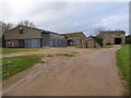
Former WW2 airfield buildings, RAF Stanton Harcourt
by Vieve Forward
geograph for square SP4105
Some of these buildings were originally part of RAF Stanton Harcourt, a WW2... (more)
|
|
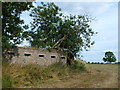
Defended fighter pen, King's Cliffe airfield
by Richard Humphrey
geograph for square TL0197
See Link and... ( more) |
|
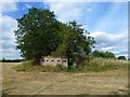
Defended fighter pen at King's Cliffe Airfield
by Richard Humphrey
geograph for square TL0197
See Link and... ( more) |
|
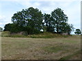
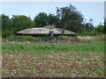
Defended fighter pen at RAF King's Cliffe
by Richard Humphrey
geograph for square TL0197
See Link and... ( more) |
|
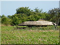
Mushroom pillbox on former airfield at King's Cliffe
by Richard Humphrey
geograph for square TL0297
See Link and... ( more) |
|
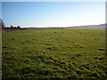
Mushroom pillbox at RAF King's Cliffe
by Richard Humphrey
geograph for square TL0297
See Link and... ( more) |
|
Pillbox in field west of former RAF Yatesbury air base
by Vieve Forward
geograph for square SU0471
A type 27 WW2 pillbox is seen in the distance across this field to the west of... (more)
|
|
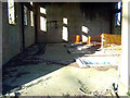
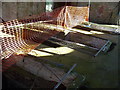
Inside the main generator house, former RAF Yatesbury air base
by Vieve Forward
for square SU0571
The inside of the derelict WW2 main generator house at the former RAF Yatesbury... (more)
|
|
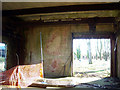
Generator mounts, main generator house, former RAF Yatesbury air base
by Vieve Forward
for square SU0571
Ceramic generator mounts inside the derelict WW2 main generator house at the... (more)
|
|
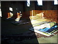
Lifting gantry, main generator house, former RAF Yatesbury air base
by Vieve Forward
for square SU0571
Lifting gantry inside the derelict WW2 main generator house at the former RAF... (more)
|
|
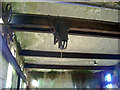
Generator mounts, main generator house, former RAF Yatesbury air base
by Vieve Forward
for square SU0571
Ceramic generator mounts inside the derelict WW2 main generator house at RAF... (more)
|
|
Lifting gantry, main generator house, former RAF Yatesbury air base
by Vieve Forward
for square SU0571
Lifting gantry inside the derelict WW2 main generator house at the former RAF... (more)
|
|
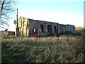
Main generator house, former RAF Yatesbury air base
by Vieve Forward
geograph for square SU0571
Derelict WW2 main generator house at the former RAF Yatesbury West Camp air base.
|
|
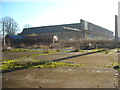
Hangar 45, former RAF Yatesbury air base
by Vieve Forward
geograph for square SU0571
|
|
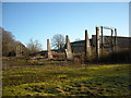
Hangars at north east corner of former RAF Yatesbury air base
by Vieve Forward
geograph for square SU0571
In the foreground are the remains of south side of a Grade II* listed WW1/WW2... (more)
|
|
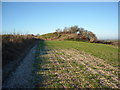
Round Barrow with WW2 gun emplacement, north of West Down
by Vieve Forward
geograph for square SU0669
Bronze Age round barrow with Second World War gun emplacement.... (more)
|

|
WW2 Pillbox, Cottingwood Common
by Mick Garratt
geograph for square NZ1987
Constructed in 1940/1 as part of the Northern Command River Wansbeck Stop Line... (more)
|
|
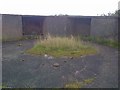
Remains of WW2 Defences
by Mick Garratt
geograph for square NG8689
Light Anti Aircraft guns I think.
|
|
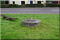
WW2 Spigot Mortar Emplacement
by Arthur Stevens
geograph for square TL5913
This Spigot Mortar Emplacement is just beside the B184 road, Leaden Roding. It... (more)
|

|
Thruxton - Thruxton Race Circuit
by Chris Talbot
geograph for square SU2745
This nissen hut is a left over from WW2 when Thruxton was a military airfield.
|
|
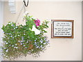
WW2 Headquarters, New Alresford
by Colin Smith
for square SU5832
Plaque on a Georgian house wall in New Alresford commemorating Americans who... (more)
|

|
WW2 lookouts, The Binks
by Mick Garratt
geograph for square NT1978
|
|
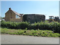
WW2 pillbox at Lower Sea Farm
by Vieve Forward
geograph for square ST3412
|

|
Rubble from former RAF Southrop NW site
by Vieve Forward
geograph for square SP1704
The former WW2 camp on the NW site has been completely demolished and all the... (more)
|

|
WW2 Anti-aircraft battery - command post
by John M
geograph for square SD2901
At the centre of a four gun battery protecting the docks at Liverpool. The above... (more)
|
|
Blast shelters, RAF Stanton Harcourt
by Vieve Forward
geograph for square SP4105
Blast shelters (the low red brick features) at the disused WW2 airfield RAF... (more)
|
|
Air raid shelter, RAF Stanton Harcourt
by Vieve Forward
geograph for square SP4105
WW2 air raid shelter on the disused aerodrome that was RAF Stanton Harcourt.... (more)
|

|
WW2 Pillbox
by Mick Garratt
geograph for square NJ0965
Constructed because of a threat of a German invasion. It would have been built... (more)
|

|
Disused RAF Blakehill Farm airfield
by Vieve Forward
geograph for square SU0791
RAF Blakehill Farm was opened in 1944 as a base for transport aircraft of No. 46... (more)
|

|
WW2 Gun Emplacement, Cocklawburn Beach
by Mick Garratt
geograph for square NU0348
Others have called this a gun emplacement. I'm not so sure, the direction... (more)
|

|
WW2 Pill Box
by Mick Garratt
geograph for square NZ7020
On Cattersty Sands. Clearly upside down having been flipped by landslip or sea action.
|

|
WW2 Type FW3/22 pillbox near Wroughton Airfield
by Vieve Forward
geograph for square SU1478
Type FW3/22 pillbox near boundary of RAF Wroughton Airfield, part of its ground... (more)
|

|
Brean Down - Weston Bay
by Chris Talbot
geograph for square ST2958
This WW2 bunker still stands guard over Weston Bay and Weston-Super-Mare.
|
