Geograph - photograph every grid square
About tags on Geograph
Tags
Geographical Context
Subjects
Types
Other Prefixes
Public Tags
Related Tags
|
Coverage Map
Tag:
Walton·Hill
Other tags:
p150 hill:
Walton Hill
Showing images tagged with
Walton Hill
tag.
View all tagged images
-
In Browser
Search within these images
:
A small valley on the south west side of Walton Hill
by
Phil Champion
geograph for square
SO9379
Looking down the field towards the hamlet of Walton Pool.
Tags:
Clent Hills
top:
Grassland
subject:
Valley
top:
Village, Rural Settlement
Walton Hill
Walton Pool
Worcestershire
A path junction in the woodland on Nag Hill
by
Phil Champion
geograph for square
SO9379
The left fork is the bridleway towards Walton Pool. The right is a footpath down... (
more
)
Tags:
Clent
Clent Hills
Nag Hill
subject:
Path Junction
top:
Paths
Walton Hill
Walton Pool
Woodland
top:
Woodland, Forest
Worcestershire
A birch tree on Walton Hill
by
Phil Champion
geograph for square
SO9479
The summit of Walton Hill kept largely free of trees, although there are a small... (
more
)
Tags:
Birch
Clent Hills
top:
Grassland
top:
Heath, Scrub
subject:
Tree
Walton Hill
Worcestershire
Car park below Walton Hill
by
Phil Champion
geograph for square
SO9480
Tags:
subject:
Car Park
Car Park
Clent Hills
top:
Roads, Road Transport
Walton Hill
Walton Hill Lane
Worcestershire
Car Park below Walton Hill
by
Phil Champion
geograph for square
SO9480
Tags:
Car Park
subject:
Car Park
Clent Hills
top:
Roads, Road Transport
Walton Hill
Walton Hill Lane
Worcestershire
Walton Hill
by
Rude Health
geograph for square
SO9479
Easy tick from handy car park with good views of West Midlands. Name: Walton... (
more
)
Tags:
top:
Grassland
Marilyn (Rhb)
P210
top:
Paths
Trig Point
top:
Uplands
Walton Hill
top:
Woodland, Forest
Walton Hill
by
Richard Webb
geograph for square
SO9479
The highest point on the Clent Hills with a typical wide path and triangulation pillar.
Tags:
top:
Paths
Summit
Triangulation Pillar
p150 hill:
Walton Hill
Fencing alongside the Cross Dyke, Walton Hill
by
Phil Champion
geograph for square
SO9479
Just south of the trig point at the summit of the hill is an ancient ditch.... (
more
)
Tags:
subject:
Archaeology
top:
Boundary, Barrier
Clent Hills
Cross Dyke
Ditch
top:
Historic Sites and Artefacts
Hollow Way
Holloway
top:
Paths
Walton Hill
Worcestershire
The summit of Walton Hill
by
Phil Champion
geograph for square
SO9479
Just south of the trig point at the summit of the hill is an ancient ditch. This... (
more
)
Tags:
top:
Boundary, Barrier
Clent Hills
Cross Dyke
Ditch
Fencing
top:
Grassland
top:
Historic Sites and Artefacts
Hollow Way
Holloway
subject:
Summit
Summit
Triangulation Pillar
Trig Pillar
Trig Point
Walton Hill
Worcestershire
The "Cross Dyke" on Walton Hill
by
Phil Champion
geograph for square
SO9479
Just south of the trig point at the summit of the hill is an ancient ditch.... (
more
)
Tags:
top:
Boundary, Barrier
Clent Hills
Cross Dyke
Ditch
Fencing
top:
Grassland
top:
Historic Sites and Artefacts
Hollow Way
Holloway
top:
Paths
Summit
Walton Hill
Worcestershire
View towards High Harcourt Farm and Clent Hill
by
Phil Champion
geograph for square
SO9480
From the bridleway climbing up Walton Hill.
Tags:
Big Bales
Clent Hill
Clent Hills
Country Park
top:
Farm, Fishery, Market Gardening
top:
Grassland
High Harcourt Farm
subject:
View
Walton Hill
Worcestershire
Bridleway towards the summit of Walton Hill
by
Phil Champion
geograph for square
SO9379
Tags:
subject:
Bridleway
Clent Hills
top:
Grassland
top:
Heath, Scrub
top:
Paths
Walton Hill
Worcestershire
Bridleway towards the summit of Walton Hill
by
Phil Champion
geograph for square
SO9479
Tags:
subject:
Bridleway
Bridleway
Clent Hills
top:
Grassland
top:
Paths
Walton Hill
Worcestershire
Trig pillar on Walton Hill
by
Phil Champion
geograph for square
SO9479
Tags:
Clent Hills
Cross Dyke
top:
Grassland
Summit
Triangulation Pillar
Trig Pillar
Trig Point
top:
Uplands
Walton Hill
Worcestershire
A junction of paths on Walton Hill
by
Phil Champion
geograph for square
SO9479
Tags:
Bridleway
top:
Grassland
subject:
Path Junction
top:
Paths
Walton Hill
Worcestershire
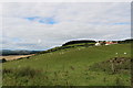
View over Fife countryside
by
Bill Kasman
geograph for square
NO3609
The buildings of Walton Hill Farm are prominent.
Tags:
Chance Inn
Chance Inn Wood
Farm
Fife
type:
Geograph
top:
Lowlands
top:
Village, Rural Settlement
Walton Hill
A footpath in woodland at Nag Hill
by
Phil Champion
geograph for square
SO9379
The path emerges from the woodland and runs downhill through a couple of fields... (
more
)
Tags:
Clent
Clent Hills
Nag Hill
top:
Paths
Walton Hill
subject:
Woodland
top:
Woodland, Forest
Worcestershire
Kissing gate on a footpath towards Clent parish church
by
Phil Champion
geograph for square
SO9379
Tags:
Clent
Kissing Gate
Nag Hill
top:
Paths
Walton Hill
top:
Woodland, Forest
Worcestershire
View more in the Image Search
or
in Browser
View images matching 'Walton Hill' anywhere
in
the tags
Don't click these:
PotMel 1
PotMel 2
☰
Home
View
Search
Marked Images
Maps
Browser
Explore
Showcase
New Images
Collections
Interact
Games
Discussions
Blog
Contributors
Submit
Statistics
Leaderboards
General
FAQ
Help Pages
Sitemap
Contact Us
Support Us
sponsored by
🔍︎
What to search:
Photos
Enter keywords or a location/postcode to search nearby images
Enter a Grid Reference
Placenames
Collections
Website Pages
Everything
Others:
Advanced Search
|
Image Browser
Or:
Coverage Map
|
Searchable Map
You are not logged in
|
login
|
register