Public Tags
Tag: Worksop
Showing images tagged with Worksop tag.

|
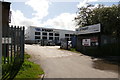
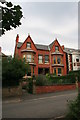
Worksop Town exhibition: From Donovans to Tigers
by Dave Pickersgill for square SK5878 Worksop Town exhibition: From Donovans to Tigers. Worksop Library, December... (more)
Tags:
top:City, Town CentreX
top:Educational SitesX
subject:ExhibitionX
type:InsideX
top:LowlandsX
top:Public Buildings and SpacesX
top:Sport, LeisureX
place:Worksop
name:Worksop TownX
|

|
Tiger Ale
by Dave Pickersgill for square SK5879 Worksop Tiger Ale is unveilled at the 2014 Worksop Beer and Music Festival. This... (more)
Tags:
BeerX
top:City, Town CentreX
FestivalX
FootballX
name:Grafton BreweryX
top:People, EventsX
top:Sport, LeisureX
place:Worksop
name:Worksop TownX
|
|
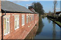
Chesterfield Canal and the workshopos
by Dave Pickersgill geograph for square SK5978 The Chesterfield Canal, in Worksop. On the left is the site of the former... (more)
|
|
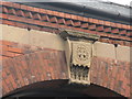
Worksop and Retford Brewery workshops
by Dave Pickersgill for square SK5979 Close-up of the motif of the Worksop and Retford Brewery. This motive is above... (more)
|
|
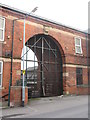
Worksop and Retford Brewery workshops
by Dave Pickersgill for square SK5979 The site of the former Worksop and Retford Brewery workshops (on the site of an... (more)
|
|
|
Penistone Church v Worksop Town
by Dave Pickersgill geograph for square SE2403 Tags:
top:City, Town CentreX
FootballX
sport:FootballX
Football FieldX
Football GroundX
subject:Football GroundX
Football MatchX
Football PitchX
type:GeographX
place:PenistoneX
Penistone ChurchX
Penistone Church FCX
top:Sport, LeisureX
top:UplandsX
Worksop
name:Worksop TownX
|
|
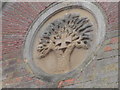
Motif of the Worksop and Retford Brewery
by Dave Pickersgill for square SK7081 The company motif of the Worksop and Retford Brewery, an iron cross superimposed... (more)
Tags:
BreweryX
top:Business, Retail, ServicesX
top:City, Town CentreX
type:Close LookX
top:Flat LandscapesX
RetfordX
Worksop
|
|
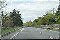
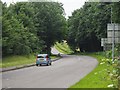
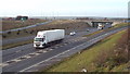
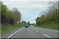
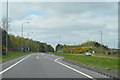
A57 near Worksop
by Julian P Guffogg geograph for square SK5977 A footbridge crosses ahead.
|
|
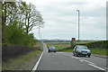
A57 near Worksop
by Julian P Guffogg geograph for square SK6178 A large wind turbine is nearby.
|
|
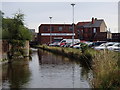
Chesterfield canal through Worksop
by Andrew Hill geograph for square SK5879 A view along the canal by one of the main town car parks.
|
|
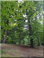
In Hannah Park
by Graham Hogg geograph for square SK5877 A Woodland Trust wood to the south of Worksop
|
|
Ollerton Road
by Graham Hogg geograph for square SK5976 The B6034 between Worksop and Ollerton
|

|
Ploughed and planted field to the east of Worksop
by Graham Hogg geograph for square SK6081 |
|
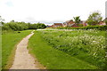
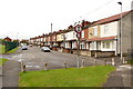
Footpath beside a housing estate
by Graham Hogg geograph for square SK5782 A green space in suburban Worksop
|
|
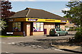
Blyth Services, near Worksop
by Malc McDonald geograph for square SK6288 Blyth Services are located just off the trunk A1 road.
Tags:
place:BlythX
top:Business, Retail, ServicesX
county:NottinghamshireX
near:RetfordX
top:Roads, Road TransportX
Service AreaX
Service StationX
ServicesX
near:Worksop
|
|
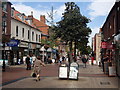
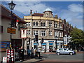
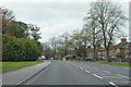
Bridge Street, Worksop
by Andrew Hill geograph for square SK5878 Looking north along the pedestrianised shopping street.
|
|
Corner of Bridge Street and Newcastle Street, Worksop
by Andrew Hill geograph for square SK5878 Bridge Street is pedestrianised, the car is travelling along Newcastle Street.... (more)
|
|
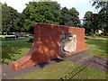
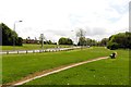
Memorial Gardens
by Graham Hogg geograph for square SK5878 The gardens and the adjacent memorial SK5878 : Worksop War Memorial were built in remembrance of... (more)
Tags:
top:City, Town CentreX
Memorial GardensX
top:Park and Public GardensX
War MemorialX
place:Worksop
|
|
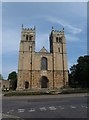
Worksop Priory
by Graham Hogg geograph for square SK5878 The west frontage of this impressive church is in SK5878 but the main body of... (more)
|
|
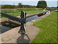
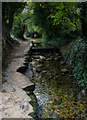
Kilton Lock
by Graham Hogg geograph for square SK5978 Lock 52 on the Chesterfield Canal on the eastern edge of Worksop.
|
|
A1 road near Worksop
by Malc McDonald geograph for square SK6288 The A1 trunk road, photographed from Blyth services.
Tags:
road:A1X
place:BlythX
LorryX
county:NottinghamshireX
near:RetfordX
top:Roads, Road TransportX
Slip RoadX
Slip RoadsX
Trunk RoadX
Trunk RouteX
near:Worksop
|
|
Grassy area beside Ashes Park Avenue
by Graham Hogg geograph for square SK5781 Tags:
top:Roads, Road TransportX
place:Worksop
|
|
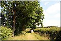
Footpath between field boundaries
by Graham Hogg geograph for square SK5677 |
|
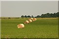
Hay bales near Castle Farm
by Graham Hogg geograph for square SK5776 Crop safely gathered in nice and early this year.
|
|
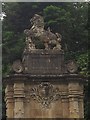
Lion Gates - detail
by Graham Hogg for square SK5977 See SK5977 : Lion Gates for the wider view
Tags:
type:Close LookX
top:Country EstatesX
Entrance GatesX
subject:GatewayX
Welbeck AbbeyX
place:Worksop
|
|
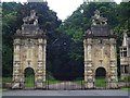
Lion Gates
by Graham Hogg geograph for square SK5977 At the eastern extremity of the Welbeck Abbey Estate.
Tags:
top:Country EstatesX
Entrance GatesX
subject:GateX
type:GeographX
top:Roads, Road TransportX
Welbeck AbbeyX
place:Worksop
|
|
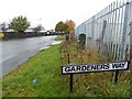
Gardeners Way sign
by Steve Fareham geograph for square SK5780 Does what is says and gives access to allotments.
|
|
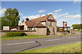
The Three Legged Stool
by Graham Hogg geograph for square SK5881 Pub on Raymoth Lane
Tags:
top:Business, Retail, ServicesX
subject:Public HouseX
Public HouseX
top:Suburb, Urban FringeX
place:Worksop
|
|
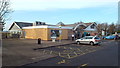
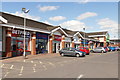
Celtic Point shopping centre
by Graham Hogg geograph for square SK5781 Tags:
top:Business, Retail, ServicesX
subject:Shopping CentreX
top:Suburb, Urban FringeX
place:Worksop
|
|
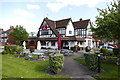
The Cannon
by Graham Hogg geograph for square SK5881 A large pub and restaurant at the corner of Thievesdale Lane and the A60 Carlton Road
Tags:
top:Business, Retail, ServicesX
subject:Public HouseX
Public HouseX
top:Suburb, Urban FringeX
place:Worksop
|
|
Thievesdale Convenience Store
by Graham Hogg geograph for square SK5981 At the corner of Thievesdale Lane and Thievesdale Close.I wonder if they have a... (more)
|
|
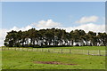
Coronation Plantation
by Graham Hogg geograph for square SK6181 Whose coronation was it planted to celebrate?
|
|
Engineering works and company head office
by Graham Hogg geograph for square SK6082 On Red Lane
Link
|

|
Public footpath through a cornfield
by Graham Hogg geograph for square SK5882 A solitary tree stands beside the path
|
|
Baulk Lane
by Graham Hogg geograph for square SK5880 Motor vehicles and cycles prohibited according to the sign, but this is surely... (more)
Tags:
top:Housing, DwellingsX
Road SignX
top:Roads, Road TransportX
subject:StreetX
top:Suburb, Urban FringeX
place:Worksop
|
|
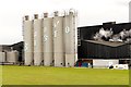
What a lot of gravy!
by Graham Hogg geograph for square SK5780 Storage silos at the Premier Foods (Bachelors) factory on the Dukeries... (more)
|
|
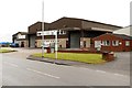
Bus stop on the Claylands Avenue
by Graham Hogg geograph for square SK5681 On the Dukeries Industrial Estate
Tags:
subject:Bus StopX
Industrial EstateX
top:IndustryX
top:Roads, Road TransportX
top:Suburb, Urban FringeX
place:Worksop
|
|
Mr Straw's House
by Graham Hogg geograph for square SK5980 A 1920s house captured in time. Owned by National Trust. See... (more)
|
|
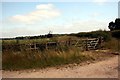
Field gate near Castle Farm
by Graham Hogg geograph for square SK5777 |
|
Approaching A60 roundabout on A57
by Julian P Guffogg geograph for square SK5778 |
|
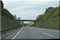
Bridge over the A57
by Julian P Guffogg geograph for square SK5877 Sparken Hill road crosses.
|
|
A57 near B&Q Distribution Centre
by Julian P Guffogg geograph for square SK6077 |
|
A60 Mansfield Road
by Julian P Guffogg geograph for square SK5678 West Wood on the left.
|
|
A60 Mansfield Road
by Julian P Guffogg geograph for square SK5677 |
|
Brook and weir near Belph
by Andy Stephenson geograph for square SK5475 It's interesting how the rock edge has been eroded into a zig zag shape. A... (more)
|
|
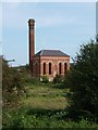
Bracebridge Pumping Station
by Graham Hogg geograph for square SK5979 Tags:
top:CanalsX
Chesterfield CanalX
Cuckoo WayX
top:PathsX
former:Pumping StationX
near:Sewage WorksX
top:Water ResourcesX
place:Worksop
|