|
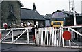
Station on the NYMR - Grosmont, North Yorkshire
by Martin Richard Phelan
for square NZ8205
The North Yorkshire Moors Railway faced its closure in 1965. In 1967 the NYMR... (more)
|
|
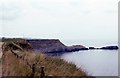
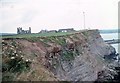
Saltwick Nab to east - Whitby, North Yorkshire
by Martin Richard Phelan
geograph for square NZ9111
This is Saltwick Nab, viewed from the west on the Cleveland Way. It lies on the... (more)
|
|
Cleveland Way to Saltwick Nab - Whitby, North Yorkshire
by Martin Richard Phelan
for square NZ9111
This is Saltwick Nab, viewed from the south on the Cleveland Way. It lies on the... (more)
|
|
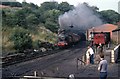
Engine shed on the NYMR - Grosmont, North Yorkshire
by Martin Richard Phelan
geograph for square NZ8204
Near to the south portal of the tunnel now in use stands the Grosmont engine... (more)
|
|
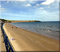
Filey Bay
by PAUL FARMER
geograph for square TA1180
|
|
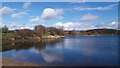
Ardsley Reservoir, Tingley, West Yorkshire
by I Love Colour
for square SE2825
A February day at Ardsley reservoir, Tingley, West Yorkshire
|

|
View from St Mary's Church - Whitby, North Yorkshire
by Martin Richard Phelan
for square NZ8911
This is the view westwards taken from beside St Mary's Church. Over the... (more)
|
|
St Mary's Church - Whitby, North Yorkshire
by Martin Richard Phelan
geograph for square NZ9011
The origins of the parish church of St Mary in Whitby, North Yorkshire date from... (more)
|
|
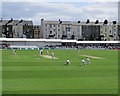
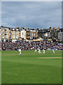
Scarborough: turned to leg
by John Sutton
geograph for square TA0389
The bowler, Nottinghamshire's Luke Wood, had taken the first five wickets... (more)
|
|
Scarborough: County Cricket at North Marine Road
by John Sutton
geograph for square TA0389
The scoreboard shows a Yorkshire recovery on the first day. Nottinghamshire had... (more)
|
|
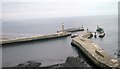
Harbour entrance - Whitby, North Yorkshire
by Martin Richard Phelan
for square NZ8911
A view over to the harbour entrance, taken on a week long walking and hostelling... (more)
|
|
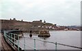
From the East Pier - Whitby, North Yorkshire
by Martin Richard Phelan
geograph for square NZ9011
A view landward to the Abbey ruins and the parish church. Whitby stands on both... (more)
|
|
Abbey to westward - Whitby, North Yorkshire
by Martin Richard Phelan
geograph for square NZ9011
A view across to the remains of Whitby Abbey. It stands up high on the right... (more)
|
|
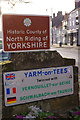
Entering Yarm
by Stephen McKay
for square NZ4113
Arriving in Yarm High Street over Yarm Bridge, motorists see these two signs,... (more)
|
|
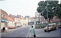
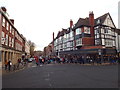
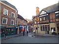
Up Smiddy Hill - Pickering, North Yorkshire
by Martin Richard Phelan
geograph for square SE7983
This photo, taken in Pickering from the junction of Hall Garth and Smiddy Hill,... (more)
|
|
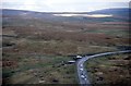
Track to Gunnerfleet - Ribblehead, North Yorkshire
by Martin Richard Phelan
geograph for square SD7579
A view of the track leading to Gunnerfleet Farm from its junction with the B6255... (more)
|
|
Wharfeside maypole and banks - Burnsall, North Yorkshire
by Martin Richard Phelan
geograph for square SE0361
On the bank of the River Wharfe in the Dales village of Burnsall, looking... (more)
|
|
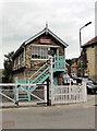
Grosmont Crossing Signal Box
by PAUL FARMER
geograph for square NZ8205
|
|
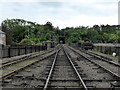
North Yorkshire Moors Railway at Grosmont
by PAUL FARMER
geograph for square NZ8205
|

|
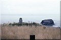
Boundary Stone Cairn, Laskill Pasture Moor
by Scott Robinson
geograph for square SE5892
Wide open moorland in the North Yorkshire Moors. Bilsdale transmitting mast can... (more)
|
|
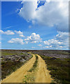
Open Moorland, Coniser Howl
by Scott Robinson
geograph for square SE5994
Wide open spaces and big skies, North Yorkshire Moors.
|
|
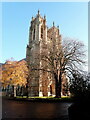
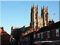
Beverley Minster
by Phil Brandon Hunter
geograph for square TA0339
The Parish Church of St. John and St. Martin, Beverley, East Riding, Yorkshire
|
|
Beverley Minster
by Phil Brandon Hunter
for square TA0339
The Parish Church of St. John and St. Martin, Beverley, East Riding, Yorkshire
|
|
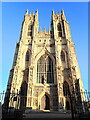
Beverley Minster - the west front
by Phil Brandon Hunter
geograph for square TA0339
Beverley Minster in Beverley, East Riding of Yorkshire, England.
|
|
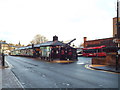
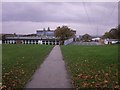
Harrogate Bus Station
by Malc McDonald
geograph for square SE3055
Harrogate bus station is next door to the railway station, making it easy for... (more)
|
|
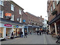
Feasegate, York
by Malc McDonald
geograph for square SE6051
A view along Feasegate in the centre of York.
The BHS store has closed down.... (more)
|
|
Piccadilly, York
by Malc McDonald
geograph for square SE6051
A view down Piccadilly, in the centre of York.
|
|
Finkle Street, York
by Malc McDonald
geograph for square SE6051
Finkle Street in York.
This image was taken in late autumn. The sun was low... (more)
|
|
York Minster School
by Malc McDonald
geograph for square SE6052
The Minster school at York.
|
|
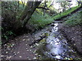
Stream, Primrose Valley
by PAUL FARMER
geograph for square TA1178
|
|
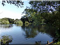
Lake at Primrose Valley Caravan Park
by PAUL FARMER
geograph for square TA1178
|

|
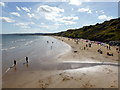
Scarborough South Bay
by PAUL FARMER
geograph for square TA0488
|
|
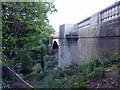
Glen Bridge
by PAUL FARMER
geograph for square TA0389
|
|
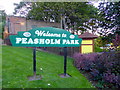
Peasholm Park Sign
by PAUL FARMER
for square TA0389
|
|
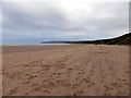
Muston Sands, Filey
by PAUL FARMER
geograph for square TA1279
|
|
Butcher Haven
by PAUL FARMER
geograph for square TA1277
|

|
Hunmanby Sands, Filey Bay
by PAUL FARMER
geograph for square TA1278
|

|
Welcome to Yorkshire on Mortimer Road
by Steve Fareham
geograph for square SK2496
LeTour of Yorkshire a triumph!
|
|
Pylons and Thornhill Community Academy
by Christopher Styles
geograph for square SE2518
The electricity pylons march on down into the Calder valley, past Thornhill... (more)
|
|
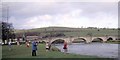
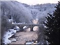
Richmond Bridge from Lady Walk, Richmond Castle
by Christopher Styles
for square NZ1600
Looking up the Tees river, The Green Bridge crosses the river to Richmond Green... (more)
|
|
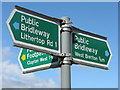
On the way to Bretton
by Dave Pickersgill
for square SE2812
Footpath sign near Yorkshire Sculpture park.
|
|
Dewsbury Minster
by Phillip Medhurst
for square SE2421
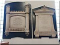
War memorials in the south west corner of the south aisle. [1]
|
|
Dewsbury Minster
by Phillip Medhurst
for square SE2421
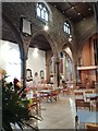
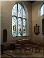
The nave and north aisle from the south east. [1] [2]
|
|
Dewsbury Minster
by Phillip Medhurst
for square SE2421
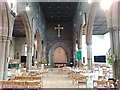
A view of the church interior from the east. [1]
|
|
Dewsbury Minster
by Phillip Medhurst
for square SE2421
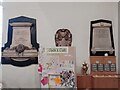
Memorials in the middle of the north aisle wall. [1]
|
|
Dewsbury Minster
by Phillip Medhurst
for square SE2421
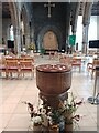
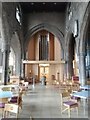
A view of the nave from behind the font at the east end. [1]
|
|
Dewsbury Minster
by Phillip Medhurst
for square SE2421
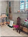
West corner of the north aisle. [1]
|
|
Dewsbury Minster
by Phillip Medhurst
for square SE2421
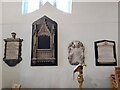
Memorials at the east end of the north aisle. [1]
|
|
Dewsbury Minster
by Phillip Medhurst
for square SE2421
Memorials at the west end of the north aisle wall. [1]
|
|
Dewsbury Minster
by Phillip Medhurst
for square SE2421
The new east end of the nave, with the font. [1] [2] The window is the east... (more)
|