Public Tags
Tag: Abandoned·Canal
Showing images tagged with Abandoned Canal tag.
|
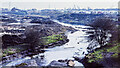
Gospel Oak branch of Walsall Canal, 1979
by Trevor Littlewood geograph for square SO9694 A truly desolate scene showing the long-abandoned Gospel Oak canal branch from... (more)
Tags:
Abandoned Canal
subject:Canal
top:Canals
top:Derelict, Disused
type:Geograph
Travellers Caravans
Waste Ground
|

|
Abandoned stretch of Wyrley & Essington Canal, 1987
by Trevor Littlewood geograph for square SK1409 This stretch of the Wyrley & Essington Canal, west from Watery Lane Bridge,... (more)
Tags:
Abandoned Canal
subject:Canal
top:Canals
top:Derelict, Disused
type:Geograph
top:Lakes, Wetland, Bog
top:Lowlands
Reed Bed
|

|
Abandoned section of the Lancaster Canal
by Oliver Dixon geograph for square SD5175 This section, blocked by the motorway to both the south and north, was abandoned in 1965.
|

|
The Derby Canal, from the bridge at Swarkestone Junction
by Christine Johnstone geograph for square SK3729 The Derby Canal opened in 1796 and was abandoned in 1964. The Derby and... (more)
Tags:
Abandoned Canal
subject:Canal
top:Canals
path:Cloud Trail
canal:Derby Canal
type:Geograph
NCN Route 6
Public Footpath
Unnavigable Canal
|
|
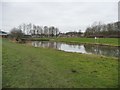
The Worsbrough terminus of the former branch canal
by Christine Johnstone geograph for square SE3503 Fed by the nearby Worsbrough Reservoir. The 2.5 mile long Worsbrough section of... (more)
Tags:
Abandoned Canal
subject:Canal
Canal Arm Terminus
Canal Basin (Disused)
top:Canals
canal:Dearne and Dove
Unnavigable Canal
place:Worsbrough
|

|
Remains of the Shrewsbury Canal from Oulton Bridge
by Trevor Littlewood geograph for square SJ7822 Oulton Bridge is a short distance west of the Shropshire Union Canal which the... (more)
Tags:
Abandoned Canal
Bog
subject:Canal
top:Canals
top:Derelict, Disused
type:Geograph
top:Lakes, Wetland, Bog
top:Lowlands
|
|
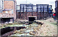
Abandoned canal at Great Bridge, 1979 - 2
by Trevor Littlewood geograph for square SO9792 The canal was a stretch of the 'Old Wednesbury Canal', part of the... (more)
Tags:
Abandoned Canal
Advertising Hoarding (Rear)
Bridge
subject:Canal
top:Canals
type:Geograph
top:Lowlands
|

|
The former Worsbrough branch canal [upper level]
by Christine Johnstone geograph for square SE3503 Looking westwards from the footbridge. The 2.5 mile long Worsbrough section of... (more)
Tags:
Abandoned Canal
subject:Canal
top:Canals
canal:Dearne and Dove
Unnavigable Canal
place:Worsbrough
|

|
The former Worsbrough branch canal [lower level]
by Christine Johnstone geograph for square SE3503 Looking eastwards from the footbridge over the weir. The 2.5 mile long... (more)
Tags:
Abandoned Canal
subject:Canal
top:Canals
canal:Dearne and Dove
Unnavigable Canal
place:Worsbrough
|

|
Approaching Bridge 51
by Trevor Littlewood geograph for square SK7735 Bridge No. 51 on the Grantham Canal carries Jericho Lane over the disused... (more)
Tags:
Abandoned Canal
top:Boundary, Barrier
Canal Bridge
Canal Towpath
top:Canals
type:Geograph
Hedge
top:Lowlands
top:Paths
top:Roads, Road Transport
|
|
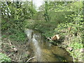
The former Market Weighton canal at River Head
by Christine Johnstone geograph for square SE8539 Completed from the Humber to River Head in 1782. This section was abandoned in... (more)
Tags:
Abandoned Canal
subject:Canal
top:Canals
Drain
type:Geograph
top:Historic Sites and Artefacts
canal:Market Weighton
top:Rivers, Streams, Drainage
Unnavigable Canal
|
|
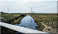
Walsall Canal, Anson branch in 1979
by Trevor Littlewood geograph for square SO9898 In this view from Bentley Mill Bridge the watered stretch of the branch... (more)
Tags:
Abandoned Canal
subject:Canal
top:Canals
top:Derelict, Disused
type:Geograph
top:Lowlands
Pipeline
|
|
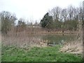
Fishing peg on the former Worsbrough branch
by Christine Johnstone geograph for square SE3503 The 2.5 mile long Worsbrough section of the Dearne and Dove Canal opened in... (more)
Tags:
Abandoned Canal
subject:Canal
top:Canals
canal:Dearne and Dove
Fishing Peg
top:Sport, Leisure
Unnavigable Canal
place:Worsbrough
|

|
Grantham Canal north of Plungar, heading north-east
by Trevor Littlewood geograph for square SK7634 The abandoned and overgrown canal with its adjacent path over uneven grass.
Tags:
Abandoned Canal
top:Boundary, Barrier
Canal Towpath
top:Canals
type:Geograph
top:Lowlands
top:Paths
Unkempt Hedge
|

|
Canal towpath with distance marker
by Trevor Littlewood geograph for square SK7936 An overgrown and currently abandoned stretch of the Grantham Canal north of the... (more)
|

|
Footbridge and derelict lock on the Lancaster Canal
by Oliver Dixon geograph for square SD5174 One of the higher of eight locks which formerly raised the level of the... (more)
Tags:
Abandoned Canal
subject:Bridge
top:Canals
Derelict Lock
Footbridge
type:Geograph
top:Paths
Weir
|

|
Footbridge and derelict lock on the Lancaster Canal
by Oliver Dixon geograph for square SD5174 One of the higher of eight locks which formerly raised the level of the... (more)
|
|
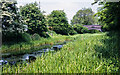
Abandoned stretch of Wyrley & Essington Canal, 1986
by Trevor Littlewood geograph for square SJ9805 An overgrown part of the canal heading towards Baker Bridge in the Upper... (more)
|

|
Tewitfield Locks
by Oliver Dixon geograph for square SD5174 A series of eight locks formerly raised the level of the Lancaster Canal by 75... (more)
|

|
Lock 2 - Tewitfield Locks
by Oliver Dixon geograph for square SD5173 The second of eight locks which formerly raised the level of the Lancaster Canal... (more)
|

|
Lock 2 - Tewitfield Locks
by Oliver Dixon geograph for square SD5173 The second of eight locks which formerly raised the level of the Lancaster Canal... (more)
|

|
Cyclists on the towpath
by Oliver Dixon geograph for square SD5175 Beside the abandoned northern reaches of the Lancaster Canal.
|

|
Saltermire Bridge
by Oliver Dixon for square SD5175 Bridge carrying minor road over the disused section of the Lancaster Canal above... (more)
Tags:
Abandoned Canal
subject:Bridge
Bridge
top:Canals
type:Cross Grid
top:Paths
top:Roads, Road Transport
Towpath
|

|
Public footpath running south from Sand Lane
by Christine Johnstone geograph for square SE8437 Not mapped, but signposted. The watercourse is the Back Delfin drain. The line... (more)
Tags:
Abandoned Canal
Drain
path:Footpath
type:Geograph
canal:Market Weighton
subject:Path
top:Paths
Public Footpath
Public Footpath Signpost
|

|
Happy Valley
by Ian Capper geograph for square TQ3056 A c.250 acre downland and woodland open space owned and managed by Croydon... (more)
Tags:
Abandoned Canal
Abandoned Car
top:Derelict, Disused
type:Geograph
top:Grassland
place:Happy Valley
place:Old Coulsdon
top:Suburb, Urban Fringe
top:Woodland, Forest
|

|
Overgrown stretch of Grantham Canal north of Barkestone-le-Vale
by Trevor Littlewood geograph for square SK7835 Here the canal is around a kilometre north of the village, Barkestone-le-Vale... (more)
Tags:
Abandoned Canal
top:Boundary, Barrier
Canal Towpath
top:Canals
type:Geograph
Hedge
top:Lowlands
top:Paths
|

|
Lancaster Canal at Tewitfield
by Oliver Dixon geograph for square SD5174 Weed-filled canal above the head of navigation.
|

|
Course of the Stroudwater Canal at Upper Framilode
by John Winder geograph for square SO7510 Looking the other way from my previous shot of the canal at this location.... (more)
|

|
Barkestone Bridge, No. 50
by Trevor Littlewood geograph for square SK7734 The bridge is across the overgrown and disused Grantham Canal to the west of... (more)
Tags:
Abandoned Canal
Canal Bridge
Canal Towpath
top:Canals
type:Geograph
top:Lowlands
top:Paths
Unkempt Hedge
|

|
Lancaster Canal
by Oliver Dixon geograph for square SD5382 A short length of the disused Lancaster Canal trapped between the A65 and the M6... (more)
|

|
Northern end of the culvert under the M6
by Oliver Dixon geograph for square SD5175 At this point the northern reaches of the Lancaster Canal were severed by the... (more)
Tags:
Abandoned Canal
top:Canals
subject:Culvert
Culvert
type:Geograph
Motorway
top:Paths
top:Roads, Road Transport
Steps
|

|
Lancaster Canal at Tewitfield
by Oliver Dixon geograph for square SD5174 Weed-filled canal above the head of navigation. Greenland Farm SD5273 beyond.
Tags:
Abandoned Canal
subject:Canal
top:Canals
top:Farm, Fishery, Market Gardening
Field
type:Geograph
|

|
Lancaster Canal at Tewitfield
by Oliver Dixon geograph for square SD5174 Weed-filled canal above the head of navigation. A wind turbine on the skyline.
Tags:
Abandoned Canal
subject:Canal
top:Canals
top:Energy Infrastructure
top:Farm, Fishery, Market Gardening
Field
type:Geograph
Wind Turbine
|

|
The Old Cut and Navigation Yard, Wakefield
by Christine Johnstone geograph for square SE3320 The original terminus of the Wakefield branch of the Aire & Calder... (more)
Tags:
Abandoned Canal
canal:Aire and Calder
Aire and Calder Navigation
subject:Canal
Canal Terminus
top:Canals
Former HQ
type:Geograph
place:Wakefield
|

|
Bridleway bridge over the Lancaster Canal
by Oliver Dixon geograph for square SD5174 The bridge crosses the canal immediately below one of the eight derelict locks... (more)
Tags:
Abandoned Canal
subject:Bridge
Bridleway Bridge
top:Canals
Derelict Lock
type:Geograph
top:Paths
Towpath
|

|
Lancaster Canal at Tewitfield
by Oliver Dixon geograph for square SD5173 Weed-filled canal above the head of navigation.
|

|
The Old Cut turns green
by Christine Johnstone geograph for square SE3320 The original route of the Wakefield branch of the Aire & Calder Navigation,... (more)
Tags:
Abandoned Canal
canal:Aire and Calder
Aire and Calder Navigation
subject:Canal
top:Canals
top:Derelict, Disused
type:Geograph
place:Wakefield
|

|
Course of the Stroudwater Canal at Upper Framilode
by John Winder geograph for square SO7510 Taken from Moor Street bridge looking towards Saul Junction which is just under... (more)
|

|
Yealand Road Bridge
by Oliver Dixon geograph for square SD5175 Bridge carrying minor road over disused section of the Lancaster Canal.
|

|
The towpath resumed
by Oliver Dixon geograph for square SD5175 After a short section along a minor road, a gate gives on to a path which... (more)
Tags:
Abandoned Canal
top:Boundary, Barrier
top:Canals
County Boundary
subject:Gate
Gate
type:Geograph
Motorway
top:Paths
top:Roads, Road Transport
Sign
Towpath
|
