Public Tags
Tag: Abandoned·Railway
Showing images tagged with Abandoned Railway tag.
|
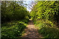
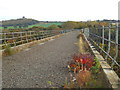
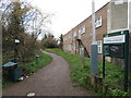
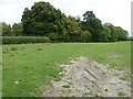
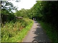
Path along abandoned railway line, Mill Hill
by Christopher Hilton geograph for square TQ2391 This line, part of the Great Northern Railway's suburban network, ran from... (more)
Tags:
Abandoned Railway
type:GeographX
London Underground Northern Heights SchemeX
Path on Disused RailwayX
top:PathsX
former:Railway LineX
top:RailwaysX
top:Suburb, Urban FringeX
|
|
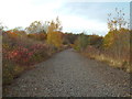
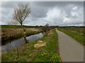
Abandoned line from Bradford Abbas Junction to River Junction
by Richard Green geograph for square ST5714 The bracken-covered embankment marks the original route of the Salisbury and... (more)
Tags:
Abandoned Railway
top:LowlandsX
Old Railway EmbankmentX
top:RailwaysX
top:Village, Rural SettlementX
|
|
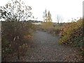
Former railway cutting, East Grinstead
by Malc McDonald geograph for square TQ3838 This very overgrown site in East Grinstead was once a railway cutting. The... (more)
Tags:
Abandoned Railway
Abandoned Railway CuttingX
subject:CuttingX
top:Derelict, DisusedX
place:East GrinsteadX
Former Railway CuttingX
Former Railway RouteX
Former Railway TrackbedX
type:GeographX
county:West SussexX
|
|
Old railway at Smalmstown
by Oliver Dixon geograph for square NY3668 This thoroughly abandoned railway ran from the sub-depot at Smalmstown to the... (more)
|
|
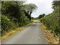
Farm road on abandoned railway
by Oliver Dixon geograph for square NY4829 Farm road on the alignment of the former Cockermouth, Keswick and Penrith... (more)
|
|
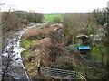
Bridge HLB17 over disused mineral railway
by Richard Green geograph for square SK7525 This stone arch bridge carries the Scalford - Eastwell road over the abandoned... (more)
Tags:
Abandoned Railway
top:LowlandsX
top:RailwaysX
top:Roads, Road TransportX
Stone Arch BridgeX
top:Village, Rural SettlementX
|
|
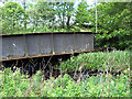
Girder bridge 11a taking the Cloud Trail over the Trent and Mersey
by Richard Green geograph for square SK3827 A view from above of the plate girder bridge which took the abandoned Derby -... (more)
Tags:
Abandoned Railway
Girder BridgeX
top:LowlandsX
top:RailwaysX
Signal PostX
TrailX
top:Village, Rural SettlementX
|
|
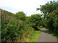
Path on an abandoned railway line
by David Lally geograph for square SU4827 Approaching a bridge over a footbridge. For the bridge and info on the line see... (more)
|
|
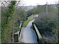
Former railway viaduct near Washington
by Malc McDonald geograph for square NZ3154 This view looks along a viaduct which used to carry a railway across the River... (more)
Tags:
Abandoned Railway
top:Derelict, DisusedX
Dismantled Railway LineX
Disused Railway ViaductX
Disused ViaductX
Former Railway RouteX
Former Railway TrackX
Former Railway TrackbedX
Former Railway ViaductX
type:GeographX
Railway (Dismantled)X
Railway Line (Dismantled)X
disused:Railway ViaductX
former:Railway ViaductX
Railway Viaduct (Former)X
county:Tyne & WearX
subject:ViaductX
near:WashingtonX
place:WearsideX
|
|
Path on an old viaduct, Halifax
by Malc McDonald geograph for square SE0725 This path crosses a disused railway viaduct. The wall at the right of the image... (more)
Tags:
Abandoned Railway
top:Derelict, DisusedX
Disused RailwayX
Disused Railway LineX
Disused Railway RouteX
Disused Railway ViaductX
Former Rail ViaductX
Former Railway Track BedX
Former Railway TrackbedX
Former Railway ViaductX
type:GeographX
place:HalifaxX
subject:PathX
Path on Disused RailwayX
top:PathsX
disused:RailwayX
disused:Railway TrackX
disused:Railway ViaductX
county:West YorkshireX
|
|
Dismantled railway line near Washington
by Malc McDonald geograph for square NZ3154 This was the route of the original main line between London and... (more)
|
|
Dismantled railway near Washington
by Malc McDonald geograph for square NZ3154 This is the original route of the railway line between London and... (more)
|

|
Dismantled railway line near Washington
by Malc McDonald geograph for square NZ3154 This is the original route of the railway line between London and... (more)
|
|
Parkland Walk at Finsbury Park
by Malc McDonald geograph for square TQ3187 Tags:
Abandoned Railway
place:Finsbury ParkX
type:GeographX
place:London N4 (Finsbury Park)X
Nature ReserveX
subject:Nature ReserveX
place:North LondonX
Old Railway Line PathX
Parkland WalkX
place:Parkland WalkX
Path on Disused RailwayX
top:PathsX
Railway PathX
Route of Former RailwayX
Route of Old RailwayX
|
|
Old railway bridge on the former Peebles railway
by Oliver Dixon geograph for square NT2449 The trackbed of the former Peebles railway, originally a spur off the... (more)
Tags:
Abandoned Railway
subject:BridgeX
former:Railway BridgeX
top:RailwaysX
RiverX
top:Rivers, Streams, DrainageX
TreesX
top:Woodland, ForestX
|
|
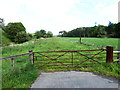
Trackbed of the Peebles Railway
by Oliver Dixon geograph for square NT2448 The trackbed of the former Peebles railway in a broad valley separating the... (more)
Tags:
Abandoned Railway
GateX
top:GrasslandX
GrasslandX
subject:Railway InfrastructureX
top:RailwaysX
WoodlandX
top:Woodland, ForestX
|
|
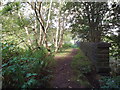
Derelict Military Railway
by Des Blenkinsopp geograph for square SP6217 The large area of military storage sheds around here was served by an extensive... (more)
|

|
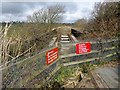
Disused railway bridge
by David Lally geograph for square SU4726 For a full description and the opposite view see SU4726 : Footpath under the former railway line.
The path under... (more)
|
|
Tree line following the path of an unfinished railway
by Dave Spicer geograph for square TQ4520 The planned route was from the Balcombe Viaduct to Uckfield but due to the... (more)
|

|
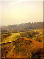
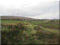
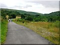
Course of old railway near Glespin
by Alan O'Dowd geograph for square NS7927 This track follows the course of the old Lanark to Muirkirk Branch Line.
Tags:
Abandoned Railway
top:Derelict, DisusedX
Dismantled Railway LineX
type:GeographX
top:PathsX
top:RailwaysX
top:UplandsX
|
|
Waterford Greenway, West of Kilmeadan
by David Dixon geograph for square S5010 The Waterford Greenway is a spectacular off-road cycling and walking trail along... (more)
Tags:
Abandoned Railway
FootpathX
Former Railway TrackbedX
type:GeographX
Hiking TrailX
top:Historic Sites and ArtefactsX
camera:IPhone SEX
PathX
top:PathsX
top:RailwaysX
Waterford GreenwayX
|

|
Old Bridge on the Waterford Greenway near Kilmeadan
by David Dixon geograph for square S5010 The Waterford Greenway is a spectacular off-road cycling and walking trail along... (more)
Tags:
Abandoned Railway
FootpathX
Former Railway TrackbedX
type:GeographX
Hiking TrailX
top:Historic Sites and ArtefactsX
camera:Panasonic DC-G9X
PathX
top:PathsX
top:RailwaysX
Waterford GreenwayX
|

|
Horse riders on the trackbed of the former Peebles railway
by Oliver Dixon geograph for square NT2449 The trackbed of the former Peebles railway, originally a spur off the... (more)
Tags:
Abandoned Railway
subject:Horse RideX
Horse RidersX
top:RailwaysX
top:Sport, LeisureX
WoodlandX
top:Woodland, ForestX
|
|
Bed of Old Railway Line
by Les Hull geograph for square NY6658 From Lambley to Tindale and eventually Carlisle.
Tags:
Abandoned Railway
top:RailwaysX
|
|
A fragment of the Amlwch Line
by Oliver Dixon geograph for square SH4673 The Lon Las Cefni cycle track (part of National Cycle Network route 566) here... (more)
|
|
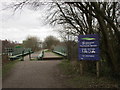
Welcome to Derbyshire
by Jonathan Thacker geograph for square SK4581 Though the sign is actually in Sheffield, South Yorkshire (just).
On the cycle... (more)
|
|
The Celtic Trail near Glynogwr
by Simon Mortimer geograph for square SS9687 Looking west, with the cycle path descending the valley of Cwm Ogwr Fach along... (more)
Tags:
Abandoned Railway
national cycle route:Celtic TrailX
top:LowlandsX
National Cycle Network Route 4X
top:PathsX
former:RailwayX
|
|
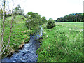
Eddleston Water
by Oliver Dixon geograph for square NT2448 A tributary of the Tweed flowing in a broad valley separating the Meldon Hills... (more)
|
|
Entrance to the Brunel Trail near Rosemarket
by Simon Mortimer geograph for square SM9408 Looking north towards Johnston. The cycle route runs along the course of the... (more)
|
|
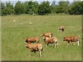
Young bulls in field at Flusco
by Oliver Dixon geograph for square NY4529 The boundary in the background marks the line of the Cockermouth, Keswick and... (more)
|
|
Brunel Trail cycle path near Rosemarket
by Simon Mortimer geograph for square SM9409 The cycle path follows the route of the old railway between Johnston and Neyland.
|
|
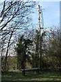
Old signal post near Bridge 11a
by Richard Green geograph for square SK3827 This signal post, positioned just south of bridge 11a over the Trent and Mersey... (more)
|
|
Lon Las Cefni
by Oliver Dixon geograph for square SH4674 The Lon Las Cefni (part of National Cycle Network route 566) is a cycle track... (more)
Tags:
Abandoned Railway
Canalised RiverX
Cycle PathX
subject:Cycle RouteX
top:PathsX
RiverX
top:Rivers, Streams, DrainageX
|
|
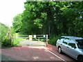
The Brunel Trail near Westfield Hill
by Simon Mortimer geograph for square SM9607 Looking north towards Rosemarket from the crossing at Water Lane.
|