Geograph - photograph every grid square
About tags on Geograph
Tags
Geographical Context
Subjects
Types
Other Prefixes
Public Tags
Related Tags
|
Coverage Map
Tag:
Access·Road·to·Farm
Showing latest 50 of 97 images tagged with
Access Road to Farm
tag.
View all tagged images
-
In Browser
Search within these images
:
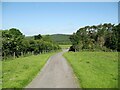
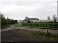
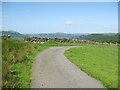
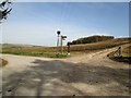
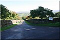
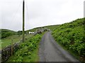
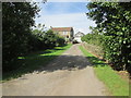
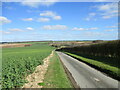
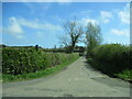
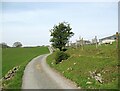
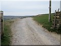
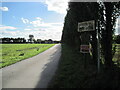
The Cumbria Way near Peter House Farm
by
Adrian Taylor
geograph for square
NY2432
The Cumbria Way low level alternative route from Skiddaw House to Caldbeck... (
more
)
Tags:
Access Road
X
Access Road to Farm
Cumbria Way
X
type:
Geograph
X
top:
Lowlands
X
subject:
Road
X
top:
Roads, Road Transport
X
ldp:
The Cumbria Way
X
long distance footpath:
The Cumbria Way
X
The Cumbria Way
X
long distance path:
The Cumbria Way
X
The Cumbria Way Alternative Route
X
Unfenced Road
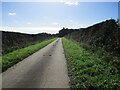
X
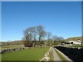
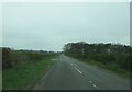
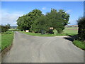
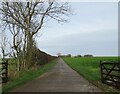
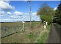
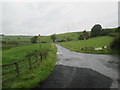
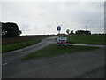
The road to Ranelands Farm
by
Adrian Taylor
geograph for square
SE0362
Between John Lathe and Ranelands Farm. A public footpath from Burnsall Lane to... (
more
)
Tags:
Access Road
X
Access Road to Farm
Farm Access Road
X
Footpath to Hebden
X
type:
Geograph
X
top:
Grassland
X
subject:
Road
X
top:
Roads, Road Transport
X
Wharfedale
X
Yorkshire Dales National Park
X
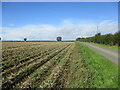
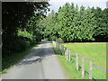
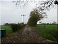
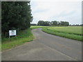
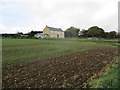
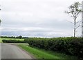
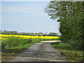
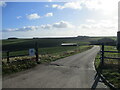
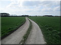
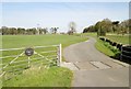
Farm access road alongside potato crop
by
Martin Dawes
geograph for square
SE9169
Access road to Linton Wold Farm and Thirkleby Warren farm. Potatoes sprayed and... (
more
)
Tags:
Access Road to Farms
X
East Yorkshire Wolds
X
top:
Farm, Fishery, Market Gardening
X
type:
Geograph
X
Hedgerows & Grass Verges
X
top:
Lowlands
X
Potato Field
X
top:
Roads, Road Transport
X
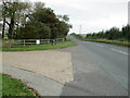
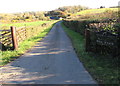
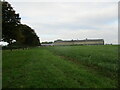
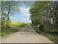
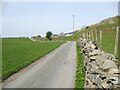
Bewick Hall access road from B1242
by
Martin Dawes
geograph for square
TA2339
Footpath goes from access road north of the hall over fields to the Withernwick... (
more
)
Tags:
Access Road to Farm
Arable Land
X
B Road Junction with Farm Access
X
top:
Farm, Fishery, Market Gardening
X
top:
Flat Landscapes
X
type:
Geograph
X
top:
Paths
X
top:
Roads, Road Transport
X
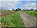
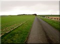
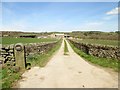
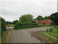
Access road to Sturton Grange Farm
by
Martin Dawes
geograph for square
SE4233
Footpath to Garforth crosses access road here
Tags:
Access Road to Farm
Farm Buildings
X
top:
Farm, Fishery, Market Gardening
X
Footpath
X
type:
Geograph
X
top:
Lowlands
X
top:
Roads, Road Transport
X
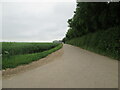
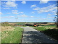
Farm access road on the left
by
Martin Dawes
geograph for square
NU2320
Access to Dunston Hill farm, wood to the right Hollow Plantation
Tags:
Access Road to Farm
Country Road
X
top:
Farm, Fishery, Market Gardening
X
top:
Flat Landscapes
X
type:
Geograph
X
Hedgerows & Grass Verges
X
Plantation
X
top:
Roads, Road Transport
X
top:
Woodland, Forest
X
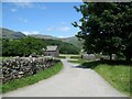
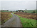
Coniston Hall access road
by
Adrian Taylor
geograph for square
SD3096
The access road to Coniston Hall and the campsite beyond is a public footpath... (
more
)
Tags:
Access Road
X
Access Road to Farm
Campsite Access Road
X
near:
Coniston
X
Coniston Hall
X
ldp:
Cumbria Way
X
type:
Geograph
X
Long Distance Footpath
X
subject:
Road
X
top:
Roads, Road Transport
X
ldp:
The Cumbria Way
X
long distance footpath:
The Cumbria Way
X
The Cumbria Way
X
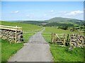
The Cumbria Way below Cockup
by
Adrian Taylor
geograph for square
NY2532
The gated farm access road is a public bridleway and the route of The Cumbria... (
more
)
Tags:
Access Road
X
Access Road to Farm
top:
Boundary, Barrier
X
ldp:
Cumbria Way
X
Cumbria Way
X
Gate
X
subject:
Gateway
X
Gateway in Dry Stone Wall
X
type:
Geograph
X
Lake District
X
top:
Roads, Road Transport
X
ldp:
The Cumbria Way
X
The Cumbria Way
X
The Cumbria Way Alternative Route
X
Farm access road near Springsyke
by
Adrian Taylor
geograph for square
NY2532
The road is a public bridleway and the route of The Cumbria Way low level... (
more
)
Tags:
Access Road
X
Access Road to Farm
ldp:
Cumbria Way
X
Cumbria Way
X
type:
Geograph
X
top:
Paths
X
subject:
Road
X
top:
Roads, Road Transport
X
ldp:
The Cumbria Way
X
long distance footpath:
The Cumbria Way
X
The Cumbria Way
X
long distance path:
The Cumbria Way
X
The Cumbria Way Alternative Route
X
Farm access roads on East Yorkshire Wolds
by
Martin Dawes
geograph for square
SE9170
Straight ahead to Linton Wold Farm or turn right to Thirkleby Warren farm
Tags:
Access Road to Farm
East Yorkshire Wolds
X
top:
Farm, Fishery, Market Gardening
X
type:
Geograph
X
Hedgerows & Grass Verges
X
top:
Lowlands
X
top:
Roads, Road Transport
X
Winter Cereal Crop
X
Access road to Brick Fields Farm
by
Martin Dawes
geograph for square
SE7085
Also to Sewage Works which is behind trees on the right.
Tags:
Access Road to Farm
type:
Geograph
X
Hedgerow and Grass Verge
X
top:
Lowlands
X
top:
Paths
X
top:
Roads, Road Transport
X
Sewage Works Access Road
X
top:
Suburb, Urban Fringe
X
top:
Waste, Waste Management
X
Wooden Fence with Mesh
X
top:
Woodland, Forest
X
Mill Farm access road, Dinas Powys
by
Jaggery
geograph for square
ST1572
From Penyturnpike Road.
Tags:
Access Road to Farm
Farm Access Road
X
top:
Farm, Fishery, Market Gardening
X
type:
Geograph
X
top:
Roads, Road Transport
X
Junction on the Yorkshire Wolds
by
Martin Dawes
geograph for square
SE8250
A lot happens here, the minor road coming in then going out on the left is from... (
more
)
Tags:
Access Road to Farm
Chalkland Way
X
top:
Farm, Fishery, Market Gardening
X
Footpath Junction
X
type:
Geograph
X
top:
Lowlands
X
Minor Road
X
top:
Paths
X
Road Junction
X
top:
Roads, Road Transport
X
Yorkshire Wolds
X
long distance path:
Yorkshire Wolds Way
X
Access road to Tithe Top Farm
by
Martin Dawes
geograph for square
SE9153
Also a Green Dotty which runs past Tithe Top and Arden Fleets farm to the B1246... (
more
)
Tags:
Access Road to Farm
type:
Geograph
X
Hedgerows and Grass Verges
X
top:
Lowlands
X
top:
Paths
X
Plantation
X
top:
Roads, Road Transport
X
top:
Woodland, Forest
X
Yorkshire Wolds
X
Access road to Moor House farm
by
Martin Dawes
geograph for square
TA1349
From New Road
Tags:
Access Road to Farm
Autumn Leaves
X
Farm Buildings
X
top:
Farm, Fishery, Market Gardening
X
top:
Flat Landscapes
X
type:
Geograph
X
Hedgerows & Grass Verges
X
top:
Roads, Road Transport
X
Footpath over crop to right of barn at Bewick Hall
by
Martin Dawes
geograph for square
TA2339
Farm access road to left of line of trees
Tags:
Access Road to Farm
Arable Land
X
Farm
X
top:
Farm, Fishery, Market Gardening
X
top:
Flat Landscapes
X
type:
Geograph
X
Line of Trees
X
top:
Paths
X
top:
Roads, Road Transport
X
top:
Village, Rural Settlement
X
top:
Woodland, Forest
X
Access road to Lazonby Manor Farm Office
by
Roger Templeman
geograph for square
NY5340
Tags:
Access Road to Farm
Farm Name Sign
X
top:
Farm, Fishery, Market Gardening
X
type:
Geograph
X
top:
Roads, Road Transport
X
Rural Road
X
Stone Walls
X
Trees
X
Access road to Gomary Hall Farm
by
Martin Dawes
geograph for square
TA0044
Tags:
Access Road to Farm
Arable Crops
X
Farm
X
Farm Name Sign
X
top:
Farm, Fishery, Market Gardening
X
type:
Geograph
X
top:
Lowlands
X
top:
Paths
X
top:
Roads, Road Transport
X
top:
Village, Rural Settlement
X
top:
Woodland, Forest
X
Access road to Peel Park Farm
by
Martin Dawes
geograph for square
SE5872
The footpath comes up the field edge to the right
Tags:
Access Road to Farm
Farm
X
top:
Farm, Fishery, Market Gardening
X
Footpath
X
type:
Geograph
X
top:
Lowlands
X
top:
Paths
X
top:
Roads, Road Transport
X
top:
Village, Rural Settlement
X
Access road to Bellasize Grange
by
Martin Dawes
geograph for square
SE8227
A large farm in the trees to the left of the road
Tags:
Access Road to Farm
Arable Land
X
Farm
X
top:
Farm, Fishery, Market Gardening
X
top:
Flat Landscapes
X
type:
Geograph
X
Hedgerows & Grass Verges
X
top:
Roads, Road Transport
X
top:
Village, Rural Settlement
X
Kirkdale Buildings at the head of Kirk Dale
by
Martin Dawes
geograph for square
SE8985
From the farm access road which goes into Hagg Side Lane down to the A170
Tags:
Access Road to Farm
Farm
X
top:
Farm, Fishery, Market Gardening
X
type:
Geograph
X
top:
Lowlands
X
top:
Roads, Road Transport
X
Winter Cereal Crop
X
Access road to Fawdington House farm
by
Martin Dawes
geograph for square
SE4372
From its junction with Fawdington Road which is the route of the Swale Way towards Thirsk.
Tags:
Access Road to Farm
Arable Fields
X
Farm
X
top:
Farm, Fishery, Market Gardening
X
top:
Flat Landscapes
X
type:
Geograph
X
Long Distance Path The Swale Way
X
top:
Roads, Road Transport
X
top:
Village, Rural Settlement
X
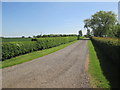
Access road to Tottlebank Farm
by
Martin Dawes
geograph for square
SD2788
On the Cumbria Way the white farmhouse can be seen to the left, the Cumbria Way... (
more
)
Tags:
Access Road to Farm
long distance footpath:
Cumbria Way
X
Farm
X
top:
Farm, Fishery, Market Gardening
X
type:
Geograph
X
top:
Grassland
X
top:
Paths
X
top:
Roads, Road Transport
X
Sheep
X
top:
Uplands
X
Access road to Whin Moor farm
by
Martin Dawes
geograph for square
SE9272
Tags:
Access Road to Farm
Farm
X
top:
Farm, Fishery, Market Gardening
X
type:
Geograph
X
top:
Lowlands
X
top:
Roads, Road Transport
X
top:
Woodland, Forest
X
Access road and bridleway to Cook House farm
by
Martin Dawes
geograph for square
NZ9400
The fields are behind the farm, behind me is Stony Marl Moor
Tags:
Access Road to Farm
Bridleway
X
Farm
X
top:
Farm, Fishery, Market Gardening
X
type:
Geograph
X
top:
Moorland
X
North York Moors
X
top:
Paths
X
top:
Roads, Road Transport
X
top:
Uplands
X
top:
Village, Rural Settlement
X
New Road takes a tight left
by
Martin Dawes
geograph for square
TA1250
The access road to The Bungalow and Moor Cottage Farm is to the right
Tags:
Access Road to Farm
top:
Farm, Fishery, Market Gardening
X
top:
Flat Landscapes
X
type:
Geograph
X
Hedgerows & Grass Verges
X
Minor Road Junction
X
top:
Roads, Road Transport
X
Access road and bridleway to Thirkleby Wold farm
by
Martin Dawes
geograph for square
SE9367
The bridleway passes the farm and goes over the wold toward West Lutton
Tags:
Access Road to Farm
Farm
X
top:
Farm, Fishery, Market Gardening
X
top:
Lowlands
X
top:
Paths
X
top:
Roads, Road Transport
X
top:
Village, Rural Settlement
X
Winter Crops
X
Yorkshire Wolds
X
Access road through fields to farm at Kingsforth
by
Martin Dawes
geograph for square
TA0319
Tags:
Access Road to Farm
Arable Fields
X
Bridleway
X
top:
Farm, Fishery, Market Gardening
X
type:
Geograph
X
Grass Verges
X
top:
Lowlands
X
top:
Paths
X
top:
Roads, Road Transport
X
Access road to White Hart Farm from Brigg Road
by
Martin Dawes
geograph for square
TA0218
Tags:
Access Road to Farm
Arable Fields
X
road:
B1218
X
top:
Farm, Fishery, Market Gardening
X
type:
Geograph
X
Hedgerows & Grass Verges
X
top:
Lowlands
X
top:
Roads, Road Transport
X
Wood
X
top:
Woodland, Forest
X
Access road to Manor Wold Farm
by
Martin Dawes
geograph for square
SE9919
Tags:
Access Road to Farm
top:
Farm, Fishery, Market Gardening
X
type:
Geograph
X
top:
Lowlands
X
crop:
Oilseed Rape
X
Plantation
X
top:
Roads, Road Transport
X
top:
Woodland, Forest
X
Access road down to Nafferton Kesters
by
Martin Dawes
geograph for square
TA0462
It becomes a green dotted grass track when it passes the farm
Tags:
Access Road to Farm
top:
Farm, Fishery, Market Gardening
X
type:
Geograph
X
Green Dotted Track
X
Hedgerow and Grass Verge
X
top:
Lowlands
X
crop:
Oil Seed Rape
X
top:
Paths
X
top:
Roads, Road Transport
X
Yorkshire Wolds
X
Access road to Westfield Farm rising over Wold Newton Field
by
Martin Dawes
for square
TA0373
Tags:
Access Road to Farm
type:
Cross Grid
X
top:
Farm, Fishery, Market Gardening
X
Hedgerow and Grass Verge
X
top:
Lowlands
X
top:
Roads, Road Transport
X
top:
Village, Rural Settlement
X
Winter Root Crop
X
Yorkshire Wolds
X
Moor Grange Farm over flowering Oil Seed Rape
by
Martin Dawes
for square
TA1351
From farm access road
Tags:
Access Road to Farm
type:
Cross Grid
X
top:
Farm, Fishery, Market Gardening
X
top:
Flat Landscapes
X
crop:
Oil Seed Rape
X
top:
Roads, Road Transport
X
Access road to Moor Grange Farm from A165
by
Martin Dawes
geograph for square
TA1251
Tags:
Access Road to Farm
Farm Name Sign
X
top:
Farm, Fishery, Market Gardening
X
top:
Flat Landscapes
X
type:
Geograph
X
crop:
Oil Seed Rape
X
top:
Roads, Road Transport
X
top:
Woodland, Forest
X
Access road to South Broomford farm
by
Martin Dawes
for square
NU1925
From the minor road to Preston
Tags:
Access Road to Farm
type:
Cross Grid
X
top:
Flat Landscapes
X
Hedgerows & Grass Verges
X
Minor Road Junction
X
No Through Road Sign
X
top:
Roads, Road Transport
X
top:
Woodland, Forest
X
Walk on the access road to Carr House farm
by
Martin Dawes
geograph for square
TA0838
The home made footpath sign pointing the way
Tags:
Access Road to Farm
Arable Farmland
X
top:
Farm, Fishery, Market Gardening
X
top:
Flat Landscapes
X
Foot Path
X
type:
Geograph
X
top:
Paths
X
top:
Roads, Road Transport
X
top:
Village, Rural Settlement
X
Access road to Crooked Dale Farm
by
Martin Dawes
geograph for square
TA0065
Tags:
Access Road to Farm
Arable Fields
X
East Yorkshire Wolds
X
top:
Farm, Fishery, Market Gardening
X
type:
Geograph
X
top:
Lowlands
X
top:
Roads, Road Transport
X
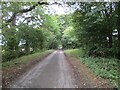
The Cumbria Way, Long Lane
by
Adrian Taylor
geograph for square
SD2787
Long Lane is the access road to Kiln Bank and it is the route of The Cumbria Way... (
more
)
Tags:
Access Road
X
Access Road to Farm
top:
Boundary, Barrier
X
Bridleway
X
Cumbria
X
Cumbria Way
X
Dry Stone Wall
X
type:
Geograph
X
top:
Grassland
X
Lake District
X
subject:
Road
X
top:
Roads, Road Transport
X
ldp:
The Cumbria Way
X
long distance path:
The Cumbria Way
X
The Cumbria Way
X
Long Lane near Kiln Bank
by
Adrian Taylor
geograph for square
SD2787
Long Lane is the access road to Kiln Bank and it is the route of The Cumbria Way... (
more
)
Tags:
Access Road
X
Access Road to Farm
Cumbria
X
ldp:
Cumbria Way
X
long distance footpath:
Cumbria Way
X
Cumbria Way
X
type:
Geograph
X
top:
Grassland
X
Hawthorn Tree
X
Long Lane
X
subject:
Road
X
top:
Roads, Road Transport
X
ldp:
The Cumbria Way
X
long distance path:
The Cumbria Way
X
The Cumbria Way
X
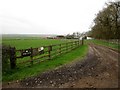
Access road to Drinkstone Farm and Sunnybank
by
Martin Dawes
geograph for square
NT4918
Tags:
Access Road to Farm
long distance path:
Borders Abbeys Way
X
top:
Farm, Fishery, Market Gardening
X
type:
Geograph
X
top:
Grassland
X
top:
Lowlands
X
top:
Paths
X
top:
Roads, Road Transport
X
place:
Scottish Borders
X
Sheep in Field
X
Wooden Fencing
X
Access road to Fosses Farm
by
Martin Dawes
geograph for square
SE7640
Tags:
Access Road to Farm
Avenue of Trees
X
Farm Name Sign
X
top:
Flat Landscapes
X
type:
Geograph
X
Hedgerows & Grass Verges
X
top:
Roads, Road Transport
X
top:
Woodland, Forest
X
Access to Westfield Farm
by
Martin Dawes
geograph for square
TA1148
Also a bridleway
Tags:
Access Road to Farm
Arable Farmland
X
Bridleway
X
top:
Farm, Fishery, Market Gardening
X
top:
Flat Landscapes
X
type:
Geograph
X
top:
Roads, Road Transport
X
Track off a track In Moor Lane
by
Martin Dawes
geograph for square
SE0874
This track is the access road to some farms and to moorland shooting areas it... (
more
)
Tags:
Access Road to Farm
Drystone Walls
X
top:
Farm, Fishery, Market Gardening
X
type:
Geograph
X
top:
Grassland
X
top:
Moorland
X
Moorland Track
X
Nidderdale Way
X
top:
Paths
X
top:
Roads, Road Transport
X
Sheep
X
top:
Uplands
X
Access road to Chimney Barn Farm
by
Martin Dawes
geograph for square
SE2762
From Scarah Bank road also Nidderdale Way
Tags:
Access Road to Farm
top:
Farm, Fishery, Market Gardening
X
type:
Geograph
X
top:
Grassland
X
long distance path:
Nidderdale Way
X
top:
Paths
X
top:
Roads, Road Transport
X
top:
Uplands
X
top:
Woodland, Forest
X
Access road to Riva Hill Farm
by
Martin Dawes
geograph for square
SE2164
The Nidderdale Way crosses here
Tags:
Access Road to Farm
Farm
X
top:
Farm, Fishery, Market Gardening
X
type:
Geograph
X
top:
Grassland
X
long distance path:
Nidderdale Way
X
top:
Paths
X
top:
Roads, Road Transport
X
top:
Uplands
X
top:
Village, Rural Settlement
X
Access road to St Giles Farm from A6136
by
Martin Dawes
geograph for square
SE2198
Tags:
Access Road to Farm
top:
Flat Landscapes
X
Footpath Diversion
X
type:
Geograph
X
Long Distance Path The Swale Way
X
top:
Paths
X
top:
Roads, Road Transport
X
Wood
X
top:
Woodland, Forest
X
Access road to Quosquo Hall from Jowland Winn Lane
by
Martin Dawes
geograph for square
SE6226
Tags:
Access Road to Farm
top:
Farm, Fishery, Market Gardening
X
top:
Flat Landscapes
X
type:
Geograph
X
top:
Roads, Road Transport
X
Trinity House Farm access junction onto Patrington Road
by
Martin Dawes
geograph for square
TA3523
Tags:
Access Road to Farm
Arable Farmland
X
top:
Farm, Fishery, Market Gardening
X
top:
Flat Landscapes
X
type:
Geograph
X
Minor Country Road Junction
X
top:
Roads, Road Transport
X
Corner on access road near Kingsforth Hall
by
Martin Dawes
geograph for square
TA0219
Also bridleway
Tags:
Access Road to Farm
Bridleway
X
Cattle Grazing
X
Farm
X
top:
Farm, Fishery, Market Gardening
X
type:
Geograph
X
Hedgerow and Grass Verge
X
top:
Lowlands
X
top:
Paths
X
top:
Roads, Road Transport
X
Wood
X
top:
Woodland, Forest
X
Sharp left turn on Green Dikes Lane
by
Martin Dawes
geograph for square
TA0461
Straight on is the access road to Nafferton Kesters
Tags:
Access Road to Farm
top:
Farm, Fishery, Market Gardening
X
type:
Geograph
X
top:
Lowlands
X
Minor Country Lane
X
Road Sign Arrows
X
top:
Roads, Road Transport
X
Yorkshire Wolds
X
View more in the Image Search
or
in Browser
View images matching 'Access Road to Farm' anywhere
in
the tags
Don't click these:
PotMel 1
PotMel 2
☰
Home
View
Search
Marked Images
Maps
Browser
Explore
Showcase
New Images
Collections
Interact
Games
Discussions
Blog
Contributors
Submit
Statistics
Leaderboards
General
FAQ
Help Pages
Sitemap
Contact Us
Support Us
sponsored by
🔍
What to search:
Photos
Enter keywords or a location/postcode to search nearby images
Enter a Grid Reference
Placenames
Collections
Website Pages
Everything
Others:
Advanced Search
|
Image Browser
Or:
Coverage Map
|
Searchable Map
You are not logged in
login
|
register