|
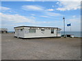
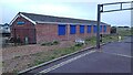
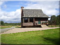
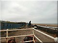
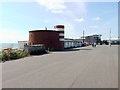
Bexhill Sea Angling Clubhouse
by Malc McDonald
geograph for square TQ7507
The clubhouse of the Bexhill Sea Angling Club, on the seafront at Bexhill-on-Sea.
|
|
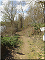
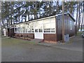
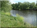
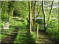
Entrance to Meadlands Angling Club
by Geographer
geograph for square TM1251
|
|
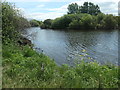
Entrance to Meadlands Angling Club
by Geographer
geograph for square TM1251
|
|
The club hut of the Queen Elizabeth Angling Club
by Lairich Rig
geograph for square NS4879
Category: Huts
This club was formerly known as the Burncrooks Angling Club, but was renamed in... (more)
|
|
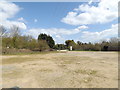
Fylde Boat Angling Club
by Gerald England
geograph for square SD3141
The clubhouse was created in the 1980s by converting two derelict promenade... (more)
|
|
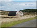
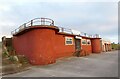
Stocksbridge Works Angling Club
by Dave Pickersgill
for square SK2998
|
|
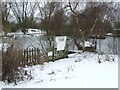
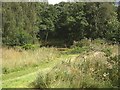
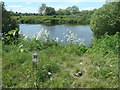
Looking towards Pesthouse Lane
by Geographer
geograph for square TM1251
At Meadlands Angling Club
|
|
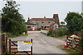
Vale of Leven District Angling Club
by Lairich Rig
geograph for square NS3981
The club's buildings are on the left. On the right is a cycle path /... (more)
|
|
Gosport and District Angling Club
by David Martin
geograph for square SZ6097
|
|
Westwater Angling Club hut
by Oliver Dixon
geograph for square NY9676
At the southern end of the causeway separating the two Hallington Reservoirs.
|
|
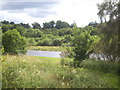
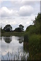
Fishing Lake
by Keith Evans
geograph for square TL7544
Category: Fishing lake
Fishing lake belonging to Haverhill Angling Club near to Clare, Suffolk.
|
|
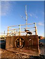
Selby Shipyard Angling Club
by Ian S
geograph for square SE7627
|
|
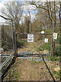
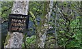
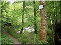
Matson Casters Angling Club board, Gloucester
by Jaggery
geograph for square SO8415
The information and rules board is on a tree at the edge of a pond... (more)
|
|
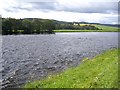
River Dee
by Stanley Howe
geograph for square NO5797
As seen from the Angling Club.
|
|
Angling Club pond
by Stanley Howe
geograph for square NO5797
|
|
Angling Club bothy
by Stanley Howe
geograph for square NO5797
|
|
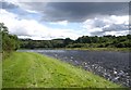
Upstream River Dee
by Stanley Howe
geograph for square NO5797
From Angling Club beach.
|
|
Downstream River Dee
by Stanley Howe
geograph for square NO5797
From Angling Club beach.
|
|
Angling Club bothy
by Stanley Howe
geograph for square NO5797
By the River Dee.
|
|
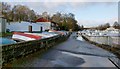
Grove Road Angling Club
by Ian S
geograph for square SE4521
|
|
Peg 5, north bank of the Calder, above Penbank weir
by Christine Johnstone
geograph for square SE3725
Mirfield Angling Club maintain over 50 pegs here, Nineteen are between the weir... (more)
|
|
Peg 13, north bank of the Calder, above Penbank weir
by Christine Johnstone
geograph for square SE3825
Mirfield Angling Club maintain over 50 pegs here, 19 above the weir and the rest below.
|
|
Peg 18, north bank of the Calder, above Penbank weir
by Christine Johnstone
geograph for square SE3825
Mirfield Angling Club maintain over 50 pegs here, 19 above the weir and the rest below.
|
|
Deal Angling Club on The Marina, Deal
by Ian S
geograph for square TR3753
|
|
From the lookout at Little Bispham
by Gerald England
geograph for square SD3141
|
|
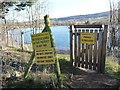
Dunoon and District Angling Club
by M J Richardson
geograph for square NS1778
Entrance to Loch Loskin fishing facility on the Sandbank-Dunoon Road [A885].
|
|
Lookout point at Little Bispham
by Gerald England
geograph for square SD3141
A lookout point and flagpole at Little Bispham.
In the background is the... (more)
|
|
Entrance to a private fishery
by Christine Johnstone
geograph for square SE2245
A flooded gravel pit on the south side of Old Pool Road.
|
|
RIP Josh, by the Old River Ancholme, Brigg
by Christine Johnstone
geograph for square SE9907
Graffiti on an angling club sign. Is it a memorial, or a threat?
|
|
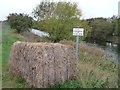
Hay bale on Warping Drain's south bank
by Christine Johnstone
geograph for square SK7897
Scunthorpe Pisces Angling Club's way of blocking vehicular access to the floodbank.
|
|
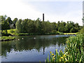
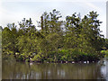
Stamford Park Upper Lake
by David Dixon
geograph for square SJ9599
The former mill reservoir known as Chadwick Dams was incorporated into Stamford... (more)
|
|
The Upper Lake, Stamford Park
by David Dixon
geograph for square SJ9599
The former mill reservoir known as Chadwick Dams was incorporated into Stamford... (more)
|
|
A path by the River Devon near Vicar's Bridge
by Stanley Howe
geograph for square NS9898
No fishing on a Sunday; by order of the Devon Angling Association.
|
|
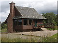
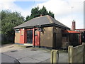
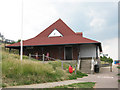
Heron Angling Society clubhouse
by Stephen Craven
geograph for square TR1668
Category: Clubhouse
On the seafront west of Herne Bay.
|
|
Reservoir near Stonebridge
by John Myers
geograph for square TQ9188
Dove Wood Angling Group water
|
|
Hove Deep Sea Anglers Club
by PAUL FARMER
geograph for square TQ2604
|
|
Memorial plaque near Watercrook Farm
by Karl and Ali
for square SD5190
Dedicated to Jim Parkin 'secretary to KAA for in excess of thirty... (more)
|
|
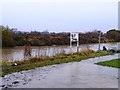
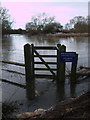
Flooded River Thames near Hannington Bridge
by Vieve Forward
geograph for square SU1796
This degree of flooding is enough to deter even the keenest sportsman!
|
|
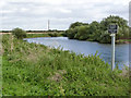
River Trent near South Muskham
by Alan Murray-Rust
geograph for square SK7856
The Nottingham Piscatorial Society appear to have fishing rights along a... (more)
|
|
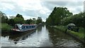
Fishing match on the Staffs & Worcs canal
by Christine Johnstone
geograph for square SJ9106
At Cross Green, between bridges 72 and 71. The photographer steered slowly and... (more)
|
|
Loch Loskin
by M J Richardson
geograph for square NS1778
A small fishery between Sandbank and Dunoon.
|
|
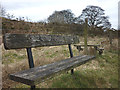
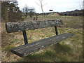
Another memorial bench by the Lune
by Karl and Ali
for square NY6103
This bench, one of two close to the river where Roundthwaite Beck joins, says:... (more)
|
|
Memorial bench by the Lune
by Karl and Ali
geograph for square NY6103
This is one of two benches close to the river where Roundthwaite Beck joins.... (more)
|
|
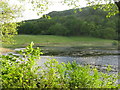
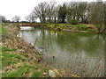
Moat at Broadoak Farm
by Peter Barr
geograph for square SJ9387
The fishing is the preserve of the members of Torkington Anglers. Only ducks... (more)
|
|
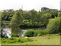
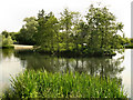
The Island, Stamford Park Upper Lake
by David Dixon
geograph for square SJ9599
The former mill reservoir known as Chadwick Dams was incorporated into Stamford... (more)
|
|
Stamford Park Upper Lake
by David Dixon
geograph for square SJ9599
The former mill reservoir known as Chadwick Dams was incorporated into Stamford... (more)
|