|
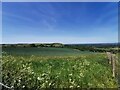
South Downs Way, Firle
by PAUL FARMER
geograph for square TQ4605
|
|
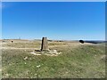
Trig point at Red Lion Pond, South Downs Way
by PAUL FARMER
geograph for square TQ4405
|
|
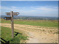
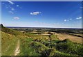
South Downs Way near Ditchling Beacon
by Malc McDonald
geograph for square TQ3313
A signpost on the South Downs Way, close to Ditchling Beacon, photographed on a... (more)
|
|
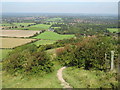
South Downs Way near Ditchling Beacon
by Malc McDonald
geograph for square TQ3313
A view westwards along the South Downs Way, heading away from Ditchling Beacon.
|
|
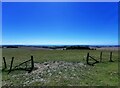
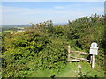
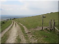
Footpath Junction at South Downs Way
by PAUL FARMER
geograph for square TQ4505
|
|
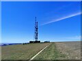
Radio Masts at Firle Beacon
by PAUL FARMER
geograph for square TQ4505
|
|
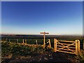
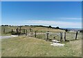
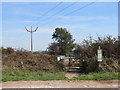
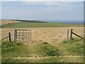
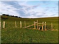
Gate on South Downs Way near Firle Borstal
by PAUL FARMER
geograph for square TQ4605
|
|
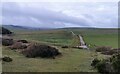
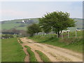
Road to Cornish Farm
by PAUL FARMER
geograph for square TV5695
|
|
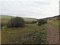
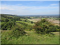
South Downs, looking west from Horseshoe Plantation
by PAUL FARMER
geograph for square TV5695
|
|
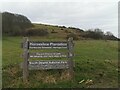
Horseshoe Plantation, Beachy Head Road
by PAUL FARMER
geograph for square TV5695
|

|
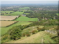
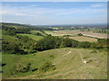
South Downs near Brighton
by Malc McDonald
geograph for square TQ3208
A view on the southern fringe of the South Downs National Park, near Brighton.... (more)
|
|
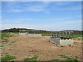
Animal feed pens, near Brighton
by Malc McDonald
geograph for square TQ3208
Animal feed pens in a field in the South Downs National Park, on the edge of Brighton.
|
|
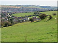
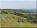
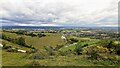
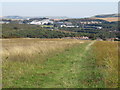
View over Coldean, Brighton
by Malc McDonald
geograph for square TQ3209
A view over Coldean, a suburb of Brighton.
The grassland in the foreground,... (more)
|
|
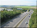
A27 near Brighton
by Malc McDonald
geograph for square TQ3209
The A27 trunk road passing through the edge of the South Downs National Park as... (more)
|
|
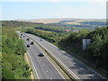
A27 near Brighton
by Malc McDonald
geograph for square TQ3209
The A27 trunk road passing through the edge of the South Downs National Park, as... (more)
|
|
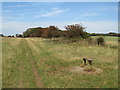
Path and seat on the South Downs near Brighton
by Malc McDonald
geograph for square TQ3210
A public footpath and a wooden seat on the South Downs, near Brighton.
|
|
Path on the South Downs near Brighton
by Malc McDonald
geograph for square TQ3210
A gate on a public footpath on the South Downs, near Brighton.
|
|
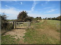
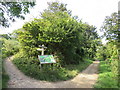
Footpath gate off Ditchling Road, near Brighton
by Malc McDonald
geograph for square TQ3210
A gate leading to a footpath on the South Downs.
The notice case to the right... (more)
|
|
South Downs, near Brighton
by Malc McDonald
geograph for square TQ3211
A gateway into a field with sheep grazing, on the South Downs.
|
|
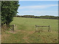
Path on the South Downs near Brighton
by Malc McDonald
geograph for square TQ3211
A path on the South Downs, near Brighton.
|
|
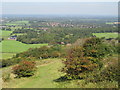
North Bottom, South Downs, near Brighton
by Malc McDonald
geograph for square TQ3212
North Bottom is a dip on the South Downs.
In the far distance, the A27 trunk... (more)
|
|
Gate on the South Downs, near Ditchling Beacon
by Malc McDonald
geograph for square TQ3212
A gate leading into a field on the South Downs, near Ditchling Beacon.
|
|
Path on the South Downs, near Ditchling Beacon
by Malc McDonald
geograph for square TQ3313
A footpath on the South Downs, close to Ditchling Beacon.
The village of... (more)
|
|
Path on the South Downs, near Ditchling Beacon
by Malc McDonald
geograph for square TQ3313
A footpath on the South Downs, close to Ditchling Beacon.
|
|
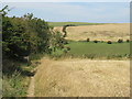
Path on the South Downs, near Ditchling Beacon
by Malc McDonald
geograph for square TQ3213
A path along the top of the South Downs ridge, near Ditchling Beacon.
|
|
Gate on the South Downs, near Ditchling Beacon
by Malc McDonald
geograph for square TQ3213
A gate on the South Downs ridge, near Ditchling Beacon.
|
|
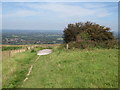
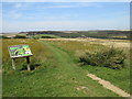
Path on the South Downs, near Ditchling
by Malc McDonald
geograph for square TQ3213
A path on the South Downs with a good view over Sussex coutnryside
|
|
Path on the South Downs near Ditchling
by Malc McDonald
geograph for square TQ3213
A path on the South Downs with a view over Sussex countryside.
|
|
Path on the South Downs, near Ditchling
by Malc McDonald
geograph for square TQ3213
A public footpath on the South Downs, looking northwards.
|
|
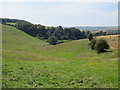
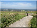
South Downs, near Ditchling
by Malc McDonald
geograph for square TQ3213
A view westwards along the South Downs, near Ditchling.
|
|
South Downs near Ditchling
by Malc McDonald
geograph for square TQ3213
A view west along the South Downs, photographed on a warm and sunny day in August 2019.
|
|
Footpath and Stile on Ditchling Down, near Brighton
by Malc McDonald
geograph for square TQ3213
A footpath and stile leading into woodland on Ditchling Down, on the South... (more)
|
|
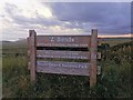
'Z Bends' Parking Sign Eastbourne Downland
by PAUL FARMER
for square TV5895
|
|
Stile on Footpath near Beachy Head, South Downs
by PAUL FARMER
geograph for square TV5896
|
|
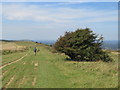
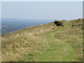
Paths on Wolstonbury Hill, near Pyecombe
by Malc McDonald
geograph for square TQ2813
A bridleway on the South Downs, with a footpath leading off to the right.
|
|
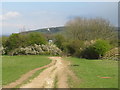
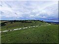
Bridleway on the South Downs, near Pyecombe
by Malc McDonald
geograph for square TQ2813
A bridleway on the South Downs ridge.
A pair of windmills, known as Jack and... (more)
|
|
Bridleway near Pyecombe
by Malc McDonald
geograph for square TQ2913
A public bridleway on the South Downs ridge, near Pyecombe.
Visible on the... (more)
|
|
Crops, Clayton Hill
by PAUL FARMER
geograph for square TQ3013
|
|
Combe Hill, looking toward Polegate
by PAUL FARMER
geograph for square TQ5702
|
|
Combe Hill, Eastbourne
by PAUL FARMER
geograph for square TQ5702
|
|
Bo Peep Borstal
by PAUL FARMER
geograph for square TQ4906
|
|
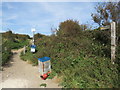
Public footpath near Brighton
by Malc McDonald
geograph for square TQ3207
A public footpath leading into the South Downs National Park, on the outskirts... (more)
|
|
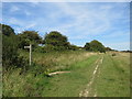
Path near Brighton
by Malc McDonald
geograph for square TQ3207
A view northwards along an unmade path on the fringe of the South Downs National... (more)
|
|
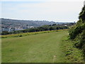
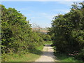
Path near Brighton
by Malc McDonald
geograph for square TQ3207
An unmade path on the fringes of the South Downs National Park, with a view over Brighton.
|
|
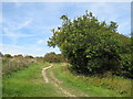
Path near Brighton
by Malc McDonald
geograph for square TQ3207
A path on the fringe of the South Downs National park, on the outskirts of Brighton.
|
|
Path near Brighton
by Malc McDonald
geograph for square TQ3207
A path on the fringe of the South Downs National Park, on the outskirts of Brighton.
|
|
Gate onto access land near Brighton
by Malc McDonald
geograph for square TQ3207
A gate leading onto access land overlooking Moulsecoomb Pit, on the outskirts of... (more)
|
|
Footpaths near Brighton
by Malc McDonald
geograph for square TQ3207
Footpaths in the South Downs National Park, close to Brighton.
|
|
Path across Wild Park, near Brighton
by Malc McDonald
geograph for square TQ3208
A path across Wild Park, on the outskirts of Brighton. The park is within the... (more)
|
|
Wild Park, near Hollingbury, Brighton
by Malc McDonald
geograph for square TQ3208
Wild Park is within the boundary of the South Downs National Park. Visible... (more)
|