Geograph - photograph every grid square
About tags on Geograph
Tags
Geographical Context
Subjects
Types
Other Prefixes
Public Tags
Related Tags
|
Coverage Map
Prefix:
at
Tag:
Bury·St.Edmunds
Other tags:
Bury St.Edmunds
looking towards:
Bury St.Edmunds
near:
Bury St.Edmunds
Showing images tagged with
at:
Bury St.Edmunds
tag.
View all tagged images
-
In Browser
Search within these images
:
Bury St Edmunds: the Cathedral from the Abbey ruins
by
Christopher Hilton
geograph for square
TL8564
The columns like fingers pointing upwards mark the site of the crossing in the... (
more
)
Tags:
ruins:
Abbey
former:
Abbey
Abbey
Abbey (Ruins)
Abbey Ruins
cathedral:
Bury St Edmunds
place:
Bury St Edmunds
Bury St Edmunds
Bury St Edmunds Suffolk
Bury St.Edmunds
at:
Bury St.Edmunds
Bury St.Edmunds Suffolk
Cathedral
Cathedral (Church of England)
Cathedral Tower
Church Ruins
top:
Historic Sites and Artefacts
Monastery (Ruins)
top:
Park and Public Gardens
top:
Religious Sites
Ruins
cathedral:
St Edmundsbury
Bury St Edmunds: houses embedded in the abbey ruins
by
Christopher Hilton
geograph for square
TL8564
The big arch here forms part of the west front.
Tags:
ruins:
Abbey
former:
Abbey
Abbey
Abbey (Ruins)
Abbey Ruins
place:
Bury St Edmunds
Bury St Edmunds
Bury St Edmunds Suffolk
at:
Bury St.Edmunds
Bury St.Edmunds
Bury St.Edmunds Suffolk
Church Ruins
top:
Historic Sites and Artefacts
top:
Housing, Dwellings
Monastery (Ruins)
Ruins
Bury St Edmunds: houses embedded in the abbey ruins
by
Christopher Hilton
for square
TL8564
The ruins here are of the west front.
Tags:
Abbey
ruins:
Abbey
former:
Abbey
Abbey (Ruins)
Abbey Ruins
Bury St Edmunds
place:
Bury St Edmunds
Bury St Edmunds Suffolk
at:
Bury St.Edmunds
Bury St.Edmunds
Bury St.Edmunds Suffolk
Church Ruins
top:
Historic Sites and Artefacts
top:
Housing, Dwellings
Monastery (Ruins)
Ruins
Bury St Edmunds: houses embedded in the abbey ruins
by
Christopher Hilton
for square
TL8564
Tags:
ruins:
Abbey
former:
Abbey
Abbey
Abbey (Ruins)
Abbey Ruins
place:
Bury St Edmunds
Bury St Edmunds
Bury St Edmunds Suffolk
at:
Bury St.Edmunds
Bury St.Edmunds
Bury St.Edmunds Suffolk
Church Ruins
top:
Historic Sites and Artefacts
top:
Housing, Dwellings
Monastery (Ruins)
Ruins
Bury St Edmunds: houses embedded in the abbey ruins
by
Christopher Hilton
geograph for square
TL8564
Tags:
Abbey
ruins:
Abbey
former:
Abbey
Abbey (Ruins)
Abbey Ruins
Bury St Edmunds
place:
Bury St Edmunds
Bury St Edmunds Suffolk
at:
Bury St.Edmunds
Bury St.Edmunds
Bury St.Edmunds Suffolk
Church Ruins
top:
Historic Sites and Artefacts
top:
Housing, Dwellings
Monastery (Ruins)
Ruins
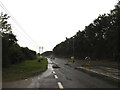
A143 Bury Road, Bury St Edmunds
by
Geographer
geograph for square
TL8665
Tags:
A Road (Classified A)
A143
A143 Bury Road
at:
Bury St.Edmunds
Footpath
at:
Fornham St Martin
type:
Geograph
subject:
Road
top:
Roads, Road Transport
top:
Village, Rural Settlement
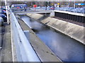
River at Tesco Bury St.Edmunds
by
Geographer
geograph for square
TL8565
Tags:
at:
Bury St.Edmunds
subject:
River
top:
Rivers, Streams, Drainage
Tesco
at:
Tesco Bury St.Edmunds
River at Tesco Bury St.Edmunds
by
Geographer
for square
TL8565
Tags:
at:
Bury St.Edmunds
subject:
River
top:
Rivers, Streams, Drainage
Tesco
at:
Tesco Bury St.Edmunds
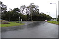
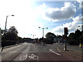
A143 at Bury St. Edmunds
by
Geographer
geograph for square
TL8665
Tags:
A Road (Classified A)
road:
A143
at:
Bury St. Edmunds
type:
Geograph
subject:
Road
top:
Roads, Road Transport
top:
Suburb, Urban Fringe
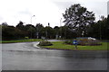
A143 at Bury St. Edmunds
by
Geographer
geograph for square
TL8665
Tags:
A Road (Classified A)
road:
A143
at:
Bury St. Edmunds
type:
Geograph
Road Junction
top:
Roads, Road Transport
subject:
Roundabout
top:
Suburb, Urban Fringe
Hollow Road, Bury St. Edmunds
by
Geographer
geograph for square
TL8665
At the junction with the A143
Tags:
road:
A143
at:
Bury St. Edmunds
type:
Geograph
Hollow Road
Road Junction
top:
Roads, Road Transport
Roundabout
subject:
Roundabout
top:
Suburb, Urban Fringe
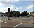
A143 at Bury St. Edmunds
by
Geographer
geograph for square
TL8565
Tags:
A Road (Classified A)
road:
A143
at:
Bury St. Edmunds
type:
Geograph
subject:
Road
top:
Roads, Road Transport
top:
Suburb, Urban Fringe
Pettycoat Lane, Bury St.Edmunds
by
Geographer
geograph for square
TL8463
At the junction with the A143 Out Westgate
Tags:
A Road (Classified A)
A143
A143 Out Westgate
at:
Bury St.Edmunds
Out Westgate
Pettycoat Lane
Public House
subject:
Road Junction
top:
Roads, Road Transport
Spread Eagle
Spread Eagle Public House
Traffic Lights
A143 Out Westgate, Bury St.Edmunds
by
Geographer
geograph for square
TL8463
At the junction with Pettycoat Lane
Tags:
A Road (Classified A)
A143
A143 Out Westgate
at:
Bury St.Edmunds
Out Westgate
Pettycoat Lane
Public House
subject:
Road Junction
top:
Roads, Road Transport
Spread Eagle
Spread Eagle Public House
Traffic Lights
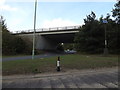
A14 Bridge
by
Geographer
geograph for square
TL8663
At junction 44 Bury St.Edmunds East
Tags:
A14
A14 Bridge
subject:
Bridge
Bridge
at:
Bury St.Edmunds
Bury St.Edmunds East
Junction 44
top:
Roads, Road Transport
Tesco Bury St.Edmunds Fuel Filling Station
by
Geographer
geograph for square
TL8565
Tags:
at:
Bury St.Edmunds
top:
Business, Retail, Services
subject:
Filling Station
Fuel Filling Station
Tesco
at:
Tesco Bury St.Edmunds
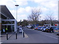
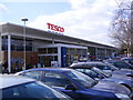
The entrance of Tesco Bury St.Edmunds
by
Geographer
geograph for square
TL8565
Tags:
at:
Bury St.Edmunds
top:
Business, Retail, Services
subject:
Entrance
Entrance Road
top:
Roads, Road Transport
Tesco
Tesco Bury St.Edmunds
The front of Tesco Bury St.Edmunds
by
Geographer
geograph for square
TL8565
Tags:
at:
Bury St.Edmunds
top:
Business, Retail, Services
Front
subject:
Superstore
Tesco
Tesco Bury St.Edmunds
Tesco Bury St.Edmunds
by
Geographer
geograph for square
TL8565
Tags:
at:
Bury St.Edmunds
top:
Business, Retail, Services
subject:
Superstore
Tesco
Tesco Bury St.Edmunds
A14 slip road
by
Geographer
geograph for square
TL8663
Waiting at traffic lights
Tags:
A14
A14 Slip Road
at:
Bury St.Edmunds
Bury St.Edmunds East
Junction 44
Road Junction
subject:
Road Junction
top:
Roads, Road Transport
Slip Road
waiting at:
Traffic Lights
Traffic Lights
A14 & Layby at Bury St.Edmunds
by
Geographer
geograph for square
TL8664
Tags:
A Road (Classified A)
road:
A14
at:
Bury St.Edmunds
type:
Geograph
subject:
Lay-by
top:
Roads, Road Transport
top:
Suburb, Urban Fringe
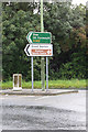
Roadsign on the A143
by
Geographer
geograph for square
TL8665
Tags:
A Road (Classified A)
road:
A143
at:
Bury St. Edmunds
type:
Geograph
top:
Roads, Road Transport
Roadsign
subject:
Sign
top:
Suburb, Urban Fringe
A134 Compiegne Way, Bury St. Edmunds
by
Geographer
geograph for square
TL8565
Tags:
A Road (Classified A)
A134
A134 Compiegne Way
at:
Bury St.Edmunds
Compiegne Way
type:
Geograph
subject:
Road
top:
Roads, Road Transport
top:
Suburb, Urban Fringe
A134 Rougham Road, Bury St Edmunds
by
Geographer
geograph for square
TL8663
Looking towards Southgate Bridge near the Police Investigation Centre
Tags:
A Road (Classified A)
A134 Rougham Road
at:
Bury St.Edmunds
subject:
Road
top:
Roads, Road Transport
Rougham Road
looking towards:
Southgate Bridge
near:
The Police Investigation Centre
Mustow Street, Bury St.Edmunds
by
Geographer
geograph for square
TL8564
Looking towards the War Memorial and Council Offices on Angel Hill
Tags:
on:
Angel Hill
at:
Bury St.Edmunds
Mustow Street
subject:
Road
top:
Roads, Road Transport
looking towards:
The Council Offices
looking towards:
The War Memorial
Mustow Street, Bury St.Edmunds
by
Geographer
geograph for square
TL8564
Looking towards the junction with Northgate Street on Angel Hill
Tags:
on:
Angel Hill
Angel Hill
at:
Bury St.Edmunds
Mustow Street
Northgate Street
subject:
Road Junction
top:
Roads, Road Transport
View more in the Image Search
or
in Browser
View images matching 'Bury St.Edmunds' anywhere
in
the tags
Don't click these:
PotMel 1
PotMel 2
☰
Home
View
Search
Marked Images
Maps
Browser
Explore
Showcase
New Images
Collections
Interact
Games
Discussions
Blog
Contributors
Submit
Statistics
Leaderboards
General
FAQ
Help Pages
Sitemap
Contact Us
Support Us
sponsored by
🔍︎
What to search:
Photos
Enter keywords or a location/postcode to search nearby images
Enter a Grid Reference
Placenames
Collections
Website Pages
Everything
Others:
Advanced Search
|
Image Browser
Or:
Coverage Map
|
Searchable Map
You are not logged in
|
login
|
register