|
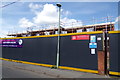
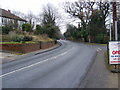
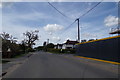
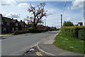
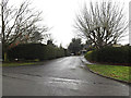
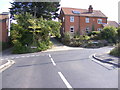
Former Woodbridge Police Station
by Geographer
geograph for square TM2649
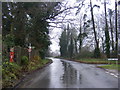
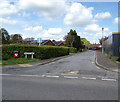
On the B1079 Grundisburgh Road at the junction with Moor's Way
|
|
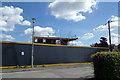
Former Woodbridge Police Station
by Geographer
geograph for square TM2649
On the B1079 Grundisburgh Road at the junction with Moor's Way
|
|
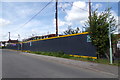
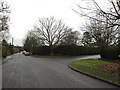
Former Woodbridge Police Station
by Geographer
geograph for square TM2649
Off the B1079 Grundisburgh Road at the junction with Moor's Way
|
|
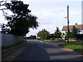
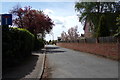
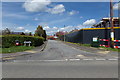
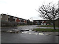
Haugh Lane, Woodbridge
by Geographer
geograph for square TM2650
Approaching the A12 Woodbridge Bypass at the junction with Barton Road
|
|
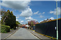
Manor Road & Manor Road Edward VII Postbox
by Geographer
geograph for square TM2649
Category: Road
Looking towards the A12 Woodbridge Bypass at the junction with Russell Close... (more)
|
|
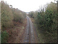
Railway Lines looking towards Woodbridge
by Geographer
geograph for square TM2647
Off Broomheath Railway Bridge at Broom Hill
|

|
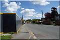
Estate Agents Advertising Banner
by Geographer
for square TM2649
On the B1079 Grundisburgh Road at the junction with Moor's Way.
|
|
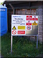
Woodbridge Water Tower sign
by Geographer
for square TM2749
Off Bredfield Road
|
|
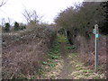
Collett's Walk footpath to B1079 Grunsburgh Road
by Geographer
geograph for square TM2649
Category: Footpath
Off the A12 Woodbridge Bypass
|
|
Footpath to Boulge Road
by Geographer
geograph for square TM2650
Category: Footpath
Off the A12 Woodbridge Bypass
|
|
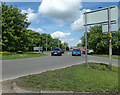
A12 Grove Road (Woodbridge Bypass)
by Geographer
geograph for square TM2650
Category: A road (Classified A)
Looking towards the junction with the A1152 Woods Lane
|
|
Footpath to Boulge Road
by Geographer
geograph for square TM2650
Category: Footpath
Off the A12 Woodbridge Bypass
|
|
Footpath to Boulge Road
by Geographer
geograph for square TM2650
Category: Footpath
Off the A12 Woodbridge Bypass
|
|
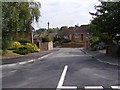
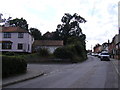
B1438 Ipswich Road, Woodbridge
by Geographer
geograph for square TM2648
Category: B road (Classified B)
Looking towards the town centre near John Grose car showroom at the junction... (more)
|
|
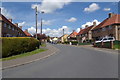
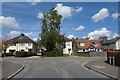
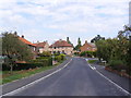
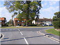
B1079 Grundisburgh Road, Woodbridge
by Geographer
geograph for square TM2649
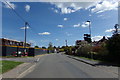
At the junction with Naunton Road
|
|
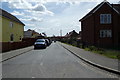
Naunton Road, Woodbridge
by Geographer
geograph for square TM2649
At the junction with Mill View Close
|
|
Naunton Road, Woodbridge
by Geographer
geograph for square TM2649
At the junction with Mill View Close & Collett's Walk
|
|
Naunton Road, Woodbridge
by Geographer
geograph for square TM2649
At the junction with the B1079 Grundisburgh Road
|
|
Naunton Road, Woodbridge
by Geographer
geograph for square TM2649
At the junction with the B1079 Grundisburgh Road
|
|
B1079 Grundisburgh Road, Woodbridge
by Geographer
geograph for square TM2649
At the junction with Naunton Road
|
|
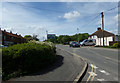
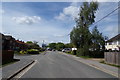
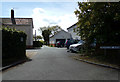
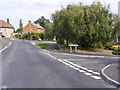
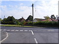
Moor's Way, Woodbridge
by Geographer
geograph for square TM2649
At the entrance to Ryder Davies & Partners Veterinary Surgery and the... (more)
|
|
B1079 Grundisburgh Road, Woodbridge
by Geographer
geograph for square TM2649
At the junction with Moor's Way
|
|
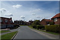
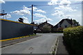
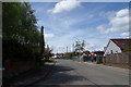
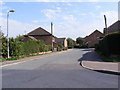
Wilmslow Avenue, Woodbridge
by Geographer
geograph for square TM2649
At the junction with the B1079 Grundisburgh Road
|
|
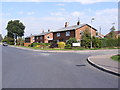
B1079 Grundisburgh Road, Woodbridge
by Geographer
geograph for square TM2649
At the junction with Conach Road
|
|
Conach Road, Woodbridge
by Geographer
geograph for square TM2649
At the junction with the B1079 Grundisburgh Road
|

|
Broomheath, Woodbridge
by Geographer
geograph for square TM2647
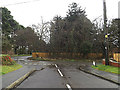
Looking towards the railway Bridge & Sandy Lane at Kyson Hill
|
|
Pembroke Avenue, Woodbridge
by Geographer
geograph for square TM2648
At the junction with Peterhouse Crescent
|
|
Peterhouse Crescent, Woodbridge
by Geographer
geograph for square TM2648
At the junction with Pembroke Avenue
|
|
Old Barrack Road, Woodbridge
by Geographer
geograph for square TM2548
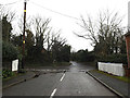
Looking towards the B1438 Ipswich Road at the junction with Seckford Hall Road
|
|
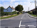
B1079 Grundisburgh Road, Woodbridge
by Geographer
geograph for square TM2649
At the junction with Moor's Way near Ryder Davies & Partners Veterinary Surgery
|
|
B1079 Grundisburgh Road, Woodbridge
by Geographer
geograph for square TM2649
At the junction with Moor's Way near Ryder Davies & Partners Veterinary Surgery
|
|
Moor's Way, Woodbridge
by Geographer
geograph for square TM2649
At the junction with the B1079 Grundisburgh Road near Ryder Davies &... (more)
|
|
Moor's Way, Woodbridge
by Geographer
geograph for square TM2649
At the entrance to Ryder Davies & Partners Veterinary Surgery near the... (more)
|
|
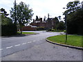
A12 Grove Road, Woodbridge
by Geographer
geograph for square TM2649
At the junction with the B1079 Grundisburgh Road
|
|
Moor's Way, Woodbridge
by Geographer
geograph for square TM2649
At the junction with the B1079 Grundisburgh Road near Ryder Davies &... (more)
|
|
B1079 Grundisburgh Road, Woodbridge
by Geographer
geograph for square TM2649
At the junction with Moor's Way near Ryder Davies & Partners Veterinary Surgery
|
|
Brairwood Road, Woodbridge
by Geographer
geograph for square TM2648
At the junction with Sandy Lane
|
|
California, Woodbridge
by Geographer
geograph for square TM2647
At the junction with Sandy Lane
|
|
Duke's Meadow, Woodbridge
by Geographer
geograph for square TM2548
At the junction with California
|
|
California, Woodbridge
by Geographer
geograph for square TM2548
At the junction with Duke's Meadow
|
|
Kings Close, Woodbridge
by Geographer
geograph for square TM2648
At the junction with Old Barrack Road
|
|
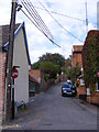
Colletts Walk, Woodbridge
by Geographer
geograph for square TM2649
At the junction with Naunton Road
|
|
Naunton Road, Woodbridge
by Geographer
geograph for square TM2649
At the junction with Colletts Walk
|
|
Naunton Road, Woodbridge
by Geographer
geograph for square TM2649
Looking towards Collett's Walk, Mill View Close & Grundisburgh Road at... (more)
|
|
Drybridge Hill, Woodbridge
by Geographer
geograph for square TM2649
At the junction with Bridgewood Road
|
|
Queens Head Lane, Woodbridge
by Geographer
geograph for square TM2649
At the junction with Seckford Street
|
|
Clare Avenue, Woodbridge
by Geographer
geograph for square TM2548
At the junction with Peterhouse Crescent
|
|
Clare Avenue, Woodbridge
by Geographer
geograph for square TM2648
At the junction with Old Barrack Road
|
|
Bullards Lane, Woodbridge
by Geographer
geograph for square TM2648
At the junction with Old Barrack Road & Drybridge Hill
|
|
Clare Avenue, Woodbridge
by Geographer
geograph for square TM2648
At the junction with Old Barrack Road
|