|
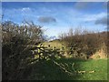
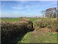
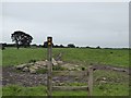
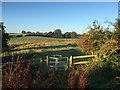
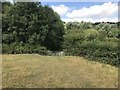
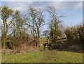
Audley: stile in field corner near Millend
by Jonathan Hutchins
geograph for square SJ7852
Two paths lead off from here: Audley FP 17 along the hedge on the left, and... (more)
|
|
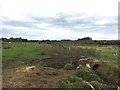
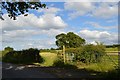
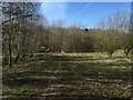
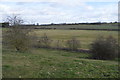
Field footpaths south of Audley
by Jonathan Hutchins
geograph for square SJ7949
Footpaths designated Audley FP 34 and Audley FP 35.
|
|
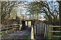
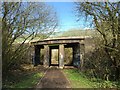
Former railway bridge over farm track
by Jonathan Hutchins
geograph for square SJ8050
On the right of, and parallel to, the farm track, footpath Audley 31 leads via a... (more)
|
|
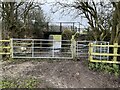
Former railway bridge over farm track
by Jonathan Hutchins
geograph for square SJ8050
On the right of, and parallel to, the farm track, footpath Audley 31 leads up... (more)
|
|
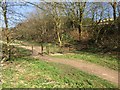
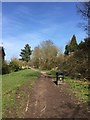
Audley: meeting of three footpaths
by Jonathan Hutchins
geograph for square SJ8050
Looking north on Audley 29 which runs in a north-south direction, coming in from... (more)
|

|
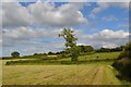
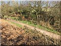
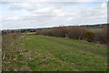
Audley: path along former railway trackbed
by Jonathan Hutchins
geograph for square SJ7949
|
|
Hedgerows by 'the Lines'
by Jonathan Hutchins
geograph for square SJ8049
To left and right is the former route of the Audley branch line (closed 1963).... (more)
|
|
Footpath to field corner near Audley
by Jonathan Hutchins
geograph for square SJ7751
The photographer is standing on the route of Audley FP 81. Straight ahead, an... (more)
|
|
Audley: bridge over former railway line
by Jonathan Hutchins
geograph for square SJ7949
|
|
Audley: bridge over former railway trackbed
by Jonathan Hutchins
geograph for square SJ7949
This carries Wereton Road over the old trackbed.
|
|
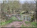
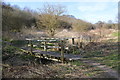
Gates into Leddy's Field
by Jonathan Hutchins
geograph for square SJ8050
|
|
Leddy's Field from Hall Street
by Jonathan Hutchins
geograph for square SJ7950
|
|
Entrance to Leddy's Field off Hall Street
by Jonathan Hutchins
geograph for square SJ7950
This is part of the route of the Two Saints' Way.
|
|
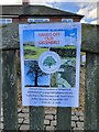
Protect Audley Parish Greenbelt sign
by Jonathan Hutchins
for square SJ7950
The Newcastle-under-Lyme Local Plan published in 2021 aroused some concern in... (more)
|
|
Field footpath in Audley
by Jonathan Hutchins
geograph for square SJ7950
The footpath, designated Audley 36, runs the short distance between Ryehills and... (more)
|
|
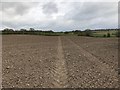
Footpath across ploughed field near Audley
by Jonathan Hutchins
geograph for square SJ7949
Footpath Audley 35 crossing a ploughed field south of the eponymous village. The... (more)
|
|
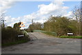
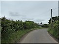
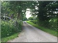
Barthomley Road, Audley
by Jonathan Hutchins
geograph for square SJ7751
In the hedge on the left is a leaning ivy-wreathed footpath signpost, indicating... (more)
|
|
Footpaths off Audley Road
by Jonathan Hutchins
geograph for square SJ7751
|
|
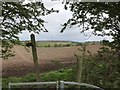
Stile off Audley Road
by Jonathan Hutchins
geograph for square SJ7751
Beyond the stile is a footpath fingerpost pointing to two footpath routes.
|
|
Audley: public footpath along field edge near Millend
by Jonathan Hutchins
geograph for square SJ7852
Looking north-east along Audley FP 16 towards Millend.
|
|
Audley: wooden footbridge over stream near Yewtree Farm
by Jonathan Hutchins
geograph for square SJ7851
This carries public footpath Audley FP 17 between Yewtree Farm and Millend.
|
|
Kissing gate on field path south of Audley
by Jonathan Hutchins
geograph for square SJ7949
This is footpath Audley FP 35.
|
|
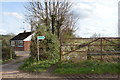
Audley: footpath off Moat Lane
by Jonathan Hutchins
geograph for square SJ7850
The signpost and metal kissing gate indicate the route of footpath Audley 82... (more)
|
|
Audley: field corner on Kent Hill
by Jonathan Hutchins
geograph for square SJ7850
Footpath Audley 82 follows the zig-zag field edge up Kent Hill.
|
|
Audley: track to Moat House Farm
by Jonathan Hutchins
geograph for square SJ7851
This is also the route of a public footpath, Audley 21.
|
|
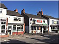
Audley shops
by Jonathan Hutchins
geograph for square SJ7950
Binny - Medium & Spiritual Messenger opened her shop in October 2014. Next... (more)
|

|
Audley: three adjacent hairdressers
by Jonathan Hutchins
geograph for square SJ7950
Compare with a November 2012 view Link .... ( more) |
|
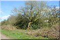
Heavily pruned vegetation by former railway line
by Jonathan Hutchins
geograph for square SJ8050
|
|
Kink in path on former railway line
by Jonathan Hutchins
geograph for square SJ8050
|
|
Tree by former railway line
by Jonathan Hutchins
geograph for square SJ8050
|
|
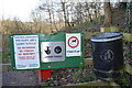
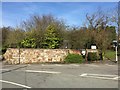
Audley: Leddy's Field: notices at north end
by Jonathan Hutchins
geograph for square SJ8050
These signs are at the north entrance off the B5500.
|
|
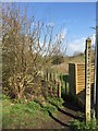
Audley: Leddy's Field: footpath
by Jonathan Hutchins
geograph for square SJ8050
This path is marked on OS:25000 maps but is not a public footpath.
|
|
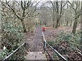
Audley: Leddy's Field: wooden footbridge
by Jonathan Hutchins
geograph for square SJ8050
|
|
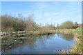
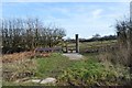
Audley: Leddy's Field: pond
by Jonathan Hutchins
geograph for square SJ8050
|
|
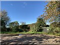
Audley: Leddy's Field
by Jonathan Hutchins
geograph for square SJ8050
|
|
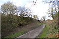
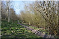
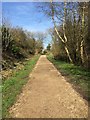
Bignall End: path along former railway trackbed
by Jonathan Hutchins
geograph for square SJ8050
|
|
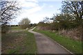
Bignall End: path along former railway trackbed
by Jonathan Hutchins
geograph for square SJ8050
The kink in the pathway and the metal barrier and stile are presumably intended... (more)
|
|
Bignall End: path along former railway trackbed
by Jonathan Hutchins
geograph for square SJ8050
|
|
Bignall End: path along former railway trackbed
by Jonathan Hutchins
geograph for square SJ8050
|
|
Bignall End: retaining wall of former railway bridge
by Jonathan Hutchins
geograph for square SJ8150
On the opposite side of the road to Link.... ( more) |
|
Audley: south end of footpath Audley 36
by Jonathan Hutchins
geograph for square SJ7949
Entry to Audley 36 off Wereton Road. The top (=north) end can be seen in... (more)
|
|
Footbridge between Staffordshire and Cheshire
by Jonathan Hutchins
for square SJ8053
The stream here forms the county boundary between Staffordshire and Cheshire, in... (more)
|
|
Footpath entering Leddy's Field
by Jonathan Hutchins
geograph for square SJ8050
|
|
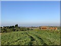
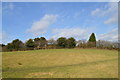
Audley from the south
by Jonathan Hutchins
geograph for square SJ7949
Looking across to the southern edge of the Wereton Estate from footpath Audley... (more)
|
|
Audley: footpath off Wereton Road
by Jonathan Hutchins
geograph for square SJ7950
The footpath is designated Audley 35.
|
|
Audley: stile and bench on Cross Lane
by Jonathan Hutchins
geograph for square SJ8051
Here footpath FP Audley 86 leads due east across the field beyond.
|
|
Audley: stile at field corner
by Jonathan Hutchins
geograph for square SJ8051
On footpath Audley 24.
|
|
Audley: field near New Farm
by Jonathan Hutchins
geograph for square SJ7951
The footpath crossing in the foreground is Audley 24.
|
|
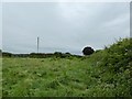
Audley: field and stream north of village
by Jonathan Hutchins
geograph for square SJ7951
Viewed from footpath Audley 23.
|
|
Audley: footpath north out of village
by Jonathan Hutchins
geograph for square SJ7951
This is designated FP Audley 23.
|