Public Tags
Tag: Barn
Showing latest 50 of 9,453 images tagged with Barn tag.
|
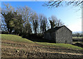
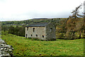
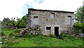
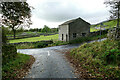
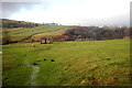
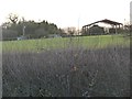
Field barn by Low Wood Lane
by Andy Waddington geograph for square SE1089 Category: Barn Among the trees, Low Wood Lane is a sunken thoroughfare which is classified as a... (more)
|
|
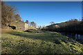
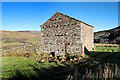
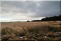
Footpath to Ivelet passes a riverside barn
by Andy Waddington geograph for square SD9297 Category: Barn Swaledale is known for its large population of field barns, several of which lie... (more)
Tags:
category:BarnX
top:Farm, Fishery, Market GardeningX
type:GeographX
top:GrasslandX
top:LowlandsX
top:PathsX
category:Public FootpathX
top:Rivers, Streams, DrainageX
top:Woodland, ForestX
|
|
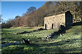
Riverside barn
by Andy Waddington geograph for square SD9297 Category: Barn Swaledale is known for its large population of field barns, several of which lie... (more)
|
|
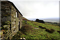
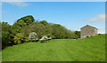
Barn above Strands
by Andy Waddington geograph for square SD8692 Category: Public footpath From Simonstone, a public footpath climbs on the left bank of Hardraw Beck to... (more)
|
|
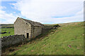
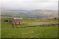
Substantial field barn below Low Lane
by Andy Waddington geograph for square SD9998 Category: Barn Perched on a terrace south of the River Swale, just above a section of... (more)
|
|
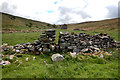
Wall gap and barn in Belah Valley
by Andy Waddington geograph for square NY8509 Category: Barn I hesitate to tag this as "Stile" as it is far from clear that this... (more)
|
|
Field barn by the River Eden
by Andy Waddington geograph for square NY7708 Category: Barn Quite a large barn, but as it is nowhere near any other farm buildings, it must... (more)
|
|
Barn below Lofthouse Moor
by Andy Waddington geograph for square SE1076 Category: Barn A network of virtually unsignposted footpaths surrounds High Thrope, but one... (more)
|
|
Decaying barn by the Nidderdale Way
by Andy Waddington geograph for square SE0972 Category: Barn A track from High Blayshaw to the south joins the track followed by the... (more)
|
|
Field barn above Low Oxnop
by Andy Waddington geograph for square SD9297 Category: Barn Swaledale is known for its plethora of field barns, and this one seems to be... (more)
|
|
Barn above Hilton Gill
by Andy Waddington geograph for square NY8210 Category: Barn The barn sits on a spur between Hilton Gill and a small unnamed tributary, whose... (more)
|
|
Barn on Oxnop Side
by Andy Waddington geograph for square SD9296 Category: Barn The bottom of the valley of Oxnop Gill is unsuited for livestock farming and is... (more)
|
|
Outlying barn north of Long Green Farm
by Andy Waddington geograph for square NZ0706 Category: Barn There's a public footpath across the foreground field, but it looks even... (more)
|
|
Barn below Ellerlands Edge
by Andy Waddington geograph for square SE0291 Category: Barn In a landscape with many traditional stone field barns, this corrugated iron... (more)
|
|
Barn opposite Strands
by Andy Waddington geograph for square SD9697 Category: Barn The barn stands in a field south of the River Swale, directly across from... (more)
|
|
Field barn by Water Houses
by Andy Waddington geograph for square NY7111 Category: Barn A stone-built barn in apparently good condition is unusual in these days of... (more)
|
|
Rare, unconverted barn above Askrigg
by Andy Waddington geograph for square SD9491 Category: Barn This close to the village of Askrigg, and especially next to a road, it's... (more)
Tags:
category:BarnX
top:Farm, Fishery, Market GardeningX
type:GeographX
top:GrasslandX
top:Roads, Road TransportX
top:UplandsX
top:Village, Rural SettlementX
|
|
Field barn above Countersett
by Andy Waddington geograph for square SD9188 Category: Barn Taken from the path which descends from the Roman Cam High Road to Countersett,... (more)
|
|
Overgrown barn south of Leyburn
by Andy Waddington geograph for square SE1189 Category: Barn The map suggests a building in two sections, but it appears that the western... (more)
|
|
Field barn below Brough Scar
by Andy Waddington geograph for square SD9389 This barn lies to the east of the steep road down to Bainbridge, east of the... (more)
|
|
Field barn in Semerdale
by Andy Waddington geograph for square SD9388 The public footpath we had intended to follow passes across this field on the... (more)
|
|
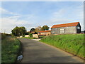
Field barn, West Burton
by Andy Waddington geograph for square SE0286 Category: Barn Looking up towards Hazely Moor from the footpath east of Walden Beck
|
|
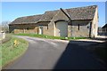
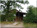
Barn between Three Chimneys and Lane Head, Kelton
by Andy Waddington geograph for square NY9220 Category: Barn |
|
Derelict barn at Gate House Farm, Marholm
by Paul Bryan geograph for square TF1503 The farm is located on Hurn Road close to the former railway level crossing on... (more)
Tags:
Bales of StrawX
Barn
subject:Barn
Barn (Derelict)X
Derelict BarnX
top:Derelict, DisusedX
barn:DisusedX
Disused BarnX
top:Farm, Fishery, Market GardeningX
top:Flat LandscapesX
type:GeographX
Straw BalesX
|
|
Derelict barn at Gate House Farm, Marholm
by Paul Bryan geograph for square TF1503 The farm is located on Hurn Road close to the former railway level crossing on... (more)
Tags:
Bales of StrawX
former:Barn
Barn
subject:Barn
Barn (Derelict)X
Derelict BarnX
top:Derelict, DisusedX
barn:DisusedX
Disused BarnX
top:Farm, Fishery, Market GardeningX
top:Flat LandscapesX
type:GeographX
Straw BalesX
|
|
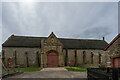
Barn at Cryfield Grange
by A J Paxton geograph for square SP2974 This is a very fine Warwickshire barn, a double barn in fact, with two sets of... (more)
Tags:
subject:Barn
house:Barn ConversionX
Barn ConversionX
Barn Conversion to HouseX
Double BarnX
top:Farm, Fishery, Market GardeningX
type:GeographX
top:Housing, DwellingsX
top:Village, Rural SettlementX
|
|
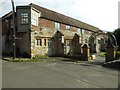
The Grange, Crudwell Lane
by Vieve Forward geograph for square ST9392 Former barn.
|
|
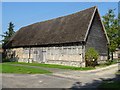
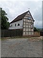
Timber-framed barn
by Philip Halling geograph for square SO7406 A timber-framed tithe barn, Grade II* listed... (more)
Tags:
Barn
subject:Barn
top:Farm, Fishery, Market GardeningX
type:GeographX
Grade II Star ListedX
Timber Framed BarnX
Tithe BarnX
|
|
Stanton's Barn
by PAUL FARMER geograph for square TQ3714 Grade II listed. Late 16th Century Barn
Tags:
building type:Barn
subject:Barn
former:Barn
Barn
Barn ConversionX
house:Barn ConversionX
Barn Conversion to HouseX
Barn Converted to HouseX
East ChiltingtonX
top:Farm, Fishery, Market GardeningX
type:GeographX
top:Historic Sites and ArtefactsX
top:Village, Rural SettlementX
|
|
Manor Farm Barn, Aston Subedge
by Philip Halling geograph for square SP1341 Cotswold stone built barn on Manor Farm, Aston Subedge. The building is Grade... (more)
|
|
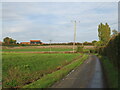
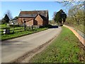
Water Lane, near Great Dunmow
by Malc McDonald geograph for square TL5925 Water Lane is a minor lane in the countryside of north Essex. In the background... (more)
Tags:
Barn (Converted)X
housing:Barn ConversionX
Barn ConversionX
house:Barn ConversionX
Barn Conversion to HouseX
Barn Converted to HouseX
near:Bishops StortfordX
barn:ConvertedX
county:EssexX
type:GeographX
near:Great DunmowX
subject:LaneX
Minor Country LaneX
Minor LaneX
road:Minor RoadX
Minor RoadX
Minor Rural LaneX
Minor Rural RoadX
top:Roads, Road TransportX
Rural LaneX
Rural RoadX
near:Stansted AirportX
|
|
Minor lane near Great Dunmow
by Malc McDonald geograph for square TL5925 A minor lane in the north Essex countryside. The black-timbered building... (more)
Tags:
Barn (Converted)X
Barn ConversionX
house:Barn ConversionX
housing:Barn ConversionX
Barn Conversion to HouseX
Barn Converted to HouseX
near:Bishops StortfordX
barn:ConvertedX
county:EssexX
type:GeographX
near:Great DunmowX
top:Housing, DwellingsX
subject:LaneX
Minor Country LaneX
Minor LaneX
Minor RoadX
road:Minor RoadX
Minor Rural LaneX
Minor Rural RoadX
top:Roads, Road TransportX
Rural LaneX
Rural RoadX
near:Stansted AirportX
top:Village, Rural SettlementX
|
|
Tithe Barn, Abbotsbury Abbey
by Brian Deegan geograph for square SY5785 The abbeys great tithe barn, dating from the 14th century. Nearly 80 metres... (more)
Tags:
subject:Barn
top:Farm, Fishery, Market GardeningX
type:GeographX
top:Historic Sites and ArtefactsX
subject:Tithe BarnX
Tithe BarnX
top:Village, Rural SettlementX
|
|
Roadside barn
by Philip Halling geograph for square SP2346 Roadside barn opposite Talton House in Crimscote. The barn is Grade II listed.... (more)
Tags:
Barn
subject:Barn
Country RoadX
top:Farm, Fishery, Market GardeningX
type:GeographX
top:Roads, Road TransportX
|
|
Brick-built barn
by Philip Halling geograph for square SO9531 Brick-built barn with a number of diamond shaped ventilation holes. The barn is... (more)
|
|
Abbey Barn, Tewkesbury
by Philip Halling geograph for square SO8832 Abbey Barn is adjacent to Abbey Mill and is Grade II listed. At some point the... (more)
|
|
Abbey Barn
by Philip Halling for square SO8832 Abbey Barn is adjacent to Abbey Mill and is Grade II listed. At some point the... (more)
|
|
Disused barn off Lincoln Road, Deeping Gate
by Paul Bryan geograph for square TF1309 Tags:
former:Barn
ruin:Barn
Barn
building type:Barn
subject:Barn
Barn (Derelict)X
Derelict BarnX
top:Derelict, DisusedX
top:Farm, Fishery, Market GardeningX
Former BarnX
type:GeographX
top:Suburb, Urban FringeX
|
|
Barn, St Radigund's Abbey Farm
by Ian Capper geograph for square TR2741 16th Century barn. Grade II listed - see... (more)
Tags:
Barn
near:DoverX
top:Farm, Fishery, Market GardeningX
top:Religious SitesX
St Radegunds AbbeyX
St RadigundsX
|
|
A traditional cum Dutch barn
by Philip Halling geograph for square SP2134 From the rear this appears for be a traditional stone barn, however, from the... (more)
|
|
Dilapidated Barn For Sale
by Jeff Buck geograph for square SJ4742 This old timber framed barn next to The Brunett farmhouse is up for sale,... (more)
Tags:
subject:Barn
Barn
Barn for SaleX
top:Derelict, DisusedX
FarmX
Old BarnX
Timber FramedX
Timber Framed BarnX
country:WalesX
county:WrexhamX
|
|
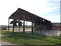
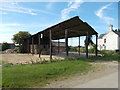
Open Sided Barn
by Mick Garratt geograph for square SK2567 Close up of the barn shown in SK2567 : Open Sided Barn.
|
![SU2694 : Great Coxwell Barn [3] by Michael Dibb](https://s2.geograph.org.uk/geophotos/04/23/52/4235250_e2a7e7e5_120x120.jpg)
|
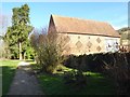
Great Coxwell Barn [3]
by Michael Dibb for square SU2694 An interior view of this magnificent barn. The barn is dated circa 1230 and was... (more)
|
![SU2694 : Great Coxwell Barn [2] by Michael Dibb](https://s3.geograph.org.uk/geophotos/04/23/52/4235243_8aefb762_120x120.jpg)
|
Great Coxwell Barn [2]
by Michael Dibb for square SU2694 An interior view of this magnificent barn. The barn is dated circa 1230 and was... (more)
|
|
Stone Barn at Silverbridge Farm
by Nigel Mykura geograph for square SY4193 This large stone barn has two sections one of which is open sided with... (more)
|
|
Listed Barn at Ripley
by Mike Smith geograph for square SZ1698 This barn is elevated on Staddle Stones. These mushroom-shaped stones were used... (more)
|
|
Dutch barn at Westhay Lodge
by Christine Johnstone geograph for square TL0199 Also known as a pole barn or a hay barn. Seen from the minor road, over a high hedge.
|
|
Upper Barn, Y Golfa
by Christine Johnstone geograph for square SJ1906 A roof on stilts, otherwise know as a Dutch barn, hay barn or pole barn. Taken... (more)
|
|
Dutch barn, with Swiss rolls
by Christine Johnstone geograph for square SO5470 Also known as hay barns or pole barns, these open-sided barns are now mostly... (more)
|
|
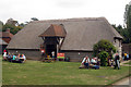
Vale Barn at The Museum of Kent Life
by Oast House Archive geograph for square TQ7458 Category: Barn The barn was relocated in 1989 from its original location at Calcott near... (more)
Tags:
subject:Barn
top:Farm, Fishery, Market GardeningX
|