About tags on Geograph

Public Tags

Related Tags | Coverage Map
Tag:  Beacon·Way  

Showing latest 50 of 230 images tagged with Beacon Way tag.

View all tagged images - In Browser
:

SN6825 : Beacons Way Bench in Bethlehem by Nigel Davies Beacons Way Bench in Bethlehem by Nigel Davies
geograph for square SN6825
This is one of 2 benches placed at either end of the Beacons Way, a long... (more)
Tags: long distance path:Beacons Way   Beacons Way   national park:Brecon Beacons   Brecon Beacons National Park   top:Sport, Leisure   top:Village, Rural Settlement  
SP0293 : Beacon Wayside flood warning - Newton, Birmingham by Martin Richard Phelan Beacon Wayside flood warning - Newton, Birmingham by Martin Richard Phelan
geograph for square SP0293
As you leave the A4041 Newton Road for the Beacon Way you are confronted by this... (more)
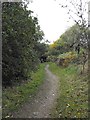
SP0696 : Beacon Way near Beacon Road by Penny Mayes Beacon Way near Beacon Road by Penny Mayes
geograph for square SP0696
The Beacon Way long distance path goes up from Pinfold Lane to Beacon Road here.
Tags: Beacon Way   top:Paths   top:Suburb, Urban Fringe   top:Woodland, Forest  
SP0596 : Beacon Way near Beacon Road by Penny Mayes Beacon Way near Beacon Road by Penny Mayes
geograph for square SP0596
The Beacon Way long distance path goes down from Beacon Road to Pinfold Lane here.
Tags: Beacon Way   top:Paths   top:Suburb, Urban Fringe   top:Woodland, Forest  
SP0293 : Maytime on the Beacon Way - Newton, Birmingham by Martin Richard Phelan Maytime on the Beacon Way - Newton, Birmingham by Martin Richard Phelan
geograph for square SP0293
This photo was taken on the Beacon Way at a point just to the south of Brook... (more)
SP0293 : Beacon Wayside bench - Newton, Birmingham by Martin Richard Phelan Beacon Wayside bench - Newton, Birmingham by Martin Richard Phelan
geograph for square SP0293
On your walk on the route of the Beacon Way you will find places to rest, such... (more)
SP0293 : Beacon Way on Tameside - Newton, Birmingham by Martin Richard Phelan Beacon Way on Tameside - Newton, Birmingham by Martin Richard Phelan
for square SP0293
Here NCN (National Cycle Network) Route no. (number) 5 runs with the Beacon Way... (more)
SP0293 : Beacon Way north-west - Newton, Birmingham by Martin Richard Phelan Beacon Way north-west - Newton, Birmingham by Martin Richard Phelan
geograph for square SP0293
A view north-west on the Beacon Way. Ahead is the A4041 Newton Road from West... (more)
Tags: A4041 Newton Road   A452 Chester Road   Beacon Way   place:Birmingham   place:Gentleshaw Common   type:Geograph   top:Lowlands   area:Newton   area:North Birmingham   subject:Path   top:Paths   top:Rivers, Streams, Drainage   place:Sandwell Park Farm   top:Sport, Leisure   top:Suburb, Urban Fringe   place:Sutton Park   place:West Bromwich   area:West Midlands  
SO1319 : Beacons Way near Maes-y-Beddau by Derek Harper Beacons Way near Maes-y-Beddau by Derek Harper
geograph for square SO1319
The lane from Llangynidr drops towards the farm; before reaching it, the Beacons... (more)
Tags: Bank (Slope)   long distance path:Beacons Way   national park:Brecon Beacons   type:Geograph   Lane   top:Lowlands   fences:Post and Wire   top:Roads, Road Transport   Roadside Trees  
SO1218 : Sheep pasture by Beacons Way by Derek Harper Sheep pasture by Beacons Way by Derek Harper
for square SO1218
A view that duplicates SO1219 : Towards Dyffryn Crawnon but, by virtue of being taken a few metres... (more)
Tags: long distance path:Beacons Way   national park:Brecon Beacons   type:Cross Grid   top:Farm, Fishery, Market Gardening   Hillside   top:Lowlands   Sheep Pasture   Trees on Field Boundaries   top:Uplands   Valley   top:Woodland, Forest   Woods  
SO1018 : Marsh Thistle by the Beacons Way by Derek Harper Marsh Thistle by the Beacons Way by Derek Harper
for square SO1018
The white form of Cirsium palustre beside the rock picnic table at the point... (more)
Tags: Access Land   long distance path:Beacons Way   national park:Brecon Beacons   Cirsium Palustre   type:Close Look   top:Grassland   plant:Marsh Thistle   top:Rocks, Scree, Cliffs   top:Uplands   top:Wild Animals, Plants and Mushrooms  
SN9317 : Beacons Way heading towards Blaen Llia by John Light Beacons Way heading towards Blaen Llia by John Light
geograph for square SN9317
The Beacons Way heads downhill towards Blaen Llia, then joins up with Sarn Helen... (more)
Tags: long distance path:Beacons Way   Brecon Beacons National Park   top:Moorland   top:Paths   top:Uplands   top:Woodland, Forest  
SN9216 : Beacons Way footbridge over Afon Llia by John Light Beacons Way footbridge over Afon Llia by John Light
geograph for square SN9216
A relatively new footbridge over the Afon Llia, built after the Beacons Way was... (more)
Tags: long distance path:Beacons Way   Brecon Beacons National Park   Footbridge   top:Paths   top:Rivers, Streams, Drainage   top:Uplands  
SN9622 : Marker post on Beacons Way by John Light Marker post on Beacons Way by John Light
geograph for square SN9622
Category: Footpath marker
The Beacons Way marker has been taken off these marker posts, but these posts in... (more)
SP0293 : Bike way on bank of River Tame - Newton, Birmingham by Martin Richard Phelan Bike way on bank of River Tame - Newton, Birmingham by Martin Richard Phelan
geograph for square SP0293
This cycle/walkway is on the route of the Beacon Way. The Beacon Way is a 25... (more)
Tags: Beacon Way   subject:Cycle Route   place:Forge Mill Lake   place:Gentleshaw Common   type:Geograph   top:Lowlands   place:Newton   top:Paths   top:Rivers, Streams, Drainage   place:Sandwell Park Farm   place:Sandwell Valley   top:Sport, Leisure   top:Suburb, Urban Fringe   place:Swan Pool   place:West Bromwich   area:West Midlands  
SP0293 : Footpath ways - Newton, Birmingham by Martin Richard Phelan Footpath ways - Newton, Birmingham by Martin Richard Phelan
geograph for square SP0293
These two fieldpaths start off in different directions but both lead to the bank... (more)
Tags: Beacon Way   Cycle/walk Route   subject:Field   place:Gentleshaw Common   type:Geograph   top:Grassland   top:Lowlands   place:Newton   top:Paths   River Tame   place:Sandwell Park Farm   top:Sport, Leisure   area:Staffordshire   top:Suburb, Urban Fringe   area:West Midlands  
SN9920 : Winter on the Brecon Beacons by John Light Winter on the Brecon Beacons by John Light
geograph for square SN9920
Looking across to Y Gyrn from the Beacons Way.
Tags: top:Air, Sky, Weather   long distance path:Beacons Way   Brecon Beacons National Park   top:Uplands  
SO1419 : Woodland, Beacons Way by Derek Harper Woodland, Beacons Way by Derek Harper
geograph for square SO1419
Llangynidr footpath 11/1, as seen on the right of SO1419 : Woodland, Beacons Way, carries the Way... (more)
Tags: long distance path:Beacons Way   national park:Brecon Beacons   type:Geograph   top:Lowlands   top:Paths   Public Footpath   Wooded Hillside   top:Woodland, Forest  
SO1419 : Woodland, Beacons Way by Derek Harper Woodland, Beacons Way by Derek Harper
geograph for square SO1419
The Way follows Llangynidr footpath 11/1 through open woodland above the Afon Crawnon.
Tags: long distance path:Beacons Way   national park:Brecon Beacons   type:Geograph   top:Lowlands   Open Woodland   top:Paths   Public Footpath   top:Woodland, Forest  
SO3217 : The Beacons Way by Stuart Wilding The Beacons Way by Stuart Wilding
geograph for square SO3217
View of the Beacons Way on the ridge of Ysgyryd Fawr.
Tags: long distance path:Beacons Way   top:Moorland   top:Paths  
SO0319 : On Craig Cwmoergwm by Derek Harper On Craig Cwmoergwm by Derek Harper
geograph for square SO0319
Clifftop grassland by the Beacon Way as it skirts the head of Cwm Oergwm. A good... (more)
Tags: long distance path:Beacons Way   national park:Brecon Beacons   top:Grassland   Mountains   top:Paths   Ridges   top:Uplands  
SO0319 : Shelter on the Beacons Way by Derek Harper Shelter on the Beacons Way by Derek Harper
geograph for square SO0319
Also shown in SO0319 : Beacons Way. According to "The Brecon Beacons - A... (more)
Tags: long distance path:Beacons Way   national park:Brecon Beacons   top:Lakes, Wetland, Bog   Mountain Shelter   Reservoirs   top:Rivers, Streams, Drainage   top:Uplands   Valley  
SN9721 : The Beacons Way by David Purchase The Beacons Way by David Purchase
geograph for square SN9721
The Beacons Way, and also the Taff Trail, follow the old drovers' road from... (more)
Tags: long distance path:Beacons Way   top:Paths   top:Uplands  
SN9720 : The Beacons Way by David Purchase The Beacons Way by David Purchase
geograph for square SN9720
The Beacons Way, and also the Taff Trail, follow the route of the old... (more)
Tags: long distance path:Beacons Way   top:Paths   top:Uplands  
SN9819 : Bridge and Ford over Taf Fawr by John Light Bridge and Ford over Taf Fawr by John Light
geograph for square SN9819
Category: Ford
Taken from the start of the popular route up to Pen y Fan. The footbridge is a... (more)
Tags: long distance path:Beacons Way   Brecon Beacons National Park   Ford   top:Paths   top:Rivers, Streams, Drainage   top:Uplands  
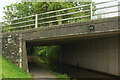
SO1520 : Bridge 131, Monmouthshire and Brecon Canal by Derek Harper Bridge 131, Monmouthshire and Brecon Canal by Derek Harper
geograph for square SO1520
Looking the other way from SO1520 : Monmouthshire and Brecon Canal at Llangynidr. The bridge carries the B4560, and the... (more)
Tags: long distance path:Beacons Way   national park:Brecon Beacons   Canal Bridge   top:Canals   Canalside Trees   type:Geograph   top:Lowlands   canal:Monmouthshire and Brecon   top:Paths   Public Footpath   Railings   Road Bridge Over Canal   top:Roads, Road Transport   Towpath   long distance path:Usk Valley Walk  
SO1419 : Woodland, Beacons Way by Derek Harper Woodland, Beacons Way by Derek Harper
geograph for square SO1419
A reverse view of SO1419 : Woodland, Beacons Way, with the Way climbing Llangynidr footpath 11/1.
Tags: long distance path:Beacons Way   national park:Brecon Beacons   type:Geograph   top:Lowlands   Open Woodland   top:Paths   Public Footpath   Wooded Hillside   top:Woodland, Forest  
SO1419 : Field on the Beacons Way by Derek Harper Field on the Beacons Way by Derek Harper
for square SO1419
Crossed by the Way following Llangynidr footpath 11/1 as the land gently drops... (more)
Tags: long distance path:Beacons Way   national park:Brecon Beacons   type:Cross Grid   top:Farm, Fishery, Market Gardening   Grass Fields   Hedges   Hills   top:Lowlands   top:Paths   Trees on Field Boundaries   Wooded Hill   top:Woodland, Forest  
SO1319 : Beacons Way near Llwyn-yr-êos by Derek Harper Beacons Way near Llwyn-yr-êos by Derek Harper
geograph for square SO1319
The Way follows Llangynidr footpath 11/1 through bracken, with the farm ahead right.
Tags: long distance path:Beacons Way   plant:Bracken   national park:Brecon Beacons   Farm   top:Farm, Fishery, Market Gardening   Farmland   type:Geograph   Hedges   top:Lowlands   top:Paths   Public Footpath   Trees on Field Boundaries  
SO1319 : Beacons Way to Llangynidr by Derek Harper Beacons Way to Llangynidr by Derek Harper
geograph for square SO1319
The Way follows Llangynidr footpath 11/1 through the gate on the right.
Tags: long distance path:Beacons Way   national park:Brecon Beacons   top:Farm, Fishery, Market Gardening   Farmland   type:Geograph   Hills   top:Lowlands   top:Paths   fences:Post and Wire   Public Footpath   gates:Steel   Valley   top:Woodland, Forest   Woods  
SO1319 : Beacons Way to Llangynidr by Derek Harper Beacons Way to Llangynidr by Derek Harper
geograph for square SO1319
The Way follows Llangynidr footpath 11/1 across a field beside Pen-y-beili with... (more)
Tags: Agricultural Equipment   long distance path:Beacons Way   national park:Brecon Beacons   Farm Trailer   top:Farm, Fishery, Market Gardening   Farmland   type:Geograph   Hedge   Hills   top:Lowlands   Pasture   top:Paths   Public Footpath   gates:Steel   Valley   View   top:Woodland, Forest   Woods  
SO1319 : Beacons Way near Maes-y-Beddau by Derek Harper Beacons Way near Maes-y-Beddau by Derek Harper
geograph for square SO1319
The Way follows Llangynidr bridleway 34/1 towards the lane northeast of the farm.
Tags: long distance path:Beacons Way   national park:Brecon Beacons   Bridleway   top:Farm, Fishery, Market Gardening   type:Geograph   Grass Fields   top:Lowlands   top:Paths   Trees   Trees on Field Boundaries   Valley  
SO1319 : Beacons Way at Maes-y-Beddau by Derek Harper Beacons Way at Maes-y-Beddau by Derek Harper
geograph for square SO1319
The Way follows Llangynidr bridleway 34/1 past the trees on the left;... (more)
Tags: long distance path:Beacons Way   national park:Brecon Beacons   Bridleway   top:Farm, Fishery, Market Gardening   Farms   type:Geograph   top:Lowlands   Pasture   top:Paths   Trees on Field Boundary   Valley  
SO1319 : View from Beacons Way by Derek Harper View from Beacons Way by Derek Harper
for square SO1319
Looking left from SO1218 : Dyffryn Crawnon down the valley, with Maes-y-Beddau the farm... (more)
Tags: long distance path:Beacons Way   national park:Brecon Beacons   type:Cross Grid   top:Farm, Fishery, Market Gardening   Farms   Fields   Hedges   top:Lowlands   Trees on Field Boundaries   Valley   top:Woodland, Forest   Woods  
SO1119 : Hillside above Beacons Way by Derek Harper Hillside above Beacons Way by Derek Harper
geograph for square SO1119
On the slopes of Tor y Foel. Taken a few metres above the Way.
Tags: long distance path:Beacons Way   national park:Brecon Beacons   top:Farm, Fishery, Market Gardening   type:Geograph   Grass Field   Hillside   Open Woodland   Trees on Field Boundaries   top:Uplands   top:Woodland, Forest  
SO1118 : Wall, Beacons Way by Derek Harper Wall, Beacons Way by Derek Harper
for square SO1118
Near Bwlch-y-waun as the Way follows Talybont-on-Usk restricted byway 26/1.... (more)
Tags: long distance path:Beacons Way   top:Boundary, Barrier   national park:Brecon Beacons   type:Close Look   top:Geological Interest   top:Paths   gate:Steel   top:Uplands   Wall   Wood   top:Woodland, Forest  
SP0293 : NCN 5 on Tameside - Newton, Birmingham by Martin Richard Phelan NCN 5 on Tameside - Newton, Birmingham by Martin Richard Phelan
for square SP0293
Here NCN (National Cycle Network) Route no. (number) 5 runs with the Beacon Way... (more)
SP0292 : Swan Pool side - Sandwell Valley, West Midlands by Martin Richard Phelan Swan Pool side - Sandwell Valley, West Midlands by Martin Richard Phelan
geograph for square SP0292
A view along the Poolside path which is part of a long distance route the Beacon... (more)
Tags: Beacon Way   subject:Cycle Route   type:Geograph   top:Lakes, Wetland, Bog   top:Lowlands   top:Park and Public Gardens   top:Paths   area:Sandwell   place:Sandwell Park Farm   area:Sandwell Valley   top:Sport, Leisure   place:Swan Pool   top:Village, Rural Settlement   area:West Midlands  
SO2726 : Beacons Way at Bal Bach by John Winder Beacons Way at Bal Bach by John Winder
geograph for square SO2726
The route of the Beacons Way long distance path - at this point a well - defined... (more)
Tags: Bal Bach   long distance path:Beacons Way   area:Black Mountains   type:Geograph   top:Moorland   Path   subject:Path   top:Paths   top:Uplands  
SP0293 : Beacon Way to railway - Newton, Birmingham by Martin Richard Phelan Beacon Way to railway - Newton, Birmingham by Martin Richard Phelan
for square SP0293
On the Beacon Way approaching the railway bridge which crosses the River Tame at... (more)
SO2927 : Public footpath heading down from Wiral Wood by Christine Johnstone Public footpath heading down from Wiral Wood by Christine Johnstone
geograph for square SO2927
Passing some beautiful autumnal trees on its way to Llanthony. Part of the Beacons Way.
Tags: season:Autumn   long distance path:Beacons Way   national park:Brecon Beacons   Cross Field Footpath   path:Footpath   type:Geograph   subject:Path   top:Paths   Public Footpath  
SP0293 : Kissing gate to where - Newton, Birmingham by Martin Richard Phelan Kissing gate to where - Newton, Birmingham by Martin Richard Phelan
geograph for square SP0293
Through this kissing gate paths run to the bank of the River Tame and the Beacon... (more)
Tags: Beacon Way   Cycle/walk Route   subject:Gate   place:Gentleshaw Common   type:Geograph   top:Lowlands   place:Newton   top:Paths   River Tame   place:Sandwell Park Farm   top:Sport, Leisure   area:Staffordshire   top:Suburb, Urban Fringe   area:West Midlands  
SO0220 : Beacons Way by Derek Harper Beacons Way by Derek Harper
geograph for square SO0220
Looking in the opposite direction to SO0220 : The Beacons Way along the slopes below Cribyn,... (more)
Tags: long distance path:Beacons Way   national park:Brecon Beacons   Footpath   top:Grassland   Hillside   Moorland   Mountains   top:Paths   top:Rivers, Streams, Drainage   top:Uplands  
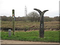
SP0393 : Guided on your way - Sandwell Valley, West Midlands by Martin Richard Phelan Guided on your way - Sandwell Valley, West Midlands by Martin Richard Phelan
geograph for square SP0393
Here beside the River Tame there are markers to show you your way. On the left... (more)
SO1419 : Woodland, Beacons Way by Derek Harper Woodland, Beacons Way by Derek Harper
geograph for square SO1419
A little beyond SO1419 : Woodland, Beacons Way and the ground steepens for Llangynidr footpath... (more)
Tags: long distance path:Beacons Way   national park:Brecon Beacons   type:Geograph   top:Lowlands   top:Paths   Public Footpath   Wooded Hillside   top:Woodland, Forest  
SO1319 : Goats by Beacons Way by Derek Harper Goats by Beacons Way by Derek Harper
geograph for square SO1319
At Pen-y-bailey.
Tags: long distance path:Beacons Way   national park:Brecon Beacons   top:Farm, Fishery, Market Gardening   type:Geograph   Goats   Hedgebank   top:Lowlands   gate:Timber   Trees  
SO1319 : Beacons Way near Pen-y-beili by Derek Harper Beacons Way near Pen-y-beili by Derek Harper
geograph for square SO1319
The lane along Dyffryn Crawnon from Llangynidr descending towards Maes-y-Beddau.
Tags: long distance path:Beacons Way   national park:Brecon Beacons   top:Farm, Fishery, Market Gardening   Farmland   type:Geograph   Hedgebanks   Lane   top:Lowlands   top:Roads, Road Transport   Trees   Valley  
SO1319 : Beacons Way by Derek Harper Beacons Way by Derek Harper
geograph for square SO1319
Taken from where Llangynidr bridleway 34/1 meets the lane between Maes-y-Beddau... (more)
Tags: long distance path:Beacons Way   national park:Brecon Beacons   Footpath Signpost   type:Geograph   Lane   top:Lowlands   top:Roads, Road Transport   Roadside Trees   Wall   Waymarks  
SO1319 : Maes-y-Beddau by Derek Harper Maes-y-Beddau by Derek Harper
geograph for square SO1319
Farm buildings seen from the Beacons Way.
Tags: long distance path:Beacons Way   national park:Brecon Beacons   top:Farm, Fishery, Market Gardening   Farms   type:Geograph   top:Lowlands   Oak Trees   Pasture   Valley   top:Woodland, Forest  
SO1219 : Pasture by Beacons Way by Derek Harper Pasture by Beacons Way by Derek Harper
geograph for square SO1219
On the slopes of Dyffryn Crawnon.
Tags: long distance path:Beacons Way   national park:Brecon Beacons   top:Farm, Fishery, Market Gardening   type:Geograph   Hedges   top:Lowlands   Pasture   Trees on Field Boundaries   Wood   top:Woodland, Forest  
View more in the Image Search or in Browser
View images matching 'Beacon Way' anywhere in the tags
Don't click these: PotMel 1 PotMel 2