Public Tags
Tag: Bend·Sign
Showing latest 50 of 58 images tagged with Bend Sign tag.

|
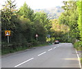
Sharp bend on Woodcroft Road near Marholm
by Paul Bryan geograph for square TF1303 Unfortunately the sign indicating the bend is now largely obscured by foliage.... (more)
|
|
Two bend warning signs, Talywain
by Jaggery geograph for square SO2603 The two signs alongside the B4246 Lodge Road differ both in appearance and... (more)
|

|
Dangerous bends
by Ian Paterson geograph for square O1347 Sign slightly obscured by the low February sun warning of a series of bends ahead.
|

|
Illuminated slow down sign on High Street, Glinton
by Paul Bryan for square TF1505 A 20-mile per hour speed limit is in force on the section of High Street near... (more)
Tags:
Bend Sign
type:Close Look
Illuminated Road Sign
Illuminated Sign
Night
taken:Night
at:Night
Night Scene
Night Time
Night View
signage:Road Sign
Road Sign
top:Roads, Road Transport
subject:Sign
Slow Down
Slow Down Sign
Slow Sign
Traffic Sign
top:Village, Rural Settlement
Warning Sign Bend in Road
Warning Sign Slow Down
|
|
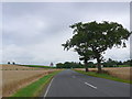
B4453
by Nigel Mykura geograph for square SP3769 Looking towards the Wappenbury junction from the road to Weston under Wetherly.... (more)
|

|
Bend sign in the south of Clarbeston Road, Pembrokeshire
by Jaggery geograph for square SN0120 The sign is opposite the entrance to a football pitch,... (more)
|

|
Right bend ahead triangular sign, Pillmawr Road, Malpas, Newport
by Jaggery geograph for square ST3090 The sign doesn't tell the whole story. There is a junction... (more)
|

|
Bend Arrow Bent
by Des Blenkinsopp geograph for square SU6289 A not particularly sharp bend along Clack's Lane, and clearly marked with... (more)
|

|
Dunkeswick Lane
by Derek Harper geograph for square SE2948 Further down the road shown in SE2949 : Dunkeswick Lane, approaching the first bend since... (more)
|

|
Upottery Bridge: parapet works
by Christopher Hilton geograph for square ST2007 Tags:
Bend in Road
Bend in the Lane
Bend in the Road
Bend Sign
subject:Bridge
Lane
Parapet Works
bridge:Road Over River
Road Sign
top:Roads, Road Transport
Roadworks
|

|
White arrows on black signs alongside the B4293, Monmouth
by Jaggery geograph for square SO5011 On the approach to a bend where the course of the B4293
turns through about 90... (more)
|
|
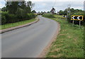
Yellow-edged bend signs, Walford
by Jaggery geograph for square SO5820 Alongside the B4234 Walford Road. Another bend is in the distance.
|

|
Field gate between bend signs near Freshwater East
by Jaggery geograph for square SS0198 At a bend in the B4584 Portclew Road in south Pembrokeshire.
|

|
Road past Worcester Lodge
by Derek Harper geograph for square SO8644 The lodge Link
 ... (more) |
|
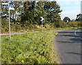
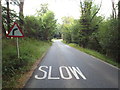
Sharp bend in the road from Cam to Coaley
by Jaggery geograph for square SO7502 Viewed from a grass triangle. One arm of a signpost points right towards Coaley.... (more)
|
|
Priory Road, near Forest Row
by Malc McDonald geograph for square TQ4032 Priory Road, approaching a bend to the right.
Tags:
Bend in Road
Bend in the Road
Bend Sign
county:East Sussex
near:Forest Row
type:Geograph
Minor Rural Road
subject:Road
top:Roads, Road Transport
Rural Road
|

|
A6, Near Selside
by David Dixon geograph for square SD5399 The northbound A6. The turn off for Selside is shortly after the approaching bend.
|

|
Bend sign on a Barrack Hill lamppost, Newport
by Jaggery geograph for square ST3089 On a lamppost alongside a metal barrier. Ahead for the steep part of Barrack... (more)
|
|
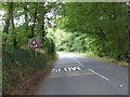
Warnings for motorists on Wellington Hill
by David Smith geograph for square ST1316 The road has been straight for some distance, so warnings of the bends ahead are essential
|

|
Hatherton: A529 northwards from the Park Lane junction
by Christopher Hilton geograph for square SJ6748 Tags:
road:A Road
A-Classifed Road
Bend Sign
Bend Signs
type:Geograph
Road
subject:Road
top:Roads, Road Transport
|
|
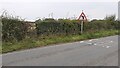
Former fieldgate and bend sign on NW side of rural road SW of Carleton Hill Cottages
by Roger Templeman geograph for square NY4550 Ordnance Survey records indicate that a benchmark levelled at 82.980m above... (more)
|
|
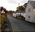
Quinta Terrace left bend ahead, Chirk Bank
by Jaggery geograph for square SJ2937 The road ahead bends to the left adjacent to Chirk Bank Bridge... (more)
Tags:
Bend Sign
top:Roads, Road Transport
|

|
Bend in Three Mile Lane
by Jonathan Hutchins geograph for square SJ8044 Tags:
Bend in the Lane
Bend Signs
Country Road
top:Farm, Fishery, Market Gardening
Field
type:Geograph
top:Grassland
near:Keele
subject:Lane
top:Roads, Road Transport
|
|
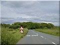
Woodland by a bend in the A3079
by David Smith geograph for square SX5294 The road curves here to pass the head of the valley which is the source of a... (more)
|
|
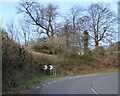
Warning of sharp bend, Upcott Hill, Okehampton
by David Smith geograph for square SX5795 The dashed white line marks a gentler bend than the edge of the road surface
|
|
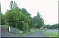
Lay-by, Llansantffraed
by Derek Harper geograph for square SO1223 Providing parking for the church and visitors to Henry Vaughan's grave. On... (more)
Tags:
A Road (Classified A)
Arafwch Nawr Sign
Bend Sign
national park:Brecon Beacons
type:Geograph
Hedge
Lay-by
top:Lowlands
Reduce Speed Now Sign
Road Sign
top:Roads, Road Transport
Roadside Verge
Trees
top:Village, Rural Settlement
Wall and Gatepier
|

|
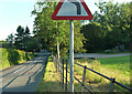
Bend in B5307 at junction to Burgh by Sands
by Roger Templeman geograph for square NY3256 There is a Cumberland Council County finger signpost NY3256 : Cumberland County Council signpost at B5307 T-junction west of Moorhouse on the left hand verge
|
|
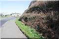
B4219 approaching Storridge
by Derek Harper geograph for square SO7548 A left bend coming up, at which I should have been joining the B road from a... (more)
Tags:
B Road (Classified B)
Bend Sign
fence:Galvanized Tube
type:Geograph
top:Lowlands
top:Roads, Road Transport
Roadside Hedge
Trees
|
|
Cutting for A595 at bend at the approach to Parton
by Roger Templeman geograph for square NX9719 Ordnance Survey records indicate a benchmark cut into the rock face here: see... (more)
Tags:
road:A Road
Bend Signs
type:Geograph
Ordnance Survey
top:Roads, Road Transport
top:Village, Rural Settlement
|

|
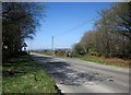
Lower Norton Lane
by Derek Harper geograph for square ST3463 The lane has only just entered the square, and is about to leave it again,... (more)
Tags:
Bend Sign
top:Flat Landscapes
type:Geograph
Lane
top:Roads, Road Transport
Roadside Hedges
Roadside Trees
|
|
Junction on the B3257
by Derek Harper geograph for square SX3772 With a side road to Downgate on the right, the start of the Tamar Valley... (more)
|

|
Bend in A329 at Primrose Hill
by Roger Templeman geograph for square SU6095 The minor road to the right leads to Berrick Prior
|

|
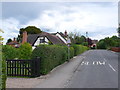
Bends ahead
by J.Hannan-Briggs geograph for square TF2580 An unnamed lane near Stenigot.
|
|
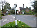
Houses in Haselor
by Nigel Mykura geograph for square SP1257 These half timbered cottages are on the main street of the village opposite the... (more)
|
|
Follaton Cross
by Derek Harper geograph for square SX7860 Category: Road junction The junction on Follaton Road that marks the abrupt change from countryside to... (more)
|

|
T-junction near The Keep. Turning Course Lonning to the right
by Roger Templeman geograph for square NY5461 There are new and oldish signposts NY5461 : Signposts: old and new styles at T-junction near The Keep on the left hand verge
|

|
T-junction NW of Washstones Bridge
by Roger Templeman geograph for square SK6817 There is a Leicestershire County Council signpost SK6817 : Leicestershire County Council finger signpost at junction of Asfordby Road, Hoby Road & Washstones Lane against the hedge... (more)
|

|
Entrance to Eastby on Barden Road
by Roger Templeman geograph for square SE0254 |
|
B3141 approaching Cote
by Derek Harper geograph for square ST3444 Crossing Huntspill Moor north of the Huntspill River.
|
|
Barns of Stone's Farm, Netherton Lane
by Roger Templeman geograph for square SU4199 There is an OS benchmark SU4199 : Benchmark on Stone's Farm barn on the corner of the near barn on its road face
|
|
B4100 at Home Farm
by Roger Templeman geograph for square SP5825 |
|
House extension, Cockington Lane
by Derek Harper geograph for square SX8962 A new roof going on, seen across the junction with All Hallows Road.
|

|
A385 at Glazegate Lane
by Derek Harper geograph for square SX8460 A route with public access and green lane forks off to the left from the main road
|
|
Roundabout on A61
by Roger Templeman geograph for square SK3480 |
|
Bus stop, Laneast
by Derek Harper geograph for square SX2284 As promised in SX2284 : Junction, Laneast. The 410 service will take you Launceston or Delabole.
|

|
A3066, Dibberford
by Derek Harper geograph for square ST4503 The Monarch's Way used to come this way, and I was using a slightly dated map ...
|
|
Arnold Hill Well 2013
by Gerald England geograph for square SJ9593 Arnold Hill Well was dressed by the children of Gee Cross Holy Trinity Primary... (more)
|

|
Warning of a curve in M53, west of J5
by David Smith geograph for square SJ3578 The M53 has a curve which is tighter than is normal on motorways, so a warning is needed
|

|
Junction of A607 (Melton Road) with road to Woodfold Lane
by Roger Templeman geograph for square SK7922 |
|
East parapet of bridge taking road over High Stand Gill
by Roger Templeman geograph for square NY4949 There is an Ordnance Survey benchmark NY4949 : Benchmark on east parapet of bridge over High Stand Gill at the middle of the bridge parapet
|
