|
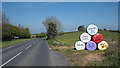
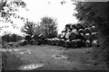
Coronavirus message, Ballyboley
by Rossographer
geograph for square J5870
Wrapped silage bales, painted and with messages related to the Coronavirus... (more)
|
|
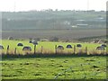
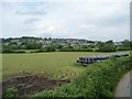
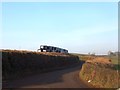
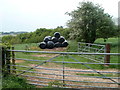
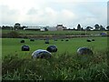
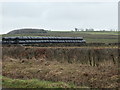
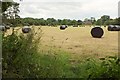
Wrapped bales near Dungeon Lane Farm
by Christine Johnstone
geograph for square SE3426
East-bound traffic on the M62 is just visible about 600 metres away.
|
|
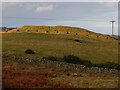
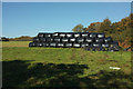
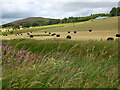
Line of black bales, Morning Hill
by Jim Barton
geograph for square NT2438
Black plastic-wrapped bales arranged on the hillside for some reason.
|
|
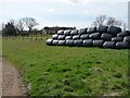
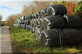
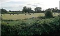
Wall of bales near Irving House Farm
by Christine Johnstone
geograph for square NZ4004
Not so much Swiss rolls as black puddings.
|
|
Stack of wrapped bales, alongside Cownhayne Lane
by Christine Johnstone
geograph for square SY2593
Seen from the top deck of an open-topped tram, heading south to Seaton.
|
|
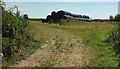
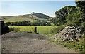
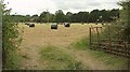
Bales near Middle Whitestone
by Derek Harper
geograph for square SS7818
|
|
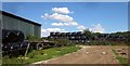
Bales, Hart Grove Farm
by Derek Harper
geograph for square SY2994
Black plastic bales and a trailer, seen from Mounthill Lane and the East Devon Way.
|
|
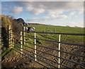
Bales above Rumleigh
by Derek Harper
geograph for square SX4567
|
|
Bales in black plastic near Cadeleigh
by David Smith
geograph for square SS9107
At a bend in the road, one passes this high pile of bales.
|
|
Stack of bales, West Preston
by Christine Johnstone
geograph for square NX9655
On the north side of the road from Loaningfoot.
|
|
Black plastic bales and a black barn near Llangybi
by Jaggery
geograph for square ST3696
Viewed from Parc Road in rural Monmouthshire.
|
|
Farmland, east end of Peaker Ings
by Christine Johnstone
geograph for square SE6311
Wrapped bales on the south bank of the River Dun Navigation.
|
|
Black plastic bales, Old House Farm near Dingestow
by Jaggery
geograph for square SO4411
View from the road NW from Dingestow, near Llantrothy.
|
|
Black plastic bales, Withiel Florey
by Derek Harper
geograph for square SS9933
On the verge by the lane from Swansea Farm.
|
|
Footpath, Windy Ridge
by Derek Harper
geograph for square SX6655
North Huish footpath 1 leaves Ridge Road past a large collection of black plastic bales.
|
|
Black plastic bales as an F1 crash barrier on the B9136
by Stanley Howe
geograph for square NJ1520
Warning too late to save the rabbit though!
|
|
Towards Conegar Hill
by Derek Harper
geograph for square SY3994
With a pile of rubble and black plastic bales in the foreground. Conegar Hill,... (more)
|
|
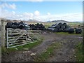
Gate and field near Muchlarnick
by Derek Harper
geograph for square SX2156
With black plastic bales on a hillside that climbs to over 125 metres.
|
|
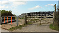
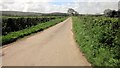
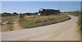
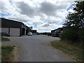
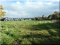
Portway Lane
by Derek Harper
geograph for square ST1741
|
|
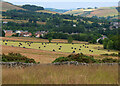
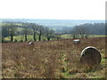
Field with bales near Craigerne
by Jim Barton
geograph for square NT2439
Plastic-wrapped bales below Edderston on the outskirts of Peebles.
|
|
Black bales near Broadhempston
by Derek Harper
geograph for square SX8065
Monochrome chose because of the poor light, but I can confirm that the bales are... (more)
|
|
Wrapped bales below Butterhill Bank
by Christine Johnstone
geograph for square SJ9230
On the east bank of the Trent & Mersey canal, in the Trent valley south-east of Stone.
|
|
Bales by Jordan Lane
by Derek Harper
geograph for square SX5170
|
|
Trees along a drain at Peaker Ings
by Christine Johnstone
geograph for square SE6311
On the south bank of the River Dun Navigation.
|
|
Stack of black bales, east of Glencaple
by Christine Johnstone
geograph for square NY0068
The distant woodland is Craig Wood.
|
|
Black bales of grass, near Upper Dolarddyn
by Christine Johnstone
geograph for square SJ1406
For hay or silage, I'm not sure.
|
|
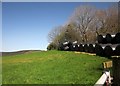
Roadside trees at Garford Pond
by Christine Johnstone
geograph for square NZ0419
Looking south.
|
|
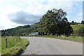
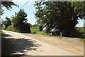
Towards Pugsley
by Derek Harper
geograph for square SS6423
|
|
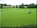
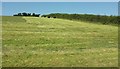
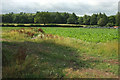
Harvested grass field, Ash Mill
by Derek Harper
geograph for square SS7723
|
|
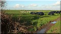
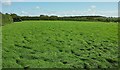
Grass field, East Leigh
by Derek Harper
geograph for square SX6852
|
|
Footpath near Rodwell Manor
by Derek Harper
geograph for square ST4018
Footpath L 17/75 leaves Rodwell Lane past some plastic bales.
|
|
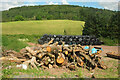
Logs and bales by the B4558
by Derek Harper
geograph for square SO1221
A storage area sandwiched between the road and the Monmouthshire and Brecon... (more)
|
|
Plastic bales by the Avon Valley path
by Derek Harper
geograph for square SU1415
|
|
Plastic bales by the Avon Valley path
by Derek Harper
geograph for square SU1415
From where the Path makes a right-angled bend involving Fordingbridge footpaths... (more)
|
|
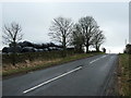
Lane near Lutworthy
by Derek Harper
geograph for square SS7616
The road to Mouseberry Cross curves past some plastic bales.
|
|
Baled and left
by Neil Owen
geograph for square ST7260
The grassland near the A367 as it leaves Bath seems to have been given a trim in... (more)
|
|
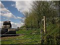
Barns, Bray Street, Avebury
by Vieve Forward
geograph for square SU0869
|
|
Lane near South Grendon
by Derek Harper
geograph for square SS7917
|
|
Stacks of bales near Terfynau
by Christine Johnstone
geograph for square SH4646
On the east side of the minor road from Bwlch-Derwin.
|
|
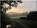
Sunset, Doddiscombsleigh
by Derek Harper
geograph for square SX8586
|
|
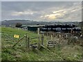
Silage bales, Burnetland farm
by Jim Barton
geograph for square NT1036
Bales in a field on the north side of the Biggar Water.
|
|
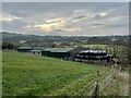
Bale stack at Stone Heath
by Christine Johnstone
geograph for square SJ9735
Field on the east side of the minor road junction.
|
|
Stile with bales
by Jonathan Hutchins
geograph for square SJ8049
Taken from footpath Audley 99, this stile gives access to the adjacent field... (more)
|
|
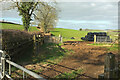
Farm buildings and bales
by Jonathan Hutchins
geograph for square SJ8049
|
|
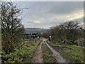
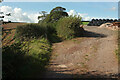
Farm track at Miles Green
by Jonathan Hutchins
geograph for square SJ8049
County Council signs state:
PUBLIC FOOTPATH ONLY
NO UNAUTHORISED VEHICLES,... (more)
|
|
Bale on the path above Maidencombe
by Derek Harper
geograph for square SX9268
Unignorable on the stretch of permissive path following a green lane up to the... (more)
|
|
Gates and bales, Parsonage Cross
by Derek Harper
geograph for square SX8163
In the angle between the lane to Copper Tree Cross and Parsonage Lane.
|
|
Bales near Willing
by Derek Harper
geograph for square SX7561
|
|
Woodhead Lane
by Derek Harper
geograph for square SX8464
The green lane keeps left of a storage area for bales and stone, but changes its... (more)
|
|
Farmland near River Dart Country Park
by Derek Harper
geograph for square SX7369
|