Public Tags
Showing images tagged with blocked path:Brambles tag.

|
Sowerby Bridge FP079 (N11), Milner Royd Lane blocked by brambles
by Humphrey Bolton geograph for square SE0723 There is a nice peaceful job to be done here. However it would have to be... (more)
Tags:
blocked path:Brambles
top:Grassland
Green Lane
top:Lowlands
subject:Path
top:Paths
Public Footpath
|

|
Footpath 111/12 blocked, Barkisland
by Humphrey Bolton geograph for square SE0517 There might be a stile lurking under the brambles, which could be cleared, but... (more)
Tags:
blocked path:Barbed Wire
blocked path:Brambles
type:Geograph
top:Grassland
top:Lowlands
subject:Path
top:Paths
Public Footpath
|

|
Back Lane, Soyland
by Humphrey Bolton geograph for square SE0221 This is a sunken lane, blocked by brambles. This view is from the southern end... (more)
|

|
Queensbury Footpath 48
by Humphrey Bolton geograph for square SE0928 This is the original and 'definitive' line of the path, blocked by... (more)
|

|
Impassable overgrown boardwalk
by M J Roscoe geograph for square ST3483 The boardwalk, on the Wales Coast Path, joins a wooden footbridge ST3483 : Overgrown gated footbridge,... (more)
Tags:
top:Boundary, Barrier
blocked path:Brambles
top:Flat Landscapes
type:Geograph
Gwent Levels
subject:Path
top:Paths
Wales Coast Path
|

|
Former towpath, Dearne & Dove Canal [2]
by Christine Johnstone for square SE3804 Looking westwards on a path less walked. This is a public footpath up the former... (more)
Tags:
plant:Brambles
blocked path:Brambles
derelict:Canal
former:Canal
former:Canal Towpath
top:Canals
type:Close Look
canal:Dearne and Dove
top:Derelict, Disused
path:Footpath
Former Locks
subject:Path
top:Paths
Public Footpath
|

|
Footpath to Bampton Road
by Philip Jeffrey geograph for square SP2902 You would need to be more determined than me to wade through the brambles though
|

|
Former towpath, Dearne & Dove Canal [1]
by Christine Johnstone geograph for square SE3804 Looking east, on the former Stairfoot flight of locks. This is a public... (more)
Tags:
blocked path:Brambles
plant:Brambles
former:Canal
derelict:Canal
former:Canal Towpath
top:Canals
canal:Dearne and Dove
path:Footpath
Former Locks
type:Geograph
subject:Path
top:Paths
Public Footpath
|

|
Overgrown footbridge, Windmill Reen, Nash
by M J Roscoe geograph for square ST3483 Public footpath on footbridge from West Nash Road impassable due to dense growth... (more)
Tags:
top:Boundary, Barrier
blocked path:Brambles
Cattle Pasture
subject:Field
top:Flat Landscapes
type:Geograph
top:Grassland
Gwent Levels
Obstructed Footbridge
top:Paths
|

|
Footpath now blocked by wall under former railway east of Hawes Station
by Roger Templeman geograph for square SD8789 Tags:
blocked path:Brambles
bridge:Former Railway Over Footpath
type:Geograph
top:Paths
top:Railways
Stone Wall
top:Suburb, Urban Fringe
Trees
|

|
Footpath 115 from Banks Common to Effingham Common
by Hugh Craddock geograph for square TQ1156 What a difference a decade can make: TQ1156 : Footpath from Mornshill woods and Banks Common. The footpath has been fenced... (more)
Tags:
blocked path:Brambles
Fenced Path
public right of way:Footpath
type:Geograph
Overgrown Path
subject:Path
top:Paths
|

|
Overgrown gated footbridge
by M J Roscoe geograph for square ST3483 The bridge, on the Wales Coast Path, leads to an impassable boardwalk ST3483 : Impassable overgrown boardwalk.
Tags:
top:Boundary, Barrier
blocked path:Brambles
subject:Bridge
Gated Footbridge
type:Geograph
Gwent Levels
top:Paths
Wales Coast Path
top:Wild Animals, Plants and Mushrooms
|

|
Start of the footpath to Top Farm
by Philip Jeffrey geograph for square TL1457 Though you would need to be determined to take it
Tags:
blocked path:Brambles
top:Farm, Fishery, Market Gardening
Footpath Fingerpost
type:Geograph
Hedge
subject:Path
top:Paths
|
|
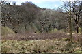
Cwm Philkins below Llys-pentwyn-uchaf
by M J Roscoe geograph for square ST1897 Marshy overgrown pasture near the head of the valley. The line of the little... (more)
Tags:
blocked path:Brambles
top:Energy Infrastructure
subject:Field
top:Grassland
place:Near Oakdale
top:Suburb, Urban Fringe
Trees in Spring
Wooden Electricity Pylon
top:Woodland, Forest
|
