Public Tags
Tag: Blocked·Road
Showing latest 50 of 80 images tagged with Blocked Road tag.
|
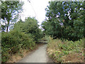
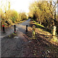
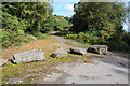
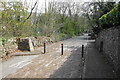
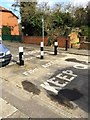
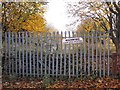
Nightingale Hall Road, Greenstead Green (Blocked)
by Geographer geograph for square TL8328 Tags:
Blocked Off RoadX
Blocked Road
near:Earls ColneX
type:GeographX
at:Greenstead GreenX
Nightingale Hall RoadX
subject:RoadX
Road BlockX
Road BlockedX
top:Roads, Road TransportX
top:Village, Rural SettlementX
|
|
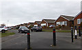
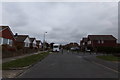
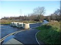
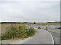
Downland Road, Woodingdean
by Geographer geograph for square TQ3405 At the junction with Seaview Road
|
|
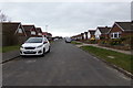
Downland Road, Woodingdean
by Geographer geograph for square TQ3405 Approaching the junction with Seaview Road
|
|
Seaview Road, Woodingdean
by Geographer geograph for square TQ3405 At the junction with Downland Road
|
|
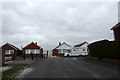
Downland Road (Blocked)
by Geographer geograph for square TQ3405 This has been introduced to stop Downland Road being a rat run avoiding Warren... (more)
|
|
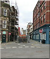
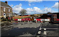
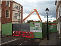
Blocked Market Street in Newport city centre
by Jaggery geograph for square ST3188 The Upper Dock Street end of Market Street is blocked during the erection of... (more)
|
|
The end of Waterhouse Road
by Gerald England geograph for square SJ8995
Direct access between Hyde Road SJ8995 : Hyde Road and Waterhouse Road/Woodland... (more)
Tags:
road:A57X
Blocked AccessX
Blocked Road
Flower PlantersX
type:GeographX
top:Roads, Road TransportX
|
|
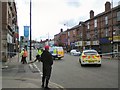
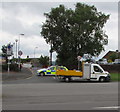
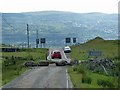
Bomb alert in Levenshulme
by Gerald England geograph for square SJ8794
Stockport Road in Levenshulme was blocked off. When I first heard the police... (more)
Tags:
road:A6X
Blocked Road
top:Defence, MilitaryX
type:GeographX
place:LevenshulmeX
Police CarX
Police IncidentX
top:Roads, Road TransportX
|
|
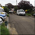
Blocked-off Hollybush Avenue, Malpas, Newport
by Jaggery geograph for square ST3090 At 10.57am on Sunday June 26th 2016 a police car blocks the junction of... (more)
|
|
Blocked off northern end of an unnamed road in Caerwent
by Jaggery geograph for square ST4790 Viewed from the A48 in January 2016. This looks like it used to be a through... (more)
|
|
Blocked Church Road, Havenstreet, Isle of Wight
by Jaggery geograph for square SZ5690 Blocked by road resurfacing work in early September 2015.
|
|
Blocked end of a former through route, Bridgend Road, Aberkenfig
by Jaggery geograph for square SS8982 Boulders and a metal gate block vehicles from using Bridgend Road ahead.... (more)
|
|
Blocked off Traston Road, Newport
by Jaggery geograph for square ST3386 Two older-looking metal posts and three slimmer metal posts block vehicular... (more)
Tags:
Blocked Road
top:Roads, Road TransportX
|
|
Blocked road near St Margaret's church
by Penny Mayes geograph for square SP0495 I had hoped to walk down this road a bit as there is a large ruined building on... (more)
|
|
Blocked lane, South Leaze
by Vieve Forward geograph for square SU1282 The lane connecting Swindon and Wharf Road via South Leaze has now been... (more)
|
|
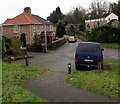
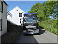
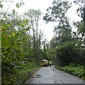
Blocking the road
by Adrian Taylor geograph for square NY0703 The delivery truck was delivering beer kegs to the Kellbank Hotel (formerly the... (more)
|

|
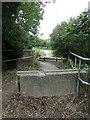
Nightingale Hall Road, Greenstead Green (Blocked)
by Geographer geograph for square TL8328 At Bourne Brook
Road No.U4330
Tags:
BlockedX
Blocked Road
at:Bourne BrookX
type:GeographX
at:Greenstead GreenX
Nightingale Hall RoadX
subject:RoadX
Road BlockedX
top:Roads, Road TransportX
U Road (Classified U)X
top:Village, Rural SettlementX
|
|
Nightingale Hall Road, Greenstead Green (Blocked)
by Geographer geograph for square TL8328 At Bourne Brook
Tags:
BlockedX
Blocked Road
at:Bourne BrookX
type:GeographX
at:Greenstead GreenX
Nightingale Hall RoadX
subject:RoadX
Road BlockedX
top:Roads, Road TransportX
top:Village, Rural SettlementX
|
|
Nightingale Hall Road, Greenstead Green (Blocked)
by Geographer geograph for square TL8328 Road No.U4330
|
|
Park Lodge Lane, blocked
by Christine Johnstone geograph for square SE3521 The road has been cut in half by the new A6194, and blocked to traffic on the... (more)
Tags:
Blocked Road
type:GeographX
subject:LaneX
Proposed Residential Development SiteX
top:Roads, Road TransportX
Urban FringeX
|
|
Blocked part of Langford Road, Johnston
by Jaggery geograph for square SM9310 In February 2016, temporary metal fencing blocks Langford Road at the Hillcroft... (more)
|
|
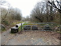
Blocked entrance
by Philip Halling geograph for square SO5911 A block former entrance, possibly to a former quarry of the B4229 to the east of Coleford.
Tags:
Blocked Road
top:Roads, Road TransportX
|
|
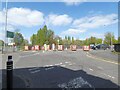
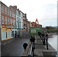
West Quay blocked, Bridgwater
by Jaggery geograph for square ST3037 Viewed in early October 2012. After the collapse of part of the River Parrett... (more)
|
|
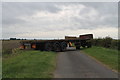
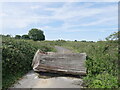
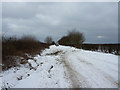
Sykemouth Drove blocked by trailer
by J.Hannan-Briggs geograph for square TF2442 No idea why the road was purposely blocked.
|
|
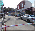
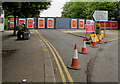
Blocked part of Stow Hill, Newport
by Jaggery for square ST3188 Viewed on March 14th 2020. This part of Stow Hill, south of School Lane, is... (more)
|
|
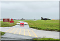
Blocked roadway at RAF Valley
by Trevor Littlewood geograph for square SH3076 A road junction at the north-western end of the air base with an exit blocked...... (more)
Tags:
AircraftX
AirfieldX
subject:AirfieldX
Blocked Road
top:Boundary, BarrierX
top:Defence, MilitaryX
top:Flat LandscapesX
type:GeographX
top:Roads, Road TransportX
|
|
Closed road to Moorgate
by David Smith geograph for square SX0966 This road now leads to Moorgate only. Formerly it led to join the A38, but the... (more)
Tags:
Blocked Road
top:Roads, Road TransportX
|
|
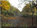
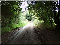
Blocked loop road
by David Pashley geograph for square TG3324 Part of old Yarmouth Road
Tags:
Blocked Road
top:Farm, Fishery, Market GardeningX
type:GeographX
top:LowlandsX
subject:RoadX
top:Roads, Road TransportX
top:Village, Rural SettlementX
|
|
Gone for a walk?
by Adrian Taylor for square NY2725 The single track access road to Latrigg Car Park was obstructed by this... (more)
|
|
Snitterton Road
by Bill Boaden geograph for square SK2960 This road has been blocked off to prevent it being used as a rat run into the... (more)
Tags:
Blocked Road
Dry Stone WallX
type:GeographX
top:LowlandsX
top:Roads, Road TransportX
top:Suburb, Urban FringeX
|
|
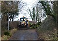
Sandy Lane blocked by fallen tree
by David Smith geograph for square ST6505 Workmen on the scene to clear the road after a windy, wet night brought a tree... (more)
Tags:
Blocked Road
Fallen Tree RemovalX
type:GeographX
top:Roads, Road TransportX
subject:TreeX
top:Woodland, ForestX
|
|
Blocked eastern end of Great Western Crescent, Llanelli
by Jaggery geograph for square SS5099 Viewed from the corner of Station Road in November 2019.
An August 2018 Google... (more)
|
|
Blocked part of Overton Road, Bristol
by Jaggery geograph for square ST5874 The northwest end of Overton Road viewed from the corner of Gloucester Road on... (more)
|
|
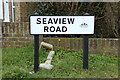
Seaview Road sign
by Geographer for square TQ3405 On Seaview Road at the junction with Downland Road
Tags:
Blocked Road
in:Brighton And HoveX
type:Close LookX
Downland RoadX
No Through RoadX
Road BlockedX
Road JunctionX
Road Name SignX
top:Roads, Road TransportX
on:Seaview RoadX
subject:SignX
top:Village, Rural SettlementX
at:WoodingdeanX
|
|
Road blocked, Donaghanie Road, Edenderry
by Kenneth Allen geograph for square H4969 You can't proceed any further here
|
|
Blocked southeast end of Newton Nottage Road, Porthcawl
by Jaggery geograph for square SS8377 Viewed from the corner of Pine Close.
|
|
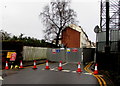
Blocked-off Bridge Street, Newport
by Jaggery geograph for square ST3088 Viewed on July 16th 2016. Behind the barrier, the Edwardian railway bridge... (more)
|

|
Blocked western end of Livingstone Place, Maindee, Newport
by Jaggery geograph for square ST3288 Viewed in June 2016. A 1960 Newport street map shows that this end
of... (more)
|
|
Wandle Road, blocked
by Alex McGregor geograph for square TQ3065 |
|
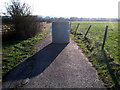
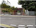
No access to Station Road
by Gerald England geograph for square SJ9694 Since the building of Kerry Way, access to Godley Hill from Station Road under... (more)
Tags:
Blocked Road
subject:BridgeX
place:Godley HillX
Railway BridgeX
top:RailwaysX
top:Roads, Road TransportX
|
|
Blocked-off eastern end of Ruperra Street, Newport
by Jaggery geograph for square ST3187 Viewed from Lower Dock Street. Newport Masonic Hall... (more)
Tags:
Blocked Road
top:Roads, Road TransportX
|
|
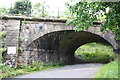
Railway bridge 104 (CGJ7 30m 67¾ ch) Low Borrowbridge
by Roger Templeman geograph for square NY6001 The bridge carries the West Coast Main Line over a road blocked by the M6... (more)
Tags:
Blocked Road
Ordnance SurveyX
bridge:Railway Over RoadX
top:RailwaysX
top:Roads, Road TransportX
WCMLX
|
|
Blocked eastern end of Castle Street, Bridgwater
by Jaggery geograph for square ST2937 This early October 2012 view along Castle Street shows that there was no... (more)
Tags:
Blocked Road
top:Roads, Road TransportX
|
|
Whalebone Lane
by Richard Croft geograph for square SK9433 Whalebone Lane closed by drifting snow and stranded vehicles ... meanwhile,... (more)
|
|
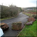
Boulders block access to Perrygrove Road, Coleford
by Jaggery geograph for square SO5709 Though it would be apt if this were Rock Lane (which is nearby), this is the... (more)
|
|
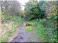
Fly-tippers route, Old Lane
by Humphrey Bolton geograph for square SE2329 Old Lane is a public road, part of the pre-turnpike route, as shown on... (more)
|
|
Blocked road near St Margaret's church
by Penny Mayes geograph for square SP0495 I had hoped to walk down this road a bit as there is a large ruined building on... (more)
Tags:
Blocked Road
top:Suburb, Urban FringeX
|
|
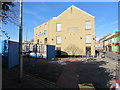
Waiting for business
by Christine Johnstone geograph for square SE4412 Development land east of the new road, north of South Kirkby.
|
|
Minor road above Merthyr Tydfil
by Robin Drayton geograph for square SO0705 The old road which led to a narrow bridge has been blocked off and a new section created.
|
|
Road blocked!
by Russel Wills geograph for square NU2412 With 98 MPH winds recorded on Brizlee Wood a number of trees have and branches... (more)
Tags:
Blocked Road
Fallen TreeX
type:GeographX
top:LowlandsX
top:Roads, Road TransportX
top:Woodland, ForestX
subject:WreckageX
|