Public Tags
Tag: Brown·Sign
Showing latest 50 of 325 images tagged with Brown Sign tag.

|
Brown direction signs, Blenheim Road, Minehead
by Jaggery geograph for square SS9746 Three brown directions signs are on a lamppost at the eastern end of Blenheim... (more)
|

|
Brown direction sign, Crawfordsburn
by Albert Bridge for square J4681 A brown direction sign, on the Bridge Road South, at the entrance to... (more)
|

|
Junction of lane and A529 at Browns Bank
by Christopher Hilton geograph for square SJ6443 |

|
Dartmouth Middleway (A4540)
by David Dixon geograph for square SP0788 Dartmouth Middleway, near Birmingham city centre. The brown sign on the right... (more)
Tags:
road:A4540
Advance Direction Sign
Advertising Hoarding
Art Galleries
Aston Hall
Botanical Gardens
Brown Sign
Canals
Cathedrals
top:City, Town Centre
Dual Carriageway
Jewellery Quarter
Museums
National Sea Life Centre
Primary Road
top:Roads, Road Transport
Theatres
Tourist Route
Tourist Route Sign
Tourist Sign
Villa Park
|

|
Priskilly Forest Golf Course direction sign, Letterston
by Jaggery geograph for square SM9429 The brown sign alongside the A40 shows that Golf Course is Cwrs Golff in Welsh.
Tags:
road:A40
Brown Direction Sign
Brown Sign
type:Geograph
Golf Course Direction Sign
top:Roads, Road Transport
top:Village, Rural Settlement
|

|
Bilingual brown direction sign, Rumney, Cardiff
by Jaggery geograph for square ST2179 The brown sign facing Newport Road near the corner of Claremont Avenue
shows... (more)
Tags:
road:B4487
Bilingual Sign
Brown Sign
Direction Sign
English/Welsh
type:Geograph
top:Roads, Road Transport
top:Suburb, Urban Fringe
|
|
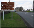
Brown directions sign at the edge of Nottage
by Jaggery geograph for square SS8278 Facing westbound traffic on the approach to Nottage.
Brown signs show places... (more)
|
|
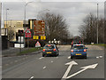
Birmingham, Ashted Circus
by David Dixon geograph for square SP0887 Approaching Ashted Circus via the A4540, Lawley Middleway. Notice the different... (more)
|

|
Wordless brown directions sign alongside Brecon Road, Abergavenny
by Jaggery geograph for square SO2914 Symbolic sign facing eastbound traffic on the A40 Brecon Road. Ahead for the... (more)
|

|
Brown signs, High Street, Caerleon
by Jaggery geograph for square ST3390 Above a cycle route crossing warning sign, brown signs show the way to the Roman... (more)
|

|
Brown direction sign at the edge of the canal, Pontywaun
by Jaggery geograph for square ST2193 Pointing towards Cwmcarn Forest Drive. Link
Tags:
Brown Road Sign
Brown Sign
top:Canals
Direction Sign
type:Geograph
top:Roads, Road Transport
top:Village, Rural Settlement
|

|
Brown signs facing Wilder Road Ilfracombe
by Jaggery geograph for square SS5147 Brown signs show places of tourist or leisure interest.
|

|
Brown sign, Strath Halladale
by Richard Webb for square NC8963 This could soon be replaced as the marketing men have got stuck in. The roads... (more)
Tags:
Brown Sign
top:Roads, Road Transport
|

|
Welsh National Woollen Museum direction and distance sign in Adpar, Ceredigion
by Jaggery for square SN3040 Alongside the B4571 on the approach to Newcastle Emlyn and Carmarthenshire,
the... (more)
|

|
Brown direction and distances sign, Trow, Devon
by Jaggery geograph for square SY1589 Facing westbound traffic on the A3052, the brown sign points towards this... (more)
|

|
A338 Approaching Blackwater Junction
by David Dixon geograph for square SZ1395 |

|
Exit for Woolsthorpe Manor
by David Dixon geograph for square SK9225 |
|
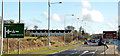
Direction signs near Bangor
by Albert Bridge geograph for square J4780 Two directions sign on the Belfast Road. The one on the left shows the route to... (more)
|

|
Westbound A66 at the turning for Flusco
by David Dixon geograph for square NY4528 The direction sign at the side is "patched". Its background colour is... (more)
|

|
Sign for visitors to Wye Valley by M5
by David Smith geograph for square ST4874 The brown sign advises motorists about the route to the Wye Valley and Forest of... (more)
|

|
Kingskerswell Road
by Derek Harper for square SX8966 Kingskerswell Road is the lane leading uphill between blackthorn in blossom,... (more)
|
|
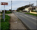
Wordless brown direction sign, West Road, Nottage, Porthcawl
by Jaggery geograph for square SS8178 The sign shows symbols for a golf course, wildfowl and historic buildings.
Tags:
Brown Sign
Direction Sign
type:Geograph
top:Roads, Road Transport
top:Suburb, Urban Fringe
Symbolic Sign
|

|
B6403, High Dike near Colsterworth
by David Dixon geograph for square SK9325 Tags:
road:B6403
Brown Patch
Brown Sign
Direction Sign
camera:Nikon P100
Patched Sign
top:Roads, Road Transport
Tourist Sign
White Sign
|

|
Brown direction signs, Langstone
by Jaggery geograph for square ST3689 Signs alongside the A48 Chepstow Road show the way to Coldra Court Hotel
and to... (more)
|

|
Wetlands Reserve direction sign, Goldcliff
by Jaggery geograph for square ST3783 Showing "Wetlands reserve 3" (miles) and "follow (duck... (more)
Tags:
Brown Sign
Direction and Distance Sign
type:Geograph
top:Roads, Road Transport
top:Village, Rural Settlement
|

|
Signs by Rush Hill
by Derek Harper for square ST6255 Leaning against a large brown sign for Farrington Golf and Country Club is a... (more)
Tags:
Brown Sign
type:Close Look
top:Paths
Public Footpath Signpost
top:Roads, Road Transport
Woodland
top:Woodland, Forest
|

|
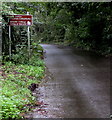
Happy Jakes direction sign, St Athan Road, Eglwys Brewis, Vale of Glamorgan
by Jaggery geograph for square ST0169 Brown sign for Happy Jakes Touring Park in Flemingston, Vale of Glamorgan,... (more)
Tags:
Brown Sign
Direction Sign
type:Geograph
top:Roads, Road Transport
top:Village, Rural Settlement
|
|
Bilingual brown sign alongside Dimlands Road, St Donats
by Jaggery geograph for square SS9468 The sign shows Arts Centre and Atlantic College and their Welsh equivalents.
Tags:
Bilingual Sign
Brown Sign
English/Welsh
type:Geograph
top:Roads, Road Transport
top:Village, Rural Settlement
|

|
McLaren Miners Memorial direction sign, Abertysswg
by Jaggery geograph for square SO1305 On the corner of The Green and Charles Street, the brown sign points towards... (more)
Tags:
Brown Sign
Direction Sign
type:Geograph
top:Roads, Road Transport
top:Village, Rural Settlement
|

|
National Park Visitor Centre direction sign, Libanus, Powys
by Jaggery geograph for square SN9925 The English/Welsh brown sign is alongside the A470 in the Brecon Beacons National Park.
Tags:
national park:Brecon Beacons
Brown Sign
Direction Sign
English/Welsh
type:Geograph
top:Roads, Road Transport
top:Village, Rural Settlement
|

|
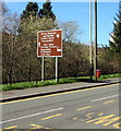
Mining Memorial & Garden direction sign, Senghenydd
by Jaggery geograph for square ST1191 The wordless brown sign points left towards the entrance to the Mining Memorial... (more)
Tags:
Brown Sign
Direction Sign
type:Geograph
top:Roads, Road Transport
top:Village, Rural Settlement
|
|
Brown direction sign alongside High Street, Abertridwr
by Jaggery geograph for square ST1289 Ahead for the Mining Memorial & Garden and the Aber Valley Heritage Museum.... (more)
|
|
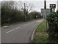
Golf course direction sign in Marshfield
by Jaggery geograph for square ST2681 The brown sign is alongside Marshfield Road, the main road through the village.
Tags:
Brown Sign
type:Geograph
Golf Course Direction Sign
top:Roads, Road Transport
top:Village, Rural Settlement
|
|
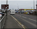
Brown sign 4 miles from Parc y Scarlets, Llanelli
by Jaggery geograph for square SN4900 The sign facing eastbound traffic on the A484 Sandy Road is 4 miles (c6.5km)... (more)
Tags:
A484
road:A484
Brown Sign
Distance Sign
type:Geograph
top:Roads, Road Transport
top:Suburb, Urban Fringe
|

|
Kenfig Nature Reserve direction sign, Porthcawl
by Jaggery geograph for square SS8277 The brown sign faces westbound traffic on the A4106 Newton Nottage Road.
Tags:
road:A4106
Brown Sign
Direction Sign
type:Geograph
top:Roads, Road Transport
top:Suburb, Urban Fringe
|

|
Large brown sign alongside Leamington Road near Broadway
by Jaggery geograph for square SP0938 Museums direction sign alongside the B4632 Leamington Road on the approach to... (more)
Tags:
road:B4632
Brown Sign
type:Geograph
Large Road Sign
top:Roads, Road Transport
top:Village, Rural Settlement
|

|
Red Kite Feeding Signs on the A470 at Rhayader
by David Dixon geograph for square SN9767 The red kite is Wales' most popular bird... (more)
Tags:
road:A470
Brown Signs
type:Geograph
camera:Nikon P100
top:Roads, Road Transport
top:Suburb, Urban Fringe
Tourist Route Signs
|

|
The attractions of Ipswich (brown tourist sign)
by David Smith geograph for square TM2446 Beside the tourist information centre, there are: Christchurch Mansion, Museums... (more)
Tags:
Brown Sign
top:Business, Retail, Services
top:Roads, Road Transport
subject:Sign
top:Sport, Leisure
|

|
Manston, Hengist Way
by David Dixon geograph for square TR3564 |
|
Two brown signs on a bank alongside the A484 Tanerdy, Carmarthen
by Jaggery geograph for square SN4221 Left ahead for steam railway (rheilffordd ager in Welsh) 2 miles away.
Right... (more)
|

|
Westbound M7, Welcome to County Offaly
by David Dixon geograph for square S0783 Brown sign advising than we are about to cross from County Tipperary into County Offaly.
Tags:
Brown Sign
County Boundary Sign
type:Geograph
motorway:M7
Motorway
camera:Panasonic DMC-G7
top:Roads, Road Transport
|

|
Valley choice near a Daleside flowerbed, Bryncethin
by Jaggery geograph for square SS9183 The brown sign alongside the A4061 Bridgend Road shows left
ahead for the Garw... (more)
Tags:
Brown Sign
Directions Sign
Flowerbed
type:Geograph
top:Roads, Road Transport
top:Village, Rural Settlement
|
|
Brown directions sign, Dan Lan Road, Pembrey
by Jaggery geograph for square SN4201 The sign in Welsh and English showing the way to sports and recreation
venues... (more)
Tags:
A484
road:A484
Bilingual
Brown Sign
type:Geograph
top:Roads, Road Transport
top:Village, Rural Settlement
Welsh/English
|

|
Picnic area this way near Sugar Loaf
by Jaggery geograph for square SN8342 The white arrow on a brown sign alongside the A483 points left towards this... (more)
|

|
Mace shop, Sirhowy Bridge, Tredegar
by Jaggery geograph for square SO1409 Part of a Gulf fuel filling station located near the roundabout at the A4047 and... (more)
|

|
This way to Christchurch, Newport
by Jaggery geograph for square ST3089 The brown sign alongside Malpas Road points left towards the Christchurch... (more)
|
|
Kenfig Nature Reserve this way, North Cornelly
by Jaggery geograph for square SS8181 The brown sign is on the west side of the B4283 Porthcawl Road, facing the... (more)
Tags:
Brown Sign
Direction Sign
type:Geograph
top:Roads, Road Transport
top:Village, Rural Settlement
|

|
Brown directions sign facing the A48 near Cleppa Park, Newport
by Jaggery geograph for square ST2885 Alongside the southbound carriageway of the A48. Turn left at the crossroads... (more)
Tags:
road:A48
Brown Sign
Directions Sign
type:Geograph
top:Roads, Road Transport
top:Suburb, Urban Fringe
|

|
Brown destinations sign on the approach to the Old Green Interchange, Newport
by Jaggery geograph for square ST3188 Facing the B4591 in the Crindau area of Newport.
The car is near the ruins of... (more)
|

|
Brown directions sign, Cambridge Road, Bournemouth
by Jaggery geograph for square SZ0791 Facing the B3066 Cambridge Road on the approach to St Michael's Roundabout... (more)
|
