
|
Seaside shelter, Fort Crescent, Margate
by Christopher Hilton
geograph for square TR3571
|

|
Clifftop shelter, Southbourne, Bournemouth
by Malc McDonald
geograph for square SZ1391
A shelter on the clifftop at Southbourne, to the east of Bournemouth. Visible... (more)
|

|
Shelter on the clifftop, Barton-on-Sea, near New Milton
by Malc McDonald
geograph for square SZ2392
A wooden shelter on the clifftop at Barton-on-Sea, on the Hampshire coast.
|

|
Shelter on the seafront, Milford-on-Sea, near Lymington
by Malc McDonald
geograph for square SZ2991
A shelter on the seafront at Milford-on-Sea, on the Hampshire coast.
|

|
Shelter on the seafront, Milford-on-Sea, near Lymington
by Malc McDonald
geograph for square SZ2991
A shelter on the seafront at Milford-on-Sea, on the Hampshire coast.
This... (more)
|

|
Air Raid Shelter, Donaghadee
by Rossographer
for square J5978
WW2 air raid shelter on the corner of the Ballyvester and Millisle roads on the... (more)
|

|
Former cabman's shelter, Kensington Road
by A J Paxton
geograph for square TQ2679
Dating from 1888, this is one of the earliest of the shelters erected by the... (more)
|

|
Seafront shelter, Walton-on-the-Naze
by Christopher Hilton
geograph for square TM2521
|

|
Shelter in Pitshanger Park, near Ealing
by Malc McDonald
geograph for square TQ1682
A wooden shelter in Pitshanger Park, in the suburbs of west London.
|

|
Shelter on Boscombe overcliff
by Malc McDonald
geograph for square SZ1291
A coastal shelter on the overcliff at Boscombe, near Bournemouth.
|

|
Seaside shelter, Marine Drive, Margate
by Christopher Hilton
geograph for square TR3570
On the other side of Marine Drive, off the left edge of the photograph, is the... (more)
|

|
Seaside shelter, Marine Drive, Margate
by Christopher Hilton
geograph for square TR3570
On the other side of Marine Drive, off the right edge of the photograph, is the... (more)
|

|
Gardens on the seafront, St. Anne's-on-the-Sea
by Malc McDonald
geograph for square SD3128
A shelter in the gardens on the seafront at St. Anne's-on-the-Sea, on the... (more)
|

|
The Mourne Wall, Slieve Commedagh
by Rossographer
geograph for square J3428
As the Mourne Wall reaches the top of Slieve Commedagh it is broken by this... (more)
|

|
Derelict Shelter, Princes Park
by PAUL FARMER
geograph for square TQ6200
|

|
Sheltered seating area by Flanagan Lawrence, Littlehampton
by PAUL FARMER
geograph for square TQ0301
|

|
The Mourne Wall, Slieve Donard
by Rossographer
geograph for square J3527
The summit of Slieve Donard on a clear bright morning with the rest of the high... (more)
|

|
Shelter on Bexhill seafront
by Malc McDonald
geograph for square TQ7306
A shelter on the promenade at Bexhill-on-Sea
|

|
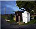
Promenade shelter, Barry Island
by Jaggery
geograph for square ST1166
This is the eastern end of a 60 metre long shelter.
|
|
Shelter, Orlock
by Rossographer
geograph for square J5583
A small shelter on the corner of Orlock Road and Coastguard Lane. It appears to... (more)
|

|
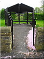
Cyclists' Rest, Starr Gate, Blackpool
by Malc McDonald
geograph for square SD3031
Cyclists' Rest stands at the southern end of Blackpool's seafront.... (more)
|
|
Curious shelter?
by John M
geograph for square SD7341
More like a lock up than a shelter. All it needs is a set of gates and a... (more)
|

|
Brookwood Military Cemetery - RAF Shelter
by Colin Smith
for square SU9556
Brookwood Military Cemetery, owned by the Commonwealth War Graves Commission, is... (more)
|

|
Josephine's Patio (3), Fowey
by Marika Reinholds
for square SX1252
An information board called 'The History of Fowey in Eight Ships' is... (more)
|

|
Lookout post, St John's Point
by Rossographer
geograph for square G7069
Lookout or coastguard shelter at St John's Point, Donegal. I didn't... (more)
|

|
Staircase and shelter, Margate
by Christopher Hilton
geograph for square TR3570
This staircase leads down from Albert Terrace to Marine Drive and the promenade;... (more)
|

|
Shelter, Lough Shannagh
by Rossographer
geograph for square J2926
An unusual man-made shelter in the Mournes by Lough Shannagh. A well known... (more)
|

|
Promenade Shelter
by John M
geograph for square NS0864
|

|
The ruins of a shelter
by Richard Law
geograph for square SJ0737
Tumbledown shelter on the trackside.
|

|
Ruined shelter on the flank of White Hill
by Richard Law
geograph for square NO3675
Too big for a conventional shieling, this looks more like the ruins of a... (more)
|

|
Looking towards the B4211 in Guarlford
by Mike Dodman
geograph for square SO8145
With what I presume is a rather dilapidated bus shelter (though I couldn't... (more)
|

|
Cliff top path and shelter, Bournemouth
by Malc McDonald
geograph for square SZ0890
A path on the cliff top at West Cliff, Bournemouth.
|

|
Shelter, by Rivoulich
by Craig Wallace
geograph for square NH5233
A small stone shelter, next to the mountain bike trails.
|
|
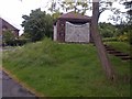
Wooden Shelter
by Mick Garratt
geograph for square SK5118
At the junction of Nanpantan Road and Valley Road.
|
|
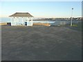
Shelter on Ledge Point overlooking St Mildred's Bay
by John Baker
geograph for square TR3270
On the horizon, the tower block called Arlington House in Margate is visible.
|

|
Shelter near to Kersall just off A616
by Steve Fareham
geograph for square SK7162
|

|
Looking north from the Mushroom Shelter on Scout Scar
by Karl and Ali
geograph for square SD4891
Although the shelter gives a more extensive view to the east the better (and... (more)
|

|
The Mushroom Shelter on Scout Scar
by Karl and Ali
geograph for square SD4891
There is a frieze of the view running around the inside rim of the roof - I used... (more)
|

|
Memorial shelter on moor above Scout Scar
by Roger Templeman
geograph for square SD4891
|

|
Shelter
by Bill Harrison
geograph for square NJ8911
This probably predates the new houses surrounding it by a long time...
|

|
Shelter at sea front, Bexhill-on-Sea
by PAUL FARMER
geograph for square TQ7407
|

|
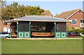
Ferry shelter. Lifeboat Lane, Teignmouth
by Robin Stott
geograph for square SX9372
Passengers for the Teign ferry may wait here in inclement weather. The blue and... (more)
|
|
Shelter on Government Acre
by Steve Daniels
geograph for square TR3764
|

|
Shelter, Village Green, Ide Hill
by N Chadwick
geograph for square TQ4851
|

|
Canal worker's shelter [disused], Shropshire Union canal
by Christine Johnstone
geograph for square SJ7825
In Grub Street cutting.
|

|
Puffin mural
by Richard Sutcliffe
for square NO5402
On the end wall of a shelter beside the Fife Coastal Path.
|

|
Puffin mural, Pittenweem
by Jim Barton
geograph for square NO5402
Decorating a wall of the seaside shelter on the clifftop path west of the village.
|

|
Inscription in Shelter at Milton
by Billy McCrorie
for square NS3705
Built in memory of Jean Galloway Hunter Blair 1890-1953.
|

|
Crest in Shelter at Milton
by Billy McCrorie
for square NS3705
Above the door on the inside.
|

|
Inscription in Shelter at Milton
by Billy McCrorie
for square NS3705
Built in memory of Jean Galloway Hunter Blair 1890-1953.
|
