
|
Bancroft Basin, Stratford-Upon-Avon Canal
by David Dixon
geograph for square SP2054
Bancroft Basin is where The Stratford-upon-Avon Canal joins the River Avon at... (more)
|

|
Stratford upon Avon Canal - Entering Lock 43 under Bridge 61
by Rob Farrow
geograph for square SP1757
Lock No.43 on the Stratford upon Avon Canal is immediately after this split... (more)
|

|
Edstone Aqueduct on the Stratford upon Avon Canal
by Rob Farrow
geograph for square SP1660
Looking northwards along the Edstone Aqueduct on the Stratford upon Avon Canal.... (more)
|

|
Warwick Road Bridge, Stratford-Upon-Avon Canal
by David Dixon
geograph for square SP1765
Bridge#47A carries Warwick Road (A4189) over the Stratford-Upon-Avon Canal at... (more)
|

|
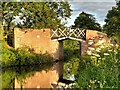
Stratford-Upon-Avon Canal, Bridge#49
by David Dixon
geograph for square SP1764
Bridge number 49, to the south of Preston Bagot, is a split bridge. This is a... (more)
|
|
Bridge#49, Stratford-Upon-Avon Canal
by David Dixon
geograph for square SP1764
Bridge number 49, to the south of Preston Bagot, is a split bridge. This is a... (more)
|

|
Narrowboat, Stratford-Upon-Avon Canal
by David Dixon
geograph for square SP1765
A narrowboat moored on the Stratford-Upon-Avon Canal at Preston Bagot.
|

|
Stratford-Upon-Avon Canal, Bridge#48
by David Dixon
geograph for square SP1765
Bridge number 48 at Preston Bagot is a split bridge. This is a design typical of... (more)
|

|
Junction of Stratford-upon-Avon canal and River Avon
by Rod Grealish
geograph for square SP2054
The Stratford-upon-Avon Canal flows under the footbridge to join the River Avon.... (more)
|

|
Canal junction near King's Norton
by Philip Halling
geograph for square SP0579
Junction of the Worcester and Birmingham Canal with the Stratford-upon-Avon... (more)
|

|
Tourist Barge in Lock 56, Stratford-upon-Avon Canal
by Rod Grealish
geograph for square SP2054
The barge is waiting in Lock 56 for transfer from the Stratford-upon-Avon Canal... (more)
|

|
Bridge #48, Stratford-Upon-Avon Canal
by David Dixon
geograph for square SP1765
Bridge number 48 is a split bridge, a design typical of the Stratford Canal. The... (more)
|

|
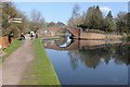
Stratford-Upon Avon Canal, Bridge#53 at Wootton Wawen
by David Dixon
geograph for square SP1663
Bridge number 53 carries the track to Lucy's Farm. It is a split bridge, a... (more)
|
|
Junction of two canals
by Philip Halling
geograph for square SP0579
The junction of the Worcester and Birmingham Canal and the Stratford-upon-Avon... (more)
|
|
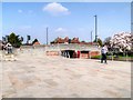
Stratford-Upon-Avon, Bridge#69 (Entrance to Bancroft Basin)
by David Dixon
geograph for square SP2054
|

|
Stratford-Upon-Avon Canal, Bridge#47 at Preston Bagot
by David Dixon
geograph for square SP1765
|

|
Narrowboats on the Stratford-Upon-Avon Canal
by David Dixon
geograph for square SP1765
Narrowboats moored near Preston Bagot.
|

|
Stratford-Upon-Avon Canal
by David Dixon
geograph for square SP1764
|

|
Stratford-Upon-Avon Canal, South of Preston Bagot
by David Dixon
geograph for square SP1764
|

|
Bridge#47 over the Stratford-Upon-Avon Canal at Preston Bagot
by David Dixon
geograph for square SP1765
|

|
Stratford-Upon-Avon Canal, Preston Bagot Bottom Lock (#38)
by David Dixon
geograph for square SP1765
|

|
Wootton Wawen Aqueduct
by David Dixon
geograph for square SP1562
Wootton Wawen Aqueduct is one of three aqueducts on a 6 km length of the... (more)
|

|
Warning Notice
by David Dixon
for square SP1663
A weight limit warning notice next to Bridge#53 on the Stratford-Upon-Avon Canal.
|

|
Stratford-Upon-Avon Canal, Wootton Wawen
by David Dixon
geograph for square SP1563
The wharf near Wootton Wawen Aqueduct.
|

|
Wootton Wawen Aqueduct
by David Dixon
geograph for square SP1562
Wootton Wawen Aqueduct is one of three aqueducts on a 6 km length of the... (more)
|

|
Stratford-upon-Avon - Canal Basin
by Colin Smith
geograph for square SP2054
The basin in Stratford is the southern end of the canal which connects with the... (more)
|

|
Stratford-upon-Avon Canal
by Colin Smith
geograph for square SP2054
The basin in Stratford is the southern end of the canal which connects with the... (more)
|

|
Floating Ice-Cream Shop, Bancroft Basin
by David Dixon
geograph for square SP2054
Narrowboat selling ice cream to tourists at Bancroft Basin.
|

|
Preston Bagot Bottom Lock (#38) and Bridge#47
by David Dixon
geograph for square SP1765
|

|
Stratford-Upon-Avon, Bancroft Basin
by David Dixon
geograph for square SP2054
The Stratford-upon-Avon Canal joins the River Avon at the Bancroft Basin in... (more)
|

|
Stratford-upon-Avon - Canal Lock
by Colin Smith
geograph for square SP2054
The pleasure boat "Jennifer May" leaving the basin at the start of the... (more)
|
|
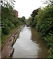
Canal east of Birmingham Road, Stratford-upon-Avon
by Jaggery
geograph for square SP1955
Looking along the Stratford-upon-Avon Canal towards Clopton Road bridge.
|

|
Canal basin, Stratford-upon-Avon
by Christopher Hilton
geograph for square SP2054
|

|
Bancroft Basin
by David Dixon
geograph for square SP2054
The Stratford-upon-Avon Canal joins the River Avon at the Bancroft Basin in... (more)
|

|
Lock and Bancroft Basin
by David Dixon
geograph for square SP2054
This lock (Wide Lock 56 which is a double lock... (more)
|

|
Bridgefoot canal bridge inscription 1994
by Robin Stott
for square SP2054
Bridgefoot crosses the Stratford-upon-Avon canal where it leaves the canal basin... (more)
|

|
Footbridge by the lock
by Robin Stott
geograph for square SP2054
Part of the remodelling of the Bancroft Gardens (re-opened spring 2009) included... (more)
|

|
Stratford-upon-Avon Canal
by Jaggery
geograph for square SP1955
Looking west from near Birmingham Road. A Premier Inn... (more)
|

|
Narrowboat in a lock on the Stratford-upon-Avon Canal
by Jaggery
geograph for square SP1955
Viewed from the A3400 Birmingham Road.
|
|
Weight restriction sign, Bridgefoot, 1874
by Robin Stott
for square SP2054
The Bridgefoot canal bridge crosses the Stratford-upon-Avon Canal where it... (more)
|

|
Stratford-upon-Avon - Canal Traffic
by Colin Smith
geograph for square SP2055
Narrowboat "Chaffinch" moored by the towpath above the canal basin.
|

|
Waterside View
by Gordon Griffiths
geograph for square SP2054
The Stratford-upon-Avon view of the Bancroft Basin.
|
|
Yarningale aqueduct
by Derek Harper
for square SP1866
The Stratford-upon-Avon Canal crosses the Kingswood Brook on this grade II*... (more)
|

|
Bridge 24 from the east, Stratford-upon-Avon Canal
by Robin Stott
geograph for square SP1472
The east parapet of the bridge appears to have been damaged and partly repaired.... (more)
|

|
Junction of Stratford Road and Pennyford Lane
by Robin Stott
geograph for square SP1563
On the left an aqueduct carries the Stratford-upon-Avon Canal over Stratford... (more)
|

|
Approaching a winding hole, Stratford upon Avon Canal
by Christine Johnstone
geograph for square SP1659
Where someone is turning their boat. A winding hole is usually a small bay in a... (more)
|

|
Bridge No 28, raised and open for a narrowboat
by Christine Johnstone
geograph for square SP1671
The bridge takes the Millennium Way and the access track to Drawbridge Farm... (more)
|

|
Bridge 26, Stratford upon Avon Canal
by Christine Johnstone
geograph for square SP1572
Open for the photographer's boat, which has just passed through. These lift... (more)
|

|
Moorings on a canal feeder, Lady lane Wharf
by Christine Johnstone
geograph for square SP1175
This channel feeds water into the Stratford upon Avon Canal from the canal... (more)
|

|
Towpath bridge, Hockley Heath
by Christine Johnstone
geograph for square SP1572
Carrying the towpath of the Stratford upon Avon canal over a disused arm which... (more)
|
