|
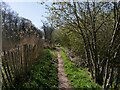
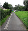
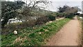
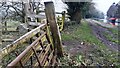
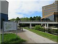
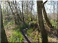
Blocked canalside path, Pontywaun
by Jaggery
geograph for square ST2292
In December 2016, temporary fencing blocks access to the canalside path under... (more)
|
|
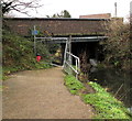
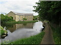
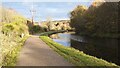
Huddersfield Broad Canal, Huddersfield
by Malc McDonald
geograph for square SE1417
The Huddersfield Broad Canal close to the centre of Huddersfield.
|
|
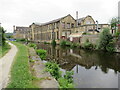
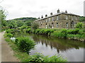
Sandhill Cottages, near Marsden
by Malc McDonald
geograph for square SE0512
Sandhill Cottages are a terrace of cottages on the bank of the Huddersfield... (more)
|
|
Looking NW along Leeds & Liverpool Canal at Farnhill
by Roger Templeman
geograph for square SE0046
|
|
Looking north along the Leeds and Liverpool Canal at a point 26¼ miles from Leeds
by Roger Templeman
geograph for square SD9947
|
|
Huddersfield Narrow Canal, Huddersfield
by Malc McDonald
geograph for square SE1115
A view eastwards along the Huddersfield Narrow Canal as it heads into... (more)
|
|
Huddersfield Narrow Canal, Huddersfield
by Malc McDonald
geograph for square SE1115
Modern apartments on the bank of the Huddersfield Narrow Canal on the outskirts... (more)
|
|
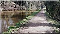
North on Canalside Path
by David Pashley
for square TG3327
|
|
South on Canalside Path
by David Pashley
for square TG3326
|
|
South on Canalside Path
by David Pashley
geograph for square TG2931
|
|
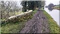
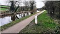
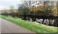
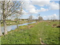
Pound below Lock 17, Monmouthshire & Brecon Canal
by M J Roscoe
geograph for square ST2888
Viewed from the bund below the restored lock. The track on the left is part of... (more)
|
|
Canalside path
by David Pashley
geograph for square TG2931
|
|
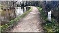
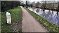
Canalside path, Five Locks Moorings, Cwmbran
by Jaggery
geograph for square ST2897
This part of the Monmouthshire and Brecon Canal is near Five Locks Close.... (more)
|
|
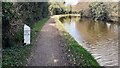
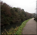
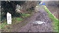
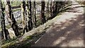
Canalside path in Pontywaun
by Jaggery
geograph for square ST2193
Combined footpath and cycle route alongside the disused
Crumlin Arm of the... (more)
|
|
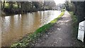
Monmouthshire & Brecon Canal (Crumlin Arm) at Ruskin Avenue
by M J Roscoe
geograph for square ST2788
The disused canal and old towpath, now part of the Sirhowy Valley Walk and... (more)
|
|
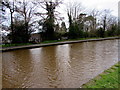
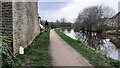
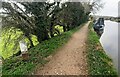
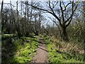
Canalside path, Pontywaun
by Jaggery
geograph for square ST2292
Footpath and cycle route above the disused Crumlin Arm of the Monmouthshire... (more)
|
|
Canalside path towards Commercial Street, Pontnewydd, Cwmbran
by Jaggery
geograph for square ST2996
The disused Monmouthshire & Brecon Canal is below the bank and trees on the right.
|
|
Parapet of bridge for Grange Beck on south side of Leeds & Liverpool Canal
by Luke Shaw
geograph for square SE0145
Grange Beck flows under the canal here on its way to the River Aire. The... (more)
|
|
A bend in the Leeds and Liverpool Canal at Farnhill 102 miles from Liverpool
by Roger Templeman
geograph for square SE0046
|
|
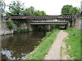
Looking south along the Leeds and Liverpool Canal towards Hamblethorpe Swing Bridge
by Roger Templeman
geograph for square SD9947
|
|
Path beside Leeds & Liverpool Canal heading for Kildwick
by Roger Templeman
geograph for square SE0145
|
|
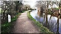
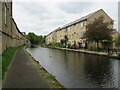
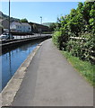
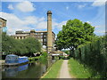
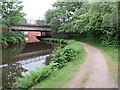
Aspley Basin and Turnbridge Mills, Huddersfield
by Malc McDonald
geograph for square SE1416
The towpath alongside Aspley Basin, on the Huddersfield Broad Canal.
In the... (more)
|
|
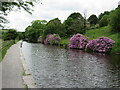
Rhododendrons on the canalside near Linthwaite
by Malc McDonald
geograph for square SE0914
Rhododendrons in bloom on the bank of the Huddersfield Narrow Canal.
|
|
East on Canalside path
by David Pashley
geograph for square TG2931
|
|
Leeds and Liverpool Canal going north passing house #7
by Roger Templeman
geograph for square SD9850
|
|
Looking north along the Leeds & Liverpool Canal at 27¼ miles from Leeds
by Roger Templeman
geograph for square SD9948
|
|
Leeds & Liverpool Canal heading south at 100 miles from Liverpool
by Roger Templeman
geograph for square SD9948
|
|
Leeds and Liverpool Canal and A629 running NW in parallel 27 Miles from Leeds
by Roger Templeman
geograph for square SD9948
|
|
Looking east along Leeds and Liverpool Canal from a point 100½ miles from Liverpool
by Roger Templeman
geograph for square SD9948
|
|
Liverpool & Leeds Canal heading south approaching Farnhill Wood
by Luke Shaw
geograph for square SE0047
|
|
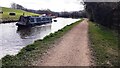
Narrow boat approaching Farnhill Bridge from the south on Leeds & Liverpool Canal
by Luke Shaw
geograph for square SE0046
|
|
Canal maintenance boat approaching Leeds & Liverpool Canal Bridge 188
by Roger Templeman
geograph for square SE0245
|
|
South side of Leeds & Liverpool Canal opposite Grange Lane
by Roger Templeman
geograph for square SE0245
|
|
Leeds and Liverpool Canal towpath and Keighley Road opposite Farnhill Wood
by Roger Templeman
for square SE0047
|
|
Leeds & Liverpool Canal northeast of Shipley
by Roger Templeman
geograph for square SE1638
|
|
New River Path near Enfield
by Malc McDonald
geograph for square TQ3397
The New River Path follows the route of the New River through north London and... (more)
|
|
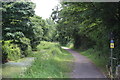
Canal path, Huddersfield
by Malc McDonald
geograph for square SE1416
A path alongside the Huddersfield Narrow Canal passing through the University of... (more)
|
|
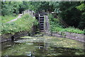
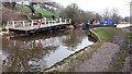
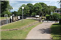
Canal pound, Fourteen Locks Canal Centre
by M J Roscoe
geograph for square ST2788
Pound between locks 21 and 20, just visible on the right. The path alongside the... (more)
|
|
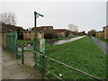
Path beside Leeds and Liverpool Canal at approach to railway bridge
by Luke Shaw
geograph for square SE1538
Beside the path is a post with a sign warning anglers of overhead power lines,... (more)
|
|
Canal path, Huddersfield
by Malc McDonald
geograph for square SE1516
A towpath alongside the Huddersfield Broad Canal.
|
|
Meandering Path
by David Pashley
geograph for square TG3326
|
|
Peaceful Path by Canal
by David Pashley
for square TG3326
|
|
Track by Lock 21 at Cwm Lane
by M J Roscoe
geograph for square ST2788
Combined Sirhowy Valley Walk path and National cycle route 47 at junction with... (more)
|
|
Looking across the Leeds and Liverpool Canal from path on its NW side
by Roger Templeman
geograph for square SE1638
|
|
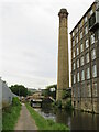
Huddersfield Broad Canal, Huddersfield
by Malc McDonald
geograph for square SE1417
A double-bend on the Huddersfield Broad Canal, taking it beneath a major road... (more)
|
|
Huddersfield Broad Canal, Huddersfield
by Malc McDonald
geograph for square SE1417
The Huddersfield Broad Canal and towpath near Huddersfield town centre. The... (more)
|
|
Huddersfield Broad Canal, Huddersfield
by Malc McDonald
geograph for square SE1416
A view of the Huddersfield Broad Canal near the centre of Huddersfield. To the... (more)
|
|
Path beside Canal
by David Pashley
geograph for square TG3426
|
|
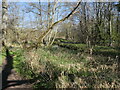
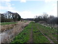
Path beside disused North Walsham& Dilham Canal
by David Pashley
geograph for square TG2931
|
|
Northwest along canal path
by David Pashley
geograph for square TG2930
|