|
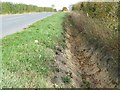
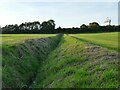
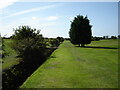
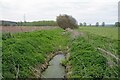
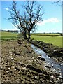
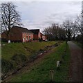
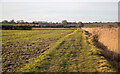
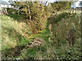
Dyr drainage ditch, Moorhouse Lane
by Christine Johnstone
geograph for square SE4809
Not surprising after a late September heatwave.
|
|
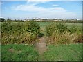
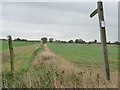
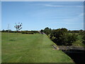
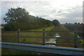
Footbridge over a drain
by Christine Johnstone
geograph for square SE4810
As the footpath to South Elmsall leaves Moorhouse Lane.
|
|
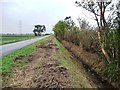
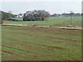
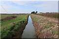
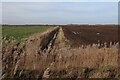
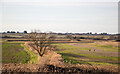
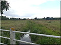
Owston Road Drain, newly cleared
by Christine Johnstone
geograph for square SK7896
Looking south towards West Stockwith.
|
|
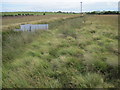
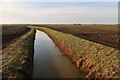
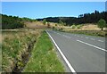
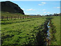
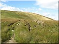
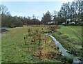
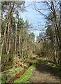
Drainage ditch on Leash Fen
by Chris Wimbush
geograph for square SK2972
Category: Drainage ditch
|
|
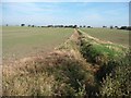
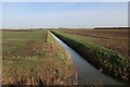
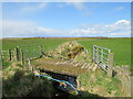
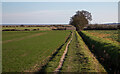
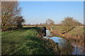
Footpath to the River Trent
by Christine Johnstone
geograph for square SK7895
Running from Owston Road to the northern edge of West Stockwith.
|
|
Fast flowing drainage in Skeeby
by Andy Waddington
geograph for square NZ2002
Category: Drainage ditch
Quite a lot of water flowing through Skeeby despite the fact that it hasn't... (more)
|
|
Drainage dike running across a greening field
by Christine Johnstone
geograph for square SE5111
Seen from Doncaster Lane, with traffic on the A1 in the distance.
|
|
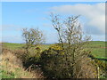
An anonymous drain north of Common Lane
by Christine Johnstone
geograph for square SE4613
Pretty dry after the hottest September days on record.
|
|
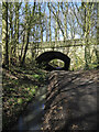
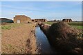
Railway path with drainage ditch and two bridges
by Trevor Littlewood
geograph for square NZ2231
The nearer structure was created apparently as an accommodation bridge for the... (more)
|
|
Footpath from Grunty Fen Road
by Hugh Venables
geograph for square TL5078
|
|
How Fen Drove from New Road
by Hugh Venables
geograph for square TL4186
|
|
Crooked Drain
by Hugh Venables
geograph for square TL4081
|
|
Crooked Drain
by Hugh Venables
geograph for square TL4182
|
|
Fields by Blockmoor Drove
by Hugh Venables
geograph for square TL4281
|
|
Ditch near Blockmoor Farm
by Hugh Venables
geograph for square TL4281
|
|
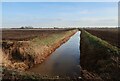
Ditch by Horseley Fen Middle Drove
by Hugh Venables
geograph for square TL3982
The land is at sea level, so needs to be actively drained.
|
|
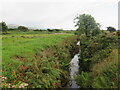
Drainage ditch near Beck Bottom
by Stephen Craven
geograph for square SE2923
This doesn't follow the pattern of field boundaries shown on older maps, so... (more)
|
|
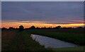
Sundown at Paglesham
by Roger Jones
geograph for square TQ9293
|
|
Drainage ditch near Dyffryn Ardudwy
by Malc McDonald
geograph for square SH5723
A drainage channel close to the coast in north Wales.
|
|
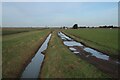
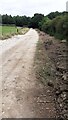
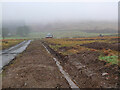
Ditch beside track heading north towards Bottom Plantation from Sproxton Road
by Roger Templeman
geograph for square SK8623
|
|
Looking back along footpath across Withernsea Golf Course
by Martin Dawes
geograph for square TA3426
|
|
Footpath across Withernsea Golf Course
by Martin Dawes
geograph for square TA3326
Houses on Egroms Lane ahead
|
|
The A821
by Richard Sutcliffe
geograph for square NN5102
A well-defined drainage ditch beside the A821, Dukes Pass.
|
|
Drainage ditch near Thurso
by Malc McDonald
geograph for square ND2472
A drainage ditch near Thurso, in the far north of Scotland.
Visible in the... (more)
|
|
Drainage Ditch Near Workhouse Green
by Glyn Baker
geograph for square TL8937
A land drain near the River Stour.
|
|
Drainage ditch near Thurso
by Malc McDonald
geograph for square ND0969
A drainage ditch between fields on the outskirts of Thurso, on the north coast... (more)
|
|
Bridge over drainage ditch
by Richard Sutcliffe
geograph for square NS5656
The edges of the ditch are well-built where two drainage channels meet.
|
|
Bridge over drainage ditch
by Richard Sutcliffe
geograph for square NS5556
The water eventually joins the Auldhouse Burn.
|
|
Drainage ditch
by Richard Sutcliffe
geograph for square NS5679
A drainage ditch between two fields, which has been cleared out over the winter.
|
|
Drainage ditch
by Richard Sutcliffe
geograph for square NS5778
The drainage ditch is at the edge of a field beside Ballagan farm. The fences... (more)
|
|
Groundworks at Corehead
by Jim Barton
geograph for square NT0712
Corehead farm was purchased in 2009 by Borders Forest Trust to demonstrate how... (more)
|
|
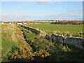
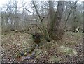
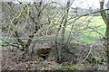
Ditch in the wood
by Robert Graham
geograph for square NZ1853
Drainage ditch in Harperley Wood, near Tanfield Lea.
|
|
Sowe Valley Footpath and drainage ditch, Wood End
by A J Paxton
geograph for square SP3682
To the right of the path, not visible in the photo, runs a small stream, a... (more)
|
|
The Essex Way, Little Oakley
by Roger Jones
geograph for square TM2229
|
|
Track on Scabcleuch Moss
by Adrian Taylor
geograph for square NT2416
The track, bounded by drainage ditches, is part of the Southern Upland Way... (more)
|
|
Roadside drain at Airies
by M J Richardson
geograph for square NW9867
Separating the B738 from grass fields. With Gorse and Hawthorn.
|
|
The Essex Way along Long Bank, Ramsey
by Roger Jones
geograph for square TM2328
This is the Essex Way long distance footpath.
|
|
Looking inland from the sea wall at Little Oakley
by Roger Jones
geograph for square TM2327
|
|
Cloberfield Open Space
by Richard Sutcliffe
geograph for square NS5575
Following heavy rain a couple of days earlier, the Allander Water (left) is high... (more)
|
|
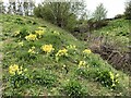
Cowslips on Silverdale Country Park
by Jonathan Hutchins
geograph for square SJ8147
|
|
Drainage ditch
by Richard Sutcliffe
geograph for square NS5573
The drainage ditch joins the Manse Burn about 50m to the east.
|
|
View down a drainage ditch from Great Drove
by Christopher Hilton
for square TL5466
|
|
Drainage ditch seen from road bridge
by David Pashley
geograph for square TG2125
|
|
Path leading up through the woods
by Robert Graham
geograph for square NZ1455
This path through Collierley Wood leads south up the increasingly steep valley... (more)
|
|
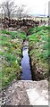
Ditch which flows under wall on west side of Inglewood Road
by Roger Templeman
geograph for square NY5032
|
|
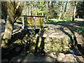
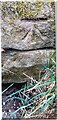
Benchmark on stone in wall above ditch on west side of Inglewood Road
by Roger Templeman
for square NY5032
Ordnance Survey cut mark benchmark levelled at 184.326m above Newlyn Datum verified 1972
|
|
Old flood gates at the end of Covell's Drain
by Hugh Venables
geograph for square TL3570
Well past being any use.
|
|
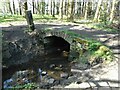
Culvert under the farm track
by Robert Graham
geograph for square NZ2045
In a field beside the Lanchester Valley Walk at Langley Park. A drainage ditch... (more)
|
|
Fields near Heald Brow
by Adrian Taylor
geograph for square SD4773
This fertile low lying land has been reclaimed from tidal salt marsh.
With the... (more)
|
|
Bridleway to Watton in low afternoon sun
by Martin Dawes
geograph for square TA0348
On the right of drainage ditch, from Wilfholme Road
|