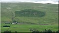
|
More of the same
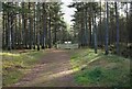
by Andy Waddington
geograph for square NZ0108
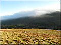
Category: Forestry plantation
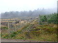
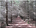
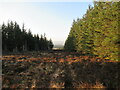
Until a few years ago, the track where this shot was taken, despite the monotony... (more)
|
|
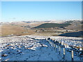
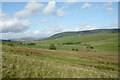
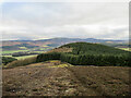
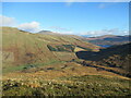
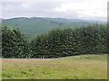
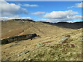
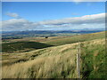
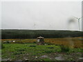
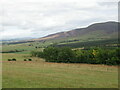
North-east spur of Lousie Wood Law
by Alan O'Dowd
geograph for square NS9315
Looking towards the River Clyde and the A74(M) motorway in the valley below. A... (more)
|
|
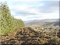
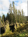
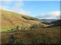
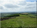
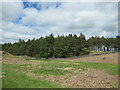
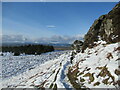
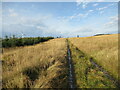
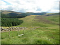
Edge of forestry plantation, Common Law
by Alan O'Dowd
geograph for square NT0832
The strip of heather down the middle was previously a firebreak between blocks... (more)
|
|
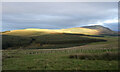
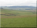
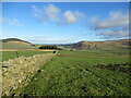
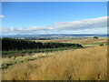
Sunlight on Lochlyock Hill and Tinto
by Alan O'Dowd
for square NS9234
The dipping late-afternoon sun highlights the crest of the hill. An area of new... (more)
|
|
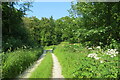
Entrance to Boat of Garten woods
by Richard Sutcliffe
geograph for square NH9319
The gate is across a track that runs through the woods.
|
|
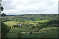
View towards Liscleugh and Strancleugh
by Alan O'Dowd
geograph for square NS8620
A view from the lower slopes of Cairn Hill with Tinto visible in the distance... (more)
|
|
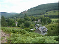
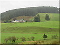
Houses north of North Third Reservoir
by Alan O'Dowd
for square NS7590
The house on the left, with the pyramidally roofed tower, is the former... (more)
|
|
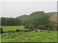
Cloan Glen
by Alan O'Dowd
geograph for square NN9610
Evening light on the northern side of the Ochil Hills, by the Cloan Burn, a... (more)
|
|
Ettrick Kirk and Craighill
by Alan O'Dowd
geograph for square NT2514
From left to right, the buildings visible are the former Ettrick Manse, a... (more)
|
|
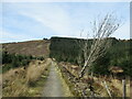
Track down into forestry Londesborough Park
by Martin Dawes
geograph for square SE8746
The track splits later into Funicle Dale and left Coneyhouse Plantation, right... (more)
|
|
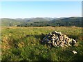
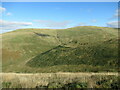
Cairn on summit of Glendowran Hill
by Alan O'Dowd
geograph for square NS8819
A summer evening view over forestry plantations towards the village of Leadhills.
|
|
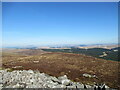
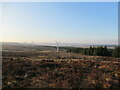
View from Cairn Table to Kennoxhead Wind Farm
by Alan O'Dowd
geograph for square NS7224
This new wind farm, one of many in the area, has sprung up over the last year or two.
|
|
By the large cairn on Cairn Table
by Alan O'Dowd
geograph for square NS7224
Looking towards the extensive forestry plantations around the head of the... (more)
|
|
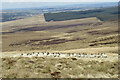
Sheep on Wedder Hill
by Alan O'Dowd
geograph for square NS5931
Probably not used to many visitors to this quiet expanse of moorland.
|
|
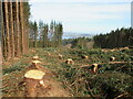
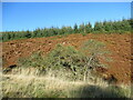
Clearfelled forestry, Ben Bowie
by Alan O'Dowd
geograph for square NS3483
A recently felled area of forestry plantations, partially opening up a view of... (more)
|
|
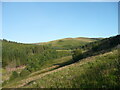
Path below Gouk Hill
by Alan O'Dowd
geograph for square NS3582
An area of forestry on the left-hand section of the hillside has been felled... (more)
|
|
On the slopes of Torbank Hill
by Alan O'Dowd
geograph for square NT1739
On a strip of mown heather, with the small forested hill of Penveny in the... (more)
|
|
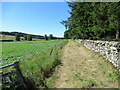
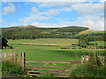
Landscape at Bluecairn
by M J Richardson
geograph for square NT5341
Looking southwest from Bluecairn over an expanse of grassy farmland. The... (more)
|
|
Wind-felled conifers by road to Loch Bradan
by Alan O'Dowd
geograph for square NX4095
The wind appears to have felled some of these skinny conifer trees in the... (more)
|
|
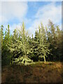
Lichen-covered trees near Stinchar Bridge
by Alan O'Dowd
geograph for square NX3995
On the edge of vast forestry plantations in the Galloway Forest Park.
|
|
Eastern spur of Doune Hill
by Alan O'Dowd
geograph for square NS3197
A glimpse of Loch Lomond comes into view as you get further up the hillside.
|
|
Rough grazing above Doune Farm
by Alan O'Dowd
geograph for square NS3197
The flanks of Beinn Bhreac are visible on the other side of Glen Douglas.
|
|
Trees and dead bracken on Clow Hill
by Alan O'Dowd
geograph for square NO0511
The commercial forestry at the top of the hill here has so far survived the... (more)
|
|
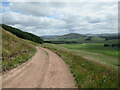
Grass track in the Carmichael House estate
by Alan O'Dowd
geograph for square NS9438
A track shown only on the large-scale OS plan, seemingly running for a short... (more)
|
|
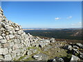
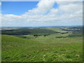
Forestry Plantation at Flisken Hill
by Sandy Gerrard
for square NT0809
|
|
Looking towards Howgate from Lochlyoch Hill
by Alan O'Dowd
geograph for square NS9234
The white farm buildings at Howgate can be seen below, with cattle and sheep... (more)
|
|
Looking down western slope of Lochlyoch Hill
by Alan O'Dowd
geograph for square NS9234
A large patch of felled forestry can be seen on Howgate Hill, in the middle distance.
|
|
Track near Howgate Mouth
by Alan O'Dowd
geograph for square NS9234
Howgate Mouth is a pass that crosses between the valleys of the Garf Water and... (more)
|
|
Temple Avenue
by Alan O'Dowd
geograph for square NT0039
The previous right-of-way from Shieldhill Road to Hillridge Farm via Biggar... (more)
|
|
Forestry seen from Middle Hill
by Jim Barton
geograph for square NT2644
The foreground trees are in Heathpool Forest which borders the larger... (more)
|
|
Boundary wall and forestry at Mickle Indernade
by Alan O'Dowd
geograph for square NS7392
A couple of cuckoos were calling from the plantation. It's possible to go... (more)
|
|
Bankend Rig Wind Farm
by Alan O'Dowd
for square NS6532
Wind turbines in an area of cleared forestry plantations above Glengavel... (more)
|
|
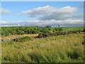
Forestry firebreak on Bibblon Hill
by Alan O'Dowd
geograph for square NS6632
A broad firebreak in the commercial forestry plantation.
|
|
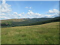
Hillsides above the head of Srath a' Ghlinne
by Alan O'Dowd
geograph for square NN6719
The hillside of Meall Reamhar rises on the other side of the forestry plantation.
|
|
Near the southern end of The Whangie
by Alan O'Dowd
geograph for square NS4980
The south-western entrance to The Whangie, a rock fissure in the cliff that... (more)
|
|
Looking towards the Clyde from Harten Hill
by Alan O'Dowd
geograph for square NS9327
Dungavel Hill is prominent on the left-hand side of the photo.
|
|
Mist rolling over forested hillsides above the Flemington Burn
by Alan O'Dowd
geograph for square NT1846
It was a day of stark contrasts between bright winter sunshine and banks of mist.
|
|
Track to High Overmuir
by Alan O'Dowd
geograph for square NS5743
One of the many turbines of the Whitelee Wind Farm is visible on the left-hand side.
|
|
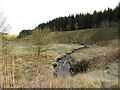
Downstream view, Pogiven Burn
by Alan O'Dowd
geograph for square NS5741
A view from Pogiven Bridge, which has been rebuilt and strengthened, presumably... (more)
|
|
New tree plantings in the Ochil Hills
by Alan O'Dowd
for square NN8501
The new trees can be seen on the flank of Kidlaw Hill, with Meikle Corum and... (more)
|
|
Fenceline on Big Hunt Hill
by Alan O'Dowd
geograph for square NN8401
The extent of new forestry plantations in this area are not yet shown on the OS... (more)
|
|
Edge of forestry plantation, Glen Tye
by Alan O'Dowd
geograph for square NN8301
Large swathes of hillside in this area have been planted with new trees (both... (more)
|
|
Cote and Crurie on the B709
by M J Richardson
geograph for square NY2595
Looking across the valley of the White Esk to the oddly named group of... (more)
|
|
The meeting of the Black and White Esks
by M J Richardson
geograph for square NY2590
Only just visible here but the meeting of the two waters is quite turbulent. The... (more)
|
|
Cairn at Stand of Milk
by M J Richardson
geograph for square NY2589
So far unidentified - it was pouring with rain. The grey panel appeared to be a... (more)
|
|
The Tweed valley near Innerleithen
by M J Richardson
geograph for square NT3136
Looking northeast across to March Wood and Kirklands Hill on the skyline, with... (more)
|
|
View towards wind turbines on Ewe Hill
by Alan O'Dowd
geograph for square NS9625
The turbines here are just some of the many on the vast Clyde Wind Turbine,... (more)
|
|
Edge of Kingshill Plantation
by Alan O'Dowd
geograph for square NS8653
Some of the turbines of the Black Law Wind Farm are visible in the background.
|
|
Edge of plantation on Black Hill
by Alan O'Dowd
geograph for square NS9136
A line of deciduous trees separates the conifer plantation from the open... (more)
|
|
Southern slopes of Bodesbeck Law
by Alan O'Dowd
geograph for square NT1709
The col below is a pass between the upper Ettrick and Moffat Dale. Rolling... (more)
|