Public Tags
Showing latest 50 of 79,888 images tagged with category:River tag.

|
Snowy hills reflected in the River Rawthey at Cautley
by Andy Waddington geograph for square SD6996 Category: Snow Frost still coats the grass at quite low level as we start our walk up into the... (more)
Tags:
category:Crags
type:Geograph
top:Moorland
category:River
top:Rivers, Streams, Drainage
top:Rocks, Scree, Cliffs
category:Snow
top:Uplands
category:Winter Scene
|

|
Milton Falls at Bridge of Dalrulzion
by Andy Waddington geograph for square NO1356 Category: Kayaks The put-in for the Black Water at Bridge of Dalruzion gives little opportunity... (more)
Tags:
category:Bridge
top:Housing, Dwellings
category:Kayaks
category:Rapids
category:River
top:Rivers, Streams, Drainage
top:Roads, Road Transport
top:Sport, Leisure
top:Uplands
|

|
Footbridge below the Carron gorge
by Andy Waddington geograph for square NH5092 Category: Footbridge The footbridge over the River Carron below Croick Schoolhouse (now a private... (more)
Tags:
top:Country Estates
category:Footbridge
category:Gorge
category:Kayaks
category:River
top:Rivers, Streams, Drainage
top:Uplands
|
|
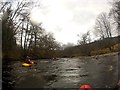
River Loy - ford below Inverskilavulin bridge
by Andy Waddington geograph for square NN1383 Category: Kayaks Downstream from Inverskilavulin bridge is a quiet reach of the River Loy ending... (more)
|

|
Beach above the Carron gorge
by Andy Waddington geograph for square NH4992 Category: River Following on from rocky rapids below East Amat, the River Carron flattens out... (more)
Tags:
category:Beach
category:Kayaks
category:River
top:Rivers, Streams, Drainage
top:Sport, Leisure
top:Uplands
|

|
Low headroom under the Weardale railway
by Andy Waddington geograph for square NZ0836 Category: Railway bridge The river had been high when we had set off on a kayak trip, but continued to... (more)
Tags:
type:Geograph
top:Lowlands
category:Railway Bridge
top:Railways
category:River
category:River in Flood
top:Rivers, Streams, Drainage
|

|
Dunalastair dam from the Upper Tummel put-in
by Andy Waddington geograph for square NN7259 Category: Abbey (site of) The Dunalastair dam releases a legally required minimum compensation flow... (more)
Tags:
category:Canoes and Canoeing
category:Dam
top:Energy Infrastructure
category:Kayaks
category:River
top:Rivers, Streams, Drainage
top:Uplands
top:Water Resources
|

|
Falls Of Dochart
by David Sanderson geograph for square NN5732 Category: Scenic drive The Falls Of Dochart With Sunlight Shining On The Water.
Taken using a ten stop... (more)
Tags:
top:Geological Interest
category:River
top:Rivers, Streams, Drainage
category:Scenery
category:Scenic Drive
top:Uplands
top:Village, Rural Settlement
top:Water Resources
category:Waterfall
category:Waterfalls
|

|
Beach above Daltulich bridge, River Findhorn
by Andy Waddington geograph for square NH9848 Category: Geological The Findhorn seen here is at about as low a level as you'd want to paddle... (more)
Tags:
category:Beach
top:Country Estates
category:Geological
category:River
top:Rivers, Streams, Drainage
top:Uplands
|

|
Stepping across the Abhainn Shira
by Andy Waddington geograph for square NN2342 Category: Stepping stones Tags:
category:Footpath
type:Geograph
top:Moorland
top:Paths
category:Right of Way
category:River
top:Rivers, Streams, Drainage
category:Stepping Stones
top:Uplands
|

|
Redundant bridge over the Abhainn Shira
by Andy Waddington geograph for square NN2341 Category: Suspension bridge Tags:
category:Footpath
type:Geograph
top:Moorland
top:Paths
category:Right of Way
category:River
top:Rivers, Streams, Drainage
category:Suspension Bridge
top:Uplands
|

|
Stepping across the Allt Sùil na Curra
by Andy Waddington geograph for square NN2341 Category: Stepping stones Tags:
category:Footpath
type:Geograph
top:Moorland
top:Paths
category:Right of Way
category:River
top:Rivers, Streams, Drainage
category:Stepping Stones
top:Uplands
|
|
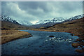
Glen Lochay from Lubchurran footbridge
by Andy Waddington geograph for square NN4535 Category: River The footbridge from which this photograph was taken (seen in Sarah... (more)
Tags:
type:Geograph
category:Glen
top:Lakes, Wetland, Bog
category:River
top:Sport, Leisure
top:Uplands
|
|
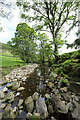
Reservoirs spare very little water for the River Nidd
by Andy Waddington geograph for square SE1074 Category: River From Middlesmoor, a really poorly waymarked footpath crosses Intake Gill and... (more)
|

|
The River Cover flows under Hullo Bridge
by Andy Waddington geograph for square SE1186 Category: Bridge The River Cover flows very clear over a rocky bed in a small gorge as it... (more)
|

|
River Hodder at Cross of Greet Bridge
by Andy Waddington geograph for square SD7058 Category: River Only a couple of kilometres from its sources and still free-flowing, the infant... (more)
Tags:
category:Bridge
category:River
top:Rivers, Streams, Drainage
top:Roads, Road Transport
top:Uplands
|
|
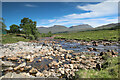
Abhainn Shira flows past the Clashgour Hut
by Andy Waddington geograph for square NN2542 Category: Mountain hut Tags:
type:Geograph
top:Moorland
category:Mountain Hut
top:Paths
category:River
top:Rivers, Streams, Drainage
top:Sport, Leisure
category:Track
top:Uplands
|
|
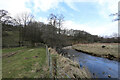
Footpath by the River Eden
by Andy Waddington geograph for square NY7700 Category: Public footpath Emerging from a track among the trees, the path becomes a lot more vague as it... (more)
Tags:
top:Farm, Fishery, Market Gardening
type:Geograph
top:Grassland
top:Lowlands
top:Paths
category:Public Footpath
category:River
top:Rivers, Streams, Drainage
|

|
River Feshie extending its floodplain
by Andy Waddington geograph for square NN8495 Category: Erosion Compare this photo with one taken by John Ferguson less than a deacde ago... (more)
Tags:
category:Erosion
type:Geograph
top:Geological Interest
category:River
top:Rivers, Streams, Drainage
top:Uplands
top:Woodland, Forest
|
|
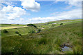
River Arkle below Hilltop Farm
by Andy Waddington geograph for square NY9706 Category: Farm Throughout Arkengarthdale, tractors were busily at work turning, rowing or... (more)
Tags:
category:Farm
top:Farm, Fishery, Market Gardening
type:Geograph
top:Grassland
top:Housing, Dwellings
category:River
top:Rivers, Streams, Drainage
top:Uplands
|

|
Bouncy water before Garth Bridge
by Andy Waddington geograph for square SH6957 Category: Kayaks This is all but the end of the Nant-y-Gwryd, after just over four and a half... (more)
Tags:
type:Geograph
category:Kayaks
category:River
top:Rivers, Streams, Drainage
top:Sport, Leisure
top:Uplands
|

|
River Ailort
by Andy Waddington geograph for square NM7883 Category: Kayaks Since, two days previously, there had been enough rain (four inches or so) to... (more)
Tags:
type:Geograph
category:Kayaks
category:River
top:Rivers, Streams, Drainage
top:Sport, Leisure
top:Uplands
|
|
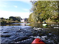
Starting the Durham to Finchale section of the River Wear in low water
by Andy Waddington geograph for square NZ2743 Category: Kayaks The River Wear downstream of Durham is a classic section for beginners and runs... (more)
Tags:
type:Geograph
category:Kayaks
top:Lowlands
category:River
top:Rivers, Streams, Drainage
top:Sport, Leisure
top:Suburb, Urban Fringe
|

|
Dropping into the last wave, White Bridge, River Garry
by Andy Waddington geograph for square NH2801 Category: Bridge On release days (Thursdays from early April, and the Saturday of the Wet West... (more)
|

|
The Nant-y-Gwryd in Dyffryn Mymbyr
by Andy Waddington geograph for square SH6856 Category: Kayaks Now wide and shallow, the heavy rain has ensured that there is still just about... (more)
Tags:
type:Geograph
category:Kayaks
category:River
top:Rivers, Streams, Drainage
top:Sport, Leisure
top:Uplands
|
|
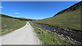
Dusty road out from Ben Lui
by Andy Waddington geograph for square NN3028 Category: Access road Tags:
category:Access Road
type:Geograph
top:Moorland
category:River
top:Rivers, Streams, Drainage
top:Roads, Road Transport
top:Uplands
|

|
The Nant-y-Gwryd below the grade 5 fall
by Andy Waddington geograph for square SH6756 Category: Kayaks Below the portage, the Nant-y-Gwryd is not as steep as above it and is a lot... (more)
Tags:
type:Geograph
category:Kayaks
category:River
top:Rivers, Streams, Drainage
top:Sport, Leisure
top:Uplands
|

|
Below the releasing dam on the River Garry
by Andy Waddington geograph for square NH2701 Category: River The Garry is a dam-release river, very useful to kayakers in the area when... (more)
|

|
Small rapid in the River Eden
by Andy Waddington geograph for square NY7803 Category: River The River Eden jogs sideways at this point, dropping a few steps down a rocky... (more)
|

|
Afon Glaslyn
by Andy Waddington geograph for square SH6048 Category: River The view is downstream from the middle of the small road bridge leading to Sygun... (more)
Tags:
Afon
type:Geograph
top:Lowlands
category:River
top:Rivers, Streams, Drainage
top:Sport, Leisure
|
|
River Wear at East Blackdene
by Andy Waddington geograph for square NY8838 Category: River This view looks upstream from the Ponderland footbridge on one of the flatter... (more)
|
|
River Ailort
by Andy Waddington geograph for square NM7882 Category: River After leaving Loch Eilt and flowing under the railway, the river has a series of... (more)
|

|
The Afon Glaslyn above the gorge
by Andy Waddington geograph for square SH5946 Category: River From Beddgelert the Afon Glaslyn continues down at a pleasant gradient, but... (more)
|

|
Nant Colwyn
by Andy Waddington geograph for square SH5749 Category: River When seen in high water at the confluence with the Glaslyn, the Nant Colwyn... (more)
|

|
River Wear with many rocks
by Andy Waddington geograph for square NZ0936 Category: River Downstream of Wolsingham Bridge, the River Wear is generally easier paddling... (more)
|

|
River Cover
by Andy Waddington geograph for square SE1486 Category: River The river looks very innocuous at this low level, but clearly floods are eroding... (more)
|

|
River Tromie
by Andy Waddington geograph for square NN7796 Category: River Just downstream from the bridge leading to Glentromie Lodge, the river is... (more)
|
|
River Ailort
by Andy Waddington geograph for square NM7782 Category: River Apart from a nasty weir at the end (portage left or simply get out there) this... (more)
|

|
Abhainn Thabhsaigh and Ruidear
by Andy Waddington geograph for square NB1016 Category: River Having paddled about 6km up Loch Reasort (from where it got too shallow for the... (more)
|

|
River Nent below Blagill
by Andy Waddington geograph for square NY7346 Category: River From Gossipgate to the Blagill bridge, the route along the River Nent (for... (more)
Tags:
top:Farm, Fishery, Market Gardening
type:Geograph
category:River
top:Rivers, Streams, Drainage
top:Uplands
|

|
River Gloy in high water under estate bridge
by Andy Waddington geograph for square NN2487 Category: River We'd already retreated from a couple of potential river trips when the Gloy... (more)
Tags:
top:Country Estates
type:Geograph
category:River
top:Rivers, Streams, Drainage
Spate
top:Sport, Leisure
top:Uplands
|

|
River Findhorn at Ardclach
by Andy Waddington geograph for square NH9545 Category: River Ardclach is a convenient take-out for the Upper Findhorn, or put-in for the... (more)
|
|
River Dochart downstream from the A827 bridge
by Andy Waddington geograph for square NN5732 Category: River |

|
Compensation flow on the Water of Deugh
by Andy Waddington geograph for square NX5498 Category: River Sometimes paddlers benefit from dam release water, but more often, the rivers... (more)
Tags:
top:Energy Infrastructure
type:Geograph
category:River
top:Rivers, Streams, Drainage
top:Uplands
|
|
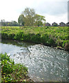
Riffle in the River Skerne
by Andy Waddington geograph for square NZ3015 Category: River The River Skerne, here seen flowing towards central Darlington, passing through... (more)
Tags:
top:Flat Landscapes
type:Geograph
category:River
top:Rivers, Streams, Drainage
top:Suburb, Urban Fringe
|
|
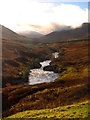
Upper Glen Roy
by Andy Waddington geograph for square NN3088 Category: River Looking down the section of the Upper River Roy which leads to the hardest rapid... (more)
|

|
River Dee
by Mark Anderson geograph for square SJ4065 Category: River Tags:
category:River
|

|
River Feshie with scoured bed
by Andy Waddington geograph for square NN8596 Category: River You'd believe that a bridge was hardly needed when seen at this water... (more)
Tags:
type:Geograph
top:Moorland
category:River
top:Rivers, Streams, Drainage
top:Uplands
top:Woodland, Forest
|

|
Abhainn Thabhsaigh runs down to Ceann Loch Reasort
by Andy Waddington geograph for square NB1017 Category: River Loch Reasort is long and shallow, so its head can only be reached in shallow... (more)
Tags:
top:Coastal
top:Country Estates
top:Estuary, Marine
type:Geograph
category:River
top:Rivers, Streams, Drainage
top:Uplands
|
|
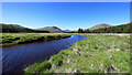
Abhainn Shira followed by the right of way to Loch Etive
by Andy Waddington geograph for square NN2442 Category: River |
