
|
Portmeirion - The Chantry and Chantry Row
by Ian Capper
for square SH5837
Two buildings at Sir Clough Williams-Ellis's Portmeirion, which he... (more)
|

|
Chantry Park
by Geographer
geograph for square TM1344
Looking towards The Chantry
|

|
The Chantry in Chantry Park
by Geographer
geograph for square TM1344
|

|
Entrance to The Chantry in Chantry Park
by Geographer
geograph for square TM1344
Off Hadleigh Road
|

|
Entrance to Hadleigh Road
by Geographer
geograph for square TM1344
From Chantry Park
|
|
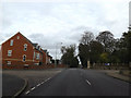
Hadleigh Road, Chantry
by Geographer
geograph for square TM1344
At the junction with Collinsons & Chantry Park
|

|
Stoke Park Drive & Ellenbrook Road signs
by Geographer
for square TM1441
On Stoke Park Drive at the junction with Ellenbrook Road & Belstead Road
|

|
Belstead Road, Stoke Park
by Geographer
geograph for square TM1441
At the junction with Stoke Park Road & Ellenbrook Road
|

|
Information Board in Chantry Park
by Geographer
for square TM1344
(Close up)
|

|
Chantry Park
by Geographer
geograph for square TM1344
|

|
Information Board in Chantry Park
by Geographer
for square TM1344
(Close up)
|

|
Information Board in Chantry Park
by Geographer
for square TM1344
|

|
Information Board in Chantry Park
by Geographer
for square TM1344
|

|
North Lodge in Chantry Park
by Geographer
geograph for square TM1344
Off Hadleigh Road
|
|
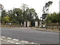
Entrance to Chantry Park
by Geographer
geograph for square TM1344
Off Hadleigh Road taken from Collinson
|

|
Belstead Road sign
by Geographer
for square TM1441
On Belstead Road at the junction with Stoke Park Road & Ellenbrook Road
|

|
Remains of a chantry, Sea Lane
by John Baker
geograph for square ST1444
This was once a collegiate dwelling belonging to chantry priests. It dates from... (more)
|
|
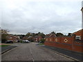
Collinsons, Chantry
by Geographer
geograph for square TM1344
At the junction with Hadleigh Road
|

|
Poplar Lane, Chantry
by Geographer
geograph for square TM1343
At the junction with the A1071
|
|
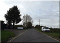
Poplar Lane, Chantry
by Geographer
geograph for square TM1243
At the entrance to Thompson & Morgan
|

|
Poplar Lane, Chantry
by Geographer
geograph for square TM1243
|

|
Poplar Lane, Chantry
by Geographer
geograph for square TM1343
At the junction with the A1071
|

|
Fleming Chantry
by Richard Croft
for square SK9771
Chantry Chapel and cadaver tomb of Bishop Fleming, founder of Lincoln College... (more)
|

|
Portmeirion - The Chantry
by Ian Capper
geograph for square SH5837
Looking up to the 1937 built Chantry at Sir Clough Williams-Ellis's... (more)
|

|
Portmeirion - The Chantry
by Ian Capper
for square SH5837
The cupola on the roof of the 1937 built Chantry at Sir Clough... (more)
|
|
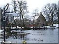
Chantry House across Gore Pond
by Penny Mayes
for square TQ8760
Category: Historic building
The Chantry was founded in 1392. A History of the County of Kent says... (more)
|

|
Tewkesbury Abbey - Chapel of the Holy Trinity - Mural
by Rob Farrow
for square SO8932
This C14th wall painting in the Chapel of the Holy Trinity (aka the Edward... (more)
|

|
Tewkesbury Abbey - Beauchamp Chantry
by Rob Farrow
for square SO8932
The superbly carved Beauchamp Chantry (also known as the Warwick Chapel) as... (more)
|

|
Donald Macintosh Way, Chantry, Ipswich
by Geographer
geograph for square TM1242
At the junction with Scrivener Drive near Ipswich Veterinary Centre
|

|
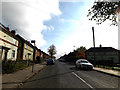
Dickens Road, Chantry, Ipswich
by Geographer
geograph for square TM1444
At the junction with the A1214 London Road
|
|
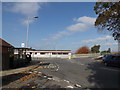
Dickens Road, Chantry, Ipswich
by Geographer
geograph for square TM1444
|
|
Dickens Road, Chantry, Ipswich
by Geographer
geograph for square TM1444
At the junction with Hadleigh Road & Pickwick Road
|

|
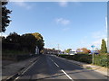
B1075 Ranelagh Road, Chantry, Ipswich
by Geographer
geograph for square TM1444
At the junction with Paul's Road
|
|
B1075 Ranelagh Road, Chantry, Ipswich
by Geographer
geograph for square TM1544
|

|
Chantry, Kilve
by Derek Harper
geograph for square ST1444
A propped-up gable on the south side of the ruined chantry... (more)
|

|
A1071 at Chantry
by Geographer
geograph for square TM1343
At the junction with Poplar Lane near the junction with the A1214 London Road
|
|
Entering Ipswich on Hadleigh Road
by Geographer
geograph for square TM1444
At the junction with Hyntle Close
|
|
Pinewood Community Hall
by Geographer
geograph for square TM1342
Category: Community centre
Off Laburnum Close
|

|
South gable wall of Kilve Chantry
by Oliver Dixon
geograph for square ST1444
The medieval chantry at Kilve dates back to the 14th century. The south gable... (more)
|

|
Fleming Chantry
by Richard Croft
for square SK9771
A rare glimpse inside the Fleming Chantry in St.Mary's Cathedral
|

|
Tewkesbury Abbey - Beauchamp Chantry - Carved angels
by Rob Farrow
for square SO8932
Two of the thirteen (six this side, seven the other) carved angels adorning the... (more)
|

|
Chantries - Winter Woodland
by Colin Smith
for square TQ0148
Setting sun shining through trees in Chantries woods, south-east of Guildford.
|

|
Chantries - North Downs Way
by Colin Smith
geograph for square TQ0248
The long distance path is also a bridleway where it passes through the Chantries woodland.
|

|
Chantries - Autumnal Hillside
by Colin Smith
geograph for square TQ0147
Deciduous woodland on the southern slope of the Chantries ridge.
|

|
Shalford - Path to Chantries
by Colin Smith
geograph for square TQ0147
Footpath across ploughed fields and ascending a gentle slope towards the wooded Chantries.
|

|
Shalford - Chantries
by Colin Smith
geograph for square TQ0047
The Greensand Ridge north of Shalford rises to the wooded Chantries.
|

|
Shalford - Chantries
by Colin Smith
geograph for square TQ0048
View uphill and over a grassy field towards Chantries, a wooded ridge popular... (more)
|

|
Chantries - Panoramic Footpath
by Colin Smith
geograph for square TQ0148
This hilltop path follows the edge of the Chantries woodland and offers sweeping... (more)
|

|
Guildford - Chantries
by Colin Smith
geograph for square TQ0147
Descending from Chantries Wood on the Greensand Ridge towards Shalford Mill in... (more)
|

|
Chantry Chapel of St Mary the Virgin
by Oliver Dixon
geograph for square SE3320
A fragment of old Wakefield sited on the old bridge (now pedestrians only)... (more)
|
