
|
Pathways near the top of Great Orme
by I Love Colour
geograph for square SH7583
Part of the network of pathways that criss-cross the headland of Great Orme,... (more)
|

|
The road to the A1 from Empingham
by Christine Johnstone
geograph for square SK9609
At the 84 metre spot height.
|

|
The causeway to Lindisfarne
by I Love Colour
geograph for square NU0842
Walkers crossing the old pilgrim's path from the county of Northumberland,... (more)
|

|
Entrance into a large wheatfield
by Christine Johnstone
geograph for square SK9609
On the west side of the road from Empingham to the A1.
|

|
Pickworth Road [1]
by Christine Johnstone
geograph for square TF0011
Heading north to Pickworth, west of East Wood.
|

|
Entrance to The Homestead, Cloot Drove
by Christine Johnstone
geograph for square TF2412
At the 2 metre spot height.
|

|
Corner of a wheatfield
by Christine Johnstone
geograph for square SK8507
On the west side of Brooke Road.
|
|
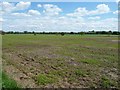
Large field south of New Platt Lane
by Christine Johnstone
geograph for square SJ7470
Nearly a national flag!
|
|
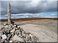
Eastern end of Forefield Rake
by Christine Johnstone
geograph for square NY9602
Looking towards Great Pinseat.
|

|
The road to the A1 at the 68 metre spot height
by Christine Johnstone
geograph for square SK9813
Just west of Pickworth.
|

|
Spring sky at Arbor Low
by Christopher Hilton
geograph for square SK1663
|

|
Disused sheepfold at Surrender Ground
by Christine Johnstone
geograph for square NY9702
With a fine view of distant Arkengarthdale.
|
|
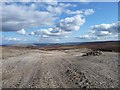
Bridleway heading to Surrender Ground
by Christine Johnstone
geograph for square NY9702
With fine views opening up to the south-east.
|
|
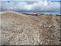
Rocky ground, cloudy sky
by Christine Johnstone
geograph for square NY9602
Bridleway climbing Forefield Rake.
|

|
Dinghy on Whitwell Creek
by Christine Johnstone
geograph for square SK9208
|

|
The shores of Kinchley Hill, Swithland Reservoir
by Christine Johnstone
geograph for square SK5513
Seen from the open window of a Great Central Railway train.
|

|
Llyn Geirionydd, Snowdonia, North Wales
by I Love Colour
geograph for square SH7660
One of those beautiful, clear, blue sky days that you somehow never expect to... (more)
|

|
Picnic spot at Hambleton bakery
by Christine Johnstone
geograph for square SK9112
With a fine view along the southern edge of Cottesmore Wood.
|

|
Pickworth Plain
by Christine Johnstone
geograph for square SK9712
North of Exeter Gorse.
|

|
Tree on a field boundary, near Pickworth Plain
by Christine Johnstone
geograph for square SK9812
|

|
Farmland near Pickworth Plain
by Christine Johnstone
geograph for square SK9812
The wood on the horizon is called Exeter Gorse.
|

|
The road from Pickworth
by Christine Johnstone
geograph for square SK9812
At the 81 metre spot height, looking towards the A1.
|

|
View from the bench, Pickworth
by Christine Johnstone
geograph for square SK9913
The Rutland Round follows the hedge up the hillside.
|

|
No sign of the bull
by Christine Johnstone
geograph for square TF0011
Eastern margin of grass field with 'bull in the field' sign, west of... (more)
|

|
The course of the River Gwash
by Christine Johnstone
geograph for square TF0210
Marked by a line of trees downstream [east] of Tolethorpe.
|

|
Ryhall Road
by Christine Johnstone
geograph for square TF0211
Looking east from the entrance to Frith Farm.
|

|
Power lines crossing the Nene valley
by Christine Johnstone
geograph for square TL1098
Seen from an open window on a Nene Valley Railway train.
|

|
Eastern side of Normangate Field
by Christine Johnstone
geograph for square TL1197
Seen from the open window of a Nene Valley Railway train.
|

|
Western end of a large wheatfield
by Christine Johnstone
geograph for square TL1397
With houses on Love's Hill in the distance. Seen from the open window of a... (more)
|

|
Pond in the middle of a wheatfield
by Christine Johnstone
geograph for square TL1397
Seen from the open window of a Nene Valley Railway train.
|

|
Corner of a wheatfield
by Christine Johnstone
geograph for square TL1397
On the west bank of the tree-lined River Nene. Seen from the open window of a... (more)
|

|
The River Nene, looking downstream
by Christine Johnstone
geograph for square TL1397
With the Nene Way and Hereward Way on the left [west] bank. Seen from the open... (more)
|

|
Rutland Belle jetty, Whitwell Creek
by Christine Johnstone
geograph for square SK9208
Providing hourly trips round the eastern end of Rutland Water.
|

|
Pole in a drain-edged wheatfield
by Christine Johnstone
geograph for square TF2514
Seen from the elevated Wash bank, with the broad spire of Crowland Abbey on the... (more)
|

|
Cereal crop south of the B5082
by Christine Johnstone
geograph for square SJ7171
The trees mark different field boundaries.
|

|
Edge of large cereal field
by Christine Johnstone
geograph for square SJ7171
Alongside the Holmes Chapel Road.
|

|
Large cereal field in springtime
by Christine Johnstone
geograph for square SJ7171
North of the Holmes Chapel Road, between Lach Dennis and Rudheath.
|
|
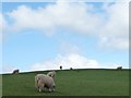
Sheep on a hillside
by Christine Johnstone
geograph for square NZ1450
North of Stonyheap Lane.
|

|
Grassy path towards South Lake
by Pauline E
geograph for square SE7269
The graceful birch with its silvery bark looks attractive in both summer and winter.
|
