
|
The coastal village of Low-Newton-by-the-Sea
by Pauline E
geograph for square NU2424
Small and fairly isolated, the former fishing village attracts many visitors.... (more)
|

|
High Street, Staithes
by Pauline E
geograph for square NZ7818
A cold, Easter Tuesday and there are not many visitors in this popular coastal village.
|
|
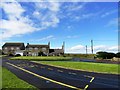
Cresswell Village centre
by Robert Graham
geograph for square NZ2993
Cresswell is a pretty little place at the southern end of Druridge Bay. The road... (more)
|
|
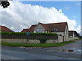
Titchwell, Norfolk
by Richard Humphrey
geograph for square TF7543
The village sign stands outside these converted farm buildings on the main... (more)
|

|
Church Cottage in Thornham, Norfolk
by Richard Humphrey
geograph for square TF7343
Just north of the church in this small but popular Norfolk coastal resort
|

|
View across Plockton Bay
by David Dixon
geograph for square NG8033
Taken from a Kyle–Inverness train, looking across the sheltered waters of... (more)
|

|
Portloe
by Derek Harper
geograph for square SW9339
|

|
Marine Drive, Bigbury-on-Sea
by Derek Harper
geograph for square SX6444
|

|
Towards Hope Cove
by Derek Harper
for square SX6739
From the coast path, looking down a combe.
|

|
Rocks, Bolt Tail Camp
by Derek Harper
geograph for square SX6639
Outcrops at the top of the coastal slope above Bolt Tail. Across the bay are... (more)
|

|
Hope Cove
by Derek Harper
for square SX6740
Seen from just east of Bolt Tail Camp. The village is Outer Hope.
|

|
Hope Cove
by Derek Harper
for square SX6740
Looking across the two coves, and the cliffs and rocks running to sea from... (more)
|

|
Looking south towards the village of Rosemarkie
by Bill Harrison
geograph for square NH7358
|

|
Rocks off Westcombe Beach
by Derek Harper
geograph for square SX6345
A stack and reefs run out to sea between the beach and Aylmer Cove. In the... (more)
|

|
Coastal path, Cockenzie
by Jim Barton
geograph for square NT3975
On the John Muir Way around the perimeter of the power station site, looking... (more)
|

|
Nolton Haven from the Pembrokeshire Coast Path
by Simon Mortimer
geograph for square SM8518
Looking east from the path on the northern side of the bay. In the nineteenth... (more)
|

|
View of Hartley from the coast path
by Robert Graham
geograph for square NZ3475
Looking from the path south of this little village north of Whitley Bay.
|

|
View of Cresswell Village
by Robert Graham
geograph for square NZ2993
View in the centre of the village. The village shop is to the right of the... (more)
|

|
Portwrinkle from the west
by Derek Harper
geograph for square SX3553
The coast path drops from Britain Point towards the fishing village and its tiny harbour.
|

|
Cockenzie High Street
by Jim Barton
for square NT4075
The John Muir Way follows a coastal path to the seaward side of the houses.
|
|
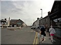
Looking along Main Street in Seahouses
by Robert Graham
geograph for square NU2131
View west along the main road through the village from just past the junction... (more)
|

|
St Abbs
by Walter Baxter
for square NT9167
This Berwickshire coastal village was viewed from a boat.
|

|
The village of Crovie
by valenta
geograph for square NJ8065
Looking down on the tiny village of Crovie, one can see how precarious living... (more)
|
|
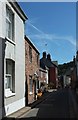
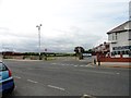
Fore Street, Kingsand
by Derek Harper
geograph for square SX4350
Looking down the street from the village store.
|
|
View looking inland from Whitburn Bents Road
by Robert Graham
geograph for square NZ4060
This is at the south end of South Bents at Whitburn.
|

|
The Kings Arms, Seaton Sluice
by Robert Graham
geograph for square NZ3376
This is the oldest pub in the village, dating from the mid 18th century. It is... (more)
|

|
Building site, Burgh Island
by Derek Harper
geograph for square SX6444
This is west of the Pilchard Inn, and I haven't been able to find out about it.
|

|
Towards Charmouth from coast path above Cain's Folly, 1998
by Derek Harper
geograph for square SY3793
This was before the coast path was diverted inland across Stonebarrow Hill... (more)
|

|
Hope Cove
by Derek Harper
geograph for square SX6739
|

|
Hillside above Buckland Stream valley
by Derek Harper
geograph for square SX6643
|

|
Cliffs, Butter Cove
by Derek Harper
geograph for square SX6643
|

|
Wave-cut platform near Bantham Sand
by Derek Harper
for square SX6543
Looking towards Burgh Island, linked at low tide to Bigbury-on-Sea on the mainland..
|

|
Path above the Avon estuary
by Derek Harper
geograph for square SX6643
Walkers follow Thurlestone footpath 19 along a ridge to meet the coast path... (more)
|

|
Hope
by Derek Harper
geograph for square SX6740
Outer and Inner Hope seen from the coast path above Mouthwell Point.
|

|
From Commons Old Road
by Derek Harper
for square SX9372
The steep north-facing slope above Shaldon cuts out the sun, especially in... (more)
|

|
Coastal road at Aultbea
by Jim Barton
geograph for square NG8689
The road connects Mellon Charles with Aultbea and the A832.
|

|
Aultbea Stores
by Jim Barton
geograph for square NG8689
Well-stocked village shop on the shores of Loch Ewe.
|

|
West Bay
by Derek Harper
geograph for square SY4690
|

|
Fields above West Bay
by Derek Harper
geograph for square SY4690
|

|
Road junction in Seahouses
by Robert Graham
geograph for square NU2131
The junction of Main Street with King Street on the left in the centre of the village.
|

|
Roundabout in the centre of Seahouses
by Robert Graham
geograph for square NU2132
This is taken from the top of Main Street, where it joins Seafield Road coming... (more)
|

|
Staithes (2)
by Chris Heaton
geograph for square NZ7818
Lovely Yorkshire coastal town tumbling down to the coast, with its striking... (more)
|

|
Staithes (1)
by Chris Heaton
geograph for square NZ7818
Lovely Yorkshire coastal town tumbling down to the sea shore, with its striking... (more)
|

|
Sunset at Low Newton
by David Chatterton
geograph for square NU2424
View along the beach at sunset. Low Newton and the old coastguard lookout in the distance.
|

|
Looking towards Ballantrae
by Ann Cook
geograph for square NX0781
The mouth of the River Stinchar can be seen in front of Ballantrae. Bennane Head... (more)
|

|
Robin Hood's Bay
by Derek Harper
geograph for square NZ9505
From the Cleveland Way following footpath 313217 along Old Lance Cliff.
|

|
Coast path approaching Portwrinkle
by Derek Harper
geograph for square SX3653
The South West Coast Path descends towards Finnygook Lane just east of... (more)
|

|
Inner Hope
by Stuart Logan
for square SX6739
Category: Coastal town
Backgrounded by the Bolt Tail, Hope Cove provides idyllic sea access for this old village.
|

|
Foreshore, Pierowall
by Derek Harper
geograph for square HY4348
The village occupies a graceful curve at the head of the Bay of Pierowall. The... (more)
|

|
View south from Whitburn
by Robert Graham
geograph for square NZ4061
Looking down the coast from the coast road, the A183. Sunderland can be seen in... (more)
|
