
|
Junction of Cuckoo Lane with Marston Road
by Roger Templeman
geograph for square SP5206
|

|
Gate on coastal path next to concrete wall
by M J Roscoe
geograph for square ST2981
Kissing gate on sea defence embankment; beyond the end of the concrete wall the... (more)
|

|
Concrete wall at Cuckmere Haven
by Oliver Dixon
geograph for square TV5197
World War II defences, or a flood bank - or maybe both.
|

|
Lining the canal sides on the Wendover Arm
by Chris Reynolds
geograph for square SP9012
The process involves the following stages
(1) The side is excavated smoothly... (more)
|
|
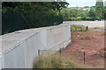
Flood defences alongside River Ebbw
by M J Roscoe
geograph for square ST2688
Concrete wall to protect new housing estate on former industrial site, right;... (more)
|
|
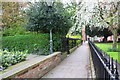
Footpath through St Mary's Church churchyard
by Roger Templeman
geograph for square SK7953
|

|
A6108 at Skelton Gate Farm
by Roger Templeman
geograph for square SE1294
|
|
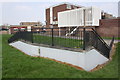
Wall above subway under Dorcan Way
by Roger Templeman
geograph for square SU1885
|

|
Concrete barrier units, Port of Teignmouth
by Robin Stott
for square SX9372
My understanding is that these units can be assembled as walls to contain or... (more)
|

|
Sea defence at Whitstable
by Malc McDonald
geograph for square TR1066
This concrete wall is continuous, protecting the town of Whitstable against... (more)
|

|
Artwork under Exe Bridges
by David Smith
for square SX9192
Local outdoor artists were commissioned to decorate the concrete walls of the... (more)
|
|
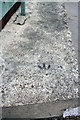
Benchmark on concrete wall beside ramp to Broad Marsh Centre
by Roger Templeman
for square SK5739
Ordnance Survey rivet benchmark described on the Bench Mark Database at... (more)
|

|
Aller Brook near Penn Inn
by Derek Harper
geograph for square SX8770
Confined between concrete walls as it flows (towards the camera) past McDonalds.
|

|
Leeds and Liverpool Canal Lane House Bridge
by Roger Templeman
geograph for square SE0245
|

|
Concrete wall beside field entrance from A6108
by Roger Templeman
geograph for square SE1198
|

|
Start of the descent
by Oliver Dixon
geograph for square NG9603
Start of the precipitous descent to Kinloch Hourn. The yellow tub of grit is... (more)
|

|
Benchmark on concrete wall beside A6108
by Roger Templeman
for square SE1294
Ordnance Survey rivet benchmark described on the Bench Mark Database at... (more)
|

|
Muddy approach to footbridge on the Thames Path
by Roger Templeman
geograph for square SU5794
|
|
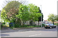
Dovercourt Road Day Centre
by Roger Templeman
geograph for square ST6076
|
|
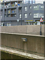
Old Kent Road
by Stephen McKay
geograph for square TQ3378
Concrete jungle: the walls in the foreground are part of the Bricklayers Arms... (more)
|
|
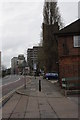
Maid Marian Way
by Roger Templeman
geograph for square SK5739
St Nic's church tower is behind the trees. There is an OS benchmark... (more)
|

|
Coastal East Lothian : Concrete pyramid, North Berwick
by Richard West
geograph for square NT5585
|
|
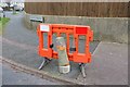
Restrained concrete post, Plainmoor
by Derek Harper
for square SX9165
On the point of breaking free and escaping, this post is being firmly grasped by... (more)
|

|
Wheel and Wall, Piccadilly Gardens
by David Dixon
geograph for square SJ8498
A view of the Manchester Wheel from the Piccadilly Gardens tram stop. The... (more)
|

|
Benchmark on concrete side to entrance beside Cuckoo Lane
by Roger Templeman
for square SP5206
Ordnance Survey cut mark benchmark described on the Bench Mark Database at... (more)
|
|
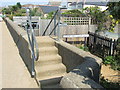
Starboard Light Alley steps, Whitstable
by Malc McDonald
geograph for square TR1066
These steps provide access from Starboard Light Alley over the wall to the sea... (more)
|

|
Benchmark on wall of walled garden in Harlaxton Park
by Roger Templeman
for square SK8832
Ordnance Survey cut mark benchmark described on the Bench Mark Database at... (more)
|
|
Rodbourne Road at Park Lane junction
by Roger Templeman
geograph for square SU1484
|
|
Haye Lane from Roman Road junction
by Roger Templeman
geograph for square SY3392
|

|
Wentlooge Sea Wall towards pumping station
by M J Roscoe
geograph for square ST2981
|

|
Sea wall, Goldcliff Pill
by M J Roscoe
geograph for square ST3682
Looking out towards the Mouth of the Severn
|
|
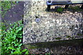
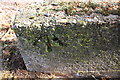
Environment Agency benchmark on wall of steps from road to riverside path
by Roger Templeman
for square NY3856
|
|
Benchmark on low wall at entrance to #100 Nicker Hill
by Roger Templeman
for square SK6231
Ordnance Survey rivet benchmark levelled at 87.084m above Newlyn Datum
|

|
Benchmark on wall of footbridge over River Cherwell
by Roger Templeman
for square SP4915
Ordnance Survey rivet benchmark described on the Bench Mark Database at... (more)
|

|
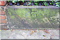
Benchmark on river embankment wall at Holme Heads Bridge
by Roger Templeman
for square SD8491
Ordnance Survey bolt benchmark described on the Bench Mark Database at... (more)
|
|
Benchmark on wall of path through St Mary's Church churchyard
by Roger Templeman
for square SK7953
Ordnance Survey cut mark benchmark described on the Bench Mark Database at... (more)
|

|
Banksy-esque Graffiti
by Stu JP
for square SJ8846
"WORK IS THE CURSE OF THE DRINKING CLASSES"
|

|
Benchmark on side wall of Thames Path footbridge
by Roger Templeman
for square SU5794
Ordnance Survey rivet benchmark described on the Bench Mark Database at... (more)
|
|
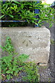
Benchmark on boundary wall of Dovercourt Road Day Centre
by Roger Templeman
for square ST6076
Ordnance Survey cut mark benchmark described on the Bench Mark Database at... (more)
|

|
Benchmark on wall of Leeds & Liverpool Canal lock
by Roger Templeman
for square SE2833
Ordnance Survey rivet benchmark described on the Bench Mark Database at... (more)
|

|
Benchmark on the side wall of Godstow Lock
by Roger Templeman
for square SP4808
Ordnance Survey rivet benchmark described on the Bench Mark Database at... (more)
|
|
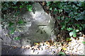
Benchmark on low wall of Colway Lane
by Roger Templeman
for square SY3493
Ordnance Survey cut mark described on the Bench Mark Database at... (more)
|

|
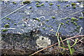
Cat and houses, Barton Road, Torquay
by Derek Harper
geograph for square SX9066
A comfortably perched ginger cat watches me from a wall. The terrace fronts onto... (more)
|
|
Benchmark on Park Road riverside wall
by Roger Templeman
for square ST9288
Ordnance Survey rivet benchmark described on the Bench Mark Database at... (more)
|

|
Sea wall near end of Seawall Road
by M J Roscoe
geograph for square ST3782
The tree lined private road goes to the end of Seawall Road.
|

|
Gateway, Wales Coast Path, Wentlooge Sea Wall
by M J Roscoe
geograph for square ST2880
Incomplete kissing gate.
|

|
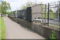
Gate on Wales Coast Path on Wentlooge Sea Wall
by M J Roscoe
geograph for square ST2880
Kissing gate on bend in sea defence embankment.
|
|
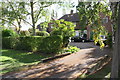
Sluice on east side of Queens Drive
by Roger Templeman
geograph for square SK5637
|
|
#100 Nicker Hill
by Roger Templeman
geograph for square SK6231
|

|
A lock on the Leeds & Liverpool Canal
by Roger Templeman
geograph for square SE2833
|
