About tags on Geograph

Public Tags

Related Tags | Coverage Map
Prefix: conversion    Tag:  Housing  
Other tags: Housing     building type:Housing     converted building:Housing     former:Housing     subject:Housing     urban fringe x top:Housing    

Showing images tagged with conversion:Housing tag.

View all tagged images - In Browser
:

TM3674 : Former Bell Inn, Walpole by Christopher Hilton Former Bell Inn, Walpole by Christopher Hilton
geograph for square TM3674
The door towards the left still has, etched into the glass, the falcon logo of... (more)
SK3824 : The Melbourne Arms is closed by Ian Calderwood The Melbourne Arms is closed by Ian Calderwood
geograph for square SK3824
The pub has been here since 1791 but, despite being grade-2 listed, is now... (more)
Tags: Conversion Project   top:Derelict, Disused   former:Hotel   conversion:Housing   Housing Development   former:Indian Restaurant   closed:Pub   former:Public House   subject:Public House   former:Restaurant   top:Village, Rural Settlement  
SK7053 : Former stable range coach house and cottage of the South Muskham Prebend by Alan Murray-Rust Former stable range coach house and cottage of the South Muskham Prebend by Alan Murray-Rust
geograph for square SK7053
Early 21st century conversion of buildings of c.1800 into a single dwelling.... (more)
Tags: building material:Brick and Tile   period:C.1800   former:Coach House   Former Stables   type:Geograph   Grade II Listed   top:Historic Sites and Artefacts   conversion:Housing   top:Housing, Dwellings   building material:Pantiles   top:Suburb, Urban Fringe  
SP2608 : Barn conversion at the junction of Church Lane and The Hill by Roger Templeman Barn conversion at the junction of Church Lane and The Hill by Roger Templeman
geograph for square SP2608
There is an OS benchmark SP2608 : Benchmark on barn conversion house at NE end of Church Road on the base quoin at the near corner, left... (more)
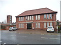
SK3616 : Former Ashby Cottage Hospital, Leicester Road, Ashby-de-la-Zouch by Alan Murray-Rust Former Ashby Cottage Hospital, Leicester Road, Ashby-de-la-Zouch by Alan Murray-Rust
geograph for square SK3616
Built 1897, currently in the process of conversion to residential use.
Tags: date:1987   building material:Brick and Tile   type:Geograph   top:Health and Social Services   former:Hospital   conversion:Housing   top:Housing, Dwellings   period:Late 19th Century   Scaffolding   top:Suburb, Urban Fringe  
SP0581 : Friends' Meeting House and Baths, Stirchley by A J Paxton Friends' Meeting House and Baths, Stirchley by A J Paxton
geograph for square SP0581
Cleanliness is next to godliness. The land for the Quaker meeting house, the... (more)
TM3852 : Former school, now housing, Chillesford by Christopher Hilton Former school, now housing, Chillesford by Christopher Hilton
geograph for square TM3852
SP0482 : Former Selly Oak Hospital by A J Paxton Former Selly Oak Hospital by A J Paxton
geograph for square SP0482
This former workhouse is now expensive flats. It was built in 1872 to designs by... (more)
Tags: Flats   type:Geograph   top:Health and Social Services   former:Hospital   Housing   converted building:Housing   conversion:Housing   Housing Development   top:Housing, Dwellings   Red Brick   top:Suburb, Urban Fringe   former:Workhouse  
TL6905 : Chelmsford: former St John's Hospital, now redeveloped as residential properties by Christopher Hilton Chelmsford: former St John's Hospital, now redeveloped as residential properties by Christopher Hilton
geograph for square TL6905
St John's Hospital, the former Chelmsford Workhouse, closed in 2010 and is... (more)
Tags: top:City, Town Centre   type:Geograph   top:Health and Social Services   top:Historic Sites and Artefacts   former:Hospital   subject:Housing   converted building:Housing   conversion:Housing   Housing   top:Housing, Dwellings   former:Workhouse  
SK6287 : Park Barn and The Byre. Sheffield Road, Blyth by Christine Johnstone Park Barn and The Byre. Sheffield Road, Blyth by Christine Johnstone
geograph for square SK6287
Originally outbuildings for Blyth Hall. Now converted to housing.
Tags: road:A634   place:Blyth   type:Geograph   converted building:Housing   conversion:Housing   top:Housing, Dwellings   Village Housing  
TQ3186 : Stadium Mews, London N5 by Christopher Hilton Stadium Mews, London N5 by Christopher Hilton
geograph for square TQ3186
This is the entrance to the housing development that occupies the former... (more)
Tags: former:Football Ground   type:Geograph   conversion:Housing   Housing   subject:Housing   top:Housing, Dwellings   top:Sport, Leisure   former:Sports Stadium  
SK5645 : The Old Pump House, 221 Beckhampton Road by Alan Murray-Rust The Old Pump House, 221 Beckhampton Road by Alan Murray-Rust
geograph for square SK5645
Former Nottingham Corporation Water Works pumping station, built 1958, converted... (more)
Tags: date:1958   period:Early 21st Century   type:Geograph   conversion:Housing   top:Housing, Dwellings   former:Pumping Station   top:Suburb, Urban Fringe   top:Water Resources  
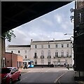
SP3165 : The former Crown Hotel, seen from Bath Place by A J Paxton The former Crown Hotel, seen from Bath Place by A J Paxton
geograph for square SP3165
The Crown Hotel opened in 1814 on a newly laid-out street called Warwick Row, a... (more)
Tags: top:Business, Retail, Services   top:City, Town Centre   type:Geograph   former:Hotel   building type:Housing   conversion:Housing   Housing   top:Housing, Dwellings   Railway   top:Railways   style:Regency   Road   top:Roads, Road Transport  
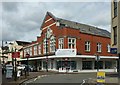
SP3165 : Former art gallery and public library, Leamington Spa by A J Paxton Former art gallery and public library, Leamington Spa by A J Paxton
geograph for square SP3165
These were converted to housing early in the 21st century; the library, art... (more)
Tags: top:City, Town Centre   top:Educational Sites   Former Public Library   type:Geograph   conversion:Housing   Housing   top:Housing, Dwellings   building material:Red Brick   Red Brick   Renaissance Revival Style   building material:Terracotta   material:Terracotta   Terracotta  
SP3165 : Former public library, Leamington Spa by A J Paxton Former public library, Leamington Spa by A J Paxton
geograph for square SP3165
The library, art and technical school were built in 1900; the art gallery, off... (more)
Tags: top:Air, Sky, Weather   top:City, Town Centre   top:Educational Sites   Former Public Library   type:Geograph   Housing   conversion:Housing   top:Housing, Dwellings   building material:Red Brick   Red Brick   Renaissance Revival Style   building material:Terracotta   material:Terracotta   Terracotta  
TL4153 : Housing on Cantelupe Road by Philip Jeffrey Housing on Cantelupe Road by Philip Jeffrey
geograph for square TL4153
Tags: type:Geograph   conversion:Housing   subject:Housing   top:Roads, Road Transport  
TF0206 : The Bath House, Bath Row, Stamford by Alan Murray-Rust The Bath House, Bath Row, Stamford by Alan Murray-Rust
geograph for square TF0206
An early baths building, dated 1823 with Gothic detailing, now converted to... (more)
Tags: date:1823   top:City, Town Centre   period:Early 19th Century   Former Bath House   type:Geograph   style:Georgian Gothic   Grade II Listed   top:Historic Sites and Artefacts   conversion:Housing   top:Housing, Dwellings   building material:Stone and Stone Slates  
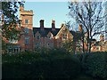
SK3034 : Mickleover Manor by Alan Murray-Rust Mickleover Manor by Alan Murray-Rust
geograph for square SK3034
Built in 1849 in 'restrained Tudor style', the house has had a varied... (more)
Tags: date:1849   type:Geograph   Grade II Listed   top:Historic Sites and Artefacts   conversion:Housing   top:Housing, Dwellings   former:Manor House   period:Mid 19th Century   top:Suburb, Urban Fringe   style:Tudor Revival  
SK9235 : Barracks Square, Stonebridge Road, Grantham by Alan Murray-Rust Barracks Square, Stonebridge Road, Grantham by Alan Murray-Rust
geograph for square SK9235
Built 1858 by County Surveyor Henry Goddard as NCOs' quarters. The houses... (more)
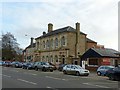
SK7519 : Court House, Norman Way, Melton Mowbray by Alan Murray-Rust Court House, Norman Way, Melton Mowbray by Alan Murray-Rust
geograph for square SK7519
Former Magistrates Court building, now converted to apartments and town houses.... (more)
Tags: date:1878   building material:Brick and Slate   top:City, Town Centre   former:Courthouse   type:Geograph   Grade II Listed   conversion:Housing   top:Housing, Dwellings   period:Late 19th Century   top:Public Buildings and Spaces  
SK9804 : Former Midland Hotel, Ketton by Alan Murray-Rust Former Midland Hotel, Ketton by Alan Murray-Rust
geograph for square SK9804
Originally attached to Ketton and Collyweston Station, now converted to a private house.
NZ6619 : Marlborough Court, Skelton, west side by Christine Johnstone Marlborough Court, Skelton, west side by Christine Johnstone
geograph for square NZ6619
A First World War Drill Hall that has been converted to housing.
NZ6619 : Marlborough Court, Skelton, from the south-east by Christine Johnstone Marlborough Court, Skelton, from the south-east by Christine Johnstone
geograph for square NZ6619
A First World War Drill Hall that has been converted to housing.
SK5538 : Former Bayley's tannery, Leengate by Alan Murray-Rust Former Bayley's tannery, Leengate by Alan Murray-Rust
geograph for square SK5538
Now converted to apartments. After ceasing to be used as a tannery, it was part... (more)
Tags: conversion:Housing   subject:Housing   top:Housing, Dwellings   top:Industry   housing:Low Rise Flats   top:Suburb, Urban Fringe   former:Tannery  
SK6587 : The Old Parish Room by Alan Murray-Rust The Old Parish Room by Alan Murray-Rust
geograph for square SK6587
Now converted into a dwelling.
Tags: subject:House   conversion:Housing   top:Housing, Dwellings   former:Parish Rooms   top:Village, Rural Settlement  
NZ2915 : The Beaumonts, Northgate, Darlington by Alan Murray-Rust The Beaumonts, Northgate, Darlington by Alan Murray-Rust
geograph for square NZ2915
Former Salvation Army citadel, dated 1887, now converted into serviced... (more)
Tags: date:1887   housing:Apartments   top:City, Town Centre   type:Geograph   conversion:Housing   top:Housing, Dwellings   period:Late 19th Century   top:Religious Sites   former:Salvation Army Citadel  
SE1337 : Sir Titus Salt’s Hospital by Alan Murray-Rust Sir Titus Salt’s Hospital by Alan Murray-Rust
geograph for square SE1337
So states the inscription on the northern façade. Built in 1868 as an integral... (more)
NZ0737 : Former convent in Wolsingham by Robert Graham Former convent in Wolsingham by Robert Graham
geograph for square NZ0737
The former St Anne's Convent on Angate Street in the town. It was an R C... (more)
Tags: subject:Convent   Former Convent   type:Geograph   conversion:Housing   top:Housing, Dwellings   top:Religious Sites   top:Suburb, Urban Fringe  
SE2467 : Sawley Parish Room by Alan Murray-Rust Sawley Parish Room by Alan Murray-Rust
geograph for square SE2467
Built in 1900 to provide social amenities for the village. Converted to a... (more)
Tags: date:1900   period:Early 20th Century   type:Geograph   conversion:Housing   top:Housing, Dwellings   former:Parish Rooms   top:Public Buildings and Spaces   top:Village, Rural Settlement  
SP9957 : Tithe Barn, Church End, Felmersham by PAUL FARMER Tithe Barn, Church End, Felmersham by PAUL FARMER
geograph for square SP9957
The barn was built in 1428 and was converted into four dwellings in the early eighties.
TL2793 : Old pumphouse at Glassmoor Bank by Alan Murray-Rust Old pumphouse at Glassmoor Bank by Alan Murray-Rust
geograph for square TL2793
Built in 1865 to house a steam driven pump to drain Glass Moor into... (more)
NZ6016 : Guisborough's Drill Hall, now housing by Christine Johnstone Guisborough's Drill Hall, now housing by Christine Johnstone
geograph for square NZ6016
On the north side of Park Lane, immediately east of the Fire Station.
NZ6016 : Entrance to I - 7 The Drill Hall, Park Lane by Christine Johnstone Entrance to I - 7 The Drill Hall, Park Lane by Christine Johnstone
geograph for square NZ6016
Guisborough's First World War Drill Hall has been converted into housing.... (more)
SK0146 : Former Temperance Hall, High Street, Kingsley by Alan Murray-Rust Former Temperance Hall, High Street, Kingsley by Alan Murray-Rust
geograph for square SK0146
Dated 1858 in the gable. The style of the windows in the front suggest a... (more)
Tags: date:1858   top:Educational Sites   Former Temperance Hall   type:Geograph   conversion:Housing   top:Housing, Dwellings   period:Mid 19th Century   top:Village, Rural Settlement  
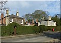
SK9809 : Cottage at Tickencote Hall by Alan Murray-Rust Cottage at Tickencote Hall by Alan Murray-Rust
geograph for square SK9809
Formerly the washhouse and bakehouse, early 18th century, Listed Grade II.
Tags: former:Bakehouse   top:Country Estates   period:Early 18th Century   type:Geograph   Grade II Listed   top:Historic Sites and Artefacts   conversion:Housing   top:Housing, Dwellings   building material:Stone and Stone Slates  
SJ9223 : Salter Street with The Malt Mill by Alan Murray-Rust Salter Street with The Malt Mill by Alan Murray-Rust
geograph for square SJ9223
The Malt Mill is the name given to the set of apartments in the upper part of... (more)
NU1433 : Spindlestone Ducket by Alan Murray-Rust Spindlestone Ducket by Alan Murray-Rust
geograph for square NU1433
SK9303 : Telephone kiosk and former Exchange by Alan Murray-Rust Telephone kiosk and former Exchange by Alan Murray-Rust
geograph for square SK9303
Standard K6 kiosk, currently still functional, Listed Grade II. The small... (more)
SK4861 : The Gatehouse, Teversal Manor by Alan Murray-Rust The Gatehouse, Teversal Manor by Alan Murray-Rust
geograph for square SK4861
Built in the 17th century, probably as an outbuilding to Teversal Manor. At some... (more)
Tags: period:17th Century   Grade II Listed   subject:Historic Building   top:Historic Sites and Artefacts   conversion:Housing   top:Housing, Dwellings   building material:Stone and Tile   top:Village, Rural Settlement  
SK6489 : The Laundry, Serlby Park by Alan Murray-Rust The Laundry, Serlby Park by Alan Murray-Rust
geograph for square SK6489
Built in the late 18th century to provide laundry facilities for Serlby Hall,... (more)
SK7585 : Forge Cottage, Low Street by Alan Murray-Rust Forge Cottage, Low Street by Alan Murray-Rust
geograph for square SK7585
This section of the building was formerly the village smithy.
Tags: building material:Brick and Tile   conversion:Housing   top:Housing, Dwellings   former:Smithy   top:Village, Rural Settlement  
TQ3086 : The Beaux-Arts Building, Manor Gardens by Jim Osley The Beaux-Arts Building, Manor Gardens by Jim Osley
geograph for square TQ3086
Formerly the GPO Money Order Office, latterly converted into apartments. Dates... (more)
Tags: subject:Accommodation   name:Beaux-Arts Building   conversion:Housing   top:Housing, Dwellings   architect:Jasper Wager   architect:John Rutherford   place:London N7 (Holloway)   building type:Office Building  
SD9312 : Former Milnrow Police Station, Newhey Road by Alan Murray-Rust Former Milnrow Police Station, Newhey Road by Alan Murray-Rust
geograph for square SD9312
Built c.1886 to accompany the Board of Health offices. Now converted to... (more)
Tags: date:1886   top:City, Town Centre   type:Geograph   conversion:Housing   top:Housing, Dwellings   period:Late 19th Century   former:Police Station   top:Public Buildings and Spaces   building material:Stone and Slate  
SE3520 : The East Pavilion, Heath Hall by Alan Murray-Rust The East Pavilion, Heath Hall by Alan Murray-Rust
geograph for square SE3520
Part of the symmetrical layout of Heath Hall with two flanking pavilions. This,... (more)
Tags: former:Brewhouse   top:Country Estates   type:Geograph   Grade I Listed   top:Historic Sites and Artefacts   conversion:Housing   top:Housing, Dwellings   period:Mid 18th Century   building material:Stone and Stone Slates   top:Village, Rural Settlement  
SJ9173 : Drill Hall, Bridge Street by Alan Murray-Rust Drill Hall, Bridge Street by Alan Murray-Rust
geograph for square SJ9173
The administrative buildings, with tower, built in 1872, now converted to... (more)
Tags: date:1872   building material:Brick and Slate   top:City, Town Centre   top:Defence, Military   former:Drill Hall   type:Geograph   conversion:Housing   top:Housing, Dwellings   period:Late 19th Century  
SK4344 : Water tower, Shipley Park by Alan Murray-Rust Water tower, Shipley Park by Alan Murray-Rust
geograph for square SK4344
Built in 1892 to serve Shipley Hall and Home Farm. Converted to residential use... (more)
Tags: date:1892   date:1920   period:Early 20th Century   type:Geograph   Grade II Listed   top:Historic Sites and Artefacts   conversion:Housing   top:Housing, Dwellings   period:Late 19th Century   top:Water Resources   former:Water Tower  
SK3448 : The Old Police Station, Matlock Road, Belper by Alan Murray-Rust The Old Police Station, Matlock Road, Belper by Alan Murray-Rust
geograph for square SK3448
Built in 1848 by the Strutts, it was one of the earliest police stations in the... (more)
Tags: date:1848   type:Geograph   Grade II Listed   top:Historic Sites and Artefacts   conversion:Housing   top:Housing, Dwellings   period:Mid 19th Century   former:Police Station   top:Public Buildings and Spaces   building material:Stone and Slate   top:Suburb, Urban Fringe  
SK3447 : Former nailer's workshop, Green Lane by Alan Murray-Rust Former nailer's workshop, Green Lane by Alan Murray-Rust
geograph for square SK3447
Latterly a garage and store, but now converted to residential use. Probably... (more)
Tags: type:Geograph   Grade II Listed   top:Historic Sites and Artefacts   conversion:Housing   top:Housing, Dwellings   top:Industry   period:Late 18th Century   Nails   top:Suburb, Urban Fringe   former:Workshop  
SK6471 : The Kennels, Perlethorpe by Alan Murray-Rust The Kennels, Perlethorpe by Alan Murray-Rust
geograph for square SK6471
Originally sets of kennels for hounds, with a central gateway, now converted to... (more)
Tags: date:1798   period:18th Century   top:Country Estates   Grade II Listed   top:Historic Sites and Artefacts   conversion:Housing   top:Housing, Dwellings   former:Kennels   style:Neo-Classical   top:Village, Rural Settlement  
SK6049 : 215 and 221 Main Street by Alan Murray-Rust 215 and 221 Main Street by Alan Murray-Rust
geograph for square SK6049
The non-consecutive numbering is due to the fact that what was once a group of... (more)
View more in the Image Search or in Browser
View images matching 'Housing' anywhere in the tags
Don't click these: PotMel 1 PotMel 2