About tags on Geograph

Public Tags

Related Tags | Coverage Map
Prefix: converted    Tag:  School  
Other tags: School     building type:School     disused:School     former:School     subject:School    

Showing latest 50 of 56 images tagged with converted:School tag.

View all tagged images - In Browser
:

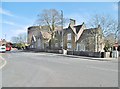
TM2154 : Former school, Clopton, Suffolk by Christopher Hilton Former school, Clopton, Suffolk by Christopher Hilton
geograph for square TM2154
According to a Clopton village website... (more)
TM3852 : Former school, now housing, Chillesford by Christopher Hilton Former school, now housing, Chillesford by Christopher Hilton
geograph for square TM3852
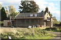
TL4701 : Former school, Fiddlers Hamlet near Epping by Malc McDonald Former school, Fiddlers Hamlet near Epping by Malc McDonald
geograph for square TL4701
A former primary school building, converted into a private home, at Fiddlers... (more)
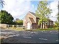
TM3374 : The Old School, Huntingfield by Christopher Hilton The Old School, Huntingfield by Christopher Hilton
geograph for square TM3374
The school was established in the mid-19th century by the Reverend Keyworth,... (more)
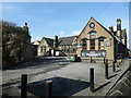
TM2251 : Former school, Grundisburgh by Christopher Hilton Former school, Grundisburgh by Christopher Hilton
geograph for square TM2251
Now converted to residential use.
TV5597 : The Old School House, East Dean by PAUL FARMER The Old School House, East Dean by PAUL FARMER
geograph for square TV5597
SE6862 : The Old School House, Flaxton by Christine Johnstone The Old School House, Flaxton by Christine Johnstone
geograph for square SE6862
Now a private residence, but the clock still keeps time.
SU4699 : Former school, Honeybottom Lane by Vieve Forward Former school, Honeybottom Lane by Vieve Forward
geograph for square SU4699
SO7928 : Converted school in Snig's End by Philip Halling Converted school in Snig's End by Philip Halling
geograph for square SO7928
A converted school building at Snig's End in Corse. Formerly it was Corse... (more)
Tags: converted:School  
SO6618 : Former primary school in Mitcheldean by Jaggery Former primary school in Mitcheldean by Jaggery
geograph for square SO6618
Viewed across the B4224 Hawker Hill. The refurbished and re-equipped former... (more)
TQ3456 : Farningham Road, Caterham by Malc McDonald Farningham Road, Caterham by Malc McDonald
geograph for square TQ3456
Farningham Road is a residential road in Caterham, in Surrey. The building to... (more)
Tags: place:Caterham   housing:Converted School   type:Geograph   Residential   Residential Area   Residential Road   Residential Street   converted:School   School (Converted)   subject:Suburb   top:Suburb, Urban Fringe   county:Surrey  
TQ3456 : Beechwood Road, Caterham by Malc McDonald Beechwood Road, Caterham by Malc McDonald
geograph for square TQ3456
Beechwood Road in Caterham, in Surrey. The building to the right of the road is... (more)
Tags: place:Caterham   housing:Converted School   type:Geograph   Residential   Residential Area   Residential Road   Residential Street   converted:School   School (Converted)   subject:Suburb   top:Suburb, Urban Fringe   county:Surrey  
SP3267 : Former Infants' School, Lillington by A J Paxton Former Infants' School, Lillington by A J Paxton
geograph for square SP3267
The school opened in 1899; the new building incorporated older cottages, visible... (more)
Tags: top:Educational Sites   type:Geograph   top:Housing, Dwellings   converted:School   School   top:Suburb, Urban Fringe  
TL8564 : Former county school, Northgate Street, Bury St Edmunds by Christopher Hilton Former county school, Northgate Street, Bury St Edmunds by Christopher Hilton
for square TL8564
County arms are visible above the door.
Tags: top:City, Town Centre   top:Educational Sites   former:School   subject:School   converted:School   building type:School   School (Converted)   School (Former)  
TL8564 : Former county school, Northgate Street, Bury St Edmunds by Christopher Hilton Former county school, Northgate Street, Bury St Edmunds by Christopher Hilton
geograph for square TL8564
Tags: top:City, Town Centre   top:Educational Sites   top:Roads, Road Transport   building type:School   former:School   subject:School   converted:School   School (Converted)   School (Former)   Street  
SW9245 : Tregony: former school by Christopher Hilton Tregony: former school by Christopher Hilton
geograph for square SW9245
Category: School (converted)
This is the former Wesleyan (Methodist) Sunday School Building): erected in... (more)
Tags: top:Educational Sites   subject:House   top:Housing, Dwellings   Methodist   building type:School   converted:School   School   former:Sunday School   Wesleyan Methodist  
SD2782 : Old school near Osmotherley Church by Adrian Taylor Old school near Osmotherley Church by Adrian Taylor
geograph for square SD2782
The school closed in 1927 and has subsequently been converted into a private... (more)
ST5774 : Redland, School House by Mike Faherty Redland, School House by Mike Faherty
geograph for square ST5774
Former school buildings on Belgrave Road, now being converted for residential use.
Tags: top:Derelict, Disused   top:Educational Sites   top:Housing, Dwellings   top:Lowlands   converted:School   subject:School   top:Suburb, Urban Fringe  
NJ5515 : Former Gallowhill School (2) by Stanley Howe Former Gallowhill School (2) by Stanley Howe
geograph for square NJ5515
Converted to a dwelling house.
Tags: postcode area:AB33   place:Alford (Aberdeenshire)   top:Educational Sites   top:Housing, Dwellings   converted:School   subject:School  
SP0786 : Former Floodgate School, Digbeth by A J Paxton Former Floodgate School, Digbeth by A J Paxton
geograph for square SP0786
This fine Grade II* board school building dates from 1891 and is by Martin &... (more)
Tags: Birmingham Board School   Board School   top:City, Town Centre   top:Educational Sites   Former Board School   Further Education College   type:Geograph   style:Gothic Revival   Red Brick   building material:Red Brick   School   converted:School   building material:Terracotta   Victorian  
SP3690 : Chilvers Coton Heritage Centre by A J Paxton Chilvers Coton Heritage Centre by A J Paxton
geograph for square SP3690
The Heritage Centre occupies the building of the former Chilvers Coton Free... (more)
SK3516 : Ashby-de-la-Zouch Library by Oliver Mills Ashby-de-la-Zouch Library by Oliver Mills
geograph for square SK3516
Originally the town's school, built in 1836 and extended in 1912. The... (more)
NT9249 : Old school, Horncliffe by David Chatterton Old school, Horncliffe by David Chatterton
geograph for square NT9249
The old village school, Horncliffe, now a private house. Built 1833.
NY4157 : Former school, Rickerby by Graham Robson Former school, Rickerby by Graham Robson
geograph for square NY4157
An old school building in Rickerby. The building dates from 1835. NY4157 : Former school, Rickerby village... (more)
Tags: Former School   type:Geograph   top:Historic Sites and Artefacts   top:Housing, Dwellings   place:Rickerby   converted:School  
SP7560 : Northampton, former school by Mike Faherty Northampton, former school by Mike Faherty
geograph for square SP7560
On Bridge Street; formerly Corporation Charity School, dated 1811. Judging from... (more)
SP2869 : Old School House, Warwick Road, Leek Wootton  by A J Paxton Old School House, Warwick Road, Leek Wootton by A J Paxton
geograph for square SP2869
The Victorian school has been superseded by a modern one, and the building is... (more)
Tags: top:Educational Sites   type:Geograph   House   top:Housing, Dwellings   School   converted:School   Victorian   top:Village, Rural Settlement  
NG2547 : The Old School Restaurant, Dunvegan by Tiger The Old School Restaurant, Dunvegan by Tiger
geograph for square NG2547
Behind the modern frontage is the former parish school for Duirinish, built... (more)
SP4873 : Former National School, Bilton, now an evangelical church by A J Paxton Former National School, Bilton, now an evangelical church by A J Paxton
geograph for square SP4873
The square stone in the gable end bears the inscription BUILT BY THE RECTOR... (more)
Tags: Blue Brick   building material:Blue Brick   Church   top:Educational Sites   church:Evangelical   Former National School   type:Geograph   House   top:Housing, Dwellings   Red Brick   building material:Red Brick   top:Religious Sites   School   converted:School   top:Suburb, Urban Fringe   building material:Yellow Brick  
ST4071 : Girls entrance to former St John's School  by S Girls entrance to former St John's School by S
geograph for square ST4071
Girls entrance to former St John's School, now Clevedon Library.
Tags: top:City, Town Centre   place:Clevedon   Clevedon Library   country:England   Gates   type:Geograph   Girls   Girls Entrance   Library   North Somerset   converted:School   St Johns School  
ST4071 : Boys entrance at former St John's School by S Boys entrance at former St John's School by S
geograph for square ST4071
Boys entrance at former St John's School, now Clevedon Library.
Tags: Boys   Boys Entrance   top:City, Town Centre   place:Clevedon   Clevedon Library   country:England   Gates   type:Geograph   Library   North Somerset   converted:School   St Johns School  
ST4459 : Part of the former school at Churchill by Brian Westlake Part of the former school at Churchill by Brian Westlake
for square ST4459
There is a flush bracket benchmark on this former school, now a holiday let.... (more)
Tags: Benchmark   type:Close Look   top:Educational Sites   House   top:Housing, Dwellings   Ordnance Survey   subject:School   converted:School   top:Village, Rural Settlement  
SE5947 : Former Church of England School - School Lane by Betty Longbottom Former Church of England School - School Lane by Betty Longbottom
geograph for square SE5947
Tags: top:Educational Sites   type:Geograph   converted:School   top:Suburb, Urban Fringe  
TL8646 : Old Long Melford Primary School by Sandy Gerrard Old Long Melford Primary School by Sandy Gerrard
geograph for square TL8646
LinkExternal link... (more)
Tags: top:Educational Sites   type:Geograph   top:Historic Sites and Artefacts   top:Lowlands   converted:School   subject:School   top:Village, Rural Settlement  
ST4071 : Clevedon Library  by S Clevedon Library by S
geograph for square ST4071
Clevedon Library, formerly St John's School.
Tags: top:Business, Retail, Services   top:City, Town Centre   place:Clevedon   Clevedon Library   country:England   type:Geograph   Library   North Somerset   converted:School   St Johns School  
ST4071 : Plaque outside Clevedon Library  by S Plaque outside Clevedon Library by S
for square ST4071
Plaque commemorating the building of St John's School in February 1889.
Tags: period:1880s   date:1889   top:City, Town Centre   place:Clevedon   Clevedon Library   type:Close Look   country:England   February   February 1889   top:Islands   Library   North Somerset   Plaque   converted:School   St Johns School  
ST4071 : Clevedon Library by S Clevedon Library by S
geograph for square ST4071
Clevedon Library, formerly St John's School.
Tags: top:Business, Retail, Services   top:City, Town Centre   place:Clevedon   Clevedon Library   country:England   type:Geograph   Library   North Somerset   converted:School   St Johns School  
ST4071 : Detail on Clevedon Library  by S Detail on Clevedon Library by S
for square ST4071
Detail of window and paneling of Clevedon Library, formerly St John's School.
ST4071 : Clevedon Library  by S Clevedon Library by S
geograph for square ST4071
Clevedon Library, formerly St John's School.
Tags: top:Business, Retail, Services   top:City, Town Centre   place:Clevedon   Clevedon Library   country:England   type:Geograph   Library   North Somerset   converted:School   St Johns School  
NX0846 : Old schoolhouse at Clachanmore by Oliver Dixon Old schoolhouse at Clachanmore by Oliver Dixon
geograph for square NX0846
This striking building dating from 1831 was used as an art gallery after the... (more)
Tags: top:Educational Sites   type:Geograph   top:Housing, Dwellings   converted:School   subject:School  
SE1733 : Byron Halls Apartments, Barkerend Road by Stephen Armstrong Byron Halls Apartments, Barkerend Road by Stephen Armstrong
geograph for square SE1733
Housed in magnificent Grade 2 Listed former school buildings. There is an OS Cut... (more)
ST4459 : Flush Bracket OSBM G2256: Churchill, School by Brian Westlake Flush Bracket OSBM G2256: Churchill, School by Brian Westlake
for square ST4459
Flush bracket benchmark on a former school, now a holiday let. See... (more)
Tags: Benchmark   subject:Benchmark   type:Close Look   top:Educational Sites   House   top:Housing, Dwellings   Ordnance Survey   converted:School   top:Village, Rural Settlement  
TF1247 : Flush Bracket OSBM 10177: Ewerby, School by Brian Westlake Flush Bracket OSBM 10177: Ewerby, School by Brian Westlake
for square TF1247
Flush bracket bench mark on a former school, now part of a private house. See... (more)
Tags: Benchmark   subject:Benchmark   type:Close Look   top:Housing, Dwellings   Ordnance Survey   converted:School   top:Village, Rural Settlement  
SO8342 : The Old School House by Philip Halling The Old School House by Philip Halling
geograph for square SO8342
The Old School House in Hanley Castle.
Tags: type:Geograph   subject:House   House   top:Housing, Dwellings   converted:School   top:Village, Rural Settlement  
SU1714 : Godshill, Lampton Lodge by Mike Faherty Godshill, Lampton Lodge by Mike Faherty
geograph for square SU1714
On Southampton Road. The building does not resemble a lodge, but a school; old... (more)
Tags: top:Derelict, Disused   top:Educational Sites   top:Housing, Dwellings   subject:Lodge   top:Lowlands   converted:School   top:Village, Rural Settlement  
NJ5515 : Former Gallowhill School (1) by Stanley Howe Former Gallowhill School (1) by Stanley Howe
geograph for square NJ5515
The Alma Mater of the poet Charles 'Hamewith' Murray.
Tags: postcode area:AB33   place:Alford (Aberdeenshire)   top:Educational Sites   converted:School   subject:School  
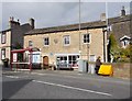
SE1730 : Former School, Bierley Lane by Stephen Armstrong Former School, Bierley Lane by Stephen Armstrong
geograph for square SE1730
Now home to Bierley Pharmacy & other small businesses.
Tags: top:Business, Retail, Services   type:Geograph   converted:School   top:Suburb, Urban Fringe  
NZ7218 : The Old Zetland School - High Street by Betty Longbottom The Old Zetland School - High Street by Betty Longbottom
geograph for square NZ7218
Tags: type:Geograph   converted:School   top:Village, Rural Settlement  
SE1010 : Former School - Meltham Mills Road by Betty Longbottom Former School - Meltham Mills Road by Betty Longbottom
geograph for square SE1010
Tags: top:Educational Sites   type:Geograph   converted:School   top:Suburb, Urban Fringe  
SE5194 : Former School, Snilesworth by Mick Garratt Former School, Snilesworth by Mick Garratt
geograph for square SE5194
22 children were studying here in 1890 out of a population in the scattered... (more)
Tags: subject:House   House   top:Housing, Dwellings   converted:School   top:Village, Rural Settlement  
SE0749 : The Old School - Main Street by Betty Longbottom The Old School - Main Street by Betty Longbottom
geograph for square SE0749
Originally built 1668 - rebuilt with second storey 1805 - now used as Parish... (more)
Tags: Library   Parish Rooms   converted:School   top:Suburb, Urban Fringe  
View more in the Image Search or in Browser
View images matching 'School' anywhere in the tags
Don't click these: PotMel 1 PotMel 2