
|
Wild Atlantic Way sign, Gola Island
by Rossographer
for square B7727
|

|
Kinnagoe Bay, County Donegal
by Rod Grealish
geograph for square C6246
Kinnagoe Bay (Irish: Bá Chionn an Ghabha) is a beach on Inishowen, County... (more)
|

|
Garvan Isles from northeast Inishowen coast, Co. Donegal
by Rod Grealish
for square C4360
The Garvan Isles (Irish : An Gharbháin) form an archipelago located off the... (more)
|

|
"Eire" sign on Malin Head, Donegal
by Rod Grealish
for square C4955
Malin Head is the most northerly point on the mainland of Ireland. Contrary to... (more)
|

|
Coronavirus sign, Gola Island
by Rossographer
for square B7727
Now redundant Covid-19 / Coronavirus signage attached to the harbour wall on Gabhla.
|

|
Gola Island Ferry
by Rossographer
geograph for square B7727
The small ferry to Gabhla. The crossing from the mainland takes only around 10 minutes.
|

|
Ruined house, Gola Island
by Rossographer
geograph for square B7726
One of many ruins on Gabhla, though there are plenty of well maintained homes... (more)
|

|
Gola Island
by Rossographer
geograph for square B7626
Walking on Gabhla. The colourful house on the left is in good condition but most... (more)
|

|
Coffee shop, Gola Island
by Rossographer
geograph for square B7626
There are virtually no facilities on Gabhla apart from a recently installed... (more)
|

|
Memorial bench, Gola Island
by Rossographer
for square B7627
Memorial bench on the north of Gabhla to Patrick Sullivan and Peter Milano, both... (more)
|

|
Sea arch, Gola Island
by Rossographer
geograph for square B7627
Sea arch at Scoilt Ui Dhúgáin, Oileán Ghabhla, on the northern tip of the island.
|

|
Track, Gola Island
by Rossographer
geograph for square B7627
Track on Gabhla with Loch Mhachaire na nGal on the right.
|

|
Track, Gola Island
by Rossographer
for square B7627
Track on Gabhla with Loch Mhachaire na nGal on the left.
|

|
Mural, Gola Island
by Rossographer
geograph for square B7626
Mural on a gable wall close to the southern harbour on Gabhla at Portacrin.
|

|
South harbour, Gola Island
by Rossographer
geograph for square B7626
The southern harbour on Gabhla at Portacrin.
|

|
Gola Island
by Rossographer
geograph for square B7726
A few sheep and ruined houses on Gabhla.
|

|
Malin Head Signal Tower
by Rossographer
geograph for square C3959
Signal Tower at Malin Head - see... (more)
|

|
Former hotel, Bunbeg
by Rossographer
geograph for square B8024
Interior of the former Óstan Ghaoth Dobhair (Ostan Gweedore) hotel, An Bun Beag.... (more)
|

|
Former hotel, Bunbeg
by Rossographer
geograph for square B8024
Interior of the former Óstan Ghaoth Dobhair (Ostan Gweedore) hotel, An Bun Beag.... (more)
|

|
View south-west along Lough Beagh from above Glenveagh Gardens
by Rod Grealish
for square C0019
Lough Beagh or Veagh (Irish: Loch Ghleann Bheatha) is part of the Glenveagh... (more)
|

|
Cloncha Church, Donegal
by Rod Grealish
geograph for square C5247
Cloncha (or Clonca) is the location of one of the most important Christian sites... (more)
|

|
Greencastle Port, Donegal
by Rod Grealish
for square C6440
Greencastle is on the western shore of Lough Foyle. It is about 30 kilometres... (more)
|

|
Greencastle Port, Donegal
by Rod Grealish
for square C6440
Greencastle is on the western shore of Lough Foyle. It is about 30 kilometres... (more)
|

|
View across Glen Beagh from above Glenveagh Gardens, Donegal
by Rod Grealish
for square C0121
The view shows Glenveagh Castle in the setting of Glen Beagh. Glenveagh Castle... (more)
|
|
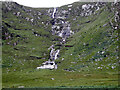
Astelleen Burn waterfall, Glenveagh National Park, Donegal
by Rod Grealish
geograph for square B9918
Astelleen Burn waterfall (Irish:Abhainn Eas Díleann, in English: Waterfall of... (more)
|

|
Sea arch on north-east coast of Inishowen, Co. Donegal
by Rod Grealish
geograph for square C4558
This sea arch is situated west of Stookaruddan, a sea stack which can be seen at... (more)
|

|
Stookaruddan, Inishowen, Co. Donegal
by Rod Grealish
geograph for square C4558
Stook is a local name for a sea stack. Stookaruddan is situated off the... (more)
|

|
'Bád Eddie', Bunbeg
by Rossographer
geograph for square B8024
The wreck of the 'Cara Na Mara', on Bunbeg's Magheraclogher... (more)
|

|
Glenveagh Castle
by Rod Grealish
geograph for square C0220
Glenveagh Castle (Irish: Caisleán Ghleann Bheatha translated as Castle of the... (more)
|

|
Map of Glenveagh Gardens
by Rod Grealish
for square C0220
The top of the map points north-west. At time of visiting Glenveagh Gardens and... (more)
|
