Public Tags
Tag: Covered·Walkway
Showing latest 50 of 89 images tagged with Covered Walkway tag.

|
The covered walkway, Grand Pier, Weston-Super-Mare
by Oliver Mills geograph for square ST3161 Constructed alongside the new pier pavilion in 2010. This covered walkway, which... (more)
Tags:
top:City, Town Centre
Covered Walkway
type:Geograph
pier:Grand Pier
top:Historic Sites and Artefacts
subject:Pier
top:Public Buildings and Spaces
Screen
place:Weston Super Mare
place:Weston-Super-Mare
Windbreak
|
|
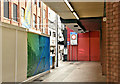
Primark (Bank Buildings) fire, Belfast - March 2019(1)
by Albert Bridge for square J3374 The covered walkway at Fountain Street. Norwich Union House is on the right.... (more)
Tags:
place:Belfast
type:Close Look
top:Construction, Development
Covered Walkway
type:Inside
Walkway
|

|
Primark (Bank Buildings) fire, Belfast - December 2018(5)
by Albert Bridge for square J3374 Inside the covered walkway connecting Donegall Place to Castle Place. The... (more)
Tags:
place:Belfast
top:Business, Retail, Services
top:City, Town Centre
Covered Walkway
Donegall Place
type:Inside
subject:Path
|

|
Covered walkway to the QE2 Pier
by Stephen Craven geograph for square TQ3980 Category: Walkway The walkway links the O2 Dome to the riverboat pier. See also TQ3980 : Walkway to the Dome.
Tags:
Covered Walkway
top:Paths
|

|
Covered Walkway at Bulbourne Garden Gentre, near Tring
by Chris Reynolds for square SP9313 When the centre was first opened one had to view some of the outside displays in... (more)
|

|
Covered walkway, Remnant Street
by Rob Farrow for square TQ3081 This is a closer view of the covered walkway on Remnant Street off... (more)
|

|
Covered walkway
by Richard Sutcliffe geograph for square NS5472 The covered walkway links New Kilpatrick Parish Church with the church's... (more)
|

|
Covered walkway
by Richard Sutcliffe geograph for square NS5472 The covered walkway links New Kilpatrick Parish Church with the New Halls.
Tags:
top:Burial Ground, Crematorium
Church
Church Hall
Covered Walkway
type:Geograph
top:Paths
top:Religious Sites
|

|
Primark (Bank Buildings) fire, Belfast - December 2018(8)
by Albert Bridge for square J3374 The covered walkway leading from Royal Avenue to Castle Place and Donegall Place.
Tags:
place:Belfast
top:City, Town Centre
type:Close Look
Covered Walkway
type:Inside
subject:Path
top:Paths
|

|
Primark (Bank Buildings) fire, Belfast - December 2018(4)
by Albert Bridge geograph for square J3374 The entrance to the covered path connecting Donegall Place to Castle Place.... (more)
Tags:
place:Belfast
top:Business, Retail, Services
top:City, Town Centre
Covered Walkway
Donegall Place
type:Geograph
subject:Path
|

|
Walkway at Leeds/Bradford Airport
by Trevor Littlewood geograph for square SE2241 The covered walkway at the left side of the image gives access to a number of... (more)
|

|
Walkway to the SECC
by Richard Sutcliffe geograph for square NS5765 Seen from Exhibition Centre Station, this is part of the covered walkway that... (more)
|

|
Walkway, Trago Mills
by Derek Harper for square SX8274 A covered walkway links the main shopping centre to the southern car park,... (more)
|

|
Barbican tour: covered walkway
by Stephen Craven for square TQ3281 The walkway slopes gently down from the precinct above Beech Street to the... (more)
|

|
Craignure: ferry terminal walkway
by Chris Downer for square NM7137 Looking along the covered walkway leading down to the boat. It's very hot... (more)
|

|
Covered walkway from Belgard Square East to Belgard Road, Tallaght, Dublin
by P L Chadwick for square O0827 Next door, on the left, is a branch of McDonald's, who have been in Ireland... (more)
|

|
Covered walkway on a rainy Saturday, The Maltings
by Pauline E for square SO6024 Category: Walkway Leading to the new Sainsbury's supermarket which has replaced Somerfield.
|

|
Covered walkway, St James's Hospital, Leeds
by Humphrey Bolton for square SE3134 This walkway is from the multi-storey car park to the Bexley Wing, which is the... (more)
Tags:
Covered Walkway
top:Health and Social Services
subject:Hospital
type:Inside
top:Lowlands
top:Paths
top:Suburb, Urban Fringe
|

|
New Kilpatrick Parish Church, Bearsden
by Richard Sutcliffe geograph for square NS5472 A covered walkway joins the Category A listed church... (more)
Tags:
subject:Church
Covered Walkway
type:Geograph
top:Historic Sites and Artefacts
Mausoleum
top:Paths
top:Religious Sites
|

|
Covered walkway, Heathrow Terminal 4
by Derek Harper geograph for square TQ0874 The outside of the walkway seen from the inside at TQ0874 : Covered walkway from Terminal 4, which links... (more)
Tags:
top:Air Transport
top:Business, Retail, Services
Covered Walkway
top:Flat Landscapes
type:Geograph
weather:Hot
Keep Left Bollard
Noise Reduction Barrier
top:Paths
Road Junction
top:Roads, Road Transport
Traffic Lights
|

|
Covered walkway from Terminal 4
by Derek Harper for square TQ0874 A walkway from the terminal divides in two; left for the Premier Inn, right for... (more)
Tags:
top:Air Transport
top:Business, Retail, Services
Covered Walkway
Hotel Access
type:Inside
Interior
top:Paths
|

|
Walkway, Otter Nurseries
by Derek Harper geograph for square SX8765 At the relocated Otter Nurseries (see SX9364 : Otter Nurseries Garden Centre - Everything Must Go, Babbacombe), now at Styles Garden Centre,... (more)
Tags:
top:Business, Retail, Services
Covered Walkway
Garden Centre
top:Lowlands
top:Paths
fence:Plastic Mesh
Shadow
|

|
Stairs to the overhead walkway
by Geographer for square TM1543 At Ipswich Railway Station off the B1073 Burrell Road at the junction with the... (more)
Tags:
B1073
B1075
B1075 Princes Street
Burrell Road
top:City, Town Centre
Covered Walkway
type:Inside
at:Ipswich
at:Ipswich Railway Station
Pedestrian Walkway
Princes Street
Railway Station
top:Railways
Ranelagh Road
Road Junction
subject:Stairs
off:The B1073 Burrell Road
to:The Overhead Walkway
Walkway
|

|
Covered Promenade, Hastings
by Graham Robson for square TQ8009 This covered walkway runs alongside the beach and provides a lower level to the... (more)
|

|
Walkway over the railway lines
by Geographer for square TM1543 At Ipswich Railway Station off the B1073 Burrell Road at the junction with the... (more)
Tags:
B1073
B1075
B1075 Princes Street
Burrell Road
top:City, Town Centre
Covered Walkway
type:Inside
at:Ipswich
at:Ipswich Railway Station
Pedestrian Walkway
Princes Street
Railway Lines
subject:Railway Station
top:Railways
Ranelagh Road
Road Junction
off:The B1073 Burrell Road
over:The Railway Lines
Walkway
|

|
Market Arches
by Neil Owen for square SS5147 A covered walkway between the upper and lower shopping streets of Ilfracombe has... (more)
|

|
Covered Walkway and Winkle Brown
by Glyn Baker geograph for square NT1573 The tunnel keeps people arriving on the tram out of the rain.
The statue is of... (more)
|

|
Bolton Interchange
by Gerald England geograph for square SD7108
The bus dropping off point outside the bus station. From inside a covered... (more)
|

|
Terminal Road South
by Gerald England geograph for square SJ8185 Outside the transport interchange. On the left is the covered walkway leading to... (more)
|

|
Malaga Avenue
by Gerald England geograph for square SJ8185 From outside the entrance to the bus/train/metrolink station looking at the... (more)
|

|
Royal Stoke University Hospital: covered walkway to main entrance
by Jonathan Hutchins geograph for square SJ8545 Tags:
Covered Walkway
top:Health and Social Services
subject:Hospital
top:Paths
Royal Stoke University Hospital
|

|
Precinct and covered walkway, North Greenwich
by Christine Johnstone geograph for square TQ3979 Few crowds on a Monday morning, so time to clean the paving.
|

|
Remnant Street from Lincoln's Inn Fields
by Rob Farrow geograph for square TQ3081 The lane leading off Lincoln's Inn Fields at its northwest corner to... (more)
|

|
The Square, Buxton
by Andrew Hill for square SK0573 A view along the colonnade or covered walkway along the side of the building.
|

|
Covered walkway, Stafford
by Derek Harper for square SJ9123 Providing a dry route around the Mount Street car park from Chell Road to, as... (more)
Tags:
top:Business, Retail, Services
top:City, Town Centre
Covered Walkway
top:Paths
Shopping Centre
|

|
Old meets new at the International School
by Christine Johnstone geograph for square SP1587 The covered walkways were built in 2012, to link the school's 1950s buildings.
Tags:
building material:Brick
Covered Walkway
top:Educational Sites
Path
school:Secondary
Secondary School
|
|
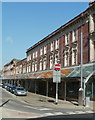
Covered walkway, Bethcar Street, Ebbw Vale
by Jaggery geograph for square SO1609 Viewed from Armoury Terrace. A long sloping roof projects from shops on the east... (more)
|

|
Covered gangway to the QE2 pier
by Stephen Craven for square TQ3980 Category: Walkway The gangway links the floating riverboat pier to the Thames Path. It can be... (more)
|

|
A covered walkway for the hall
by Neil Owen geograph for square ST4459 Adjoining the Methodist church is the old school - now a community hall. Clearly... (more)
Tags:
Covered Walkway
Former School Buildings
type:Geograph
subject:Hall
Methodist Church
top:Public Buildings and Spaces
top:Religious Sites
top:Village, Rural Settlement
|

|
New Ferry Terminal at Brodick
by David Dixon geograph for square NS0236 The new pier and terminal were completed in March 2018... (more)
Tags:
Covered Walkway
top:Docks, Harbours
Ferry Terminal
type:Geograph
Isle of Arran
Landing Stage
camera:Panasonic DC-G9
Pier
|

|
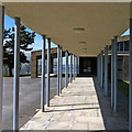
Bedford Square (Ewarts site), Belfast - September 2018(1)
by Albert Bridge geograph for square J3373 The covered walkway, at the former office building, in use for the duration of the work.
Tags:
place:Belfast
Building Under Renovation
subject:Construction
Construction Site
top:Construction, Development
Covered Walkway
type:Geograph
Safety Measures
|
|
Walkway, Mountsett Crematorium
by Pauline E for square NZ1654 Sheltered access to the chapel.
|

|
Old and new
by Barbara Carr geograph for square TM5593 Old painted sign on the end of a three-storey building next to modern covering... (more)
|

|
Thames Clippers pier at Woolwich
by Stephen Craven geograph for square TQ4379 Category: Piers This view is at around low tide and shows the same pier as described in... (more)
Tags:
Covered Walkway
Low Tide
top:Paths
Pier
top:Rivers, Streams, Drainage
river:Thames
place:Woolwich
|

|
Car Park Walkway at Morrisons, Enterprise 5, Five Lane Ends, Bradford
by Stephen Armstrong geograph for square SE1736 Tags:
top:Business, Retail, Services
Covered Walkway
type:Geograph
subject:Path
top:Paths
top:Suburb, Urban Fringe
Walkway
|

|
Walkway to Selfridges
by David Dixon for square SJ8398 This is a pedestrian bridge over Corporation Street connecting the Arndale... (more)
Tags:
Arndale Centre
Bridge
top:City, Town Centre
Covered Walkway
bucket:Indoor
type:Inside
Manchester City Centre
camera:Panasonic DC-G9
top:Paths
Pedestrian Walkway
|

|
Walkway at Joseph's Well
by Stephen Craven geograph for square SE2933 Joseph's Well is a former clothing factory in Leeds, now a small business... (more)
Tags:
top:Business, Retail, Services
Car Park
top:City, Town Centre
Covered Walkway
type:Geograph
Small Business Centre
|

|
Eldon Gardens walkway across Percy Street
by Robert Graham geograph for square NZ2464 The walkway across Percy Street was built as part of the Eldon Gardens... (more)
Tags:
top:Business, Retail, Services
top:City, Town Centre
City-Centre Street
Covered Walkway
type:Geograph
Shopping Centre
subject:Street
|

|
Kellogg's Walkway, Trafford Park
by David Dixon geograph for square SJ7895 The walkway, bridging Park Road, connects the Kellogg's factory with the warehouse.
Tags:
Bridge
Covered Walkway
Factory
Industrial Estate
top:Industry
top:Roads, Road Transport
place:Trafford Park
|

|
Craignure Pier Walkway
by Mary and Angus Hogg geograph for square NM7137 A very welcome sight for passengers on wild, wet days!
Tags:
Covered Walkway
top:Docks, Harbours
|
