Public Tags
Tag: Cracks
Showing images tagged with Cracks tag.

|
Crack in Mill Lane railway bridge
by Oliver Hunter for square SP6748 Category: Bridge A close up of the South-west side of SP6748 : Bridge on Mill Lane over dismantled railway showing a large crack and the... (more)
|

|
An ominous crack in the road surface
by Oliver Dixon geograph for square NY8677 On the way to Blindburn. Recent, I think, as I do not recall this crack on my... (more)
|

|
Wall, North Rigton
by Derek Harper geograph for square SE2849 A pot and kettle moment; I can't draw attention to the crack in this... (more)
|

|
London Museum of Water and Steam - the 100" Cornish engine
by Chris Allen for square TQ1878 The largest Cornish pumping engine in the UK. Built by Harvey & Co of Hayle... (more)
Tags:
type:Close Look
Cornish Beam Engine
Crack
top:Historic Sites and Artefacts
type:Inside
place:London
subject:Machine
Museum
former:Pumping Station
Stationary Steam Engine
|

|
Leverndale Hospital tower
by Richard Sutcliffe for square NS5162 A Category A listed... (more)
Tags:
type:Close Look
Crack
Former Hospital Building
top:Health and Social Services
top:Historic Sites and Artefacts
subject:Tower
|

|
Ashby-de-la-Zouch Canal, and a crack in the parapet
by A J Paxton geograph for square SP4191 The view is from Goodacres Bridge (SP4191 : Goodacres Bridge (Bridge no. 13), Ashby-de-la-Zouch Canal) in Stretton Baskerville,... (more)
|

|
Barn by Bennetts Hill Lane
by Derek Harper geograph for square SY4890 With a crack in the wall, and overlooking the valley shown in SY4990 : Valley near St Catherine's Cross.
Tags:
Barn
Cattle Pasture
Crack
top:Farm, Fishery, Market Gardening
type:Geograph
top:Lowlands
Valley
|

|
Outbuilding, Trevelyan
by Derek Harper for square SX1554 Also seen, with its crack in the west wall, in SX1554 : Lane past Trevelyan.
|

|
Not a reassuring sign
by Neil Owen geograph for square ST6648 The small stone bridge on Green Lane carries traffic over the Mell Stream and... (more)
Tags:
subject:Bridge
Cracking
Indicator
top:Rivers, Streams, Drainage
top:Roads, Road Transport
Stream
|

|
Damaged post, Plainmoor
by Derek Harper geograph for square SX9165 A cracked concrete post on Westhill Avenue, obviously damaged during a speedy... (more)
|

|
Crack in the ground!
by Dave Pickersgill for square SO4587 The effects of a dry summer on the fields of Shropshire.
|

|
Cracks along Badger's Lane
by Robin Stott geograph for square ST5883 |

|
Pearson's Bridge (Bridge no. 10), Ashby-de-la-Zouch Canal
by A J Paxton geograph for square SP4190 Pearson's Bridge, with its alarming crack, carries a farm track over the... (more)
Tags:
subject:Bridge
Canal Bridge
top:Canals
Crack
Farm Track
type:Geograph
top:Paths
top:Village, Rural Settlement
|

|
Footway, Charles Street, Warwick
by Robin Stott for square SP2965 The roots of a lime tree have caused cracks in a tarmac footway, on the south... (more)
Tags:
type:Close Look
tree:Common Lime
Cracks
postcode district:CV34
area:Emscote
Footway
top:Lowlands
top:Paths
Pavement
top:Suburb, Urban Fringe
Tarmac
Tree Roots
place:Warwick
|
|
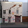
Dereliction on Bradford Street
by A J Paxton for square SP0886 Cracked like the House of Usher in Edgar Allan Poe's story, this building... (more)
Tags:
top:Business, Retail, Services
top:City, Town Centre
type:Close Look
Crack
top:Derelict, Disused
top:Housing, Dwellings
|

|
In the chancel - St Nicholas' Church, Studland
by Phil Champion for square SZ0382 Note the cracks in the arches.
Tags:
Anglican
Chancel
Chancel Arch
Church
subject:Church Interior
Church Interior
Church of England
Church of St Nicholas
Cracks
county:Dorset
Dorset
type:Inside
Isle of Purbeck
Norman
Parish Church
Purbeck
top:Religious Sites
Romanesque
Sanctuary
dedication:St Nicholas
place:Studland
|

|
Yellow sandstone, Cultra (2)
by Albert Bridge for square J4080 See J4080 : Yellow sandstone, Cultra (1). Another example nearby. This one has many fissures and cracks.
Tags:
place:Belfast Lough
top:Coastal
Cracks
place:Cultra
Fissures
Geological Interest
top:Geological Interest
Loughshore
Sandstone
Sandstone Outcrop
Yellow Sandstone
|

|
Path with bollard
by Richard Sutcliffe geograph for square NS6574 The path links Broadcroft to Broadcroft Road.
|

|
Notice board, Baldernock Parish Church Hall
by Richard Sutcliffe for square NS6073 The building is over 2 miles from Baldernock Parish Church.
SUNDAY SERVICES... (more)
Tags:
type:Close Look
Crack
subject:Hall
Notice Board
top:Religious Sites
Steps
top:Village, Rural Settlement
|

|
Mossmorran ethylene works
by Richard Webb geograph for square NT1889 Currently not in production. Has been controversial due to flaring, which... (more)
|

|
The edge of the sand, Kent estuary
by Karl and Ali geograph for square SD4679 The river has eroded a cliff about 2m tall at the edge of the exposed sand flat.... (more)
Tags:
top:Coastal
Cracking
Estuary
top:Estuary, Marine
top:Rivers, Streams, Drainage
Tidal River
Tidal Sands
|

|
Fife Ethylene Plant
by Richard Webb geograph for square NT1890 The Mossmorran chemical works. It produces ethylene (ethene if you are at... (more)
|

|
Fife Ethylene Plant
by Richard Webb for square NT1889 The Mossmorran chemical works. It produces ethylene (ethene if you are at... (more)
|

|
Fife Ethylene Plant
by Richard Webb geograph for square NT1990 The Mossmorran chemical works. It produces ethylene (ethene if you are at... (more)
|
