About tags on Geograph

Public Tags

Related Tags | Coverage Map
Prefix: date    Tag:  1839  
Other tags: 1839     built:1839     datestone:1839     year:1839    

Showing latest 50 of 115 images tagged with date:1839 tag.

View all tagged images - In Browser
:

SK9913 : All Saints Church: Loyal Hatchment by Bob Harvey All Saints Church: Loyal Hatchment by Bob Harvey
for square SK9913
The Royal coat of arms dated 1839 hangs above the West Window. 1839 was the... (more)
SJ9497 : Detail above the vestry door by Gerald England Detail above the vestry door by Gerald England
for square SJ9497
Over the vestry door SJ9497 : Old Chapel Vestry door is a block of stone from the original... (more)
Tags: date:1707   date:1839   Architectural Detail   type:Close Look   person:Elizabeth Heywood   person:James Heywood   top:Religious Sites  
SJ9497 : Old Chapel Vestry door by Gerald England Old Chapel Vestry door by Gerald England
for square SJ9497
Over the vestry door SJ9497 : Detail above the vestry door is a block of stone from the original building... (more)
Tags: date:1707   date:1839   type:Close Look   person:Elizabeth Heywood   person:James Heywood   top:Religious Sites   Vestry Door  
SJ9497 : Old Chapel by Gerald England Old Chapel by Gerald England
geograph for square SJ9497
The original Old Chapel on Chapel Hill was opened on 26th August 1708 when the... (more)
Tags: date:1708   date:1839   date:1840   date:1890   type:Geograph   top:Religious Sites   person:Samuel Angier   Unitarian Chapel  
SJ8990 : George Bowring of Stockport by Gerald England George Bowring of Stockport by Gerald England
for square SJ8990
The inscription on the south face the Bowring family tomb at St Peter's... (more)
Tags: date:1777   date:1783   date:1810   date:1813   date:1814   date:1815   date:1816   date:1819   date:1839   date:1840   date:1858   top:Burial Ground, Crematorium   person:George Bowring   person:John Bowring   person:Robert Bowring   person:Sarah Bowring   Tombstone   person:William Bowering  
SD8912 : Rochdale Station by Gerald England Rochdale Station by Gerald England
geograph for square SD8912
The original Rochdale Station was opened in 1839 adjacent to Moss Lane. It was... (more)
Tags: date:1839   date:1848   date:1863   date:1881   date:1889   date:1947   date:1970   date:2009   type:Geograph   Lancashire and Yorkshire Railway   Metrolink   Railway Station   top:Railways  
TR1459 : Ye Olde Beverlie by Gerald England Ye Olde Beverlie by Gerald England
geograph for square TR1459
The Grade II listed... (more)
Tags: date:1570   date:1634   date:1740   date:1839   date:1968   Bat and Trap   top:Business, Retail, Services   type:Geograph   Grade II Listed   Inn   Public House   person:Roger Manwood   brewer:Thomas and Wotton   brewer:Whitbread  
SE2035 : Old Hall, Woodhall Hills - rear by Stephen Craven Old Hall, Woodhall Hills - rear by Stephen Craven
geograph for square SE2035
This is a former farmhouse, dated by Historic England to 1707 with alterations... (more)
SD8912 : The view from Rochdale Station by Gerald England The view from Rochdale Station by Gerald England
geograph for square SD8912
On the left is Nye Bevan House which houses four GP practices and four dental... (more)
NS3692 : Memorial in Luss Churchyard (detail) by David Dixon Memorial in Luss Churchyard (detail) by David Dixon
for square NS3692
The inscription on NS3692 : Memorial in Luss Churchyard. In Memory of James 11th Baronet of... (more)
Tags: date:1804   date:1829   date:1832   date:1839   date:1856   date:1873   top:Burial Ground, Crematorium   Churchyard   Memorial   top:Religious Sites   top:Village, Rural Settlement  
TQ8833 : NatWest Bank by Gerald England NatWest Bank by Gerald England
geograph for square TQ8833
The Grade II listed... (more)
SD9316 : Littleborough station: main building by Stephen Craven Littleborough station: main building by Stephen Craven
geograph for square SD9316
The station building is on the down (northbound) platform. I presume it dates... (more)
Tags: date:1839   type:Geograph   Railway Station Building   top:Railways  
SH4938 : George IV Hotel by Gerald England George IV Hotel by Gerald England
geograph for square SH4938
The Grade II listed... (more)
Tags: date:1839   date:1890   top:Business, Retail, Services   top:City, Town Centre   type:Geograph   Grade II Listed   Hotel   Leisureplex  
SD8912 : Rochdale Railway Station by Gerald England Rochdale Railway Station by Gerald England
geograph for square SD8912
The original Rochdale Station was opened in 1839 adjacent to Moss Lane. It... (more)
Tags: date:1839   date:1848   date:1881   date:1889   date:2009   top:City, Town Centre   Flower Planter   type:Geograph   Lancashire and Yorkshire Railway   Metrolink   Railway Station   top:Railways  
SJ8496 : Upper Brook Street Unitarian Chapel by Gerald England Upper Brook Street Unitarian Chapel by Gerald England
geograph for square SJ8496
SJ8496 : Upper Brook Street Unitarian Chapel by Gerald England Upper Brook Street Unitarian Chapel by Gerald England
geograph for square SJ8496
SJ8496 : Unitarian Chapel on Upper Brook Street, Manchester by Gerald England Unitarian Chapel on Upper Brook Street, Manchester by Gerald England
geograph for square SJ8496
SJ8496 : Upper Brook Street Unitarian Church by Gerald England Upper Brook Street Unitarian Church by Gerald England
for square SJ8496
A look through the wire fence guarding the sad relic.
SD8501 : Christ Church, Harpurhey by Gerald England Christ Church, Harpurhey by Gerald England
geograph for square SD8501
Christ Church was built on land donated in 1836 by Robina Andrew of the Green... (more)
Tags: date:1836   date:1837   date:1838   date:1839   Church   type:Geograph   Grade II Listed   top:Religious Sites   person:Robina Andrew  
SP0687 : St Chad's Cathedral by Gerald England St Chad's Cathedral by Gerald England
geograph for square SP0687
The Grade II* listed... (more)
Tags: date:1829   date:1839   date:1841   architect:Augustus Pugin   Basilica   Cathedral   person:Edwin W Pugin   type:Geograph   Grade II(star) Listed   top:Religious Sites   Roman Catholic Cathedral   St Chads Cathedral  
SD5230 : Tang Restaurant by Gerald England Tang Restaurant by Gerald England
geograph for square SD5230
The Chinese restaurant was established on the corner of Carlton Street and... (more)
Tags: date:1839   date:2008   road:A583   top:Business, Retail, Services   Chinese Restaurant   type:Geograph   former:Public House   top:Roads, Road Transport  
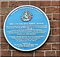
SJ9496 : Blue plaque: The Cotton Tree by Gerald England Blue plaque: The Cotton Tree by Gerald England
for square SJ9496
The blue plaque on the Cotton Tree SJ9496 : The Cotton Tree reads: TAMESIDE METROPOLITAN... (more)
SJ9494 : Six Point Charter by Gerald England Six Point Charter by Gerald England
for square SJ9494
The 3rd of the panels on the rear of the Monument to Hyde Chartists SJ9494 : Pull the Plug - Ring the Change... (more)
Tags: date:1839   date:1842   date:1848   Chartists   top:City, Town Centre   top:Historic Sites and Artefacts   Public Artwork  
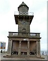
SD3348 : Two of Fleetwood's Listed Buildings by Gerald England Two of Fleetwood's Listed Buildings by Gerald England
geograph for square SD3348
The Lower (Beach) Lighthouse SD3348 : Fleetwood Lower Lighthouse at Fleetwood was designed in 1839 by... (more)
Tags: date:1839   date:1840   date:1961   person:Decimus Burton   person:Eric Morris Hart   top:Estuary, Marine   Grade II Listed   person:H M Denham   subject:Lighthouse   Lighthouse   Radar Training Station   person:Robert Booth   Wyre Estuary  
SE6132 : The Museum Hall, Park Street by Alan Murray-Rust The Museum Hall, Park Street by Alan Murray-Rust
geograph for square SE6132
The hall dates from 1839 when it opened as the Public Rooms. It subsequently... (more)
Tags: date:1839   Asian Restaurant   building material:Brick   top:Business, Retail, Services   top:City, Town Centre   Former Salvation Army Building   Grade II Listed   former:Museum   style:Neo-Classical   top:Public Buildings and Spaces   former:Public Hall   building material:Stucco  
NH6037 : Aldourie Castle by Gerald England Aldourie Castle by Gerald England
geograph for square NH6037
Only a glimpse the castle is visible from Loch Ness as dense woodland lines... (more)
Tags: date:1625   date:1839   date:2015   Aldourie Castle   person:Anders Holch Povlsen   top:Business, Retail, Services   Castle   listed building:Category A   top:Country Estates   type:Geograph   top:Lakes, Wetland, Bog   Loch Ness   person:Robert Tempest   Wedding Venue  
NH6037 :  Aldourie Castle by Gerald England Aldourie Castle by Gerald England
for square NH6037
Only a glimpse the castle is visible from Loch Ness as dense woodland lines... (more)
Tags: date:1625   date:1839   date:2015   Aldourie Castle   person:Anders Holch Povlsen   top:Business, Retail, Services   Castle   listed building:Category A   top:Country Estates   type:Cross Grid   top:Historic Sites and Artefacts   top:Lakes, Wetland, Bog   person:Robert Tempest   Wedding Venue   top:Woodland, Forest  
SE3724 : Kings Lock, Altofts by Stephen Craven Kings Lock, Altofts by Stephen Craven
geograph for square SE3724
A lock on the Aire and Calder Navigation, dating from 1839, engineers George... (more)
Tags: date:1839   Canal Locks   top:Canals   type:Geograph   Grade II Listed  
SE0153 : Methodist church, Main Street, Embsay by Stephen Craven Methodist church, Main Street, Embsay by Stephen Craven
geograph for square SE0153
The former Wesleyan Centenary chapel opened in 1839. The name presumably refers... (more)
Tags: date:1839   type:Geograph   Methodist Church   top:Religious Sites  
SE2737 : Former parish school, Hollin Lane, Far Headingley by Stephen Craven Former parish school, Hollin Lane, Far Headingley by Stephen Craven
geograph for square SE2737
I thought this looked like an old school building and indeed on the 1851 OS map... (more)
Tags: date:1839   Barbers   top:Educational Sites   Former Infants School   type:Geograph  
SD8912 : Rochdale Railway Station by Gerald England Rochdale Railway Station by Gerald England
geograph for square SD8912
The original Rochdale Station was opened in 1839 adjacent to Moss Lane. It... (more)
SD8912 : The view from Rochdale Station by Gerald England The view from Rochdale Station by Gerald England
geograph for square SD8912
On the left is Nye Bevan House which houses four GP practices and four dental... (more)
SD3348 : Beach Lighthouse by Gerald England Beach Lighthouse by Gerald England
geograph for square SD3348
The Lower (Beach) Lighthouse at Fleetwood was designed in 1839 by Decimus... (more)
Tags: date:1839   date:1840   top:Coastal   person:Decimus Burton   place:Fleetwood   type:Geograph   Grade II Listed   person:H M Denham   Lighthouse   Wyre Estuary  
SK6953 : Baptist Chapel, Nottingham Road, Southwell by Alan Murray-Rust Baptist Chapel, Nottingham Road, Southwell by Alan Murray-Rust
geograph for square SK6953
Built 1808 as a workhouse, bought and converted by the Baptist congregation in... (more)
SE3033 : The spire of Holy Trinity, Leeds by Stephen Craven The spire of Holy Trinity, Leeds by Stephen Craven
for square SE3033
This view is through the roof of the Trinity shopping centre, obviously named... (more)
SD8912 : Tram stop and church by Gerald England Tram stop and church by Gerald England
geograph for square SD8912
The Metrolink Tram Stop opened in 2013. The line was extended and opened as... (more)
SE2421 : Centenary Chapel by Gerald England Centenary Chapel by Gerald England
geograph for square SE2421
The Grade II listed building... (more)
SE2421 : Elim Pentecostal Church by Gerald England Elim Pentecostal Church by Gerald England
geograph for square SE2421
The Wellington Street entrance to Elim church. The Grade II listed building... (more)
SJ8398 : Manchester and Salford Junction Canal by Gerald England Manchester and Salford Junction Canal by Gerald England
geograph for square SJ8398
The canal was built in 1839 to link the Rochdale Canal with the River Irwell.... (more)
Tags: date:1839   date:1922   top:Canals   type:Geograph   river:Irwell   Lift Bridge   canal:Lock   Lock Gates   canal:Manchester & Salford Junction   Rochdale Canal  
SK6415 : Former Wesleyan Chapel, Thrussington by Alan Murray-Rust Former Wesleyan Chapel, Thrussington by Alan Murray-Rust
for square SK6415
Dated 1839 Link , but long since... (more)
SK6415 : 1 Seagrave Road, Thrussington (The Hollies) by Alan Murray-Rust 1 Seagrave Road, Thrussington (The Hollies) by Alan Murray-Rust
geograph for square SK6415
18th century house, with extensions. The wing along the lane to the right was... (more)
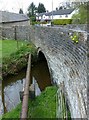
SJ9271 : Sutton Lane Ends Bridge by Alan Murray-Rust Sutton Lane Ends Bridge by Alan Murray-Rust
geograph for square SJ9271
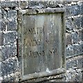
An attractive stone bridge over the Rossendale Brook. Dated 1839... (more)
SJ9271 : Sutton Lane Ends Bridge – dedication stone by Alan Murray-Rust Sutton Lane Ends Bridge – dedication stone by Alan Murray-Rust
for square SJ9271
This records the local surveyors responsible for the bridge, with the date 1839.... (more)
SJ9271 : Sutton Lane Ends Bridge by Alan Murray-Rust Sutton Lane Ends Bridge by Alan Murray-Rust
geograph for square SJ9271
An attractive stone bridge over the Rossendale Brook. Dated 1839... (more)
Tags: date:1839   type:Geograph   Grade II Listed   period:Mid 19th Century   top:Rivers, Streams, Drainage   bridge:Road Over Stream   top:Roads, Road Transport   bridge:Stone Arch  
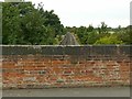
SK4433 : Looking west from Hopwell Road railway bridge by Alan Murray-Rust Looking west from Hopwell Road railway bridge by Alan Murray-Rust
geograph for square SK4433
There is a bench mark Link near the bottom... (more)
Tags: date:1839   type:Geograph   Grade II Listed   period:Mid 19th Century   Railway Line   top:Railways   bridge:Road Over Railway   top:Roads, Road Transport  
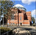
SD8912 : St John the Baptist's Roman Catholic Church by Gerald England St John the Baptist's Roman Catholic Church by Gerald England
geograph for square SD8912
St John the Baptist Roman Catholic Church was founded in 1839 but rebuilt... (more)
Tags: date:1839   date:1927   Catholic Church   person:Ernest Bower Norris   type:Geograph   Grade II Listed   Neo-Byzantine   person:Oswald Hill   top:Religious Sites  
TL2885 : Abbey Green, north side by Alan Murray-Rust Abbey Green, north side by Alan Murray-Rust
geograph for square TL2885
The nearer building is a set of almshouses, founded in 1839 by the local... (more)
Tags: date:1839   date:1848   Almshouses   top:City, Town Centre   Grade II Listed   top:Housing, Dwellings   period:Mid 19th Century   top:Religious Sites   building material:Stone and Slate   former:Village School  
SD3348 : Fleetwood Lower Lighthouse by Gerald England Fleetwood Lower Lighthouse by Gerald England
geograph for square SD3348
The Lower (Beach) Lighthouse at Fleetwood was designed in 1839 by Decimus... (more)
Tags: date:1839   date:1840   person:Decimus Burton   top:Estuary, Marine   Grade II Listed   person:H M Denham   subject:Lighthouse   Lighthouse   Wyre Estuary  
SK5855 : Church of St Mary of the Purification, Blidworth by Alan Murray-Rust Church of St Mary of the Purification, Blidworth by Alan Murray-Rust
geograph for square SK5855
The nave was heavily rebuilt between 1739-40, the 15th century tower being... (more)
SK5526 : East Leake Baptist Church by Alan Murray-Rust East Leake Baptist Church by Alan Murray-Rust
geograph for square SK5526
The date of 1839 on the plaque in the gable relates to the enlargement of the... (more)
Tags: date:1839   period:18th Century   period:19th Century   Baptist Church   building material:Brick and Slate   subject:Church   Grade II Listed   top:Historic Sites and Artefacts   top:Religious Sites   top:Village, Rural Settlement  
View more in the Image Search or in Browser
View images matching '1839' anywhere in the tags
Don't click these: PotMel 1 PotMel 2