About tags on Geograph

Public Tags

Related Tags | Coverage Map
Prefix: date    Tag:  1978  
Other tags: made:1978    

Showing images tagged with date:1978 tag.

View all tagged images - In Browser
:

ST3660 : View of Carberry Hill  by S View of Carberry Hill by S
geograph for square ST3660
On the top of Carberry Hill is Locking Castle, which is a motte and bailey... (more)
Tags: date:1100   period:1100s   period:1900s   date:1902   date:1978   period:1990s   period:2000s   period:2010s   6 January   6 January 1978   Archaeology   period:C.1100   Carberry Hill   former:Castle   building type:Castle   Castle   Coin   top:Communications   Countryside   top:Derelict, Disused   Edward IV   country:England   Field   type:Geograph   top:Grassland   Hill   top:Historic Sites and Artefacts   Housing Estate   January   January 1978   near:Locking   Locking Castle   North Somerset   top:People, Events   former:Port   Pottery   ruin:Priory   top:Religious Sites   Scheduled Monument   Stone Chamber   Sword   Uphill   Uphill Port   top:Uplands   Woodspring Priory  
TA0928 : G W Horners by Gerald England G W Horners by Gerald England
geograph for square TA0928
The Regent Picture Theatre opened on December 24, 1910 as the Kinemacolour... (more)
Tags: date:1910   date:1919   date:1978   date:2006   top:Business, Retail, Services   person:Charles Urban   Cinema (Former)   top:City, Town Centre   type:Geograph   Public House   former:Roller Skating Rink  
ST3660 : Field off Locking Moor Road  by S Field off Locking Moor Road by S
geograph for square ST3660
Looking towards Carberry Hill. On the top of Carberry Hill is Locking Castle,... (more)
Tags: 1100s   period:1900s   date:1902   date:1978   period:1990s   period:2000s   period:2010s   6 January 1978   Archaeology   period:C.1100   building type:Castle   Coin   Countryside   top:Derelict, Disused   Edward IV   country:England   Field   type:Geograph   top:Grassland   top:Historic Sites and Artefacts   Housing Estate   January   January 1978   near:Locking   Locking Castle   North Somerset   top:People, Events   former:Port   Pottery   ruin:Priory   top:Religious Sites   Sword   Uphill   Uphill Port   top:Uplands   Woodspring Priory  
ST3660 : Field off Locking Moor Road  by S Field off Locking Moor Road by S
geograph for square ST3660
On the right is Carberry Hill. On the top of Carberry Hill is Locking Castle,... (more)
Tags: date:1902   date:1978   period:1990s   period:2000s   period:2010s   6 January   6 January 1978   Carberry Hill   former:Castle   Castle   building type:Castle   Coin   Countryside   top:Derelict, Disused   Edward IV   country:England   Field   type:Geograph   top:Grassland   Hill   top:Historic Sites and Artefacts   Housing Estate   January   January 1978   near:Locking   Locking Castle   Medieval   North Somerset   top:People, Events   former:Port   Pottery   ruin:Priory   top:Religious Sites   Scheduled Monument   Stone Chamber   Sword   Uphill   Uphill Port   top:Uplands   Woodspring Priory  
NH6645 : The view down Balnain Street by Gerald England The view down Balnain Street by Gerald England
geograph for square NH6645
On the left is the Category C listed... (more)
Tags: date:1771   date:1829   date:1895   date:1978   date:1986   listed building:Category A   listed building:Category C   top:City, Town Centre   Community Hub   Former Free Church   Funeral Services   type:Geograph   Heritage Centre   place:Inverness   Old High Inverness   top:Religious Sites  
O2033 : Poolbeg Generating Station by Gerald England Poolbeg Generating Station by Gerald England
for square O2033
The City of Dublin Electricity Works founded Pigeon House Power Station in... (more)
O2133 : Poolbeg Generating Station by Gerald England Poolbeg Generating Station by Gerald England
for square O2133
The City of Dublin Electricity Works founded Pigeon House Power Station in... (more)
ST5872 : John King at the M Shed by Gerald England John King at the M Shed by Gerald England
geograph for square ST5872
The National Historic Ship... (more)
SC3876 : The Gaiety Theatre  by Gerald England The Gaiety Theatre by Gerald England
geograph for square SC3876
The Theatre is on the Protected Buildings Register... (more)
Tags: date:1900   date:1957   date:1971   date:1976   date:1978   date:1993   top:City, Town Centre   Douglas Corporation   person:Frank Matcham   Friends of The Gaiety   type:Geograph   Mannin Entertainment   Protected Structure   top:Sport, Leisure   Theatre   Villa Marina  
SC3876 : The Gaiety Theatre  by Gerald England The Gaiety Theatre by Gerald England
for square SC3876
The Theatre is on the Protected Buildings Register... (more)
Tags: date:1900   date:1957   date:1971   date:1976   date:1978   date:1993   Bench   top:City, Town Centre   type:Close Look   Douglas Corporation   person:Frank Matcham   Friends of The Gaiety   Mannin Entertainment   Protected Structure   top:Sport, Leisure   Theatre   Villa Marina  
SD7108 : The Story of Bolton's Elephants by Gerald England The Story of Bolton's Elephants by Gerald England
for square SD7108
The two cast-iron elephants set above collectively weigh over 1 tonne and were... (more)
Tags: date:1977   date:1978   date:2007   date:2014   date:2015   date:2016   Cast Iron Sculpture   top:City, Town Centre   type:Close Look   Elephants   Information Board  
SD8913 : The Regal Moon by Gerald England The Regal Moon by Gerald England
geograph for square SD8913
The Regal Cinema was designed for Associated British Cinemas (ABC) by architects... (more)
Tags: date:1938   date:1949   date:1962   date:1978   date:1986   date:1992   former:ABC Cinema   person:Barbara Stanwyk   former:Bingo Hall   Blue Plaque   top:Business, Retail, Services   Cinema (Former)   type:Geograph   person:Gracie Fields   pub:JD Wetherspoon   Public House  
SJ9398 : Dukinfield Methodist Church by Gerald England Dukinfield Methodist Church by Gerald England
geograph for square SJ9398
The first Methodist Church in Dukinfield opened in 1829. It was replaced by a... (more)
Tags: date:1829   date:1840   date:1860   date:1898   date:1977   date:1978   place:Dukinfield   church:Methodist   Methodist Church   top:Religious Sites  
ST5871 : Windmill Hill City Farm by S Windmill Hill City Farm by S
geograph for square ST5871
The site where Windmill Hill City Farm is now, was home to a community of... (more)
Tags: period:1970s   date:1976   date:1977   date:1978   period:1980s   date:1985   period:1990s   date:1995   All Weather Pitch   Bristol City Council   Doveton Street   Farm Shop   top:Farm, Fishery, Market Gardening   type:Geograph   Indoor Activity Centre   Lorry Park   Meeting Room   Percy Street   Sports Pitch   former:Street   former:Terraced Housing   Windmill Hill City Farm   former:Workshop   World War II  
SJ9494 : The corner of Church Street and Henry Street by Gerald England The corner of Church Street and Henry Street by Gerald England
geograph for square SJ9494
Behind the wall and fencing is a classroom belonging to the present St... (more)
Tags: date:1836   date:1870   date:1913   date:1978   Classroom   top:Educational Sites   type:Geograph   Primary School (Church of England)  
ST5871 : Windmill Hill City Farm by S Windmill Hill City Farm by S
geograph for square ST5871
Windmill Hill City Farm was created in 1976 by volunteers. The site where... (more)
Tags: period:1970s   date:1976   date:1977   date:1978   period:1980s   date:1985   period:1990s   date:1995   All Weather Pitch   place:Bedminster   Bedminster   county:Bristol   place:Bristol   Bristol City Council   City Farm   Doveton Street   Farm   Farm Shop   top:Farm, Fishery, Market Gardening   type:Geograph   Indoor Activity Centre   Lorry Park   Meeting Room   Percy Street   Sports Pitch   former:Street   former:Terraced Housing   Windmill Hill City Farm   former:Workshop   Workshop   World War II  
SJ9494 : A cut bench-mark on Tower Street, Hyde by Gerald England A cut bench-mark on Tower Street, Hyde by Gerald England
for square SJ9494
The cut benchmark is on the wall SJ9494 : The corner of Tower Street and Henry Street which is part of the 1870... (more)
Tags: date:1836   date:1870   date:1978   type:Close Look   Cut Bench Mark   top:Educational Sites   Primary School (Church of England)  
SJ9494 : The corner of Tower Street and Henry Street by Gerald England The corner of Tower Street and Henry Street by Gerald England
geograph for square SJ9494
Behind the wall and fencing is St George's Church of England Primary... (more)
Tags: date:1836   date:1870   date:1978   Cut Bench Mark   top:Educational Sites   type:Geograph   Primary School (Church of England)  
ST5871 : Windmill Hill City Farm,  Bedminster by S Windmill Hill City Farm, Bedminster by S
geograph for square ST5871
The site where Windmill Hill City Farm is now, was home to a community of... (more)
Tags: date:1960   period:1960s   period:1970s   date:1976   date:1977   date:1978   Blitz   Chickens   City Farm   Demolished Factory   Demolition   Den Hope Auto Engineers   Dustbin Group   subject:Farm   Farm   Farm Shop   subject:Field   Field   type:Geograph   planned:Lorry Park   Ponies   Rabbits   September   September 1976   Site of Demolished Housing   Windmill Hill City Farm   Workshop   World War II  
ST5689 : Viewpoint at Severn View Services  by S Viewpoint at Severn View Services by S
geograph for square ST5689
Viewpoint of the River Severn at Severn View Services on the M48. Severn View... (more)
Tags: period:1960s   date:1966   period:1970s   date:1978   period:1990s   date:1996   period:2000s   date:2001   period:2010s   Almondsbury   Amusement Arcade   Amusement Park   Aust   Brightside Insurance   top:Business, Retail, Services   country:England   type:Geograph   Granada Services   Gscape   Higgs and Hill Ltd   top:Industry   motorway:M4   motorway:M48   Moto Services   Motorway   Motorway Services   top:Rivers, Streams, Drainage   top:Roads, Road Transport   Severn Bridge   Severn View Services   South Gloucestershire  
SJ7899 : Royal Sovereign by Gerald England Royal Sovereign by Gerald England
geograph for square SJ7899
The building was originally the Heath Mount Hotel. In 1978 Wilson's... (more)
SJ8597 : Ardwick Green by Gerald England Ardwick Green by Gerald England
geograph for square SJ8597
On display are an abundance of daffodils. In the background on the right is... (more)
SD8913 : Former Cargo  Studios. by Gerald England Former Cargo Studios. by Gerald England
geograph for square SD8913
Studios on the corner of Baron Street and Kenion Street SD8913 : Kenion Street.... (more)
Tags: date:1978   date:1984   date:2012   top:Business, Retail, Services   type:Geograph   person:John Brierley   Music Studio   Recording Studios  
ST5872 : Bristol: Dockside cranes and M Shed by Gerald England Bristol: Dockside cranes and M Shed by Gerald England
geograph for square ST5872
M Shed is a former transhipment shed in Bristol Docks. Formerly known as Bristol... (more)
ST3261 : Emmanuel Church by S Emmanuel Church by S
geograph for square ST3261
Designed by Bath architects Manners and Gill. The church was built in 1847.... (more)
Tags: period:1840s   year:1847   date:1847   period:1970s   date:1978   19th Century   period:19th Century   subject:Church   Church   building type:Church   top:City, Town Centre   Emmanuel Church   type:Geograph   top:Historic Sites and Artefacts   Manners and Gill   top:Religious Sites   Richard Parsley   Weston Super Mare   place:Weston Super Mare  
SH4560 : 1st Earl of Snowdon's headstone at St Baglan's Llanfaglan by Richard Hoare 1st Earl of Snowdon's headstone at St Baglan's Llanfaglan by Richard Hoare
for square SH4560
Antony Charles Robert Armstrong-Jones, 1st Earl of Snowdon GCVO, FRSA, RDI, was... (more)
ST3663 : St Mark's Church and Church Cottage  by S St Mark's Church and Church Cottage by S
geograph for square ST3663
St Mark's Church was built in 1981. Church Cottage was built around 1978.... (more)
SS6188 : Newton Road, Mumbles by Gerald England Newton Road, Mumbles by Gerald England
geograph for square SS6188
The B4593 out of Oystermouth. On the corner of Castle Avenue is the Ostreme... (more)
Tags: date:1978   date:1980   road:B4593   Community Centre   type:Geograph   top:Paths   top:Suburb, Urban Fringe   place:The Mumbles  
SJ9295 : Memorial to Lance Corporal Andrew Breeze by Gerald England Memorial to Lance Corporal Andrew Breeze by Gerald England
for square SJ9295
The memorial by the side of the Denton Link Road, now Lance Corporal Andrew... (more)
NZ8911 : Statue of Captain Cook: Plaque on west face by Gerald England Statue of Captain Cook: Plaque on west face by Gerald England
for square NZ8911
The inscription on the plaque on the west face of the statue NZ8911 : Statue of Captain Cook: Rear view reads:... (more)
SJ9398 : Bridge A by Gerald England Bridge A by Gerald England
geograph for square SJ9398
Bridge A on the Peak Forest Canal is a cast-iron railway bridge, built in 1845... (more)
Tags: date:1845   date:1978   Bridge Over Canal   top:Canals   type:Geograph   canal:Peak Forest   Railway Bridge  
SJ9398 : Peak Forest Canal Bridge A by Gerald England Peak Forest Canal Bridge A by Gerald England
geograph for square SJ9398
Bridge A on the Peak Forest Canal is a cast-iron railway bridge, built in 1845... (more)
Tags: date:1845   date:1978   Bridge Over Canal   top:Canals   type:Geograph   Narrowboat   canal:Peak Forest   Railway Bridge   top:Railways  
SH7882 : Irish visitors by Gerald England Irish visitors by Gerald England
for square SH7882
The Irish must be in Llandudno for the Victorian Extravaganza Weekend and... (more)
TF0206 : George Bridge across the River Welland in Stamford by David Dixon George Bridge across the River Welland in Stamford by David Dixon
for square TF0206
The plaque on this footbridge reads: This George Bridge was rebuilt in the... (more)
SJ8989 : Stockport Baptist Church by Gerald England Stockport Baptist Church by Gerald England
geograph for square SJ8989
Greek Street Baptist Chapel LinkExternal link was built... (more)
Tags: date:1869   date:1978   Baptist Chapel   Baptist Church   top:Religious Sites  
NT2677 : Railway wagons at Leith - 1978 by Andrew Richardson Railway wagons at Leith - 1978 by Andrew Richardson
geograph for square NT2677
Exact coordinates not known, but Chancelot Mill is in the background. The photo... (more)
Tags: date:1978   top:Docks, Harbours   place:Edinburgh   top:Industry   place:Leith   top:Lowlands   Railway Wagons   top:Railways   top:Suburb, Urban Fringe  
NT1473 : Edinburgh Airport - 1978 by Andrew Richardson Edinburgh Airport - 1978 by Andrew Richardson
geograph for square NT1473
The terminal building and car park. This was the 'new' terminal, built... (more)
NT1067 : Midcalder Station and level crossing - 1978 by Andrew Richardson Midcalder Station and level crossing - 1978 by Andrew Richardson
geograph for square NT1067
At Kirknewton, and now known as Kirknewton Station, on the Edinburgh-Carstairs... (more)
Tags: date:1978   Kirknewton   Level Crossing   top:Lowlands   place:Mid Calder   top:Railways   top:Roads, Road Transport   top:Village, Rural Settlement   place:West Lothian  
NT0767 : RHM lorry leaving the feed mill at Mid Calder -1978 by Andrew Richardson RHM lorry leaving the feed mill at Mid Calder -1978 by Andrew Richardson
for square NT0767
The mill was at the end of Almondside, a short cul-de-sac. RHM was originally... (more)
Tags: date:1978   top:Industry   Lorry   top:Lowlands   place:Mid Calder   RHM   top:Roads, Road Transport   top:Village, Rural Settlement   place:West Lothian  
R4646 : St Nicholas' cemetery by Gerald England St Nicholas' cemetery by Gerald England
geograph for square R4646
The newest graveyard in Adare is located behind the present parish church,... (more)
Tags: date:1978   top:Burial Ground, Crematorium   type:Geograph   Graveyard  
SE5730 : St Francis of Assisi, Thorpe Willoughby by Stephen Craven St Francis of Assisi, Thorpe Willoughby by Stephen Craven
geograph for square SE5730
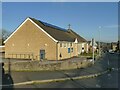
Built in 1978 as a shared Church of England and Methodist building.
SE0725 : Highgate Methodist church, Stretchgate Lane by Stephen Craven Highgate Methodist church, Stretchgate Lane by Stephen Craven
geograph for square SE0725
Construction of the present church began in 1978. It was designed and built by... (more)
Tags: date:1978   type:Geograph   Methodist Church   top:Religious Sites   top:Suburb, Urban Fringe  
SJ9173 : Olympus Trophies by Gerald England Olympus Trophies by Gerald England
geograph for square SJ9173
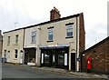
Next to Olympus Trophies LinkExternal link on Duke Street who have... (more)
Tags: date:1978   top:Business, Retail, Services   type:Geograph   Trophy Shop   postbox:Victorian  
ST3663 : Church Cottage  by S Church Cottage by S
geograph for square ST3663
Church Cottage was built around 1978 on 'Vurdills'.
Tags: period:1970s   date:1978   Church Cottage   type:Geograph   House   top:Housing, Dwellings   North Somerset   North Worle   top:Suburb, Urban Fringe   Vurdills   Worle  
SK8055 : St Leonard's Church and Bridge Community Centre  by Alan Murray-Rust St Leonard's Church and Bridge Community Centre by Alan Murray-Rust
geograph for square SK8055
Dedicated in November 1978, it was a replacement for an earlier (1873) church on... (more)
ST3660 : Field off Locking Moor Road  by S Field off Locking Moor Road by S
geograph for square ST3660
Tags: date:   period:1900s   period:1970s   date:1978   period:1990s   period:2000s   period:2010s   Archaeology   building type:Castle   Coin   Countryside   top:Derelict, Disused   Edward IV   country:England   Field   type:Geograph   top:Grassland   top:Historic Sites and Artefacts   Housing Estate   near:Locking   Locking Castle   North Somerset   top:People, Events   former:Port   ruin:Priory   top:Religious Sites   Stone   Sword   Uphill   Uphill Port   top:Uplands   Woodspring Priory  
SE2025 : Houses on Quarry Road, Gomersal by Stephen Craven Houses on Quarry Road, Gomersal by Stephen Craven
geograph for square SE2025
Unusually for the period, there is a datestone in the wall on the corner: 1978.
Tags: date:1978   type:Geograph   top:Housing, Dwellings  
View more in the Image Search or in Browser
View images matching '1978' anywhere in the tags
Don't click these: PotMel 1 PotMel 2