Geograph - photograph every grid square
About tags on Geograph
Tags
Geographical Context
Subjects
Types
Other Prefixes
Public Tags
Related Tags
|
Coverage Map
Tag:
Demolished·Site
Showing images tagged with
Demolished Site
tag.
View all tagged images
-
In Browser
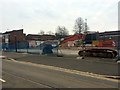
Site of demolished houses near Werrington Junction
by
Paul Bryan
geograph for square
TF1504
Two semi-detached houses on Lincoln Road, which were formerly located next to... (
more
)
Tags:
top:
Construction, Development
Container Train
Demolished
Demolished Building
Demolished House
Demolished Site
subject:
Demolition Site
East Coast Main Line
railway:
East Coast Main Line
railway:
East Coast Mainline
East Coast Mainline
ECML
top:
Flat Landscapes
Freight Train
type:
Geograph
Goods Train
top:
Housing, Dwellings
Railway Construction
Railway Line
Railway Line (Under Construction)
Railway Train
top:
Railways
Site of Demolished Building
Site of Demolished Houses
top:
Suburb, Urban Fringe
Train
Werrington Junction
Peugeot Ryton Assembly Plants
by
Nigel Mykura
geograph for square
SP3774
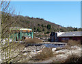
All that remains of this once great pillar of Coventry's motor industry is... (
more
)
Tags:
Demolished Car Factory
Demolished Factory
Demolished Motor Industry
Demolished Peugeot Factory
Demolished Site
top:
Derelict, Disused
top:
Industry
Site of Demolished Building
Site of Riverwalk House, Millbank
by
PAUL FARMER
geograph for square
TQ3078
Riverwalk house is now nearly demolished to make way for a new development.
Tags:
top:
City, Town Centre
Demolished
Demolished Building
Demolished Site
London
place:
London
Millbank
Road Junction
Road Scene
top:
Roads, Road Transport
The Red Cow is demolished
by
David Lally
geograph for square
SK5538
See:
Link
.
Tags:
top:
Construction, Development
Demolished Public House
Demolished Site
Demolition Site
The remains of Maryland village, Brownsea Island
by
Chris Allen
geograph for square
SZ0188
This was home to the pottery workers and included a public house. The derelict... (
more
)
Tags:
place:
Brownsea Island
Demolished Site
top:
Derelict, Disused
county:
Dorset
type:
Geograph
top:
Islands
Village
top:
Village, Rural Settlement
The future 3 Glass Wharf?
by
Christine Johnstone
geograph for square
ST5972
Between Avon Street and the Floating Harbour. Another development site [2 Glass... (
more
)
Tags:
top:
City, Town Centre
top:
Construction, Development
Demolished Site
Development Site
Development site north of Temple Meads
by
Christine Johnstone
geograph for square
ST5972
Between Anvil Street [left / north] and Avon Street [right / south].
Tags:
top:
City, Town Centre
top:
Construction, Development
Demolished Site
Development Site
Site of the former farmyard at Gelli'r-haidd-uchaf
by
Simon Mortimer
geograph for square
SS9986
Looking south-east, with Route 4 of the National Cycle Network on the left of... (
more
)
Tags:
Demolished Site
top:
Farm, Fishery, Market Gardening
former:
Farmyard
top:
Lowlands
National Cycle Network Route 4
Salisbury Street, Shipley Central Park
by
Christine Johnstone
geograph for square
SE1437
The original road surface, from the 1890s. This area became a park in the early... (
more
)
Tags:
Central Park
Demolished Site
top:
Historic Sites and Artefacts
subject:
Park
top:
Park and Public Gardens
top:
Roads, Road Transport
Setts
place:
Shipley
Street
Urban Park
Demolition site, Drawbriggs Road
by
Roger Templeman
geograph for square
NY6920
Tags:
top:
Construction, Development
Demolished Site
top:
Industry
top:
Suburb, Urban Fringe
top:
Water Resources
Water Tower
Gas & Hopeless
by
Des Blenkinsopp
geograph for square
TQ3359
Tags:
Demolished Site
top:
Derelict, Disused
Gasholder
top:
Suburb, Urban Fringe
Writing on the Wall
View more in the Image Search
or
in Browser
View images matching 'Demolished Site' anywhere
in
the tags
Don't click these:
PotMel 1
PotMel 2
☰
Home
View
Search
Marked Images
Maps
Browser
Explore
Showcase
New Images
Collections
Interact
Games
Discussions
Blog
Contributors
Submit
Statistics
Leaderboards
General
FAQ
Help Pages
Sitemap
Contact Us
Support Us
sponsored by
🔍︎
What to search:
Photos
Enter keywords or a location/postcode to search nearby images
Enter a Grid Reference
Placenames
Collections
Website Pages
Everything
Others:
Advanced Search
|
Image Browser
Or:
Coverage Map
|
Searchable Map
You are not logged in
|
login
|
register