Public Tags
Showing latest 50 of 62 images tagged with denomination:Baptist tag.

|
Eglwys Unedig Gymraeg Llandudno (Llandudno United Welsh Church)
by Gerald England geograph for square SH7782 Located at the junction of Gloddaeth Street and Arvon Avenue
The original... (more)
Tags:
denomination:Baptist
subject:Church
Eglwys Bresbyteraidd Cymru
Eglwys Unedig Gymraeg
person:George Alfred Humphries
denomination:Methodist
top:Religious Sites
United Welsh Chapel
Welsh Independent Chapel
Welsh Presbyterian Church
|

|
Baptist church, Milford-on-Sea
by Malc McDonald geograph for square SZ2892 A Baptist church in the village of Milford-on-Sea in south west Hampshire.
Tags:
denomination:Baptist
Baptist
Baptist Church
building type:Church
Church
subject:Church
type:Geograph
county:Hampshire
near:Lymington
place:Milford-on-Sea
near:New Milton
top:Religious Sites
top:Village, Rural Settlement
|

|
Grantown-on-Spey Baptist Church
by Malc McDonald geograph for square NJ0327 A baptist church in the town of Grantown-on-Spey in the Cairngroms National Park.
Tags:
denomination:Baptist
Baptist Church
place:Cairngorms National Park
Church
subject:Church
Church with Spire
type:Geograph
place:Grantown on Spey
top:Religious Sites
country:Scotland
|

|
Salem Baptist Chapel, Peterborough
by Paul Bryan geograph for square TL1999 Salem Baptist Chapel is located on Dickens Street at the junction with Eastfield... (more)
Tags:
denomination:Baptist
chapel:Baptist
Baptist
building type:Baptist Chapel
Baptist Chapel
building type:Chapel
Chapel
subject:Chapel
type:Geograph
place:Peterborough
Reformed Baptist Church
top:Religious Sites
top:Suburb, Urban Fringe
|

|
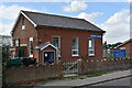
Overseal Baptist Church
by Ian Calderwood geograph for square SK2915 There has been a Baptist Chapel in Overseal since at least 1840. This building... (more)
Tags:
denomination:Baptist
chapel:Baptist
Baptist
church:Baptist
Baptist Church
subject:Church
type:Geograph
top:Religious Sites
top:Village, Rural Settlement
|
|
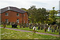
Witnesham Baptist Church
by Simon Mortimer geograph for square TM1851 Dating back to early Victorian times, the church was originally aligned with the... (more)
Tags:
denomination:Baptist
Baptist Church
subject:Chapel
type:Geograph
Particular Baptist Chapel
top:Religious Sites
|
|
Fressingfield: Baptist chapel and graveyard
by Christopher Hilton geograph for square TM2677 Tags:
denomination:Baptist
chapel:Baptist
Baptist
Baptist Chapel
top:Burial Ground, Crematorium
Chapel
Churchyard
subject:Churchyard
type:Geograph
Gravestones
top:Religious Sites
|

|
Soham Baptist Chapel, Clay Street
by Christopher Hilton geograph for square TL5972 Tags:
denomination:Baptist
chapel:Baptist
Baptist
Baptist Chapel
subject:Chapel
Chapel
type:Geograph
top:Religious Sites
|

|
Childs Hill Baptist Chapel
by Christopher Hilton geograph for square TQ2486 Tags:
denomination:Baptist
chapel:Baptist
Baptist
Baptist Chapel
subject:Chapel
Chapel
type:Geograph
top:Religious Sites
|

|
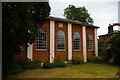
Lettering on Bethlehem Baptist chapel, Upper West Street, Newport / Trefdraeth
by Christopher Hilton for square SN0539 Tags:
denomination:Baptist
chapel:Baptist
Baptist Chapel
Baptist Chapel Sign
Chapel
subject:Chapel
type:Close Look
Lettering
Plaque
top:Religious Sites
Sign
top:Village, Rural Settlement
|
|
Baptist chapel, Woore Road, Audlem
by Christopher Hilton geograph for square SJ6643 Tags:
denomination:Baptist
chapel:Baptist
Baptist
Baptist Chapel
subject:Chapel
Chapel
type:Geograph
top:Religious Sites
top:Village, Rural Settlement
|

|
Mount Zion Baptist Church, Glascoed, Monmouthshire
by Jaggery geograph for square SO3400 Set below road level. Also known as Mount Zion Baptist Chapel, though the... (more)
Tags:
denomination:Baptist
type:Geograph
top:Historic Sites and Artefacts
top:Village, Rural Settlement
|
|
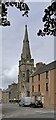
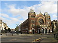
Wick Baptist Church, Wick, Caithness
by Claire Pegrum geograph for square ND3650 Viewed from Argyle Square.
Located in Dempster Street in Pulteneytown, the... (more)
Tags:
denomination:Baptist
Baptist Church
subject:Church
type:Geograph
top:Religious Sites
top:Suburb, Urban Fringe
|
|
Open Doors Baptist Church, Clapton
by Malc McDonald geograph for square TQ3485 The Open Doors Baptist Church in Clapton, in inner north east London.
Tags:
denomination:Baptist
Baptist Church
Church
subject:Church
place:Clapton
type:Geograph
near:Hackney
place:North East London
top:Religious Sites
top:Suburb, Urban Fringe
|

|
Calvary Baptist Church, Peterborough
by Paul Bryan geograph for square TF1901 The church is located on Welland Road at the junction with Poplar Avenue in the... (more)
Tags:
Baptist
denomination:Baptist
Baptist Church
subject:Church
Church
type:Geograph
place:Peterborough
top:Religious Sites
top:Suburb, Urban Fringe
|

|
English Baptist Mission, Central Street, Ystrad Mynach
by Jaggery geograph for square ST1494 The English part of the name indicates the language of worship,
to distinguish... (more)
|

|
Pier Avenue Baptist Church
by Duncan Graham geograph for square TM1714 This photograph of Pier Avenue Baptist Church was taken from the opposite side... (more)
Tags:
Baptist
denomination:Baptist
Church
subject:Church
place:Clacton
place:Clacton-on-Sea
type:Geograph
top:Public Buildings and Spaces
top:Religious Sites
|

|
Oakwood Baptist Church
by Paul Bryan geograph for square TQ2995 The church is located on Merrivale close to the junction with Sheringham Avenue.
Tags:
denomination:Baptist
Baptist
Baptist Church
Church
subject:Church
type:Geograph
top:Religious Sites
top:Suburb, Urban Fringe
|

|
Oakwood Baptist Church
by Paul Bryan geograph for square TQ2995 The church is located on Merrivale close to the junction with Sheringham Avenue.
Tags:
denomination:Baptist
Baptist
Baptist Church
Church
subject:Church
type:Geograph
top:Religious Sites
top:Suburb, Urban Fringe
|

|
Oakwood Baptist Church
by Paul Bryan geograph for square TQ2995 The church is located on Merrivale close to the junction with Sheringham Avenue.
Tags:
denomination:Baptist
Baptist
Baptist Church
Church
subject:Church
type:Geograph
top:Religious Sites
top:Suburb, Urban Fringe
|

|
Newtown's Baptist Church, from the west
by Christine Johnstone geograph for square SO1091 The Corinthian columns run out towards the back.
Tags:
chapel:Baptist
denomination:Baptist
Baptist Church
subject:Chapel
Corinthian Columns
top:Historic Sites and Artefacts
top:Religious Sites
|

|
Stondon Baptist Church, Bedfordshire
by Jim Osley geograph for square TL1535 "Geographically, Stondon Baptist Church is in Bedfordshire, and yet it... (more)
|

|
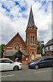
Magor Baptist Church, Monmouthshire
by Jaggery geograph for square ST4287 Viewed across The Square in Magor in December 2020.
Tags:
denomination:Baptist
Baptist Church
subject:Church
type:Geograph
top:Religious Sites
top:Village, Rural Settlement
|
|
Baptist Church, Wraysbury
by Gerald England geograph for square TQ0074 Built in 1862 to a design by surveyor William Thomas Buckland.
Tags:
year:1862
denomination:Baptist
Baptist Church
building type:Church
type:Geograph
top:Religious Sites
surveyor:William Thomas Buckland
place:Wraysbury
|

|
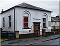
Bible Baptist Church, 59 Wood Street, Bury
by Christine Johnstone geograph for square SD7911 The congregation believe in the verbal, plenary inspiration of the entire Bible,... (more)
Tags:
denomination:Baptist
Baptist Church
Bible Church
place:Bury
subject:Church
type:Geograph
top:Religious Sites
|
|
Waterside Baptist Church, King's Langley
by Jim Osley geograph for square TL0702 Dates from 1835, with later alterations -... (more)
Tags:
year:1835
denomination:Baptist
building type:Chapel
view:Exterior
type:Geograph
place:Kings Langley
top:Religious Sites
|
|
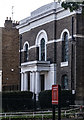
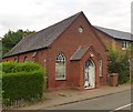
Tottenham Baptist Church
by Jim Osley for square TQ3390 Grade II listed - description at this... (more)
Tags:
denomination:Baptist
building type:Church
type:Close Look
view:Exterior
listed building status:Grade II
architect:J. Clark
place:London N17 (Tottenham)
top:Religious Sites
|
|
Former Baptist Chapel, Datchworth Green
by Jim Osley geograph for square TL2618 Built in 1892 ... closed in 1976. More at this... (more)
Tags:
year:1892
denomination:Baptist
building type:Chapel
place:Datchworth
view:Exterior
type:Geograph
top:Religious Sites
|

|
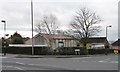
Former Ebenezer Particular Baptist Chapel, Hastings
by Jim Osley geograph for square TQ8209 Grade II listed former Baptist Chapel from 1817: architectural description at... (more)
Tags:
date:1817
denomination:Baptist
building type:Chapel
change of use:Chapel Into House
view:Exterior
listed building status:Grade II
place:Hastings
top:Religious Sites
|
|
Chingford Mount Baptist Church
by Christine Johnstone geograph for square TQ3793 At the junction of Leadale Road and Old Church Road. Also functions as a polling station.
|

|
Union Street Baptist Church, Crewe
by Rod Grealish geograph for square SJ7055 The image shows the liturgical west end, the south side of the church and the... (more)
Tags:
built:1884
denomination:Baptist
ceremonial county:Cheshire
unitary authority:Cheshire East
subject:Church
top:City, Town Centre
place:Crewe
postcode district:CW2
image:DSC 7388A
type:Geograph
Grade II Listed
top:Historic Sites and Artefacts
architect:J Wallis-Chapman.
Liturgical South Side
Liturgical West End
top:Religious Sites
road:Union Street
Union Street Baptist Church
|

|
Rugby Baptist Church, Regent Place
by Jim Osley geograph for square SP5075 Grade II listed Baptist church, built in 1905 to the designs of architects... (more)
Tags:
year:1905
denomination:Baptist
building type:Church
view:Exterior
type:Geograph
architects:George Baines and Son
listed building status:Grade II
top:Religious Sites
place:Rugby
|

|
Hampstead Garden Suburb Free Church
by Jim Osley geograph for square TQ2588 Grade I listed church built to the designs of architect Edwin Lutyens.
Tags:
denomination:Baptist
building type:Church
architect:Edwin Lutyens
listed building status:Grade I
top:Religious Sites
denomination:United Reformed
|

|
Hampstead Garden Suburb Free Church
by Jim Osley geograph for square TQ2588 Grade I listed church built to the designs of architect Edwin Lutyens.
Tags:
denomination:Baptist
building type:Church
architect:Edwin Lutyens
listed building status:Grade I
place:London NW11 (Hampstead Garden Suburb)
top:Religious Sites
denomination:United Reformed
|
|
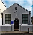
Providence Baptist Chapel, Shoreham-by-Sea
by Jim Osley geograph for square TQ2105 Tags:
denomination:Baptist
building type:Chapel
type:Geograph
top:Religious Sites
place:Shoreham by Sea
|

|
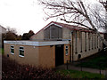
Letchworth Baptist Church
by Jim Osley geograph for square TL2132 |
|
Chingford Mount Baptist Church
by Jim Osley geograph for square TQ3793 Tags:
denomination:Baptist
building type:Church
place:London E4 (Chingford Mount)
top:Religious Sites
|

|
Trinity Baptist Church, Broadway, Bexleyheath
by Jim Osley geograph for square TQ4875 Built in 1868 and opened on the 7 October of that year, according to this... (more)
|

|
Thaxted Baptist Church
by Jim Osley geograph for square TL6130 History of this Grade II listed building at this... (more)
Tags:
denomination:Baptist
building type:Church
listed building status:Grade II
top:Religious Sites
place:Thaxted
|

|
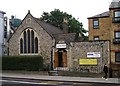
Chiswick Baptist Church
by Jim Osley geograph for square TQ2178 Built in 1897 to designs by architect John Wills. See The Buildings of England.... (more)
Tags:
denomination:Baptist
building type:Church
architect:John Wills
place:London W4 (Chiswick)
top:Religious Sites
|
|
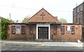
Stoke Newington Baptist Church
by Jim Osley geograph for square TQ3385 Tags:
denomination:Baptist
building type:Church
place:London N16 (Stoke Newington)
top:Religious Sites
|
|
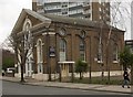
Poplar Baptist Church, Zetland Street, London E14
by Jim Osley geograph for square TQ3881 Built 1950. More at this... (more)
|
|
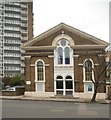
West Kilburn Baptist Church
by Jim Osley geograph for square TQ2483 Built 1856.
|
|
West Kilburn Baptist Church
by Jim Osley geograph for square TQ2483 Built 1856.
|

|
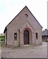
Epsom Baptist Church (built 1907)
by Jim Osley geograph for square TQ2160 |
|
Zion Strict Baptist Chapel, Prestwood
by Jim Osley geograph for square SP8601 Built 1950.
|

|
High Street Baptist Church, Tring
by Jim Osley geograph for square SP9211 Built in 1889 to the designs of local architect William Huckvale.
Tags:
denomination:Baptist
building type:Church
top:Religious Sites
place:Tring
architect:William Huckvale
|

|
Akeman Street Baptist Chapel, Tring
by Jim Osley geograph for square SP9211 Grade II listed chapel, extensively described at this... (more)
Tags:
denomination:Baptist
building type:Chapel
listed building status:Grade II
top:Religious Sites
place:Tring
|
|
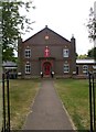
Markyate Baptist Church
by Jim Osley geograph for square TL0616 |
|
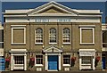
Colchester Baptist Church
by Jim Osley geograph for square TL9925 Grade II listed building from 1834, described at this... (more)
Tags:
denomination:Baptist
building type:Church
place:Colchester
listed building status:Grade II
top:Religious Sites
|
